|
Morotsuka, Miyazaki
270px, Route 327 in Morotsuka is a village in Higashiusuki District, Miyazaki Prefecture, Japan. , the village has an estimated population of 1360 in 601 households, and a population density of 9.8 persons per km². The total area of the village is . Geography Morotsuka is located in northern Miyazaki Prefecture in the steep Kyushu Mountains. Approximately 90% of the village area is forest. Morotsuka has a humid subtropical climate (Köppen ''Cfa'') characterized by warm summers and cool winters with light to no snowfall. Neighbouring municipalities Miyazaki Prefecture * Misato * Shiiba * Gokase * Hinokage * Takachiho Demographics Per Japanese census data, the population of Morotsuka has declined in recent decades. History The area of Morotsuka was part of ancient Hyūga Province. During the Edo period, it was part of the holdings of Nobeoka Domain. The village of Morotsuka was established on April 1, 1889 within Nishiusuki District, Miyazaki with the creation of ... [...More Info...] [...Related Items...] OR: [Wikipedia] [Google] [Baidu] |
Villages Of Japan
A is a local administrative unit in Japan. It is a local public body along with , , and . Geographically, a village's extent is contained within a prefecture. It is larger than an actual settlement, being in actuality a subdivision of a rural , which are subdivided into towns and villages with no overlap and no uncovered area. As a result of mergers and elevation to higher statuses, the number of villages in Japan is decreasing. Currently, 13 prefectures no longer have any villages: Tochigi (since March 20, 2006), Fukui (since March 3, 2006), Ishikawa (since March 1, 2005), Shizuoka (since July 1, 2005), Hyōgo (since April 1, 1999), Mie (since November 1, 2005), Shiga (since January 1, 2005), Hiroshima (since November 5, 2004), Yamaguchi (since March 20, 2006), Ehime (since January 16, 2005), Kagawa (since April 1, 1999), Nagasaki (since October 1, 2005), and Saga (since March 20, 2006). The six villages in the Northern Territories dispute and Atarashiki-mura (whic ... [...More Info...] [...Related Items...] OR: [Wikipedia] [Google] [Baidu] |
Misato, Miyazaki
is a town located in Higashiusuki District, Miyazaki Prefecture, Japan. The town was formed on January 1, 2006 from the merger of the villages of Kitagō, Nangō and Saigō, all from Higashiusuki District. As of October 1, 2019, the town has an estimated population of 4,823, with 2,292 households and the population density of 10.7 persons per km². The total area is 448.84 km². Geography Climate Misato has a humid subtropical climate (Köppen climate classification The Köppen climate classification is one of the most widely used climate classification systems. It was first published by German-Russian climatologist Wladimir Köppen (1846–1940) in 1884, with several later modifications by Köppen, notabl ... ''Cfa'') with hot, humid summers and cool winters. The average annual temperature in Misato is . The average annual rainfall is with August as the wettest month. The temperatures are highest on average in August, at around , and lowest in January, at around ... [...More Info...] [...Related Items...] OR: [Wikipedia] [Google] [Baidu] |
House Of Representatives Of Japan
The is the lower house of the National Diet of Japan. The House of Councillors (Japan), House of Councillors is the upper house. The composition of the House is established by and of the Constitution of Japan. The House of Representatives has 465 members, elected for a four-year term. Of these, 176 members are elected from 11 multi-member constituencies by a party-list system of proportional representation, and 289 are elected from single-member constituencies. The overall voting system used to elect the House of Representatives is a Parallel voting, parallel system, a form of semi-proportional representation. Under a parallel system the allocation of list seats does not take into account the outcome in the single seat constituencies. Therefore, the overall allocation of seats in the House of Representatives is not proportional, to the advantage of larger parties. In contrast, in bodies such as the German ''Bundestag'' or the New Zealand Parliament the election of single-seat ... [...More Info...] [...Related Items...] OR: [Wikipedia] [Google] [Baidu] |
Miyazaki 2nd District
Miyazaki 2nd district (宮崎県第2区, ''Miyazaki-ken dai-niku '' or simply 宮崎2区, ''Miyazaki-niku '') is a single-member constituency of the House of Representatives in the national Diet of Japan located in Miyazaki Prefecture. Areas Covered ;since 1994 * Hyuga *Nobeoka is a city located in the north of Miyazaki Prefecture, Japan. As of June 1, 2019, the city has an estimated population of 119,521 and a population density of 138 persons per km². The total area is . History The city was officially founded on F ... * Saito * Higashiusuki District * Koyu District * Nishiusuki District List of Representatives Election results References {{Reflist Constituencies established in 1994 1994 establishments in Japan Districts of the House of Representatives (Japan) Politics of Miyazaki Prefecture Nobeoka, Miyazaki ... [...More Info...] [...Related Items...] OR: [Wikipedia] [Google] [Baidu] |
Kadogawa, Miyazaki
is a List of towns in Japan, town located in Higashiusuki District, Miyazaki, Higashiusuki District, Miyazaki Prefecture, Japan. As of October 1, 2019, the town has an estimated population of 17,526 and the population density, density of 145 persons per km². The total area is 120.52 km². Geography Neighbouring municipalities * Nobeoka, Miyazaki, Nobeoka * Hyūga, Miyazaki, Hyuga * Misato, Miyazaki, Misato Transportation Highways * Japan National Route 327 * Japan National Route 388 * Japan National Route 446 References External links *Kadogawa official website Towns in Miyazaki Prefecture {{Miyazaki-geo-stub ... [...More Info...] [...Related Items...] OR: [Wikipedia] [Google] [Baidu] |
Unicameral
Unicameralism (from ''uni''- "one" + Latin ''camera'' "chamber") is a type of legislature, which consists of one house or assembly, that legislates and votes as one. Unicameral legislatures exist when there is no widely perceived need for multicameralism (two or more chambers). Many multicameral legislatures were created to give separate voices to different sectors of society. Multiple houses allowed, for example, for a guaranteed representation of different social classes (as in the Parliament of the United Kingdom or the French States-General). Sometimes, as in New Zealand and Denmark, unicameralism comes about through the abolition of one of two bicameral chambers, or, as in Sweden, through the merger of the two chambers into a single one, while in others a second chamber has never existed from the beginning. Rationale for unicameralism and criticism The principal advantage of a unicameral system is more efficient lawmaking, as the legislative process is simpler and there is ... [...More Info...] [...Related Items...] OR: [Wikipedia] [Google] [Baidu] |
Nishiusuki District, Miyazaki
is a district located in Miyazaki Prefecture, Japan. As of October 1, 2019, the district has an estimated population of 19,152 and the density of 27.9 persons per km2. The total area is 686.94 km2. Towns and villages * Gokase * Hinokage *Takachiho is a town in Nishiusuki District, Miyazaki Prefecture, Japan. As of October 1, 2019, the town has an estimated population of 11,959 and a density of 50.3 persons per km². The total area is 237.54 km². Geography Takachiho is in the north ... Districts in Miyazaki Prefecture {{Miyazaki-geo-stub ... [...More Info...] [...Related Items...] OR: [Wikipedia] [Google] [Baidu] |
Nobeoka Domain
is a city located in the north of Miyazaki Prefecture, Japan. As of June 1, 2019, the city has an estimated population of 119,521 and a population density of 138 persons per km². The total area is . History The city was officially founded on February 11, 1933, after it gained city status. During World War II, it was one of the most important centers of military explosives in Japan. On the night of June 28-29th, 1945, 117 United States B-29s fire-bombed the city, destroying 1.35 square km, or 36% of the city. On July 16, 1945, 33 US B-24s bombed the bridges in around the city, severing the strategically important Nippō Main Line railway. On February 20, 2006, Nobeoka absorbed the towns of Kitakata and Kitaura (both from Higashiusuki District). On March 31, 2007, the town of Kitagawa (also from Higashiusuki District) was also merged into Nobeoka. Geography Climate Nobeoka has a humid subtropical climate (Köppen climate classification ''Cfa''), which is hot and humid i ... [...More Info...] [...Related Items...] OR: [Wikipedia] [Google] [Baidu] |
Edo Period
The or is the period between 1603 and 1867 in the history of Japan, when Japan was under the rule of the Tokugawa shogunate and the country's 300 regional '' daimyo''. Emerging from the chaos of the Sengoku period, the Edo period was characterized by economic growth, strict social order, isolationist foreign policies, a stable population, perpetual peace, and popular enjoyment of arts and culture. The period derives its name from Edo (now Tokyo), where on March 24, 1603, the shogunate was officially established by Tokugawa Ieyasu. The period came to an end with the Meiji Restoration and the Boshin War, which restored imperial rule to Japan. Consolidation of the shogunate The Edo period or Tokugawa period is the period between 1603 and 1867 in the history of Japan, when Japan was under the rule of the Tokugawa shogunate and the country's regional '' daimyo''. A revolution took place from the time of the Kamakura shogunate, which existed with the Tennō's court, to the Tok ... [...More Info...] [...Related Items...] OR: [Wikipedia] [Google] [Baidu] |
Hyūga Province
was an old province of Japan on the east coast of Kyūshū, corresponding to the modern Miyazaki Prefecture. Nussbaum, Louis-Frédéric. (2005). "''Hyūga''" in . It was sometimes called or . Hyūga bordered on Bungo, Higo, Ōsumi, and Satsuma Province. The ancient capital was near Saito. History In the ''Kojiki'' and the '' Nihon Shoki'', Hyūga is called of Tsukushi-no-shima (Kyushu), along the provinces of Tsukushi, Toyo and Hi. In the 3rd month of the 6th year of the '' Wadō'' era (713), the land of Hyūga was administratively separated from Ōsumi Province (大隅国). In that same year, Empress Genmei's ''Daijō-kan'' continued to organize other cadastral changes in the provincial map of the Nara period. Titsingh, Isaac. (1834). During the Sengoku period, the area was often divided into a northern fief around Agata castle (near modern Nobeoka), and a southern fief around Obi castle, near modern Nichinan. The southern fief was held by the Shimazu clan of n ... [...More Info...] [...Related Items...] OR: [Wikipedia] [Google] [Baidu] |
Takachiho, Miyazaki
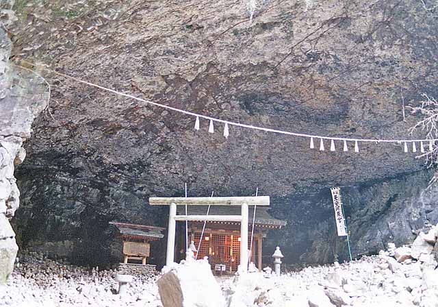
is a List of towns in Japan, town in Nishiusuki District, Miyazaki, Nishiusuki District, Miyazaki Prefecture, Japan. As of October 1, 2019, the town has an estimated population of 11,959 and a density of 50.3 persons per km². The total area is 237.54 km². Geography Takachiho is in the northernmost part of Miyazaki Prefecture, bordering Kumamoto Prefecture on its north and northwest sides and Ōita Prefecture on its north and northeast sides. The Gokase River flows from the west to the southeast part of town. The heart of the town is at its center, around the now-defunct Takachiho Station and the business office of Takachiho Kotsu, the town's public transportation company. Takachiho Gorge, in the southern part of town, is fairly famous as a tourist attraction. Takachiho is about 120 km northwest of the prefectural capital of Miyazaki, Miyazaki, Miyazaki and about 80 km southeast of the city of Kumamoto, Kumamoto, Kumamoto. Due to no public transportation faciliti ... [...More Info...] [...Related Items...] OR: [Wikipedia] [Google] [Baidu] |


