|
Morales, Guatemala
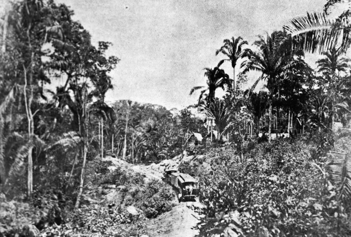
Morales is a municipality in Izabal Department of Guatemala. The municipality was created in 1920 and is formed by the town of Morales, 9 villages and 56 rural communities. The Cuevas del Silvino National Park is located a few kilometers northeast of Morales. Northern Railroad of Guatemala On 22 November 1896 the Northern Railroad Zacapa, Zacapa-Puerto Barrios connection, was opened to the public; it was the most important infrastructure project of general José María Reina Barrios given the economic crisis that loomed over Guatemala if he was not able to finish the railroad on time for the Central American Expo scheduled for March 1897. The new line had a length of . In those days, the Northern region of Guatemala was practically a new and unexplored area, a newfound place where natural resources could be exploited and the railroad construction finally gave way to the commercial and industrial exploration of the area. The complete line Puerto Barrios-Guatemala City -t ... [...More Info...] [...Related Items...] OR: [Wikipedia] [Google] [Baidu] |
Municipalities Of Guatemala
The Departments of Guatemala, departments of Guatemala are divided into 340 municipality, municipalities, or ''municipios''. The municipalities are listed below, by department. List References {{DEFAULTSORT:Municipalities Of Guatemala Municipalities of Guatemala, Subdivisions of Guatemala Lists of administrative divisions, Guatemala, Municipalities Administrative divisions in North America, Guatemala 2 Second-level administrative divisions by country, Municipalities, Guatemala Guatemala geography-related lists ... [...More Info...] [...Related Items...] OR: [Wikipedia] [Google] [Baidu] |
San Agustín Acasaguastlán
San Agustín Acasaguastlán () is a town, with a population of 17,728 (2018 census), Population of cities & towns in Guatemala and a municipality
A municipality is usually a single administrative division having corporate status and powers of self-government or jurisdiction as granted by national and regional laws to which it is subordinate.
The term ''municipality'' may also mean the go ... in the El Progreso department of Guatemala.
...
|
Cobán
Cobán ( kek, Kob'an), fully Santo Domingo de Cobán, is the capital of the department of Alta Verapaz in central Guatemala. It also serves as the administrative center for the surrounding Cobán municipality. It is located 219 km from Guatemala City. As of the 2018 census the population of the city of Cobán was at 212,047. The population of the municipality, which covers a total area of 1,974 km², was at 212,421, according to the 2018 census. Cobán, at a height of above sea level, is located at the center of a major coffee-growing area. Etymology The name "Cobán" comes from Q'eqchi' (between clouds) History Order of Preachers in the Vera Paz Between 1530 and 1531, captain on his way to Ciudad Real accidentally discovered the lagoon and hill of People of that place had historically traded with all the people that the Spaniards had conquered, so, knowing what was coming, they sought refuge in the jungle. The Spaniards tried in vain to conquer the lac ... [...More Info...] [...Related Items...] OR: [Wikipedia] [Google] [Baidu] |
Uspantán
Uspantán is a municipality in the Guatemalan department of El Quiché. It is one of the largest municipalities of El Quiché and stretches from the mountainous highlands in the South to the tropical lowlands in the North. The municipal seat is in Villa de San Miguel Uspantán with a population of 2,800. The birthplace of Nobel Peace Prize winner Rigoberta Menchú, a community named Laj Chimel, is located Uspantán not far from the municipal seat. Completion of paving on the road in from Chichicastenango has brought a small tourist boom to the town. The municipality includes the pre-Columbian Maya archaeological site of Chitinamit Chitinamit (or Chitinamit-Chujuyup) is an archeological site of the Maya civilization in the highlands of Guatemala. It has been identified as Jakawitz, the first capital of the K'iche' Maya. The site is located in the El Quiché department, in ..., believed to be Jakawitz, the first capital of the K'iche' Maya.Ministerio de Cultura y Deportes. I ... [...More Info...] [...Related Items...] OR: [Wikipedia] [Google] [Baidu] |
Chajul
Chajul (; full name San Gaspar Chajul) is a town and municipality in the Guatemalan department of El Quiché. Chajul is part of the Ixil Community, along with San Juan Cotzal and Santa Maria Nebaj. The Ixil region is isolated by beautiful mountains and has maintained its rich Ixil Maya traditions and language. Chajul, Nebaj, and Cotzal make up the Ixil Region in the Department of Quiché in the Western Highlands of Guatemala. Having been at the heart of the 36-year civil war, Chajul experiences post-war challenges such as emotional trauma, land displacement, and fragmented families. Additionally, unemployment is high, large families live in one-room adobe houses with open cooking fires, opportunities for women are scarce, and family- and gender-based violence are common. The community has a corn-based agricultural economy in which adults struggle daily to feed their families and the average income is $1–3 per day. A 2002 study revealed that less than 1% of children graduate from h ... [...More Info...] [...Related Items...] OR: [Wikipedia] [Google] [Baidu] |
Huehuetenango (department)
Huehuetenango is one of the 22 departments of Guatemala. It is situated in the western highlands and shares borders with the Mexican state of Chiapas in the north and west; with El Quiché in the east, with Totonicapán, Quetzaltenango and San Marcos to the south. The capital is the city of Huehuetenango.ITMB 2005. Huehuetenango's ethnic composition is one of the most diverse in Guatemala. While the Mam are predominant in the department, other Maya groups are the Q'anjob'al, Chuj, Jakaltek, Tektik, Awakatek, Chalchitek, Akatek and K'iche'. Each of these nine Maya ethnic groups speaks its own language. Name The department of Huehuetenango takes its name from the city of the same name which serves as the departmental capital. The name is derived from the Nahuatl language of central Mexico, given by the indigenous allies of the Spanish conquistadors during the Spanish Conquest of Guatemala. It is usually said to mean "place of the elders" but may be a corruption of "place ... [...More Info...] [...Related Items...] OR: [Wikipedia] [Google] [Baidu] |
San Mateo Ixtatán
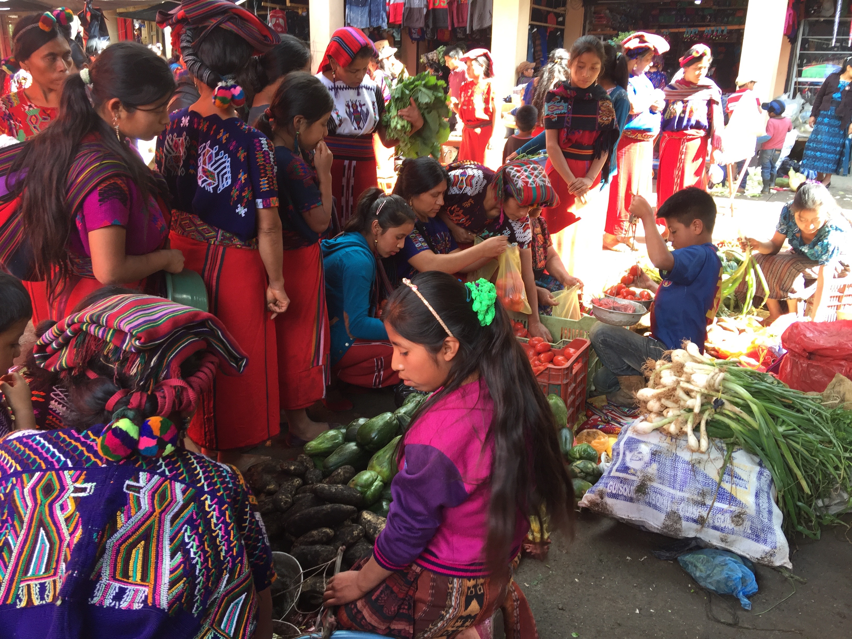
San Mateo Ixtatán is a Municipalities of Guatemala, municipality in the Guatemalan Departments of Guatemala, department of Huehuetenango Department, Huehuetenango. It is situated at above sea level in the Cuchumatanes mountain range and covers of terrain. It has a cold climate and is located in a cloud forest. The temperature fluctuates between . The coldest months are from November to January and the warmest months are April and May. The town has a population of 15,090 (2018 census) and is the municipal center for an additional 28,000 people living in the surrounding mountain villages. It has a weekly market on Thursday and Sunday. The annual town festival takes place from September 19 to September 21 honoring their patron Saint Matthew. The residents of San Mateo belong to the Chuj people, Chuj Maya peoples, Maya ethnic group and speak the Mayan language, Mayan Chuj language, not to be confused with Chuj baths, or wood fired steam rooms that are common throughout the central ... [...More Info...] [...Related Items...] OR: [Wikipedia] [Google] [Baidu] |
Ixcán
Ixcán is a municipality in the Guatemalan department of El Quiché. Its administrative centre is the town of Playa Grande. The municipality consists of 176 communities, called ''aldeas''. It has an area of 1693 km2. It is the northernmost municipality of El Quiché, and borders with Mexico, the municipalities of Chisec and Cobán of the Department of Alta Verapaz, the municipality of Santa Cruz Barillas of the Department of Huehuetenango, and the municipalities of Chajul and Uspantán of El Quiché. Native Mayan languages include Q'eqchi', Q'anjob'al, Mam, Popti and Kʼicheʼ. Spanish is also common. Its annual festival is held from 15 to 17 May. Ixcán has an airport. Its International Air Transport Association code is PKJ. History Oil potential In 1971 indigenous Q'eqchi' people from 24 villages in the Cancuén area, in southern Petén north of Chisec, were evicted by the Army, because it considered that the region was rich in oil. Since 1974, oil had ... [...More Info...] [...Related Items...] OR: [Wikipedia] [Google] [Baidu] |
Maryknoll
Maryknoll is a name shared by a number of related Catholic organizations, including the Maryknoll Fathers and Brothers (also known as the Catholic Foreign Mission Society of America or the Maryknoll Society), the Maryknoll Sisters, and the Maryknoll Lay Missioners. The organizations are independent entities with shared history that work closely together in the joint focus of the overseas mission activity of the Catholic Church particularly in East Asia, the United States, Latin America, and Africa. The organizations officially began in 1911, founded by Thomas Frederick Price, James Anthony Walsh, and Mary Joseph Rogers. The name ''Maryknoll'' comes from the hill outside the Village of Ossining, Westchester County, New York, which houses the headquarters of all three. Members of the societies are usually called ''Maryknollers''. Maryknollers are sometimes known as the "Marines of the Catholic Church" for their reputation of moving into rough areas, living side-by-side with the ... [...More Info...] [...Related Items...] OR: [Wikipedia] [Google] [Baidu] |
José María Orellana
José María Orellana Pinto (11 July 1872 – 26 September 1926) was a Guatemalan political and military leader. He was chief of staff of President Manuel Estrada Cabrera and President of Guatemala between 1921 and 1926, after overthrowing Conservative Unionist President Carlos Herrera. During his rule the Quetzal was established as the currency of Guatemala. Orellana Pinto died under suspicious circumstances in 1926 at the age of fifty-four. He was buried in the Guatemalan capital with state honors. Early life José María Orellana Pinto was born in El Jícaro; he was the son of Esteban Orellana and Leonora Pinto. Orellana had a military career becoming General of the Guatemalan Army. He was elected to the Guatemalan legislature on several occasions, as a member of the Liberal Party, and was also Chief of Staff of the President Estrada Cabrera; when serving as such, on 29 April 1907, he was riding alongside the president's coach when the latter suffered a bomb attack -which ... [...More Info...] [...Related Items...] OR: [Wikipedia] [Google] [Baidu] |
Los Amates
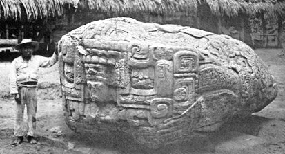
Los Amates is a municipality in the Izabal department of Guatemala. The population is about 61,000. The mayor is currently Marco Tulio Ramirez Estrada. Los Amates is located on the Motagua River, from the ruins of the ancient Maya city of Quiriguá. History Quiriguá Quiriguá is an ancient Maya archaeological site in Los Amates. It is a medium-sized site covering approximately along the lower Motagua River, with the ceremonial center about from the north bank. During the Maya Classic Period (AD 200–900), Quiriguá was situated at the juncture of several important trade routes. The site was occupied by 200, construction on the acropolis had begun by about 550, and an explosion of grander construction started in the 8th century. All construction had halted by about 850, except for a brief period of reoccupation in the Early Postclassic (''c''. 900 – ''c''. 1200). Quiriguá shares its architectural and sculptural styles with the nearby Class ... [...More Info...] [...Related Items...] OR: [Wikipedia] [Google] [Baidu] |
Tragic Week (Guatemala)
The Tragic Week of 1920 was a civil uprising that took place in Guatemala in the week of April 8 to April 14, 1920, led by Unionist Party leaders, student leaders and those who opposed President Manuel Estrada Cabrera when the latter refused to leave office after the National Assembly declared him mentally incompetent for the presidency and named Carlos Herrera as interim president. Background Unionists Party Several attacks had been made on president Manuel Estrada Cabrera's life, but fortune had always favored him. Even though he was a civilian, he based his power entirely on the support of the military. By declaring war on Germany during the First World War, he concocted a reason to increase his already well-equipped artillery by the addition of modern field guns, machine guns and ammunition. Opposition to his regime started after the 1917-1918 earthquakes, as it was evident that the President was incapable of leading recovery efforts. Urged by his cousin, Manuel Cobos ... [...More Info...] [...Related Items...] OR: [Wikipedia] [Google] [Baidu] |


