|
Montpelier, Limerick
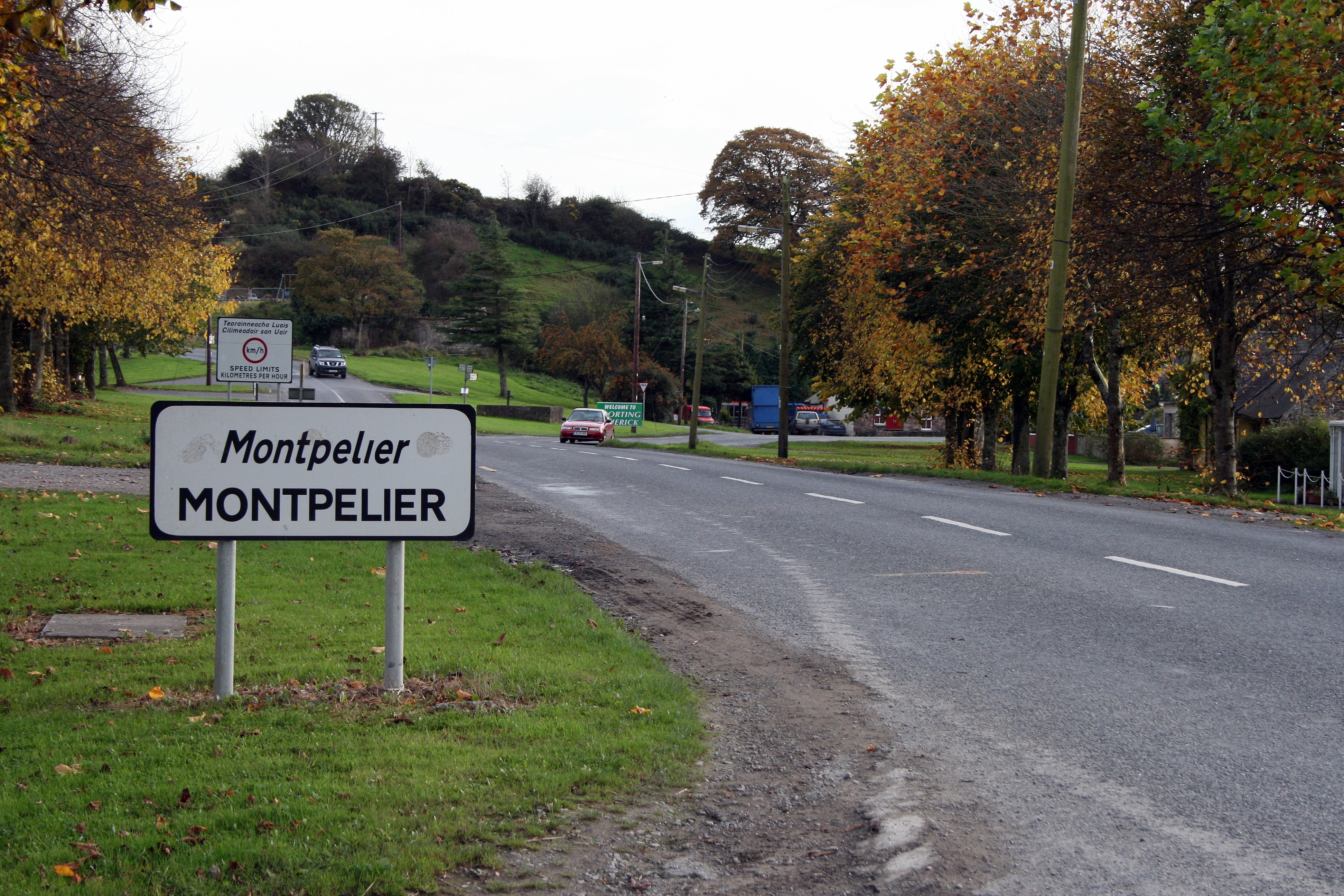
Montpelier () is a village and a townland in east County Limerick, Ireland, on the east bank of the River Shannon. It is connected to O'Briensbridge across the river in County Clare by a 14-arch stone bridge. The first bridge across the river here was built in 1506 by Turlough O'Brien, First Earl of Thomond and his brother, the Bishop of Killaloe. This 16th-century bridge was in turn replaced or rebuilt c. 1750. The five arches on the west side of the bridge date from this period. The six arches on the east side were replaced by the Shannon Commissioners in 1842. The first arch on the west side was replaced by the present navigation arch when the Shannon Scheme was built downstream in 1925–29. The bridge carries the R466 roadway. The ancient river-crossing here is believed to be identical with ''Áth Caille'' (meaning "Ford of the Wood"): one of the three fords mentioned in the Triads of Ireland, the others being ''Áth Clíath'' (Dublin) and ''Áth Lúain'' (Athlone). See ... [...More Info...] [...Related Items...] OR: [Wikipedia] [Google] [Baidu] |
Bishop Of Killaloe
The Bishop of Killaloe ( ) is an episcopal title which takes its name after the town of Killaloe in County Clare, Ireland. In the Roman Catholic Church it remains a separate title, but in the Church of Ireland it has been united with other bishoprics. History The Diocese of Killaloe was one of the twenty-four dioceses established at the Synod of Rathbreasail in 1111. The boundaries of the diocese consisted of almost all of County Clare, the northern part of County Tipperary and the western part of County Offaly. Its Irish name is ''Cill-da-lua'' (Church of Lua), so named from St Mo Lua, an abbot who lived in the late 6th century. At the Synod of Kells in March 1152, Killaloe some lost territory when the dioceses of Kilfenora, Roscrea and Scattery Island were created. Following the Reformation, there are now parallel Killaloe dioceses: one of the Church of Ireland and the other of the Roman Catholic Church. ; In Church of Ireland The pre-Reformation Cathedral Church of St Fla ... [...More Info...] [...Related Items...] OR: [Wikipedia] [Google] [Baidu] |
O'Briensbridge-Montpelier
O'Briensbridge–Montpelier is an urban area in Ireland, comprising the villages of O'Briensbridge in County Clare and Montpelier in County Limerick which face each other across the River Shannon. The combined census town had a population of 396 at the 2016 census. Bridge O'Briens Bridge () is a 12-arch bridge which connects the village of O'Briensbridge in east County Clare, on the west bank of the River Shannon, with Montpelier in County Limerick on the eastern bank. The first bridge across the river here was built in 1506 by Turlough O'Brien, First Earl of Thomond and his brother, the Bishop of Killaloe. This 16th-century bridge was in turn replaced or rebuilt c. 1750. The five arches on the west side of the bridge date from this period. The six arches on the east side were replaced by the Shannon Commissioners in 1842. The first arch on the west side was replaced by the present navigation arch when the Shannon Scheme was built downstream in 1925–29. The ancient rive ... [...More Info...] [...Related Items...] OR: [Wikipedia] [Google] [Baidu] |
List Of Towns And Villages In The Republic Of Ireland
This is a link page for cities, towns and villages in the Republic of Ireland, including townships or urban centres in Dublin, Cork, Limerick, Galway, Waterford and other major urban areas. Cities are shown in bold; see City status in Ireland for an independent list. __NOTOC__ A B C D E F G H I J K L M N O P Q R S T U V W Y See also *List of places in Ireland ** List of places in the Republic of Ireland **: List of cities, boroughs and towns in the Republic of Ireland, with municipal councils and legally defined boundaries. **: List of census towns in the Republic of Ireland as defined by the Central Statistics Office, sorted by county. Includes non-municipal towns and suburbs outside municipal boundaries. ** List of towns in the Republic of Ireland by population **: List of towns in the Republic of Ireland/2002 Census Records **: List of towns in the Republic of Ireland/2006 Censu ... [...More Info...] [...Related Items...] OR: [Wikipedia] [Google] [Baidu] |
Triads Of Ireland
The title ''Trecheng Breth Féne'' "A Triad of Judgments of the Irish", more widely known as "The Triads of Ireland", refers to a miscellaneous collection of about 256 Old Irish triads (and some numerical variants) on a variety of topics, such as nature, geography, law, custom and behaviour. Its compilation is usually dated to the ninth century. Form The Triads of Ireland cover a vast range of subjects. Triads 1-31 are about monasteries, 32-61 cover geography, and 86-149 law. The rest are a miscellany with no apparent overarching structure. Though they are all called triads, only 214 of the 256 of the triads form groups of threes. There are also three duads, seven tetrads, one nonad and 31 single items relating to monasteries at the start of the collection. The following example is Triad 91: The use of the triad form (arrangement into threes) to encapsulate certain ideas is neither distinctively Irish nor Celtic, but can be widely attested in many societies over the world, in p ... [...More Info...] [...Related Items...] OR: [Wikipedia] [Google] [Baidu] |
Ford (crossing)
A ford is a shallow place with good footing where a river or stream may be crossed by wading, or inside a vehicle getting its wheels wet. A ford may occur naturally or be constructed. Fords may be impassable during high water. A low-water crossing is a low bridge that allows crossing over a river or stream when water is low but may be treated as a ford when the river is high and water covers the crossing. Description A ford is a much cheaper form of river crossing than a bridge, and it can transport much more weight than a bridge, but it may become impassable after heavy rain or during flood conditions. A ford is therefore normally only suitable for very minor roads (and for paths intended for walkers and horse riders etc.). Most modern fords are usually shallow enough to be crossed by cars and other wheeled or tracked vehicles (a process known as "fording"). Fords may be accompanied by stepping stones for pedestrians. The United Kingdom has more than 2,000 fords, and most ... [...More Info...] [...Related Items...] OR: [Wikipedia] [Google] [Baidu] |
R466 Road (Ireland)
The R466 road is a regional road in Ireland which runs southeast-northwest from the R445 at Birdhill, County Tipperary to the R352 in East Clare. After leaving the R445 at Birdhill it passes through Montpelier before crossing the River Shannon at O'Briensbridge in County Clare via a narrow 14-arch bridge. It veers northwest for the rest of the route, passing through Broadford and O'Callaghans mills before terminating at a junction with the R352. The route is long. See also *Roads in Ireland *National primary road *National secondary road ReferencesRoads Act 1993 (Classification of Regional Roads) Order 2006– Department of Transport The Department for Transport (DfT) is a department of His Majesty's Government responsible for the English transport network and a limited number of transport matters in Scotland, Wales and Northern Ireland that have not been devolved. The d ... {{Roads in Ireland Regional roads in the Republic of Ireland Roads in County Tipperar ... [...More Info...] [...Related Items...] OR: [Wikipedia] [Google] [Baidu] |
National Inventory Of Architectural Heritage
The National Inventory of Architectural Heritage (NIAH) maintains a central database of the architectural heritage of the Republic of Ireland covering the period since 1700 in complement to the Archaeological Survey of Ireland, which focuses on archaeological sites of the pre-1700 period. As of 2022, there are over 50,000 records in the database, including buildings, monuments, street furniture and other structures. It does not cover Northern Ireland. Buildings recorded in the database are given a rating, either national or regional. Formation The NIAH is a unit of the Heritage Division within the Department of Housing, Local Government and Heritage. The unit was founded in 1990 to address the obligations of the Convention for the Protection of the Architectural Heritage of Europe of which Ireland is signatory. Initially, the NIAH existed only on a non-statutory basis with the task to create and maintain an inventory of to be protected buildings and sites. The legal framework for ... [...More Info...] [...Related Items...] OR: [Wikipedia] [Google] [Baidu] |
Shannon Scheme
The Shannon hydroelectric Scheme was a major development by the Irish Free State in the 1920s to harness the power of the River Shannon. Its product, the Ardnacrusha power plant, is a hydroelectric power station which is still producing power today and is located near Ardnacrusha within County Clare approximately from the Limerick border. It is Ireland's largest river hydroelectric scheme and is operated on a purpose built headrace connected to the River Shannon. The plant includes fish ladders so that returning fish, such as salmon, can climb the river safely past the power station. Completed within 7 years of Irish independence in 1922 at a cost which was equivalent to one fifth of the Irish state's annual budget, the plant enabled an enormous surge in demand for electricity across the country and demonstrated the ability of the new government to develop during a difficult financial period. The plant was constructed by the German company Siemens-Schuckert, although much o ... [...More Info...] [...Related Items...] OR: [Wikipedia] [Google] [Baidu] |
Earl Of Thomond
Earl of Thomond was an hereditary title in the Peerage of Ireland. It was created twice for the O'Brien dynasty which is an ancient Irish sept native to north Munster. History and background First creation Under the Crown of Ireland Act 1542, King Henry VIII of England was created King of Ireland by the Parliament of Ireland. In consequence, all reigning monarchs and clan chiefs in Ireland were ordered to surrender their native titles in return for peerages. This surrender and regrant offer was conditional upon the adoption of Tudor customs and laws, including pledging allegiance to the Irish Crown and apostatising from the Catholic faith by accepting the articles of the state established Church of Ireland. Through surrender and regrant, the earldom of Thomond was created in 1543 for Murrough O'Brien. He had previously been styled King of Thomond and was descended from the ' or High King of Ireland, Brian Boru. O'Brien was also created Baron Inchiquin, on 1 July 1543. On the ... [...More Info...] [...Related Items...] OR: [Wikipedia] [Google] [Baidu] |
County Clare
County Clare ( ga, Contae an Chláir) is a county in Ireland, in the Southern Region and the province of Munster, bordered on the west by the Atlantic Ocean. Clare County Council is the local authority. The county had a population of 118,817 at the 2016 census. The county town and largest settlement is Ennis. Geography and subdivisions Clare is north-west of the River Shannon covering a total area of . Clare is the seventh largest of Ireland's 32 traditional counties in area and the 19th largest in terms of population. It is bordered by two counties in Munster and one county in Connacht: County Limerick to the south, County Tipperary to the east and County Galway to the north. Clare's nickname is ''the Banner County''. Baronies, parishes and townlands The county is divided into the baronies of Bunratty Lower, Bunratty Upper, Burren, Clonderalaw, Corcomroe, Ibrickan, Inchiquin, Islands, Moyarta, Tulla Lower and Tulla Upper. These in turn are divided into civil parishes, ... [...More Info...] [...Related Items...] OR: [Wikipedia] [Google] [Baidu] |


