|
Monte Grammondo
Monte Grammondo is a mountain in Liguria, northern Italy, part of the Alps. Geography The mountain is located in the provinces of Imperia in Italy and Alpes-Maritimes in France. It lies at an altitude of 1378 metres. SOIUSA classification According to the SOIUSA (''International Standardized Mountain Subdivision of the Alps'') the mountain can be classified in the following way: * main part = Western Alps * major sector = South Western Alps * section = Maritime Alps * subsection = ( Fr:Préalpes de Nice/ It:Prealpi di Nizza) * supergroup = ( Fr:Groupe Rocaillon-Grand Braus/ It: Gruppo Rocaillon-Grand Braus) * group = ( Fr:Chaîne Grand Baus-Razet-Grandmont/ It:Catena Braus-Razet-Grandmont) * code = I/A-2.II-A.2 Access to the summit Grammondo's top can be reached on foot from Bevera valley starting from the villages of Sospel (in France), Olivetta, Torri, San Pancrazio or Villatella (Italy), and also from Castellar and Castillon, located in the valleys nearby M ... [...More Info...] [...Related Items...] OR: [Wikipedia] [Google] [Baidu] |
Bordighera
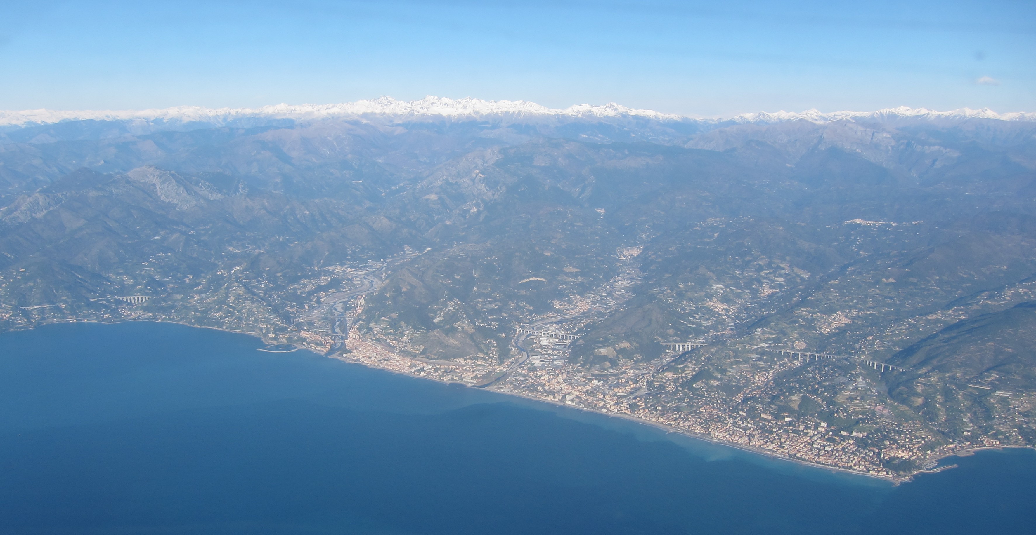
Bordighera (; lij, A Bordighea, locally ) is a town and ''comune'' in the Province of Imperia, Liguria (Italy). Geography Bordighera is located from the land border between Italy and France, and it is possible to see the French coast with a naked eye from the town. Having the "Capo Sant’Ampelio" which protrudes into the sea, it is the southernmost commune of the region. The cape is at around the same latitude as Pisa and features a little church built in the 11th century for Sant’Ampelio, the patron saint of the city. Since Bordighera is built where the Maritime Alps plunge into the sea, it benefits from the Foehn effect which creates a special microclimate that has warmer winters. History It seems that Bordighera has been inhabited since the Palaeolithic era, as archaeologists have found signs of human activities in the caves along the Italian and French coast. In the 6th century BC came the Ligures, from whom the name of the region, "Liguria" in Italian, is derived. They w ... [...More Info...] [...Related Items...] OR: [Wikipedia] [Google] [Baidu] |
Sospel
Sospel (; Mentonasc: Sospèl, Italian Sospello) is a commune (municipality) and former schismatic episcopal seat (1381-1418) in the Alpes-Maritimes department in southeastern France near the Italian border and not far from Monte Carlo. History and remains The town dates back to the 5th century, when it served as an important staging post on the royal road from Nice to Turin. Its main monument is the former cathedral. * The old toll bridge used by travellers to cross the Bévéra, built in the 13th century, still stands. It was bombed by the Germans during World War II to prevent contact between the French Resistance ("The Maquis") and the Italians. Much of the town was destroyed. Renovated after World War II it now houses the tourist office. * The ruins of a tower, part of a château (residential castle) belonging to the counts of Provence, are all that remain of the 14th century city walls. Ecclesiastical history During the Western Schism, the Diocese of Ventimiglia ( ... [...More Info...] [...Related Items...] OR: [Wikipedia] [Google] [Baidu] |
France–Italy Border
The France–Italy border is 515 km (320 mi) long. It runs from the Alps in the north, a region in which it passes over Mont Blanc, down to the Mediterranean coast in the south. Three national parks are located along the border: Vanoise National Park and Mercantour National Park on the French side and Gran Paradiso National Park on the Italian side. Features The France–Italy border is mainly mountainous. It is long, in southeast France and northwest Italy. It begins at the west tripoint of France–Italy–Switzerland () near the top of Mont Dolent ( m), in the French commune of Chamonix (department of Haute-Savoie), the Italian city of Courmayeur (Aosta Valley) and the Swiss commune of Orsières (canton of Valais). The boundary then follows a general direction towards south, to the Mediterranean, it reaches the sea at Menton in France and Ventimiglia in Italy. The border separates three regions (Aosta Valley, Piedmont and Liguria) and four provinces of Italy (Aosta, Turin, ... [...More Info...] [...Related Items...] OR: [Wikipedia] [Google] [Baidu] |
Mountains Of Alpes-Maritimes
A mountain is an elevated portion of the Earth's crust, generally with steep sides that show significant exposed bedrock. Although definitions vary, a mountain may differ from a plateau in having a limited summit area, and is usually higher than a hill, typically rising at least 300 metres (1,000 feet) above the surrounding land. A few mountains are isolated summits, but most occur in mountain ranges. Mountains are formed through tectonic forces, erosion, or volcanism, which act on time scales of up to tens of millions of years. Once mountain building ceases, mountains are slowly leveled through the action of weathering, through slumping and other forms of mass wasting, as well as through erosion by rivers and glaciers. High elevations on mountains produce colder climates than at sea level at similar latitude. These colder climates strongly affect the ecosystems of mountains: different elevations have different plants and animals. Because of the less hospitable terrain and ... [...More Info...] [...Related Items...] OR: [Wikipedia] [Google] [Baidu] |
Mountains Of Liguria
A mountain is an elevated portion of the Earth's crust, generally with steep sides that show significant exposed bedrock. Although definitions vary, a mountain may differ from a plateau in having a limited summit area, and is usually higher than a hill, typically rising at least 300 metres (1,000 feet) above the surrounding land. A few mountains are isolated summits, but most occur in mountain ranges. Mountains are formed through tectonic forces, erosion, or volcanism, which act on time scales of up to tens of millions of years. Once mountain building ceases, mountains are slowly leveled through the action of weathering, through slumping and other forms of mass wasting, as well as through erosion by rivers and glaciers. High elevations on mountains produce colder climates than at sea level at similar latitude. These colder climates strongly affect the ecosystems of mountains: different elevations have different plants and animals. Because of the less hospitable terrain ... [...More Info...] [...Related Items...] OR: [Wikipedia] [Google] [Baidu] |
Mountains Of The Ligurian Alps
A mountain is an elevated portion of the Earth's crust, generally with steep sides that show significant exposed bedrock. Although definitions vary, a mountain may differ from a plateau in having a limited summit area, and is usually higher than a hill, typically rising at least 300 metres (1,000 feet) above the surrounding land. A few mountains are isolated summits, but most occur in mountain ranges. Mountains are formed through tectonic forces, erosion, or volcanism, which act on time scales of up to tens of millions of years. Once mountain building ceases, mountains are slowly leveled through the action of weathering, through slumping and other forms of mass wasting, as well as through erosion by rivers and glaciers. High elevations on mountains produce colder climates than at sea level at similar latitude. These colder climates strongly affect the ecosystems of mountains: different elevations have different plants and animals. Because of the less hospitable terrain and ... [...More Info...] [...Related Items...] OR: [Wikipedia] [Google] [Baidu] |
Site Of Community Importance
A Site of Community Importance (SCI) is defined in the European Commission Habitats Directive (92/43/EEC) as a site which, in the biogeographical region or regions to which it belongs, contributes significantly to the maintenance or restoration at a favourable conservation status of a natural habitat type or of a species and may also contribute significantly to the coherence of Natura 2000, and/or contributes significantly to the maintenance of biological diversity within the biogeographic region or regions concerned. They are proposed to the Commission by the State Members and once approved, they can be designated as SACs by the State Member. Definition In the environment field, the term is used to define an area: * which contributes significantly to maintaining or restoring one of the 233 European natural habitat types defined in Annex I of the Habitats Directive or to maintaining in a favourable state of conservation one of the approximately 900 species defined in Annex II; * ... [...More Info...] [...Related Items...] OR: [Wikipedia] [Google] [Baidu] |
Bévéra
The Bévéra (in French) or Bevera (in Italian) (''Beura'' in Occitan and Ligurian) is a river of southeastern France and northwestern Italy. Geography Bévéra source is in the Maritime Alps, near Moulinet in the French Alpes-Maritimes department. It flows generally southeast, through Sospel, crosses the Italian border (province of Imperia) and discharges into the river Roya, near Ventimiglia. Its length within France is . The Basséra is one of its tributaries. Conservation Most of the Ligurian part of Bevera valley, along with the Italian slopes of Monte Grammondo, belongs to a SIC ''(Site of Community Importance A Site of Community Importance (SCI) is defined in the European Commission Habitats Directive (92/43/EEC) as a site which, in the biogeographical region or regions to which it belongs, contributes significantly to the maintenance or restoration at ...)'' called ''M. Grammondo T. Bevera'' (code IT 1315717). References External links * Rivers of France ... [...More Info...] [...Related Items...] OR: [Wikipedia] [Google] [Baidu] |
Menton
Menton (; , written ''Menton'' in classical norm or ''Mentan'' in Mistralian norm; it, Mentone ) is a commune in the Alpes-Maritimes department in the Provence-Alpes-Côte d'Azur region on the French Riviera, close to the Italian border. Menton has always been a frontier town. Since the end of the 14th century, it was on the border between County of Nice, held by the Duke of Savoy, and Republic of Genoa. It was an exclave of the Principality of Monaco until the disputed French plebiscite of 1860, when it was added to France. It had been always a fashionable tourist centre with grand mansions and gardens. Its temperate Mediterranean climate is especially favourable to the citrus industry, with which it is strongly identified. Etymology Although the name's spelling and pronunciation in French are identical to those for the word that means "chin", there does not seem to be any link with this French word. According to the French geographer Ernest Nègre, the name ''Menton'' c ... [...More Info...] [...Related Items...] OR: [Wikipedia] [Google] [Baidu] |
Castillon, Alpes-Maritimes
Castillon (; oc, Castilhon; it, Castiglione) is a commune in the Alpes-Maritimes department in southeastern France. Population See also *Communes of the Alpes-Maritimes department The following is a list of the 163 communes of the Alpes-Maritimes department of France. The communes cooperate in the following intercommunalities (as of 2020):Communes of Alpes-Maritimes Alpes-Maritimes communes articles needing translation from French Wikipedia {{AlpesMaritimes-geo-stub ... [...More Info...] [...Related Items...] OR: [Wikipedia] [Google] [Baidu] |


