|
Mongefossen
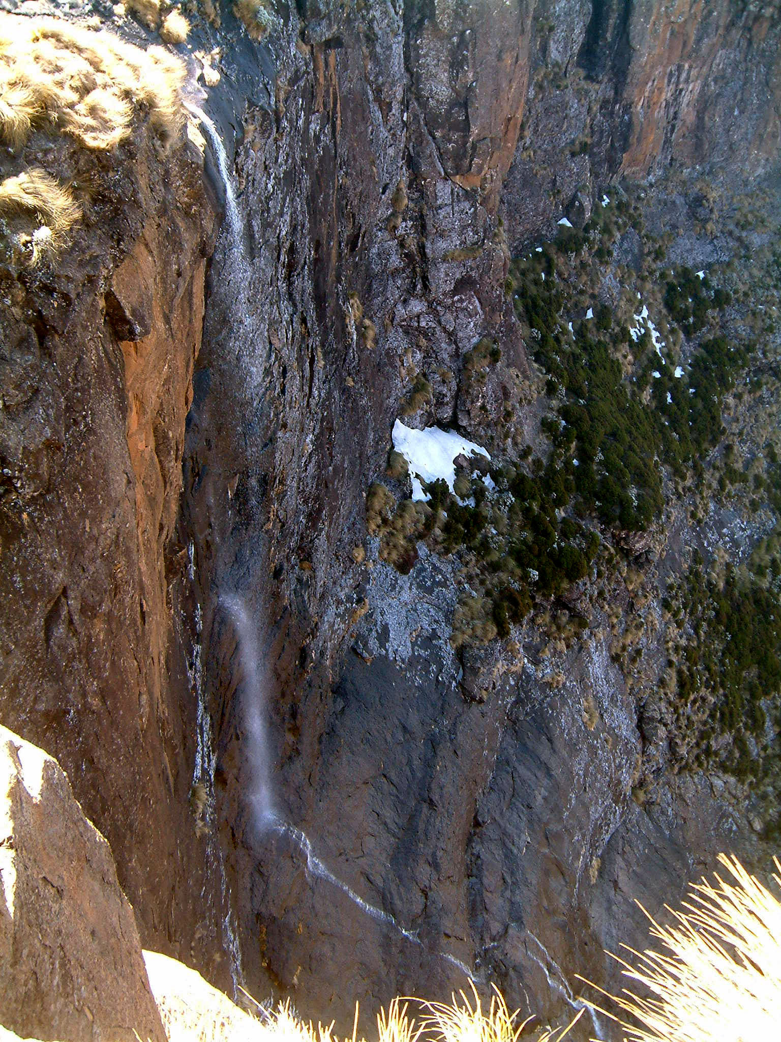
Mongefossen ( en, Monge falls) is a waterfall in the Rauma Municipality of Møre og Romsdal county, Norway. It is the fourth tallest single-drop waterfall in the world. It's located near the European route E136 highway and the Rauma River, which it flows into. There is some dispute as to the height, but it is generally listed at . As is the case with many of Norway's waterfalls, it has been targeted for hydroelectric power, which results in a greatly diminished water flow during the summer tourist season. Mongefossen also holds the distinction as being the highest waterfall in the world which may be viewed from a railway station on the Rauma Line The Rauma Line ( no, Raumabanen) is a long railway between the town of Åndalsnes (in Rauma Municipality in Møre og Romsdal county), and the village of Dombås (in Dovre Municipality in Oppland county), in Norway. Running down the Romsdalen v ..., on the north side between the villages of Flatmark and Marstein. See also * ... [...More Info...] [...Related Items...] OR: [Wikipedia] [Google] [Baidu] |
List Of Waterfalls By Height
The following are lists of waterfalls in the world by height, classified into two categories — natural and artificial. Natural waterfalls are further subdivided between overall height and tallest single drop. Each column (Waterfall, Height, Locality, Country) is sortable by using the up/down link in the column headings at the top of each column. World's tallest natural waterfalls By overall height This list consists of waterfalls which are known to have an overall height of at least . Underwater falls, such as the Denmark Strait cataract, are not included. By tallest single drop This list consists of the waterfalls which are known to have a singular individual step with a vertical drop of at least . World's tallest artificial waterfalls See also *List of waterfalls *List of waterfalls by flow rate *List of waterfalls by type References {{Reflist External linksWorld Waterfall Database: Worlds Tallest Waterfalls Heightness Waterfalls Waterfalls A waterfall is ... [...More Info...] [...Related Items...] OR: [Wikipedia] [Google] [Baidu] |
Møre Og Romsdal
Møre og Romsdal (; en, Møre and Romsdal) is a county in the northernmost part of Western Norway. It borders the counties of Trøndelag, Innlandet, and Vestland. The county administration is located in the town of Molde, while Ålesund is the largest town. The county is governed by the Møre og Romsdal County Municipality which includes an elected county council and a county mayor. The national government is represented by the county governor. Name The name ''Møre og Romsdal'' was created in 1936. The first element refers to the districts of Nordmøre and Sunnmøre, and the last element refers to Romsdal. Until 1919, the county was called "Romsdalens amt", and from 1919 to 1935 "Møre fylke". For hundreds of years (1660-1919), the region was called ''Romsdalen amt'', after the Romsdalen valley in the present-day Rauma Municipality. The Old Norse form of the name was ''Raumsdalr''. The first element is the genitive case of the name ''Raumr'' derived from the name of the ... [...More Info...] [...Related Items...] OR: [Wikipedia] [Google] [Baidu] |
Norway
Norway, officially the Kingdom of Norway, is a Nordic country in Northern Europe, the mainland territory of which comprises the western and northernmost portion of the Scandinavian Peninsula. The remote Arctic island of Jan Mayen and the archipelago of Svalbard also form part of Norway. Bouvet Island, located in the Subantarctic, is a dependency of Norway; it also lays claims to the Antarctic territories of Peter I Island and Queen Maud Land. The capital and largest city in Norway is Oslo. Norway has a total area of and had a population of 5,425,270 in January 2022. The country shares a long eastern border with Sweden at a length of . It is bordered by Finland and Russia to the northeast and the Skagerrak strait to the south, on the other side of which are Denmark and the United Kingdom. Norway has an extensive coastline, facing the North Atlantic Ocean and the Barents Sea. The maritime influence dominates Norway's climate, with mild lowland temperatures on the se ... [...More Info...] [...Related Items...] OR: [Wikipedia] [Google] [Baidu] |
Waterfall
A waterfall is a point in a river or stream where water flows over a vertical drop or a series of steep drops. Waterfalls also occur where meltwater drops over the edge of a tabular iceberg or ice shelf. Waterfalls can be formed in several ways, but the most common method of formation is that a river courses over a top layer of resistant bedrock before falling on to softer rock, which Erosion, erodes faster, leading to an increasingly high fall. Waterfalls have been studied for their impact on species living in and around them. Humans have had a distinct relationship with waterfalls for years, travelling to see them, exploring and naming them. They can present formidable barriers to navigation along rivers. Waterfalls are religious sites in many cultures. Since the 18th century they have received increased attention as tourist destinations, sources of hydropower, andparticularly since the mid-20th centuryas subjects of research. Definition and terminology A waterfall is gen ... [...More Info...] [...Related Items...] OR: [Wikipedia] [Google] [Baidu] |
Rauma Municipality
Rauma is a municipality in Møre og Romsdal county, Norway. It is part of the traditional district of Romsdal. The administrative centre is the town of Åndalsnes. Other settlements in Rauma include the villages of Måndalen, Innfjorden, Veblungsnes, Verma, Isfjorden, Eidsbygda, Rødven, Åfarnes, and Mittet. Most settlement in the municipality is located along the fjords and in the Romsdalen valley. The municipality surrounds part of the southern end of Romsdalsfjorden and the Isfjorden and it also includes the Romsdalen valley and Romsdalsalpene mountains. In the lower part of the valleys and around Romsdal Fjord and Rødvenfjorden are driven agriculture with emphasis on livestock. The clothing industry has traditionally been a dominant industry in the municipality, especially in Isfjorden. In the summer, Rauma has a fairly large amount of tourist traffic. The top tourist attractions include mountain climbing/hiking, salmon fishing, Trollstigen, and the historic Rødven ... [...More Info...] [...Related Items...] OR: [Wikipedia] [Google] [Baidu] |
European Route E136
European route E 136 is a European highway located entirely in Møre og Romsdal and Innlandet counties in Norway. The highway begins in the town of Ålesund in Møre og Romsdal county on the west coast of Norway, and it goes east up through the Romsdalen valley, crossing into the upper Gudbrandsdalen Valley to end at the village of Dombås in Dovre Municipality in Innlandet county. Møre og Romsdal county Ålesund municipality * Ålesund, to Ålesund Airport, Vigra * at Spjelkavik (jointly with E136 until Vestnes in Vestnes Municipality) * Sørnes Tunnel (236 m) * Brusdal * Sjøholt Vestnes municipality * at Vestnes (jointly with E136 from Spjelkavika in Ålesund) * Tresfjord Bridge over the Tresfjorden Rauma municipality * Vågstrand Tunnel (3,665 m) * Måndal Tunnel (2,080 m) * Innfjord Tunnel (6,594 m) * Rauma Bridge over the Rauma River (140 m) * Åndalsnes * Sogge Bridge at Åndalsnes Innlandet county Lesja municipality * at Lesja Dovre munici ... [...More Info...] [...Related Items...] OR: [Wikipedia] [Google] [Baidu] |
Rauma River
The Rauma is a river that runs through ''Romsdalen'', a valley in Møre og Romsdal and Innlandet counties in Norway. It runs for from ''Lesjaskogsvatnet'', a lake in the municipality of Lesja, to the town of Åndalsnes in the municipality of Rauma. The river was once famous for its salmon-fishing, but since an infection with ''Gyrodactylus salaris'' only 5 to 10% of the original stock survives. This, however, has begun to recover rapidly after a successful revitalisation project. The salmon runs up to the '' Slettafossen'', a high combination of waterfalls and rapids more than upriver from the estuary. The Rauma River and its valley are regarded as one of the most beautiful in Norway. The river runs very clear with a green tint and the mountains tower some above the river in the lower and middle parts of the valley. The Reinheimen National Park and the Trollveggen cliff are both located along the southwestern shores of the river through the municipality of Rauma. The ''Ro ... [...More Info...] [...Related Items...] OR: [Wikipedia] [Google] [Baidu] |
Hydroelectric
Hydroelectricity, or hydroelectric power, is electricity generated from hydropower (water power). Hydropower supplies one sixth of the world's electricity, almost 4500 TWh in 2020, which is more than all other renewable sources combined and also more than nuclear power. Hydropower can provide large amounts of low-carbon electricity on demand, making it a key element for creating secure and clean electricity supply systems. A hydroelectric power station that has a dam and reservoir is a flexible source, since the amount of electricity produced can be increased or decreased in seconds or minutes in response to varying electricity demand. Once a hydroelectric complex is constructed, it produces no direct waste, and almost always emits considerably less greenhouse gas than fossil fuel-powered energy plants. [...More Info...] [...Related Items...] OR: [Wikipedia] [Google] [Baidu] |
Train Station
A train station, railway station, railroad station or depot is a railway facility where trains stop to load or unload passengers, freight or both. It generally consists of at least one platform, one track and a station building providing such ancillary services as ticket sales, waiting rooms and baggage/freight service. If a station is on a single-track line, it often has a passing loop to facilitate traffic movements. Places at which passengers only occasionally board or leave a train, sometimes consisting of a short platform and a waiting shed but sometimes indicated by no more than a sign, are variously referred to as "stops", "flag stops", " halts", or "provisional stopping places". The stations themselves may be at ground level, underground or elevated. Connections may be available to intersecting rail lines or other transport modes such as buses, trams or other rapid transit systems. Terminology In British English, traditional terminology favours ''railway station' ... [...More Info...] [...Related Items...] OR: [Wikipedia] [Google] [Baidu] |
Rauma Line
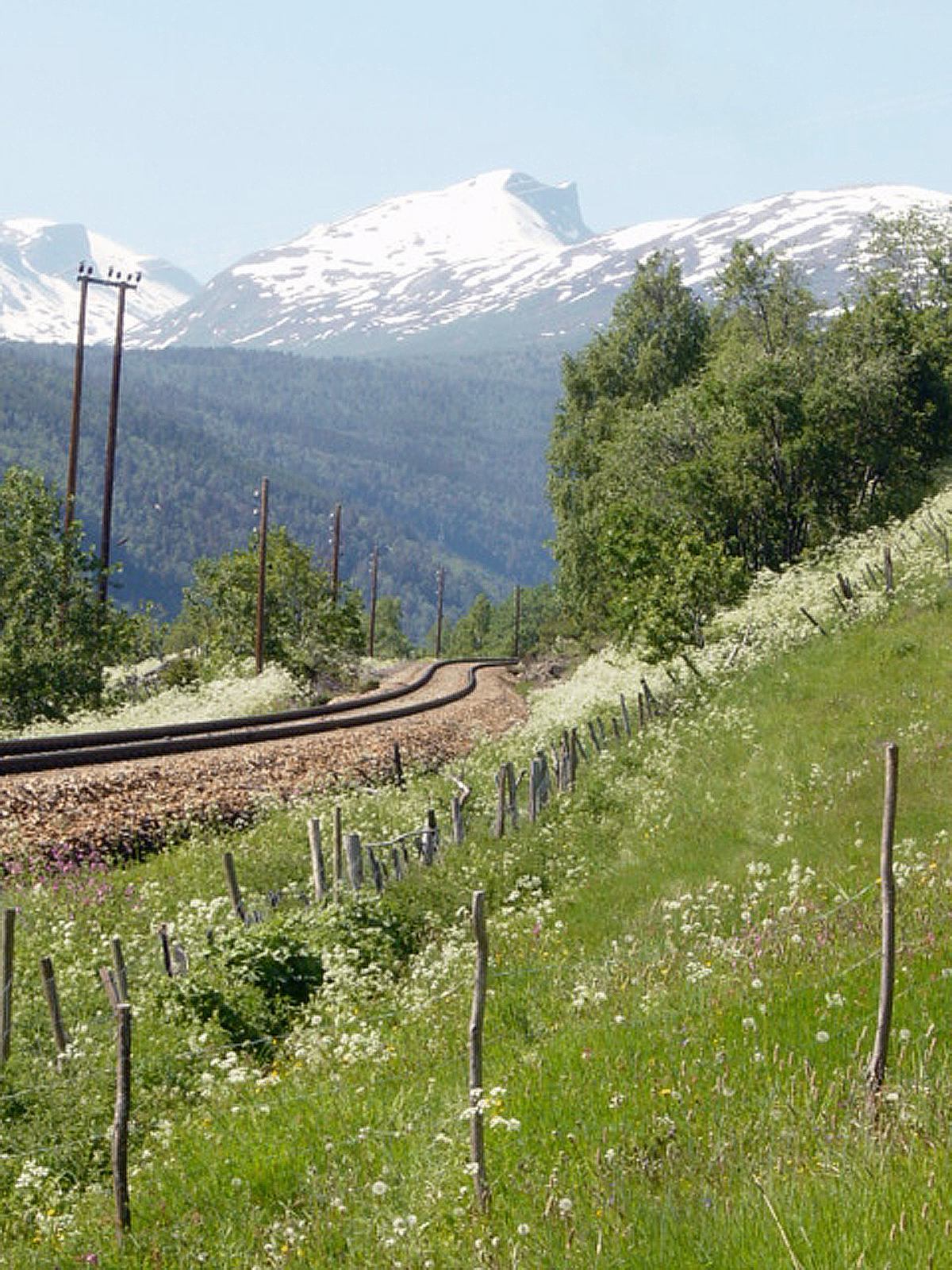
The Rauma Line ( no, Raumabanen) is a long railway between the town of Åndalsnes (in Rauma Municipality in Møre og Romsdal county), and the village of Dombås (in Dovre Municipality in Oppland county), in Norway. Running down the Romsdalen valley, the line opened between 1921 and 1924 as a branch of the Dovre Line, which connects to the cities of Oslo and Trondheim. Originally intended as the first stage to connect Ålesund, and possibly also Molde and Kristiansund, no extensions have ever been realized. The unelectrified line is served four times daily with Norwegian State Railways' Class 93, although in the summer the service only operates from Åndalsnes to Bjorli as a tourist service. CargoLink operates a daily freight train. The line features two horseshoe curves and has a elevation drop. Among the line's features is the Kylling Bridge and views of the mountainous valley. Five stations remain in use: Dombås, Lesja, Lesjaverk, Bjorli and Åndalsnes. There have been la ... [...More Info...] [...Related Items...] OR: [Wikipedia] [Google] [Baidu] |
Grytten Et Gårdsbruk Ved Mongefossen - NB MS G4 0001
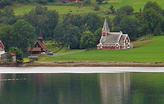
Grytten is a former municipality in Møre og Romsdal county, Norway. It existed from 1838 until its dissolution in 1964. The municipality encompassed the Romsdalen valley which follows the Rauma River from the Oppland county border to the inner part of the Romsdal Fjord at the town of Åndalsnes, as well as some smaller side valleys. The original municipality of Grytten was almost identical to the present-day Rauma Municipality, plus the southern part of Veøy Municipality (south of the Langfjorden). When Grytten ceased to exist in 1964, it had an overall area of . The administrative centre was the village of Åndalsnes. History Grytten was established as a municipality on 1 January 1838 (see formannskapsdistrikt law). On 1 January 1840, the northwestern part of Grytten was separated to form the new municipality of ''Voll og Eid''. Then on 1 January 1902, the northeastern part of Grytten was separated to form the new municipality of Hen (population: 1,128), leaving Grytten ... [...More Info...] [...Related Items...] OR: [Wikipedia] [Google] [Baidu] |
Rauma, Norway
Rauma is a municipality in Møre og Romsdal county, Norway. It is part of the traditional district of Romsdal. The administrative centre is the town of Åndalsnes. Other settlements in Rauma include the villages of Måndalen, Innfjorden, Veblungsnes, Verma, Isfjorden, Eidsbygda, Rødven, Åfarnes, and Mittet. Most settlement in the municipality is located along the fjords and in the Romsdalen valley. The municipality surrounds part of the southern end of Romsdalsfjorden and the Isfjorden and it also includes the Romsdalen valley and Romsdalsalpene mountains. In the lower part of the valleys and around Romsdal Fjord and Rødvenfjorden are driven agriculture with emphasis on livestock. The clothing industry has traditionally been a dominant industry in the municipality, especially in Isfjorden. In the summer, Rauma has a fairly large amount of tourist traffic. The top tourist attractions include mountain climbing/hiking, salmon fishing, Trollstigen, and the historic Rødven ... [...More Info...] [...Related Items...] OR: [Wikipedia] [Google] [Baidu] |


.jpg)

