|
Mohlapitse River
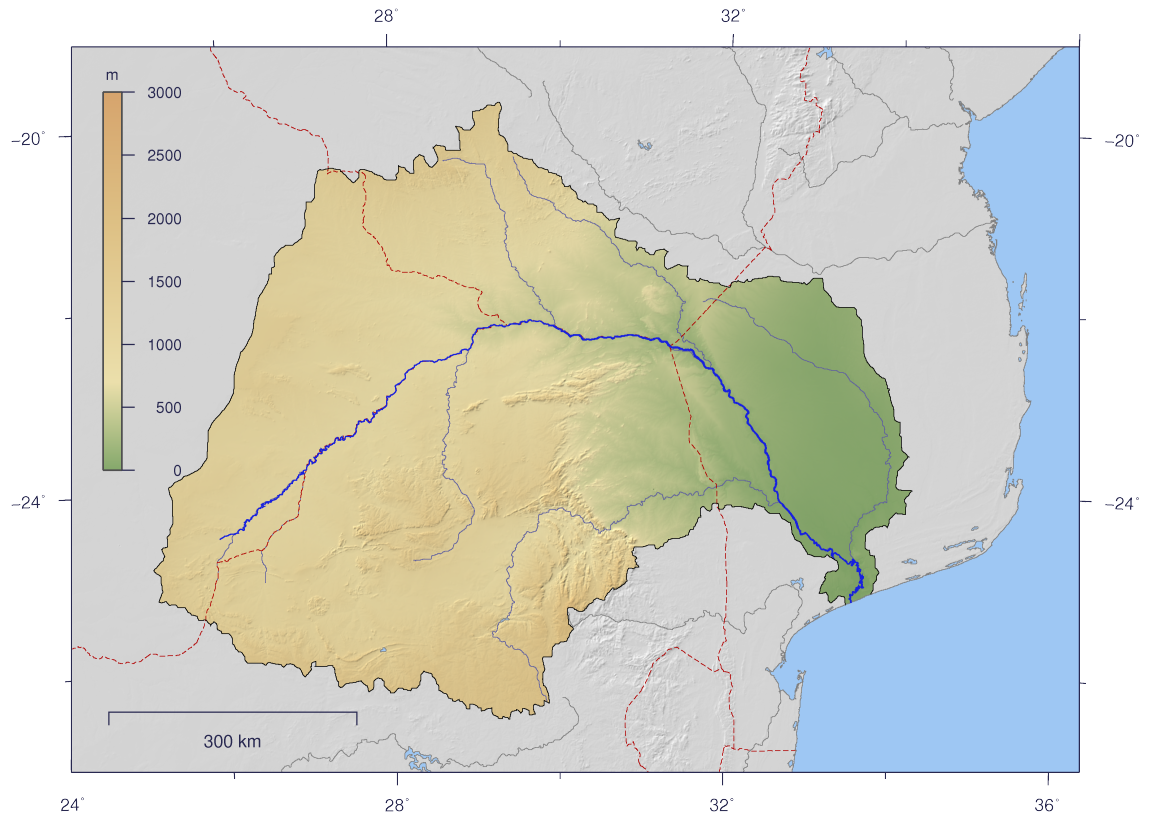
The Mohlapitse River post updated 2011-04-19; database downloaded 2017-02-28 is a small river in , . It flows due south and is a central tributary of the Olifants River, joining its right bank at a 90° angle. References See also *List of rivers of South Africa
[...More Info...] [...Related Items...] OR: [Wikipedia] [Google] [Baidu] |
South Africa
South Africa, officially the Republic of South Africa (RSA), is the southernmost country in Africa. It is bounded to the south by of coastline that stretch along the South Atlantic and Indian Oceans; to the north by the neighbouring countries of Namibia, Botswana, and Zimbabwe; and to the east and northeast by Mozambique and Eswatini. It also completely enclaves the country Lesotho. It is the southernmost country on the mainland of the Old World, and the second-most populous country located entirely south of the equator, after Tanzania. South Africa is a biodiversity hotspot, with unique biomes, plant and animal life. With over 60 million people, the country is the world's 24th-most populous nation and covers an area of . South Africa has three capital cities, with the executive, judicial and legislative branches of government based in Pretoria, Bloemfontein, and Cape Town respectively. The largest city is Johannesburg. About 80% of the population are Black South Afri ... [...More Info...] [...Related Items...] OR: [Wikipedia] [Google] [Baidu] |
Limpopo Province
Limpopo is the northernmost Provinces of South Africa, province of South Africa. It is named after the Limpopo River, which forms the province's western and northern borders. The capital and largest city in the province is Polokwane, while the provincial legislature is situated in Lebowakgomo. The province is made up of 3 former homelands of Lebowa, Gazankulu and Venda and the former parts of the Transvaal province. The Limpopo province was established as one of the new nine provinces after South Africa's first democratic election on the 27th of April 1994. The province's name was first "Northern Transvaal", later changed to "Northern Province" on the 28th of June 1995, together with two other provinces. The name was later changed again in 2002 to the Limpopo province. Limpopo is made up of 3 main ethnic groups namely; Pedi people, Tsonga people, Tsonga and Venda people. Traditional leaders and chiefs still form a strong backbone of the province's political landscape. Establ ... [...More Info...] [...Related Items...] OR: [Wikipedia] [Google] [Baidu] |
Olifants River (Limpopo)
The Olifants River, Lepelle, iBhalule or Obalule ( af, Olifantsrivier; pt, Rio dos Elefantes) is a river in South Africa and Mozambique, a tributary of the Limpopo River. It falls into the Drainage Area B of the Drainage basins of South Africa. The historical area of the Pedi people, Sekhukhuneland, is located between the Olifants River and one of its largest tributaries, the Steelpoort River. Course The Olifants River has its origin between Breyten and Bethal, Mpumalanga Province. It flows north towards Limpopo Province through Witbank Dam and then the Loskop Dam and is forced east by the Transvaal Drakensberg, cutting through at the Abel Erasmus Pass and then flowing east further across the Lowveld to join with the Letaba River. It crosses into Gaza Province, Mozambique, after cutting through the Lebombo Mountains by way of the Olifants Gorge, becoming the ''Rio dos Elefantes'', and finally joining the Limpopo River after 40 km before it enters the Indian Ocean at Xa ... [...More Info...] [...Related Items...] OR: [Wikipedia] [Google] [Baidu] |
List Of Rivers Of South Africa
This is a list of rivers in South Africa. It is quite common to find the Afrikaans word ''-rivier'' as part of the name. Another common suffix is "''-kamma''", from the Khoisan term for "river" Meiring, Barbara"South African Toponymic Guidelines for Map and other editors: Fourth Edition" 12. Retrieved on 30 April 2013. (often tautologically the English term "river" is added to the name). The Zulu word ''amanzi'' (water) also forms part of some river names. The Afrikaans term ''spruit'' (compare spring) often labels small rivers. List * A Drainage basin code assigned by the Department of Water Affairs (South Africa), a complete list is available at Drainage basins of South Africa Gallery Image:South Africa Topography.png, Topographic map of South Africa. Image:Orange watershed topo.png, Course and watershed of the Orange River with topography shading and political boundaries. Image:Groot River.jpg, Grootrivier in Nature's Valley, stained a tea colour by plant tannins ... [...More Info...] [...Related Items...] OR: [Wikipedia] [Google] [Baidu] |


