|
Mizque Province
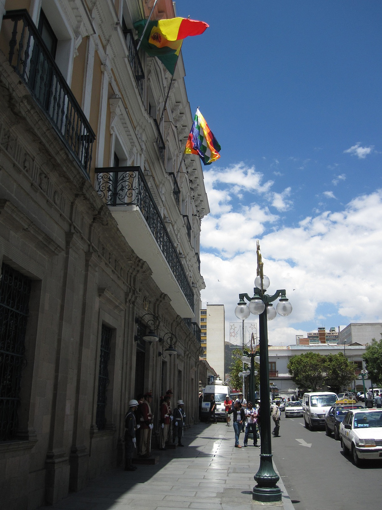
Mizque (from Quechua: ''misk'i'', meaning "sweet") is a province in the Cochabamba Department, Bolivia. Its capital is Mizque. The province, in 1992, had a population of 27,959 inhabitants, mostly indigenous citizens of Quechuan descent. In 2001, the population increased to 36,181 inhabitants and it was estimated at 41,062 in 2005. Geography Mizque Province is home to a great diversity of ecoregions because it contains a wide variety of topographic features with heights ranging between 2,000 and 3,600 m. The province belongs to the Julpe-Mizque basin with an area of 3,845 km2. The main rivers are: * Mizque River, 75 km * Julpe River, 60 km * Uyuchama River, 50 km * Tuqma River, 45 km * Kari Kari River, 42 km * Vicho Vicho River, 32 km Although there is a large amount of superficial and sub-superficial water within the province, the zone is suffering from drought due to the lack of irrigation systems. Some of the highest mountains of the pr ... [...More Info...] [...Related Items...] OR: [Wikipedia] [Google] [Baidu] |
Flag Of Bolivia
The flag of Bolivia is the national flag of the Bolivia, Plurinational State of Bolivia. It was originally adopted in 1851. The state and war flag is a horizontal tricolour (flag), tricolor of red, yellow and green with the Coat of Arms of Bolivia, Bolivian coat of arms in the center. According to one source, the red stands for Bolivia's brave soldiers, while the green symbolizes soil fertility, fertility and yellow the nation's mineral deposits. Since 2009 the Wiphala also holds the status of ''dual flag'' in the country. According to the revised Constitution of Bolivia of 2009, the Wiphala is considered a national symbol of Bolivia (along with the flag, national anthem, Coat of arms of Bolivia, coat of arms, the cockade; Cantua buxifolia, kantuta flower and patujú flower). Despite its landlocked status, Bolivia has a naval ensign used by navy vessels on rivers and lakes. It consists of a blue field with the state flag in the Flag terminology, canton bordered by nine small y ... [...More Info...] [...Related Items...] OR: [Wikipedia] [Google] [Baidu] |
Chullpa Q'asa
Chullpa Q'asa ( Quechua ''chullpa'' stone tomb, burial tower, ''q'asa'' mountain pass, "''chullpa'' pass", also spelled ''Chullpa Khasa'') is a mountain in the Bolivian Andes. It is located in the Cochabamba Department, Mizque Province, Vila Vila Municipality Vila Vila (in Hispanicized spelling) or Wila Wila ( Aymara) is the second municipal section of the Mizque Province in the Cochabamba Department, Bolivia , image_flag = Bandera de Bolivia (Estado).svg , flag_alt .... Chullpa Q'asa lies southwest of Jatun Urqu. References Mountains of Cochabamba Department {{CochabambaBO-geo-stub ... [...More Info...] [...Related Items...] OR: [Wikipedia] [Google] [Baidu] |
Tuqma Urqu
Tuqma ( Quechua ''tuqma'' canine tooth, urqu mountain, "canine tooth mountain", also spelled ''Tucma Orkho'') is a mountain in the Bolivian Andes. It is located in the Cochabamba Department, Mizque Province, Mizque Municipality. The Tuqma River or Tuqma Mayu (Quechua) which originates northwest of the mountain, south of a peak named Tuqma Tuqma ( Quechua for canine tooth, also spelled ''Tujma'') is a mountain in the Bolivian Andes which reaches a height of approximately . It is located in the Cochabamba Department, Mizque Province, Mizque Municipality, near the border to the Car ... flows along its western slope. References Mountains of Cochabamba Department {{CochabambaBO-geo-stub ... [...More Info...] [...Related Items...] OR: [Wikipedia] [Google] [Baidu] |
Tuqma
Tuqma ( Quechua for canine tooth, also spelled ''Tujma'') is a mountain in the Bolivian Andes which reaches a height of approximately . It is located in the Cochabamba Department, Mizque Province, Mizque Municipality, near the border to the Carrasco Province, Pocona Municipality. Tuqma lies south of Misk'i Misk'i (Aymara and Quechua for 'sweet' or 'honey', also spelled ''Mizque'') is a mountain in the Bolivian Andes which reaches a height of approximately . It is located in the Cochabamba Department, Carrasco Province, Pocona Municipality Pocona .... The Wanaku Mayu ("guanaco river") flows along its northern slope. References Mountains of Cochabamba Department {{CochabambaBO-geo-stub ... [...More Info...] [...Related Items...] OR: [Wikipedia] [Google] [Baidu] |
Tikrasqa (Mizque)
Tikrasqa ( Quechua ''tikray'' to turn upside down, ''-sqa'' a suffix, "turned upside down", also spelled ''Tecrasca'') is a mountain in the Bolivian Andes. It is located in the Cochabamba Department, Mizque Province, Vila Vila Municipality Vila Vila (in Hispanicized spelling) or Wila Wila ( Aymara) is the second municipal section of the Mizque Province in the Cochabamba Department, Bolivia , image_flag = Bandera de Bolivia (Estado).svg , flag_alt .... The Pukara Mayu which downstream is named Wila Wila originates north of the mountain. It flows to the southeast. References Mountains of Cochabamba Department {{CochabambaBO-geo-stub ... [...More Info...] [...Related Items...] OR: [Wikipedia] [Google] [Baidu] |
Siwinqani (Mizque)
Siwinqani (Aymara ''siwinqa'' a kind of cactus, ''-ni'' a suffix, "the one with the ''siwinqa'' plant", also spelled ''Sivingani'') is a mountain in the Bolivian Andes which reaches a height of approximately high . It is located in the Cochabamba Department, Mizque Province, Alalay Municipality Alalay Municipality is the third municipal section of the Mizque Province in the Cochabamba Department, Bolivia. Its seat is Alalay. Geography Some of the highest mountains of the municipality are listed below: Languages The languages spo .... References Mountains of Cochabamba Department {{CochabambaBO-geo-stub ... [...More Info...] [...Related Items...] OR: [Wikipedia] [Google] [Baidu] |
Rirpu
Rirpu (Quechua for mirror, possibly erroneously also spelled ''Sirpu'') is a mountain in the Bolivian Andes. It is located in the Cochabamba Department, Mizque Province, Alalay Municipality. It lies southwest of Wanq'uni Huancune (possibly from Aymara ''wanq'u'' guinea pig) is a volcano in the Barroso mountain range in the Andes of Peru, about high. It is situated in the Tacna Region, Tacna Province Tacna is the largest of four provinces in the Department of .... References Mountains of Cochabamba Department {{CochabambaBO-geo-stub ... [...More Info...] [...Related Items...] OR: [Wikipedia] [Google] [Baidu] |
Putu Phutunqu
Putu Phutunqu (Aymara ''putu'' vault, ''phutunqu'' hole, pit, crater, also spelled ''Putu Putuncu'') is a mountain in the Bolivian Andes. It is located in the Cochabamba Department, Carrasco Province, Pocona Municipality and in the Mizque Province, Alalay Municipality. Putu Phutunqu lies southeast of Inka Pirqa Inka Pirqa or Inkapirqa (Quechua ''Inka'' Inca, ''pirqa'' (Kichwa ''pirka'') wall, "Inca wall", Hispanicized spelling ''Incaperca'') is a mountain in the Andes of Peru. It is located in the Cusco Region, Canchis Province Canchis Province is .... References Mountains of Cochabamba Department {{CochabambaBO-geo-stub ... [...More Info...] [...Related Items...] OR: [Wikipedia] [Google] [Baidu] |
Puka Qawiña
Puka Qawiña ( Aymara ''puka'' colored, ''qawiña'' gable, "red gable", also spelled ''Puca Cahuiña'') is a mountain in the Bolivian Andes. It is located in the Cochabamba Department, at the border of the Esteban Arce Province, Anzaldo Municipality, and the Mizque Province, Vila Vila Municipality Vila Vila (in Hispanicized spelling) or Wila Wila ( Aymara) is the second municipal section of the Mizque Province in the Cochabamba Department, Bolivia , image_flag = Bandera de Bolivia (Estado).svg , flag_alt .... Puka Qawiña lies southeast of Tikrasqa, east of the village of Puka Pampa ''(Puca Pampa)''. References Mountains of Cochabamba Department {{CochabambaBO-geo-stub ... [...More Info...] [...Related Items...] OR: [Wikipedia] [Google] [Baidu] |
Puka Qallpa
Puka Qallpa (Quechua ''puka'' red, ''qallpa'' terrain after the harvest, also spelled ''Puca Khallpa'') is a mountain in the Bolivian Andes. It is located in the Cochabamba Department, Mizque Province, Alalay Municipality. It lies in the northwest of Kachi Q'asa and northeast of Inka Pirqa Inka Pirqa or Inkapirqa (Quechua ''Inka'' Inca, ''pirqa'' (Kichwa ''pirka'') wall, "Inca wall", Hispanicized spelling ''Incaperca'') is a mountain in the Andes of Peru. It is located in the Cusco Region, Canchis Province Canchis Province is .... The Puka Urqu Mayu ("red mountain river") flows along its western slope. Its waters flow to the Jatun Mayu ("big river") in the south. References Mountains of Cochabamba Department {{CochabambaBO-geo-stub ... [...More Info...] [...Related Items...] OR: [Wikipedia] [Google] [Baidu] |
Jatun Urqu (Mizque)
Jatun Urqu (Quechua ''jatun'' big, ''urqu'' mountain, "big mountain", also spelled ''Jatun Orkho, Jatún Orkho'') is a mountain in the Bolivian Andes which reaches a height of approximately . It is located in the Cochabamba Department, Mizque Province Mizque (from Quechua: ''misk'i'', meaning "sweet") is a province in the Cochabamba Department, Bolivia. Its capital is Mizque. The province, in 1992, had a population of 27,959 inhabitants, mostly indigenous citizens of Quechuan descent. In 20 ..., Vila Vila Municipality. Jatun Urqu lies south of Tikrasqa and southwest of Iskay Ch'utu. References Mountains of Cochabamba Department {{CochabambaBO-geo-stub ... [...More Info...] [...Related Items...] OR: [Wikipedia] [Google] [Baidu] |
Jatun Ch'utu (Cochabamba)
Jatun Ch'utu (Quechua ''jatun'' big, ''ch'utu'' cone, "big cone", also spelled ''Jatun Chutu'') is a mountain in the Bolivian Andes which reaches a height of approximately . It is located in the Cochabamba Department, Mizque Province, Alalay Municipality Alalay Municipality is the third municipal section of the Mizque Province in the Cochabamba Department, Bolivia. Its seat is Alalay. Geography Some of the highest mountains of the municipality are listed below: Languages The languages spo .... References Mountains of Cochabamba Department {{CochabambaBO-geo-stub ... [...More Info...] [...Related Items...] OR: [Wikipedia] [Google] [Baidu] |

