|
Missouri Route 158
Route 158 is a short highway in Butler County, Missouri. The eastern terminus is at Route 142 and the road runs straight west for 6 miles (10 km). The western terminus is at the intersection of U.S. Route 67 (Future Interstate 57) and U.S. Route 160 about 10 miles (16 km) southwest of Poplar Bluff. The town of Harviell is the only town on the highway. Route description Route 158 begins at an intersection with US 67/US 160 (Future I-57) in Butler County, where the road continues west as part of US 160. From the western terminus, the route heads east as a two-lane, undivided road, passing through a mix of farms and woods with some homes. Route 158 reaches the community of Harviell, where it passes to the south residences and crosses Union Pacific The Union Pacific Railroad , legally Union Pacific Railroad Company and often called simply Union Pacific, is a freight-hauling railroad that operates 8,300 locomotives over routes in 23 U.S. states west of Chicago ... [...More Info...] [...Related Items...] OR: [Wikipedia] [Google] [Baidu] |
Missouri Department Of Transportation
The Missouri Department of Transportation (MoDOT, ) is a state government organization in charge of maintaining public roadways of the U.S. state of Missouri under the guidance of the Missouri Highways and Transportation Commission. MoDOT designs, builds and maintains roads and bridges, improves airports, river ports, railroads, public transit systems and pedestrian and bicycle travel. MoDOT has been one of the leaders in the construction of the diverging diamond interchange, having built the first such interchange in the United States in June 2009 in Springfield. Regional Districts MoDOT operates seven districts throughout the state: *Northwest, based in St. Joseph *Northeast, based in Hannibal *Kansas City, based in Lee's Summit *Central, based in Jefferson City *St. Louis, based in Chesterfield *Southwest, based in Springfield *Southeast, based in Sikeston Sikeston is a city located both in southern Scott County and northern New Madrid County, in the state of Missouri, U ... [...More Info...] [...Related Items...] OR: [Wikipedia] [Google] [Baidu] |
Poplar Bluff, Missouri
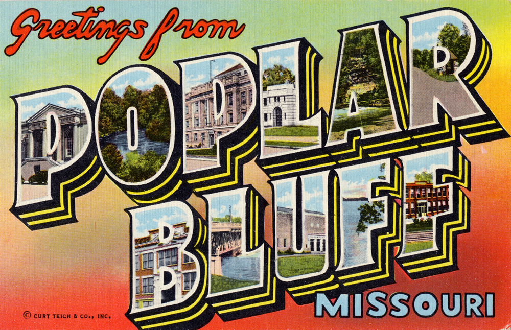
Poplar Bluff is a medium city in Butler County in Southeast Missouri, United States. It is the county seat of Butler County and is known as "The Gateway to the Ozarks" among other names. The population was 16,225 at the 2020 census. The Poplar Bluff Micropolitan Statistical Area consists of all of Butler County. The city is at the crossroads of U.S. Route 60 and U.S. Route 67. History The French were the first Europeans to assert any territorial rights over the Poplar Bluff area. The French held the area until 1770 when it was ceded by treaty to Spain. Spain held the area until 1802 when it was returned to France. During this time the area of Poplar Bluff, as well as all of Butler County, held almost no European settlements until 1819, when the first white settler family moved into the Poplar Bluff area. It was reported that about 300 Native Americans resided in the area at that time. The earliest permanent settlements in what is now Butler County occurred in the early 19t ... [...More Info...] [...Related Items...] OR: [Wikipedia] [Google] [Baidu] |
Butler County, Missouri
Butler County is a county located in the southeast Ozark Foothills Region in the U.S. state of Missouri. As of the 2020 Census, the county's population was 42,130. The largest city and county seat is Poplar Bluff. The county was officially organized from Wayne County on February 27, 1849, and is named after former U.S. Representative William O. Butler ( D-Kentucky), who was also an unsuccessful candidate for Vice President of the United States. The first meeting in the Butler County Courthouse was held on June 18, 1849. Butler County comprises the Poplar Bluff, MO Micropolitan Statistical Area. Geography According to the U.S. Census Bureau, the county has a total area of , of which is land and (0.6%) is water. Adjacent counties * Wayne County (north) * Stoddard County (northeast) * Dunklin County (southeast) *Clay County, Arkansas (south) * Ripley County (west) * Carter County (northwest) Major highways * Future Interstate 57 * U.S. Route 60 * U.S. Route 67 * U. ... [...More Info...] [...Related Items...] OR: [Wikipedia] [Google] [Baidu] |
Route 142 (Missouri)
Route 142 is a highway in southern Missouri. Its eastern terminus is at Route 53 in southern Poplar Bluff Poplar Bluff is a medium city in Butler County in Southeast Missouri, United States. It is the county seat of Butler County and is known as "The Gateway to the Ozarks" among other names. The population was 16,225 at the 2020 census. The Poplar B ...; its western terminus is at Route 101 (Missouri), Route 101 in Bakersfield, Missouri, Bakersfield. Route 142 is the southernmost east–west highway in the south-central part of the state. Despite its length, there are relatively few towns on the route. Major intersections References State highways in Missouri, 142 Transportation in Howell County, Missouri Transportation in Oregon County, Missouri Transportation in Ripley County, Missouri {{Missouri-road-stub ... [...More Info...] [...Related Items...] OR: [Wikipedia] [Google] [Baidu] |
Interstate 57
Interstate 57 (I-57) is a north–south Interstate Highway in Missouri and Illinois that parallels the old Illinois Central Railroad for much of its route. It runs from Sikeston, Missouri, at I-55 to Chicago, Illinois, at I-94. I-57 essentially serves as a shortcut route for travelers headed between the South (Memphis, New Orleans, etc.) and Chicago, bypassing St. Louis, Missouri and Springfield, Illinois. Between the junction of I-55 and I-57 in Sikeston and the junction of I-55 and I-90/I-94 in Chicago, I-55 travels for , while the combination of I-57 and I-94 is only long between the same two points. In fact, both the control cities on the overhead signs and the destination mileage signs reference Memphis along southbound I-57, even as far north as its northern origin at I-94 in Chicago. Likewise, at its southern end, Chicago is the control city listed for I-57 on signs on northbound I-55 south of Sikeston, even though I-55 also goes to Chicago. , I-57 has no spur rout ... [...More Info...] [...Related Items...] OR: [Wikipedia] [Google] [Baidu] |
Harviell, Missouri
Harviell is an unincorporated community and census-designated place in Butler County, Missouri, United States. As of the 2020 census it had a population of 98. History Harviell was founded in 1873 and is named for Simeon Harviell, an early citizen. A post office called Harviell has been in operation since 1874. Geography Harviell is located on Missouri Route 158, approximately southwest of Poplar Bluff. According to the United States Census Bureau The United States Census Bureau (USCB), officially the Bureau of the Census, is a principal agency of the U.S. Federal Statistical System, responsible for producing data about the American people and economy. The Census Bureau is part of the ..., the CDP has a total area of , of which , or 0.78%, is water. Demographics References Census-designated places in Butler County, Missouri Unincorporated communities in Butler County, Missouri Unincorporated communities in Missouri Census-designated places in Missouri ... [...More Info...] [...Related Items...] OR: [Wikipedia] [Google] [Baidu] |
Union Pacific
The Union Pacific Railroad , legally Union Pacific Railroad Company and often called simply Union Pacific, is a freight-hauling railroad that operates 8,300 locomotives over routes in 23 U.S. states west of Chicago and New Orleans. Union Pacific is the second largest railroad in the United States after BNSF, with which it shares a duopoly on transcontinental freight rail lines in the Western, Midwestern and Southern United States. Founded in 1862, the original Union Pacific Rail Road was part of the first transcontinental railroad project, later known as the Overland Route. Over the next century, UP absorbed the Missouri Pacific Railroad, the Chicago and North Western Transportation Company, the Western Pacific Railroad, the Missouri–Kansas–Texas Railroad and the Chicago, Rock Island and Pacific Railroad. In 1996, the Union Pacific merged with Southern Pacific Transportation Company, itself a giant system that was absorbed by the Denver and Rio Grande Western Railroad. ... [...More Info...] [...Related Items...] OR: [Wikipedia] [Google] [Baidu] |
Missouri Route 142
Route 142 is a highway in southern Missouri. Its eastern terminus is at Route 53 (Missouri), Route 53 in southern Poplar Bluff, Missouri, Poplar Bluff; its western terminus is at Route 101 (Missouri), Route 101 in Bakersfield, Missouri, Bakersfield. Route 142 is the southernmost east–west highway in the south-central part of the state. Despite its length, there are relatively few towns on the route. Major intersections References State highways in Missouri, 142 Transportation in Howell County, Missouri Transportation in Oregon County, Missouri Transportation in Ripley County, Missouri {{Missouri-road-stub ... [...More Info...] [...Related Items...] OR: [Wikipedia] [Google] [Baidu] |
Partial Cloverleaf Interchange
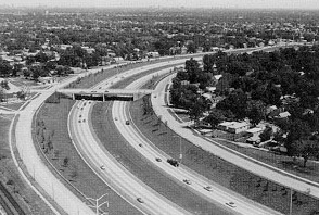
A partial cloverleaf interchange or parclo is a modification of a cloverleaf interchange. The design has been well received, and has since become one of the most popular freeway-to-arterial interchange designs in North America. It has also been used occasionally in some European countries, such as Germany, Hungary, Italy, the Netherlands, and the United Kingdom. Comparison with other interchanges *A diamond interchange has four ramps. *A cloverleaf interchange has eight ramps, as does a stack interchange. They are fully grade separated, unlike a parclo, and have traffic flow without stops on all ramps and throughways. *A parclo generally has either four or six ramps but less commonly has five ramps. Naming In Ontario, the specific variation is identified by a letter/number suffix after the name. Ontario's naming conventions are used in this article. The letter ''A'' designates that two ramps meet the freeway ''ahead'' of the arterial road, while ''B'' designates that two ram ... [...More Info...] [...Related Items...] OR: [Wikipedia] [Google] [Baidu] |
State Highways In Missouri
State may refer to: Arts, entertainment, and media Literature * ''State Magazine'', a monthly magazine published by the U.S. Department of State * ''The State'' (newspaper), a daily newspaper in Columbia, South Carolina, United States * ''Our State'', a monthly magazine published in North Carolina and formerly called ''The State'' * The State (Larry Niven), a fictional future government in three novels by Larry Niven Music Groups and labels * States Records, an American record label * The State (band), Australian band previously known as the Cutters Albums * ''State'' (album), a 2013 album by Todd Rundgren * ''States'' (album), a 2013 album by the Paper Kites * ''States'', a 1991 album by Klinik * ''The State'' (album), a 1999 album by Nickelback Television * ''The State'' (American TV series), 1993 * ''The State'' (British TV series), 2017 Other * The State (comedy troupe), an American comedy troupe Law and politics * State (polity), a centralized political organizatio ... [...More Info...] [...Related Items...] OR: [Wikipedia] [Google] [Baidu] |


