|
Missoula County
Missoula County is located in the State of Montana. As of the 2020 census, the population was 117,922, making it Montana's third-most populous county. Its county seat and largest city is Missoula. The county was founded in 1860. Missoula County comprises the Missoula, MT Metropolitan Statistical Area. History Missoula County, Washington Territory was incorporated in 1860, when this area was still part of Washington Territory. Missoula County encompassed present-day Missoula and Deer Lodge Counties, as well as a large area of land north and south of present-day Missoula County. Hell Gate Town, the county seat, was at the confluence of the Clark Fork and Bitterroot Rivers. The area encompassing today's Missoula County became part of the United States as a result of Oregon Treaty of June 14, 1846. It was part of the Oregon Territory's Clark County, which replaced the ''District of Vancouver'' September 3, 1844. The territory was divided on March 2, 1853, with Clark County bec ... [...More Info...] [...Related Items...] OR: [Wikipedia] [Google] [Baidu] |
Hell Gate, Montana
Hell Gate (sometimes known as Hell Gate Ronde, Hell's Gate or Hellgate) is a ghost town at the western end of the Missoula Valley in Missoula County, Montana, United States. The town was located on the banks of the Clark Fork River roughly five miles downstream from present-day Missoula near what is now Frenchtown.Fogarty, Kate Hammond. ''The Story of Montana.'' New York and Chicago: A. S. Barnes company, 1916. Geography Hell Gate lay at the west end of the Missoula Valley. About 13,000 BCE, the advance of the Cordilleran Ice Sheet created an ice dam on the Clark Fork which created Glacial Lake Missoula.Alt, David and Hundman, Donald W. ''Northwest Exposures: A Geologic History of the Northwest.'' Missoula, Mont.: Mountain Press, 1995. ; Bjornstad, Bruce N. ''On the Trail of the Ice Age Floods: A Geological Field Guide to the Mid-Columbia Basin.'' Sandpoint, Idaho: Keokee Books. After the Missoula Floods and the final draining of Glacial Lake Missoula about 11,000 BCE, the lake ... [...More Info...] [...Related Items...] OR: [Wikipedia] [Google] [Baidu] |
Montana
Montana () is a state in the Mountain West division of the Western United States. It is bordered by Idaho to the west, North Dakota and South Dakota to the east, Wyoming to the south, and the Canadian provinces of Alberta, British Columbia, and Saskatchewan to the north. It is the fourth-largest state by area, the eighth-least populous state, and the third-least densely populated state. Its state capital is Helena. The western half of Montana contains numerous mountain ranges, while the eastern half is characterized by western prairie terrain and badlands, with smaller mountain ranges found throughout the state. Montana has no official nickname but several unofficial ones, most notably "Big Sky Country", "The Treasure State", "Land of the Shining Mountains", and " The Last Best Place". The economy is primarily based on agriculture, including ranching and cereal grain farming. Other significant economic resources include oil, gas, coal, mining, and lumber. The health ca ... [...More Info...] [...Related Items...] OR: [Wikipedia] [Google] [Baidu] |
Continental Divide
A continental divide is a drainage divide on a continent such that the drainage basin on one side of the divide feeds into one ocean or sea, and the basin on the other side either feeds into a different ocean or sea, or else is endorheic, not connected to the open sea. Every continent on earth except Antarctica (which has no known significant, definable free-flowing surface rivers) has at least one continental drainage divide; islands, even small ones like Killiniq Island on the Labrador Sea in Canada, may also host part of a continental divide or have their own island-spanning divide. The endpoints of a continental divide may be coastlines of gulfs, seas or oceans, the boundary of an endorheic basin, or another continental divide. One case, the Great Basin Divide, is a closed loop around an endoreic basin. The endpoints where a continental divide meets the coast are not always definite since the exact border between adjacent bodies of water is usually not clearly defined. The I ... [...More Info...] [...Related Items...] OR: [Wikipedia] [Google] [Baidu] |
Montana Territory
The Territory of Montana was an organized incorporated territory of the United States that existed from May 26, 1864, until November 8, 1889, when it was admitted as the 41st state in the Union as the state of Montana. Original boundaries The Montana Territory was organized out of the existing Idaho Territory by Act of Congress and signed into law by President Abraham Lincoln on May 26, 1864. The areas east of the Continental Divide had been previously part of the Nebraska Territory and Dakota Territory and had been acquired by the United States in the Louisiana Purchase. The territory also included a portion of the Idaho Territory west of the continental divide and east of the Bitterroot Range, which had been acquired by the United States in the Oregon Treaty, and originally included in the Oregon Territory. The part of the Oregon Territory that became part of Montana had been split off as part of the Washington Territory. The boundary between the Washington Territory and ... [...More Info...] [...Related Items...] OR: [Wikipedia] [Google] [Baidu] |
Glacier County, Montana
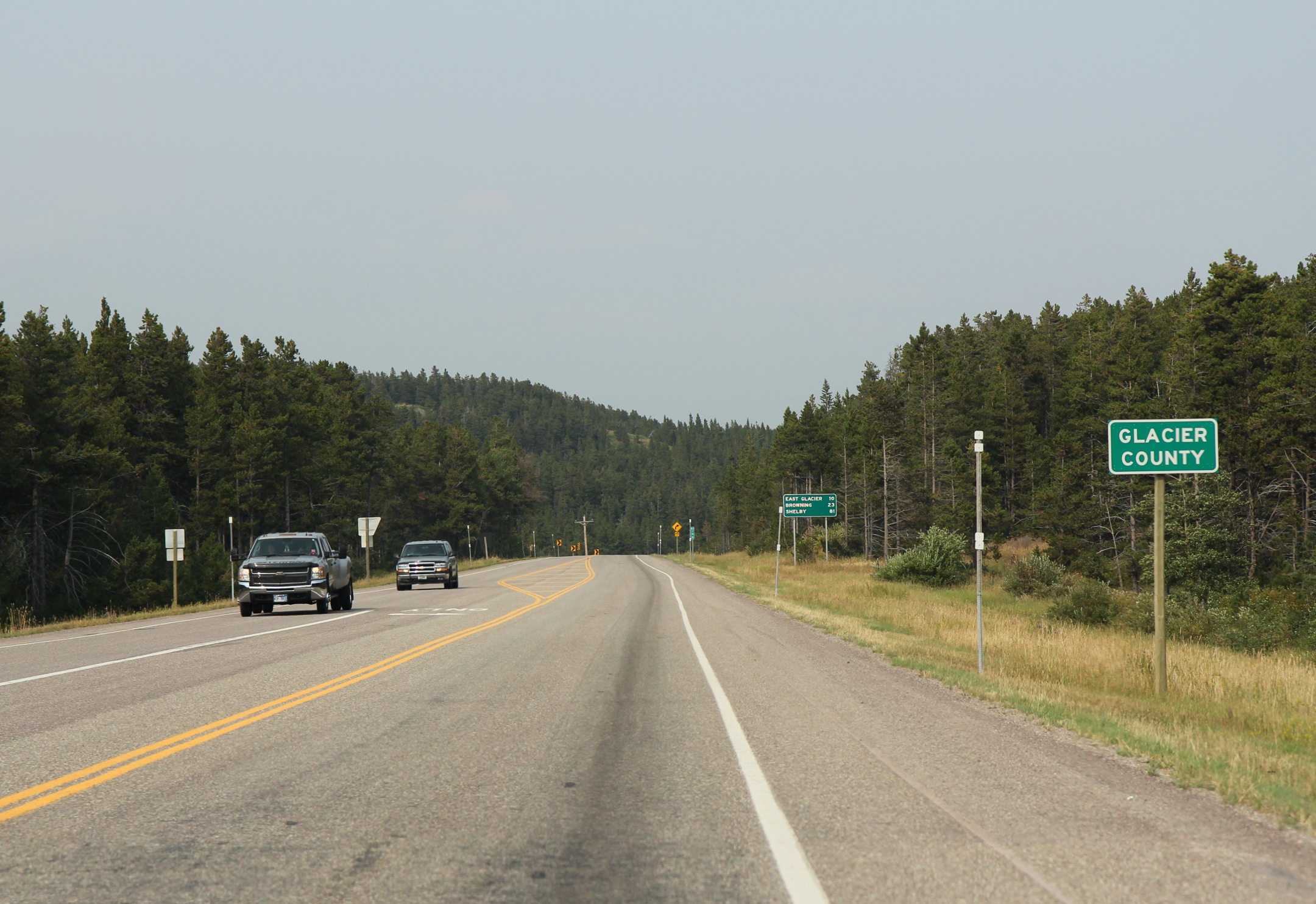
Glacier County is located in the U.S. state of Montana. As of the 2020 census, the population was 13,778. The county is located in northwestern Montana between the Great Plains and the Rocky Mountains, known to the Blackfeet as the "Backbone of the World". The county is geographically and culturally diverse and includes the Blackfeet Indian Reservation, Glacier National Park, and Lewis and Clark National Forest. The county is bordered by 75 miles of international boundary with two ports of entry ( Piegan and Del Bonita) open year-round and one seasonal (Chief Mountain) international border crossing into Alberta, Canada. Settlements Several small unincorporated communities, one incorporated town, and one incorporated city are located within the county. Cut Bank, the county seat with a population of around 3000, is located in eastern Glacier County, on the edge of the Great Plains. Cut Bank arose from the railroad and agriculture needs of the surrounding area, and was fostered ... [...More Info...] [...Related Items...] OR: [Wikipedia] [Google] [Baidu] |
Flathead County, Montana
Flathead County is in the U.S. state of Montana. At the 2020 census, its population was 104,357, making it the state's fourth most populous county. Its county seat is Kalispell. Its numerical designation (used in the issuance of license plates) is 7. Its northern border is on the state's north border, making it contiguous with the Canada–US border, facing British Columbia. Flathead County comprises the Kalispell, Montana Micropolitan Statistical Area, with neighboring Lake County following soon after. History Flathead County was founded in 1893. Some sources cite the supposed practice of the Salish tribe flattening infants' heads as the origin of the name Flathead, but there is no record of Salish Indians ever having that appearance. Geography The county includes much of Flathead Lake, the Flathead Valley, and the Flathead River. These natural treasures, originated by glaciers, are named for the unique geological formation of a broad flat valley surrounded by mountains at ... [...More Info...] [...Related Items...] OR: [Wikipedia] [Google] [Baidu] |
Lincoln County, Montana
Lincoln County is a county located in the U.S. state of Montana. As of the 2020 census, the population was 19,677. Its county seat is Libby. The county was founded in 1909 and named for President Abraham Lincoln. The county lies on Montana's north border and thus shares the US-Canadian border with the Canadian province of British Columbia. This heavily wooded and mountainous county once was part of Flathead County until residents of Libby and Eureka petitioned the state legislature for separation. Libby won an election over Eureka to host the county seat. Geography According to the United States Census Bureau, the county has a total area of , of which is land and (1.7%) is water. The county borders the Canadian province of British Columbia to the north. The lowest point in the state of Montana is located on the Kootenai River in Lincoln County, where it flows out of Montana and into Idaho. Upstream, Libby Dam backs up huge Lake Koocanusa (combination name of Kootenai, Cana ... [...More Info...] [...Related Items...] OR: [Wikipedia] [Google] [Baidu] |
Sanders County, Montana
Sanders County is a county in the U.S. state of Montana. As of the 2020 census, the population was 12,400. Its county seat is Thompson Falls. The county was founded in 1905. It has an annual county fair with rodeo at Plains. Geography According to the United States Census Bureau, the county has a total area of , of which is land and (1.1%) is water. Sanders County lies on the state's western border; thus it shares the border with Idaho to the west. It is part of the Coeur d'Alene Mountains in the Bitterroot Range. The Clark Fork River flows southeast to northwest through the middle of the county, with the Bitterroot Mountains to the south and the Cabinet Mountains to the north. It is partially arid, with the west-facing mountain slopes capturing the most rain: ranging from nearly 40 inches a year in Heron (similar to Seattle's annual precipitation) on the Western end of the county to less than 12 inches per year in Dixon on the East end. During the last ice age, this ... [...More Info...] [...Related Items...] OR: [Wikipedia] [Google] [Baidu] |
Lake County, Montana
Lake County is a county located in the northwest part of the U.S. state of Montana. As of the 2020 census, the population was 31,134. Its county seat is Polson. Geography According to the United States Census Bureau, the county has a total area of , of which is land and (9.9%) is water. Over two-thirds (67.7%) of the county's land lies within the Flathead Indian Reservation. Adjacent counties * Flathead County - north * Missoula County - east * Sanders County - west National protected areas * Bison Range (part) * Flathead National Forest (part) * Ninepipe National Wildlife Refuge * Pablo National Wildlife Refuge * Swan River National Wildlife Refuge Politics Demographics 2000 census As of the 2000 United States census, of 2000, there were 26,507 people, 10,192 households, and 7,215 families living in the county. The population density was 18 people per square mile (7/km2). There were 13,605 housing units at an average density of 9 per ... [...More Info...] [...Related Items...] OR: [Wikipedia] [Google] [Baidu] |
Mineral County, Montana
Mineral County is a county located in the U.S. state of Montana. As of the 2020 census, the population was 4,535. Its county seat is Superior. Geography According to the United States Census Bureau, the county has a total area of , of which is land and (0.3%) is water. Major highways * Interstate 90 * U.S. Route 10 (Former) * Montana Highway 135 Adjacent counties * Sanders County - north * Missoula County Missoula County is located in the State of Montana. As of the 2020 census, the population was 117,922, making it Montana's third-most populous county. Its county seat and largest city is Missoula. The county was founded in 1860. Missoula Coun ... - east * Clearwater County, Idaho, Clearwater County, Idaho - southwest/Pacific Time Border * Shoshone County, Idaho, Shoshone County, Idaho - northwest/Pacific Time Border National protected area * Lolo National Forest (part) Politics Mineral County has voted for the Republican Party candidate in all national ele ... [...More Info...] [...Related Items...] OR: [Wikipedia] [Google] [Baidu] |
Powell County, Montana
Powell County is a county in the U.S. state of Montana. As of the 2020 census, the population was 6,946. Its county seat is Deer Lodge. Geography According to the United States Census Bureau, the county has a total area of , of which is land and (0.3%) is water. Major highways * Interstate 90 * U.S. Route 10 (Former) * U.S. Route 12 * Montana Highway 141 * Montana Highway 200 Adjacent counties * Flathead County - north * Lewis and Clark County - east * Jefferson County - southeast * Deer Lodge County - south * Granite County - southwest * Missoula County - west National protected areas * Beaverhead-Deerlodge National Forest (part) * Flathead National Forest (part) * Grant-Kohrs Ranch National Historic Site * Helena National Forest (part) * Lolo National Forest (part) * Bob Marshall Wilderness Area (part) * Scapegoat Wilderness Area (part) Demographics 2000 census As of the 2000 United States census, there were 7,180 people, 2,422 households, and 1, ... [...More Info...] [...Related Items...] OR: [Wikipedia] [Google] [Baidu] |
Silver Bow County, Montana
Silver Bow County is a county in the U.S. state Montana. As of the 2020 census, the population was 35,133. Its county seat is Butte. In 1977, the city and county governments consolidated to form the single entity of Butte-Silver Bow. Additionally, the town of Walkerville is a separate municipality from Butte and is within the county. Silver Bow County comprises the Butte-Silver Bow, MT Micropolitan Statistical Area. Geography According to the United States Census Bureau, the county has an area of , of which is land and (0.08%) is water. It is Montana's smallest county by area. Major highways * Interstate 15 * Interstate 90 * Interstate 115 * U.S. Highway 10 (Former) * U.S. Highway 91 * Montana Highway 2 * Montana Highway 41 * Montana Highway 43 * Montana Highway 55 Adjacent counties * Deer Lodge County - northwest * Jefferson County - east * Madison County - south * Beaverhead County - southwest National protected areas * Beaverhead National Forest (part) ... [...More Info...] [...Related Items...] OR: [Wikipedia] [Google] [Baidu] |


