|
Mississippi County, Missouri
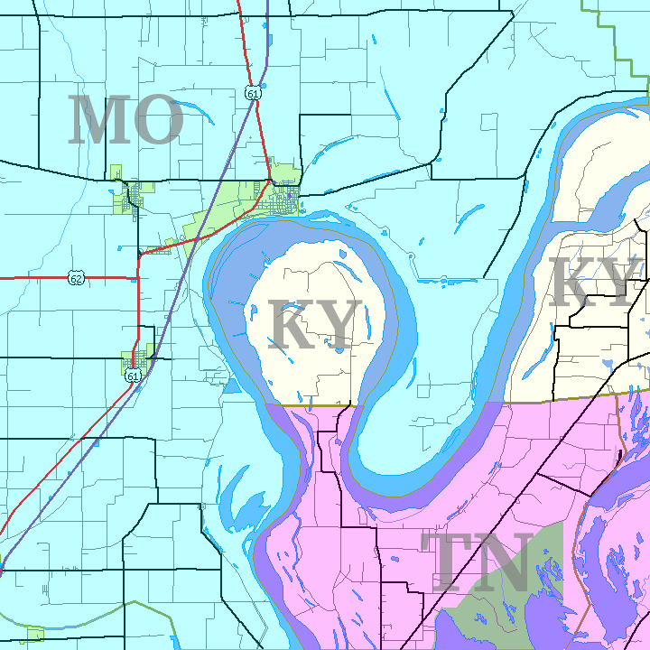
Mississippi County is a County (United States), county located in the Missouri Bootheel, Bootheel of the U.S. state of Missouri, with its eastern border formed by the Mississippi River. As of the 2020 United States census, 2020 census, the population was 12,577. The largest city and county seat is Charleston, Missouri, Charleston. The county was officially organized on February 14, 1845, and was named after the Mississippi River. History Mississippi County is located in what was formerly known as "Tywappity Bottom," a vast floodplain area bordered by the Scott County Hills on the north, St. James Bayou on the south, the Mississippi River on the east, and Little River (St. Francis River tributary), Little River on the west. In 1540, the Spanish explorer Hernando De Soto penetrated to the Arkansas River and perhaps well into present-day southeastern Missouri, which was then populated by various Native American tribes, including the Osage Nation, Osage. Under pressure from a consta ... [...More Info...] [...Related Items...] OR: [Wikipedia] [Google] [Baidu] |
Mississippi River
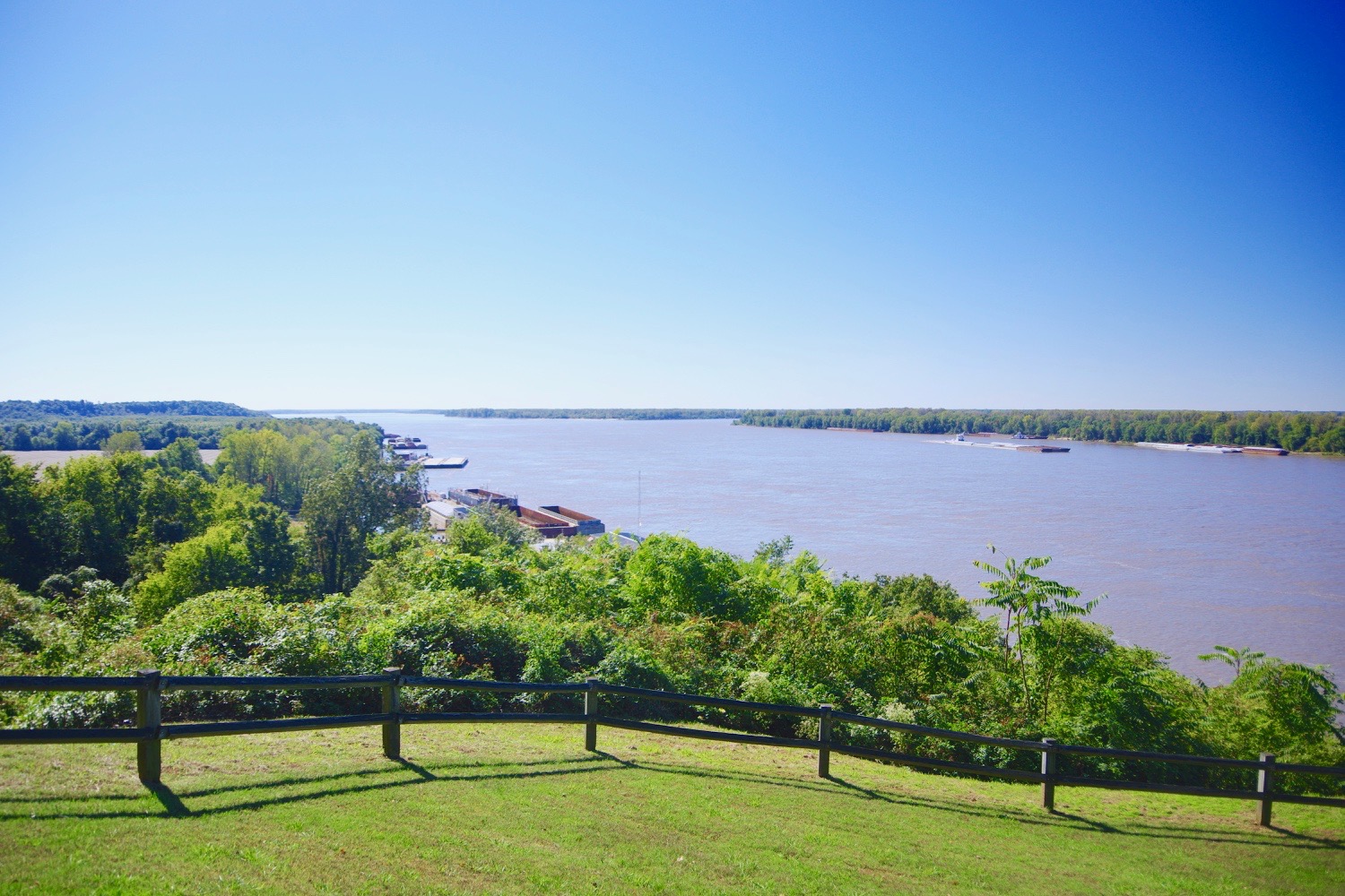
The Mississippi River is the second-longest river and chief river of the second-largest drainage system in North America, second only to the Hudson Bay drainage system. From its traditional source of Lake Itasca in northern Minnesota, it flows generally south for to the Mississippi River Delta in the Gulf of Mexico. With its many tributaries, the Mississippi's watershed drains all or parts of 32 U.S. states and two Canadian provinces between the Rocky and Appalachian mountains. The main stem is entirely within the United States; the total drainage basin is , of which only about one percent is in Canada. The Mississippi ranks as the thirteenth-largest river by discharge in the world. The river either borders or passes through the states of Minnesota, Wisconsin, Iowa, Illinois, Missouri, Kentucky, Tennessee, Arkansas, Mississippi, and Louisiana. Native Americans have lived along the Mississippi River and its tributaries for thousands of years. Most were hunter-ga ... [...More Info...] [...Related Items...] OR: [Wikipedia] [Google] [Baidu] |
Belmont, Missouri
Belmont is an extinct town in Mississippi County, on the eastern border of the U.S. state of Missouri at the Mississippi River. The GNIS classifies it as a populated place under the name "Belmont Landing". History Belmont was platted in 1853, and named after August Belmont, a businessman interested in the site. A post office called Belmont Landing was in operation from 1867 until 1869, and a post office called Belmont from 1869 until 1923. Belmont was the scene of a Civil War battle, the Battle of Belmont in 1861. The community lends its name to the Columbus-Belmont State Park, a Civil War site across the Mississippi River in Hickman County, Kentucky. After the Reconstruction era, whites asserted their dominance, often by violence and intimidation. In May 1905, a mob of 200 to 300 whites lynched Lynching is an extrajudicial killing by a group. It is most often used to characterize informal public executions by a mob in order to punish an alleged transgressor, punish a con ... [...More Info...] [...Related Items...] OR: [Wikipedia] [Google] [Baidu] |
US 60
U.S. Route 60 is a major east–west United States highway, traveling from southwestern Arizona to the Atlantic Ocean coast in Virginia. The highway's eastern terminus is in Virginia Beach, Virginia, where it is known as Pacific Avenue, in the city's Oceanfront resort district at the intersection of 5th Street and Winston-Salem Avenue. Its original western terminus was in Springfield, Missouri; it was then extended to Los Angeles, California, but in 1964, it was truncated to end southwest of Brenda, Arizona, at an interchange with Interstate 10 (I-10) after the US 60 highway designation was removed from California. I-10 replaced US 60 from Beaumont, California, to Arizona, and California State Route 60 (SR 60) replaced US 60 from Los Angeles to Beaumont. Route description , - , AZ , 368 , 592 , - , NM , 366 , 590 , - , TX , 225 , 362 , - , OK , 355 , 571 , - , MO , 341 , 549 , - , IL , 1 , 2 , - , KY , 489 , 787 , - , WV , 179 , 288 , ... [...More Info...] [...Related Items...] OR: [Wikipedia] [Google] [Baidu] |
Interstate 57 (Missouri)
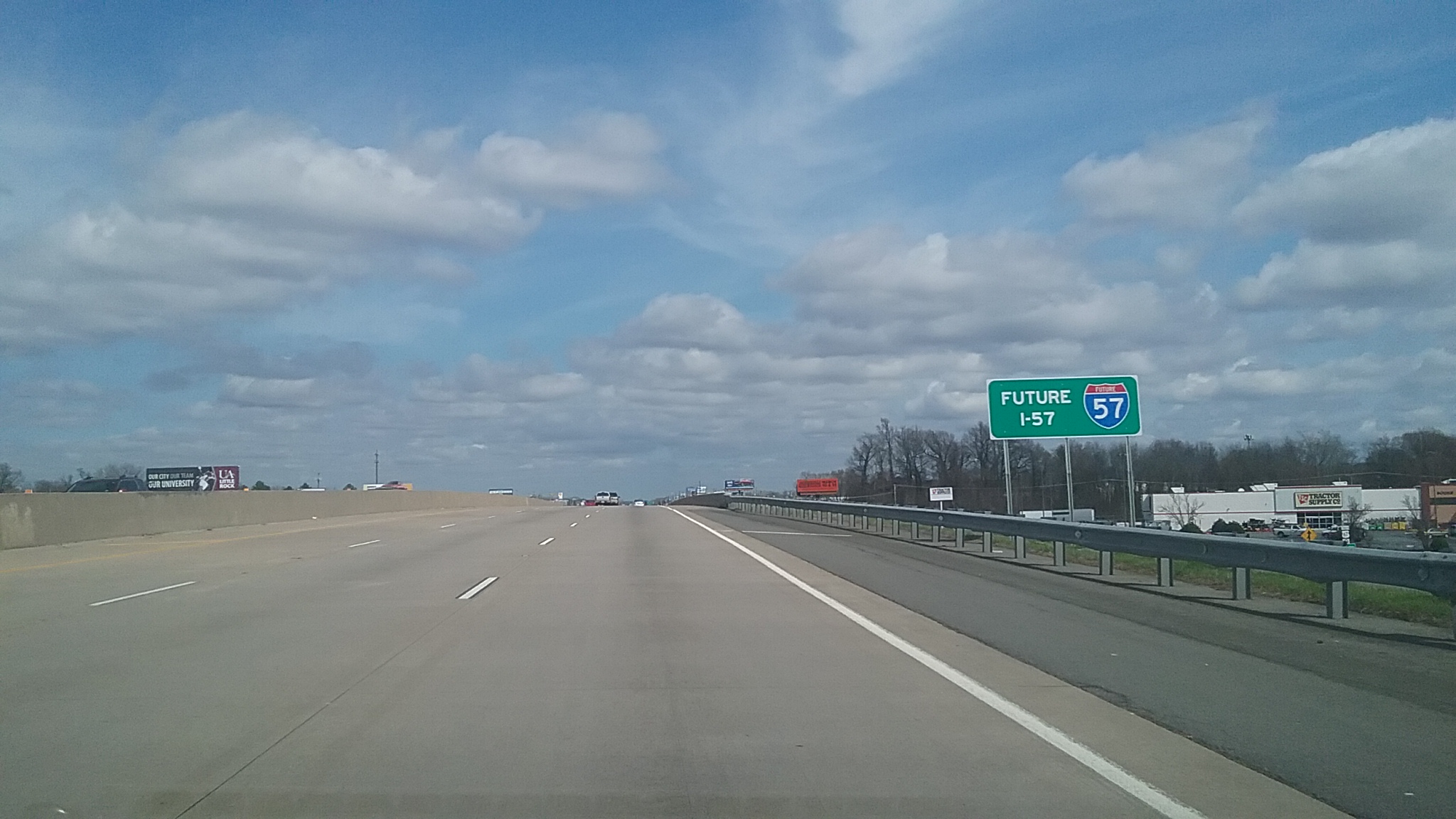
Interstate 57 (I-57) is a north–south Interstate Highway in Missouri and Illinois that parallels the old Illinois Central Railroad for much of its route. It runs from Sikeston, Missouri, at I-55 to Chicago, Illinois, at I-94. I-57 essentially serves as a shortcut route for travelers headed between the South (Memphis, New Orleans, etc.) and Chicago, bypassing St. Louis, Missouri and Springfield, Illinois. Between the junction of I-55 and I-57 in Sikeston and the junction of I-55 and I-90/I-94 in Chicago, I-55 travels for , while the combination of I-57 and I-94 is only long between the same two points. In fact, both the control cities on the overhead signs and the destination mileage signs reference Memphis along southbound I-57, even as far north as its northern origin at I-94 in Chicago. Likewise, at its southern end, Chicago is the control city listed for I-57 on signs on northbound I-55 south of Sikeston, even though I-55 also goes to Chicago. , I-57 has no spur ro ... [...More Info...] [...Related Items...] OR: [Wikipedia] [Google] [Baidu] |
I-57 (MO)
Interstate 57 (I-57) is a north–south Interstate Highway in Missouri and Illinois that parallels the old Illinois Central Railroad for much of its route. It runs from Sikeston, Missouri, at I-55 to Chicago, Illinois, at I-94. I-57 essentially serves as a shortcut route for travelers headed between the South (Memphis, New Orleans, etc.) and Chicago, bypassing St. Louis, Missouri and Springfield, Illinois. Between the junction of I-55 and I-57 in Sikeston and the junction of I-55 and I-90/I-94 in Chicago, I-55 travels for , while the combination of I-57 and I-94 is only long between the same two points. In fact, both the control cities on the overhead signs and the destination mileage signs reference Memphis along southbound I-57, even as far north as its northern origin at I-94 in Chicago. Likewise, at its southern end, Chicago is the control city listed for I-57 on signs on northbound I-55 south of Sikeston, even though I-55 also goes to Chicago. , I-57 has no spur rout ... [...More Info...] [...Related Items...] OR: [Wikipedia] [Google] [Baidu] |
Scott County, Missouri
Scott County is a county located in the southeastern portion of the U.S. state of Missouri. As of the 2020 census, the population was 38,059. Its county seat is Benton. The county was organized in 1821 and named for U.S. Representative John Scott, the first federal representative from Missouri. Scott County comprises the Sikeston, MO Micropolitan Statistical Area, which is also included in the Cape Girardeau-Sikeston, MO- IL Combined Statistical Area. The county is home to Scott County Central High School, which has won 18 state championships in boys basketball—the most of any high school in the state. History This area along the Mississippi River was long occupied by indigenous peoples. In historic times, the large and powerful Osage people dominated a large territory including this area and up and west from the later St. Louis, Missouri. Cape La Croix, a rock island in the Mississippi River, has a cross erected by Jesuit missionary Father De Montigny, who traveled with ea ... [...More Info...] [...Related Items...] OR: [Wikipedia] [Google] [Baidu] |
New Madrid County, Missouri
; french: Comté de New Madrid) is a county located in the Bootheel of the U.S. state of Missouri. As of the 2020 census, the population was 16,434. The largest city and county seat is New Madrid, located on the northern side of the Kentucky Bend in the Mississippi River, where it has formed an oxbow around an exclave of Fulton County, Kentucky. This feature has also been known as New Madrid Bend or Madrid Bend, for the city. The county was officially organized on October 1, 1812, and is named after ''Nuevo Madrid,'' a district located in the region. This area was under Spanish rule following France's cession of Louisiana after being defeated in the Seven Years' War. The Spanish named the district after Madrid, the capital of Spain. The county includes a large part of the New Madrid Fault that produced the 1811–12 New Madrid earthquakes. This zone remains geologically active, and had continued to produce smaller earthquakes with some frequency. History French Canadians from ... [...More Info...] [...Related Items...] OR: [Wikipedia] [Google] [Baidu] |
Fulton County, Kentucky
Fulton County is the westernmost county in the U.S. state of Kentucky Kentucky ( , ), officially the Commonwealth of Kentucky, is a state in the Southeastern region of the United States and one of the states of the Upper South. It borders Illinois, Indiana, and Ohio to the north; West Virginia and Virginia to ..., with the Mississippi River forming its western boundary. As of the 2010 United States Census, 2010 census, the population was 6,813. Its county seat is Hickman, Kentucky, Hickman. The county was formed in 1845 from Hickman County, Kentucky and named for Robert Fulton, the inventor of the steamboat. Allied with Tennessee by trade and culture, white Fulton County residents were largely pro-Confederate States of America, Confederate during the American Civil War. Forces from both armies passed through the county during different periods of the conflict. Because of imprecise early surveying of Kentucky's southern border, Fulton County is divided into two non-conti ... [...More Info...] [...Related Items...] OR: [Wikipedia] [Google] [Baidu] |
Hickman County, Kentucky
Hickman County is a county located in the U.S. state of Kentucky. As of the 2020 census, the population was 4,521, making it the third-least populous county in Kentucky. Its county seat is Clinton. The county was formed in 1821. It is the least densely populated county in the state and is a prohibition or dry county. History Founded in 1821, Hickman County was the seventy-first in order of formation. It was named for Captain Paschal Hickman of the 1st Rifle Regiment, Kentucky Militia. A resident of Franklin County, Kentucky, Hickman was wounded and captured at the Battle of Frenchtown in January 1813 and was killed by Indians in the Massacre of the River Raisin. Columbus, Kentucky, in the northwest of the county and located on the Mississippi River, was the original county seat. A log structure built in 1823 served as the courthouse. In 1830, the county seat was moved to the more centrally located Clinton. In 1861, early in the American Civil War, the Confederate Army ... [...More Info...] [...Related Items...] OR: [Wikipedia] [Google] [Baidu] |
Carlisle County, Kentucky
Carlisle County is a county located in the U.S. state of Kentucky. As of the 2020 census, the population was 4,826, making it the fourth-least populous county in Kentucky. Its county seat is Bardwell. The county was founded in 1886 and named for John Griffin Carlisle, a Speaker of the United States House of Representatives from Kentucky. It remains a prohibition or dry county. Geography According to the U.S. Census Bureau, the county has a total area of , of which is land and (4.8%) is water. The county's western border with Missouri is formed by the Mississippi River. Adjacent counties * Ballard County (north) * McCracken County (northeast) * Graves County (east) * Hickman County (south) * Mississippi County, Missouri (west) Demographics As of the census of 2000, there were 5,351 people, 2,208 households, and 1,574 families residing in the county. The population density was . There were 2,490 housing units at an average density of . The racial makeup of the county ... [...More Info...] [...Related Items...] OR: [Wikipedia] [Google] [Baidu] |
Ballard County, Kentucky
Ballard County is a county located in the extreme west portion of the U.S. state of Kentucky. As of the 2020 census, the population was 7,728. Its county seat is Wickliffe. The county was created by the Kentucky State Legislature in 1842 and is named for Captain Bland Ballard, a soldier, statesman, and member of the Kentucky General Assembly. Ballard County is part of the Paducah, KY- IL Micropolitan Statistical Area. History Ballard County was formed from portions of Hickman County and McCracken County. It was named for Bland Ballard (1761–1853), a Kentucky pioneer and soldier who served as a scout for General George Rogers Clark during the American Revolutionary War, and later commanded a company during the War of 1812. On February 17, 1880, the courthouse was destroyed by a fire, which also destroyed most of the county's early records. The county seat was transferred from Blandville to Wickliffe in 1882. Geography According to the U.S. Census Bureau, the county ha ... [...More Info...] [...Related Items...] OR: [Wikipedia] [Google] [Baidu] |
Alexander County, Illinois
Alexander County is the southernmost and southwesternmost county in the U.S. state of Illinois. As of the 2020 census, the population was 5,240. Its county seat is Cairo and its western boundary is formed by the Mississippi River. Alexander County is part of the Cape Girardeau, MO-IL Metropolitan Statistical Area which is made up of jurisdictions on both sides of the Mississippi River. History Alexander County was organized from part of Union County in 1819. It was named for William M. Alexander, a physician who practiced in the town of America (the first county seat). Alexander was elected as a representative to the state House, where he became Speaker of the Illinois House of Representatives in 1822. The county was initially developed for agriculture and settled by numerous migrants from the Upper South. The county seat was moved to Unity in 1833, then to Thebes in 1843, and finally to Cairo in 1860. America, the first county seat, is now within Pulaski County, which w ... [...More Info...] [...Related Items...] OR: [Wikipedia] [Google] [Baidu] |

.jpg)


.jpg)