|
Miss Dominican Republic 2011
Miss República Dominicana 2011 was held March 8, 2011 in Renaissance Auditorio de Festival del Hotel Jaragua, Santo Domingo. The Miss República Dominicana 2011 winner will represent the Dominican Republic in Miss Universe 2011, the First Runner Up or Miss Continente Dominicana will enter Miss Continente Americano 2011 and the Second Runner Up or Miss Hispanoamericana RD will enter Reina Hispanoamericana 2011. The Third Runner Up will enter Miss Supranational 2011. The Fourth Runner Up will enter Miss Intercontinental 2011. The winner, Dalia Fernández of Santiago, was crowned by Eva Arias, ''Miss Dominican Republic 2010''. Results Contestants References External linksOfficial website {{Miss República Dominicana Universo Miss Dominican Republic Dominican Republic The Dominican Republic ( ; es, República Dominicana, ) is a country located on the island of Hispaniola in the Greater Antilles archipelago of the Caribbean region. It occupies the eastern five-eighth ... [...More Info...] [...Related Items...] OR: [Wikipedia] [Google] [Baidu] |
Dalia Fernández
Dalia Cristina Fernández Sánchez (born January 3, 1990 in Santiago de los Caballeros) is a Dominican beauty pageant titleholder who was crowned Miss Dominican Republic 2011 and represented the country in the 2011 Miss Universe pageant. In 2012 she was elected by Luz García’s ''Noche de Luz'' programme as a "Summer’s Hot Body". Early life Prior to her participation in Miss Dominican Republic 2011, Fernández competed in Reina Mundial del Banano 2009 in Machala, Ecuador on September 23, 2009. As the eventual first runner-up of the event, she won a crown made of 500 green pearls, tourmaline gem stones, and 700 crystals in silver finish. Fernández is currently pursuing a bachelor's degree in psychology. Miss Dominican Republic 2011 Fernández competed as the representative of Santiago, one of 36 finalists in her country's national beauty pageant, Miss Dominican Republic 2011, broadcast live from Santo Domingo on March 8, 2011, where she became the eventual winner of ... [...More Info...] [...Related Items...] OR: [Wikipedia] [Google] [Baidu] |
Duarte Province
Duarte () is a northeastern province which comprises one of the 32 provinces of the Dominican Republic. It is divided into 7 municipalities and its capital city is San Francisco de Macorís. It is bordered by the provinces of María Trinidad Sánchez and Samaná to the east, Monte Plata and Sánchez Ramírez to the south, La Vega and Hermanas Mirabal to the west and Espaillat to the north. It is named after Juan Pablo Duarte, the founder of the Dominican Republic. It was created in 1896 as a district (an old country subdivision) with the name ''Distrito Pacificador'' but the Constitution of 1907 changed the category to province. In 1925 its name was changed to ''Duarte''. Geography The province has a total area of 1,605.35 km2.Listado de Códigos de Provincias, Municipio y Distritos MunicipalesOficina Nacional de Estadistica It has 3.3% of the area of the Dominican Republic and it is ranked as the 13th (out of 31 plus the National District) largest province. History ... [...More Info...] [...Related Items...] OR: [Wikipedia] [Google] [Baidu] |
Carolina, Puerto Rico
Carolina (; ) is a city and municipality located on the northeast coast of Puerto Rico. It lies immediately east of the capital San Juan and Trujillo Alto; north of Gurabo and Juncos; and west of Canóvanas and Loíza. Carolina is spread over 12 barrios plus Carolina Pueblo (the downtown area and administrative center). It is part of the San Juan-Caguas-Guaynabo Metropolitan Statistical Area, and home to Puerto Rico's main airport, the Luis Muñoz Marín International Airport. History The town was founded by Spanish colonists in 1816 as Trujillo Bajo ("lower Trujillo"), along with its counterpart Trujillo Alto after Trujillo, Spain. In 1857 it was renamed to San Fernando de la Carolina, later shortened to ''Carolina'', after Charles II of Spain. The city is known as ''"Tierra de Gigantes"'' (Land of Giants), not only for well-known Carolina resident Don Felipe Birriel González (who was 7'11"), but also in honor of other people from Carolina, including poet Julia de Burg ... [...More Info...] [...Related Items...] OR: [Wikipedia] [Google] [Baidu] |
Providence, Rhode Island
Providence is the capital and most populous city of the U.S. state of Rhode Island. One of the oldest cities in New England, it was founded in 1636 by Roger Williams, a Reformed Baptist theologian and religious exile from the Massachusetts Bay Colony. He named the area in honor of "God's merciful Providence" which he believed was responsible for revealing such a haven for him and his followers. The city developed as a busy port as it is situated at the mouth of the Providence River in Providence County, at the head of Narragansett Bay. Providence was one of the first cities in the country to industrialize and became noted for its textile manufacturing and subsequent machine tool, jewelry, and silverware industries. Today, the city of Providence is home to eight hospitals and List of colleges and universities in Rhode Island#Institutions, eight institutions of higher learning which have shifted the city's economy into service industries, though it still retains some manufacturin ... [...More Info...] [...Related Items...] OR: [Wikipedia] [Google] [Baidu] |
Santa Cruz De Barahona
Barahona, also known as Santa Cruz de Barahona, is the main city of the Barahona Province, in the southwest of the Dominican Republic. It has one of the most active ports in the region, as well as many ecotourism attractions. The city is a centre of sugar production and industry. Barahona is also known for being the only place where the rare Larimar stone can found. History Before its discovery by Europeans, the area belonged to the Native Taino chiefdom of Jaragua, ruled by Bohechío. The current name of the province and city is derived from the surname of the first Spaniards who came to the area, some of these Spaniards were also from the town of Baraona in Spain and named it in honor of their town of origin. The Spaniards spread throughout the territory and designated places with their names. Francisco de Barahona, Gabriel Barahona, Luis de Barahona and Juan de Barahona arrived on the first and second voyages of Christopher Columbus in the 1490s. After the nation's indepen ... [...More Info...] [...Related Items...] OR: [Wikipedia] [Google] [Baidu] |
Santa Cruz De El Seibo
Santa Cruz del Seibo or El Seibo, is a city and municipality in the El Seibo Province of the Dominican Republic, located in the eastern part of the country. History El Seibo is one of the oldest towns in the country, it was created by the Constitution of November 6, 1844 although it already existed as a territorial division since colonial times, for this reason its foundation dates back to 1502 by the Spanish conqueror Juan de Esquivel. The name of Seibo comes from a tribal chief of Taino race. The name of Santa Cruz del Seibo, is taken from the Spanish custom of placing the ''Cruz de Cristo'' (Holy Cross) in the cardinal points, as protection against evils. A cross called Asomante is still preserved, in the West Sector of the city of El Seibo. Economy In the municipality there has been a factory for more than 100 years that produces a refreshing drink called mabí, made from the stem of a plant called Indian bejuco and cane sugar. It is currently the second cocoa-producing p ... [...More Info...] [...Related Items...] OR: [Wikipedia] [Google] [Baidu] |
Baoruco Province
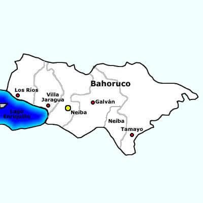
Baoruco, alternatively spelt Bahoruco (), is a province of the Dominican Republic located in the southwest of the country, part of the Enriquillo Region, along with the provinces of Barahona, Independencia and Pedernales. Before 1952 it included what is now Independencia Province. Important features are the Sierra de Neiba mountain range and Lake Enriquillo. Municipalities and municipal districts The province is divided into the following municipalities (''municipios'') and municipal districts (''distrito municipal'' - D.M.) within them: * Galván * Los Ríos ** Las Clavellinas city (D.M.) *Neiba ** El Palmar (D.M.) * Tamayo **Cabeza de Toro (D.M.) **Montserrat (D.M.) **Santana (D.M.) ** Uvilla (D.M.) *Villa Jaragua The following is a sortable table of the municipalities and municipal districts with population figures as of the 2014 estimate. Urban population are those living in the seats (''cabeceras'' literally heads) of municipalities or of municipal districts. Rural popula ... [...More Info...] [...Related Items...] OR: [Wikipedia] [Google] [Baidu] |
Azua De Compostela
Azua de Compostela, also known simply as Azua, is a municipality (''municipio'') and capital of Azua Province in the southern region of Dominican Republic. Founded in 1504, Azua is one of the oldest European settlements in the Americas. The town is located 100 kilometres west of the national capital, Santo Domingo. History The territory was part of the chiefdom of Maguana, one of the five Taino chiefdoms in the island. Christopher Columbus encountered great difficulties that forced him and his companions to take refuge in the Bay of Ocoa, in the eastern part of the Azua territory. There he met the resistance of the Great ( Cacique) of Azua Cuyocagua, whom the Admiral tried to subdue without success. The town of Azúa de Compostela was officially founded in 1504 by Diego Velázquez de Cuéllar (conqueror of Cuba), during the government of Don Nicolás de Ovando. The famous conqueror of Mexico Hernán Cortés also resided in the town for several years (1504-1511). During his st ... [...More Info...] [...Related Items...] OR: [Wikipedia] [Google] [Baidu] |
Azua Province
Azua () is a province which is collectively one of the thirty-two provinces of the Dominican Republic. It is divided into 10 municipalities (the same as Santiago) and its capital city is Azua de Compostela. It is bordered by the provinces of La Vega to the north-east, San José de Ocoa and Peravia to the east, Barahona and Baoruco to the west and San Juan to the north-west. To the south, Azua has a significant coastline of the Caribbean Sea. Azua is known for diverse geography and climate, with the southern part of the province having an arid climate that is not the typical tropical-like that is found in other parts of the Caribbean. Geography The southern part of the province is located in the Llanura or Llano de Azua (also known as the "Plena de Azua"), a coastal plain surrounded by mountains that act as barriers to the water-laden winds so that the lower parts of the province are very arid. Azua had the Sierra de Ocoa, which is the southern end of the Cordillera Central, ... [...More Info...] [...Related Items...] OR: [Wikipedia] [Google] [Baidu] |
Elías Piña Province
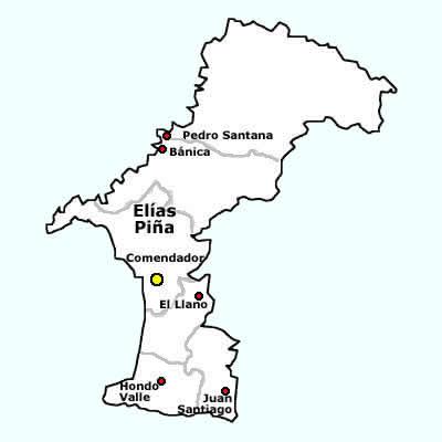
Elías Piña () is a westernmost province which composing one of the 32 Provinces of the Dominican Republic, provinces of the Dominican Republic. It is divided into 6 municipalities and its capital city is Comendador, Elías Piña, Comendador. It is bordered by the provinces of Dajabón Province, Dajabón to the north-west, Santiago Rodríguez Province, Santiago Rodríguez to the north-east, San Juan Province (Dominican Republic), San Juan to the east, Independencia Province, Independencia to the south and the Nord-Est (department), Nord-Est department of Haiti to the west. It was created on 1942 with the name ''San Rafael''. In 1965, its name was changed to ''Estrelleta'' and, finally, in 1972 it got its current name. It was a ''municipio'' of the San Juan province before being elevated to the category of province. Location The Elías Piña province has the Dajabón Province, Dajabón and Santiago Rodríguez Province, Santiago Rodríguez provinces to the north, the San Juan Prov ... [...More Info...] [...Related Items...] OR: [Wikipedia] [Google] [Baidu] |
Puerto Rico
Puerto Rico (; abbreviated PR; tnq, Boriken, ''Borinquen''), officially the Commonwealth of Puerto Rico ( es, link=yes, Estado Libre Asociado de Puerto Rico, lit=Free Associated State of Puerto Rico), is a Caribbean island and Unincorporated territories of the United States, unincorporated territory of the United States. It is located in the northeast Caribbean Sea, approximately southeast of Miami, Florida, between the Dominican Republic and the United States Virgin Islands, U.S. Virgin Islands, and includes the eponymous main island and several smaller islands, such as Isla de Mona, Mona, Culebra, Puerto Rico, Culebra, and Vieques, Puerto Rico, Vieques. It has roughly 3.2 million residents, and its Capital city, capital and Municipalities of Puerto Rico, most populous city is San Juan, Puerto Rico, San Juan. Spanish language, Spanish and English language, English are the official languages of the executive branch of government, though Spanish predominates. Puerto Rico ... [...More Info...] [...Related Items...] OR: [Wikipedia] [Google] [Baidu] |
Samaná Province
Samaná () is a Provinces of the Dominican Republic, province of the Dominican Republic in the Samaná Peninsula located in the eastern region. Its Capital (political), capital is Samaná (town), Santa Bárbara de Samaná, usually known as Samaná. The province is on the coast of the Atlantic Ocean in the northeastern part of the Dominican Republic. It is known for the mountains of which it is almost entirely formed. Samaná has numerous beaches. Samana was originally larger covering the area of what is now the María Trinidad Sánchez Province, María Trinidad Sánchez province, before being divided during the Rafael Trujillo, Trujillo era. Geography The Samana province is occupied by the Sierra de Samaná mountain range, which reaches many of the coastal areas. The highest mountain in this range (and in the province) is located in the eastern portion and is called La Meseta. Samana has a tropical rainforest climate, with an annual average temperature of 25.9 degrees Celsius. A ... [...More Info...] [...Related Items...] OR: [Wikipedia] [Google] [Baidu] |


