|
Miles, Wisconsin
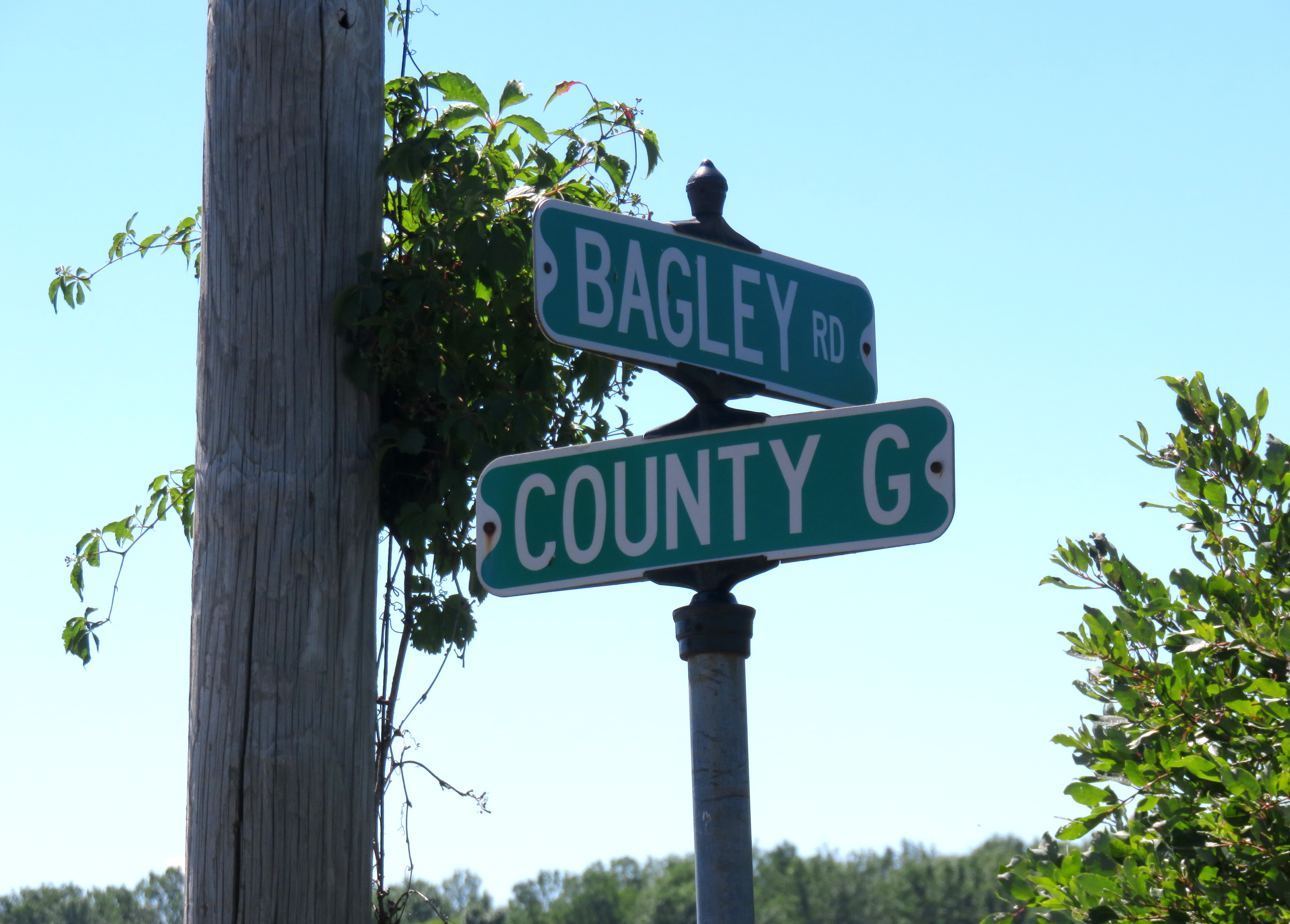
Miles is an Unincorporated area, unincorporated community located in the town of Porterfield, Wisconsin, Porterfield, Marinette County, Wisconsin, Marinette County, Wisconsin, United States. Geography Miles is located at the intersection of Miles Road and Winesville Road, at an elevation of .''Porterfield Quadrangle, Wisconsin—Marinette Co., 7.5-Minute Series (Topographic)''. 1982. Map, 1:24,000. Reston, VA: United States Department of the Interior Geological Survey. It is connected by road to Goll, Wisconsin, Goll and Wagner (community), Wisconsin, Wagner (via Old Rail Road, formerly Right of Way Road) to the north, Walsh, Wisconsin, Walsh (via County Highway G) and Porterfield (community), Wisconsin, Porterfield to the south, and Wisconsin Highway 180 to the east. History Miles was a stop between Twin Creek and Goll on the Wisconsin & Michigan (W. & M.) Railway line from Bagley Junction, Wisconsin, Bagley Junction to Iron Mountain, Michigan, Iron Mountain. The rail line th ... [...More Info...] [...Related Items...] OR: [Wikipedia] [Google] [Baidu] |
Unincorporated Area
An unincorporated area is a region that is not governed by a local municipal corporation. Widespread unincorporated communities and areas are a distinguishing feature of the United States and Canada. Most other countries of the world either have no unincorporated areas at all or these are very rare: typically remote, outlying, sparsely populated or List of uninhabited regions, uninhabited areas. By country Argentina In Argentina, the provinces of Chubut Province, Chubut, Córdoba Province (Argentina), Córdoba, Entre Ríos Province, Entre Ríos, Formosa Province, Formosa, Neuquén Province, Neuquén, Río Negro Province, Río Negro, San Luis Province, San Luis, Santa Cruz Province, Argentina, Santa Cruz, Santiago del Estero Province, Santiago del Estero, Tierra del Fuego Province, Argentina, Tierra del Fuego, and Tucumán Province, Tucumán have areas that are outside any municipality or commune. Australia Unlike many other countries, Australia has only local government in Aus ... [...More Info...] [...Related Items...] OR: [Wikipedia] [Google] [Baidu] |
Wagner (community), Wisconsin
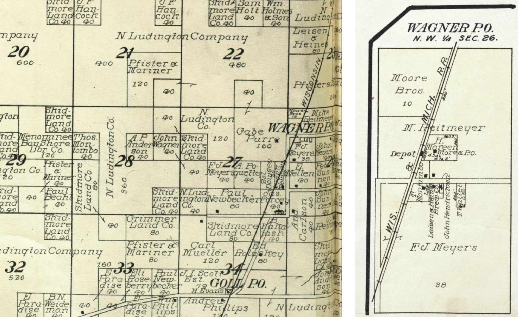
Wagner is an unincorporated community located in the town of Wagner, Marinette County, Wisconsin, United States. Wagner is east-southeast of Wausaukee. Geography Wagner is located at the intersection of Old Rail Road (formerly Right of Way Road) and Wagner Road,''Stephenson Quadrangle Wisconsin–Michigan, 15 Minute Series (Topographic)''. 1963. Map, 1:62,500. Washington, DC: U. S. Geological Survey. at an elevation of . It is connected by road to McAllister to the north, Goll to the south, and Wisconsin Highway 180 to the east. Name Wagner is named after Joseph Wagner (1850–1925), an early settler of the area. Wagner was born in Austria and emigrated to the United States in 1865, initially to Chicago and then relocating to Mankato, Minnesota, where he met and married Susan Dauffenbach (1860–1941). They later moved to what is now Wagner, where Joseph Wagner was the first white settler. Wagner built a cabin there and worked for the sawmills in nearby Wallace, Michiga ... [...More Info...] [...Related Items...] OR: [Wikipedia] [Google] [Baidu] |
Newspapers
A newspaper is a periodical publication containing written information about current events and is often typed in black ink with a white or gray background. Newspapers can cover a wide variety of fields such as politics, business, sports and art, and often include materials such as opinion columns, weather forecasts, reviews of local services, obituaries, birth notices, crosswords, editorial cartoons, comic strips, and advice columns. Most newspapers are businesses, and they pay their expenses with a mixture of subscription revenue, newsstand sales, and advertising revenue. The journalism organizations that publish newspapers are themselves often metonymically called newspapers. Newspapers have traditionally been published in print (usually on cheap, low-grade paper called newsprint). However, today most newspapers are also published on websites as online newspapers, and some have even abandoned their print versions entirely. Newspapers developed in the 17th ... [...More Info...] [...Related Items...] OR: [Wikipedia] [Google] [Baidu] |
Iron Mountain, Michigan
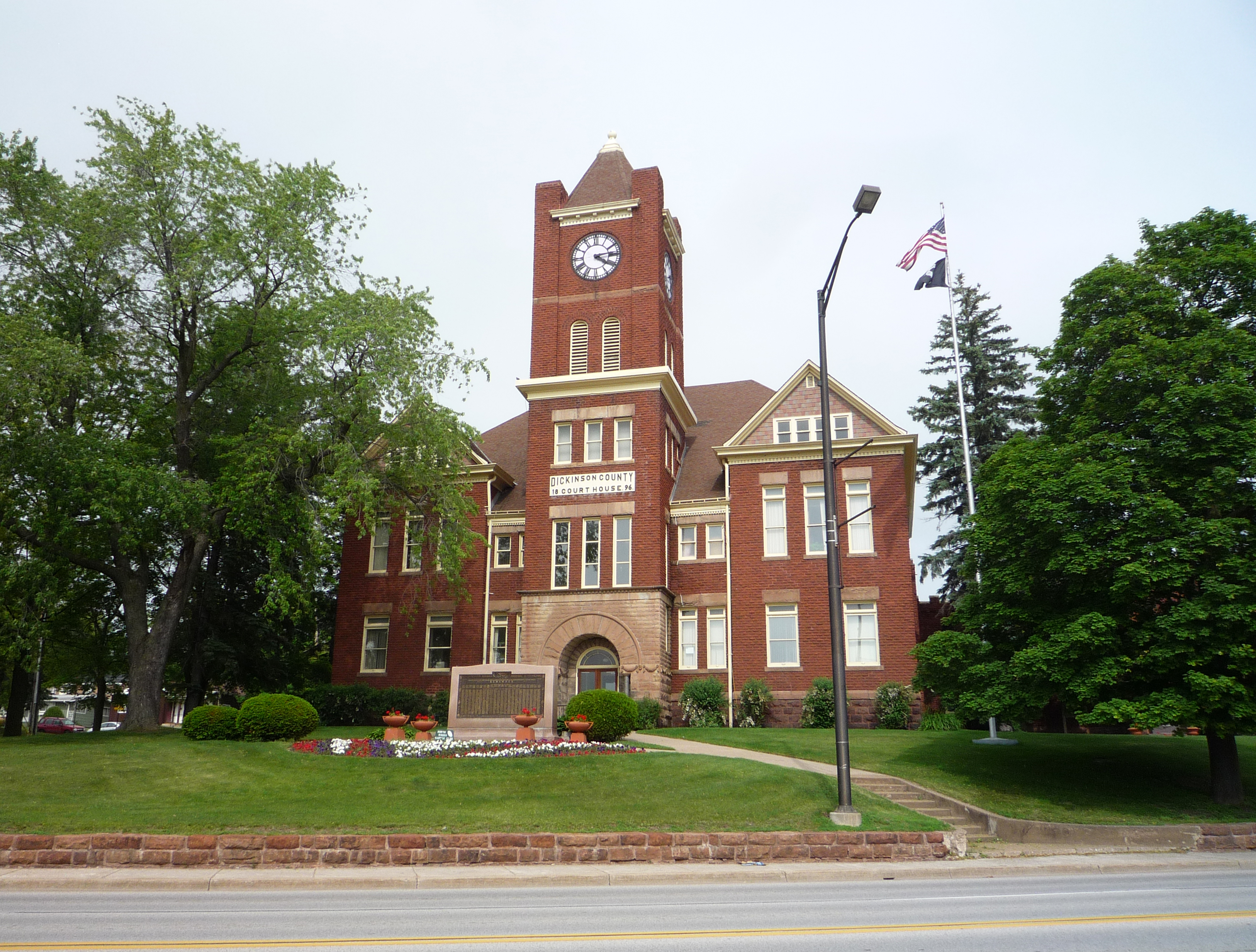
Iron Mountain is a city in the U.S. state of Michigan. The population was 7,518 at the 2020 census, down from 7,624 at the 2010 census. It is the county seat of Dickinson County, in the state's Upper Peninsula. Iron Mountain was named for the valuable iron ore found in the vicinity. Iron Mountain is the principal city of the Iron Mountain, MI-WI Micropolitan Statistical Area, which includes all of Dickinson County, Michigan and Florence County in Wisconsin. Iron Mountain hosts a few points of interest such as the Millie Hill bat cave, The Cornish Pump, and is located adjacent to Pine Mountain ski jump/ski resort, one of the largest artificial ski jumps in the world. It shares Woodward Avenue with the neighboring town, Kingsford. In addition, Iron Mountain is known for its pasties, Bocce Ball Tournaments, World Cup Ski Jumps, and Italian cuisine. Iron Mountain was also named a "Michigan Main Street" community by Michigan Governor Jennifer Granholm in 2006. It is one of only ... [...More Info...] [...Related Items...] OR: [Wikipedia] [Google] [Baidu] |
Bagley Junction, Wisconsin
Bagley Junction is an unincorporated community located in the town of Porterfield, Marinette County, Wisconsin, United States. Geography Bagley Junction is located on Bagley Road on the left bank of the Peshtigo River, at the north end of the Potato Rapids Reservoir,''Porterfield Quadrangle, Wisconsin—Marinette Co., 7.5-Minute Series (Topographic)''. 1982. Map, 1:24,000. Reston, VA: United States Department of the Interior Geological Survey. at an elevation of . It is connected by road to Walsh to the north, Porterfield to the west (via Grasser Road), Peshtigo to the south (via Right of Way Road), and Marinette to the east (via Wisconsin Highway 64). Name Bagley Junction and Bagley Road, which passes through the community, are named for John Bagley (June 20, 1852 Quebec – August 17, 1920 Tacoma, Washington),"John Bagley" (obituary). ''Chicago Lumberman'' 39, page 45. a lumberman. After his early activity in Wisconsin, Bagley was active in Washington and later becam ... [...More Info...] [...Related Items...] OR: [Wikipedia] [Google] [Baidu] |
Miles Wisconsin - Sign 2
The mile, sometimes the international mile or statute mile to distinguish it from other miles, is a British imperial unit and United States customary unit of distance; both are based on the older English unit of length equal to 5,280 English feet, or 1,760 yards. The statute mile was standardised between the British Commonwealth and the United States by an international agreement in 1959, when it was formally redefined with respect to SI units as exactly . With qualifiers, ''mile'' is also used to describe or translate a wide range of units derived from or roughly equivalent to the Roman mile, such as the nautical mile (now exactly), the Italian mile (roughly ), and the Chinese mile (now exactly). The Romans divided their mile into 5,000 Roman feet but the greater importance of furlongs in Elizabethan-era England meant that the statute mile was made equivalent to or in 1593. This form of the mile then spread across the British Empire, some successor states of which ... [...More Info...] [...Related Items...] OR: [Wikipedia] [Google] [Baidu] |
Wisconsin Highway 180
State Trunk Highway 180 (often called Highway 180, STH-180 or WIS 180) is a , north–south state highway in southeastern Marinette County, Wisconsin, United States, that runs from Wisconsin Highway 64 (WIS 64) in Marinette to U.S. Route 141 (US 141) in Wausaukee. Route description WIS 180 begins at a roundabout on WIS 64 (Hall Avenue) on the northwestern city limits of Marinette. The road continues south as County Trunk Highway T (CTH-T/Roosevelt Road) to connect with U.S. Route 41 (US 41) and then on to end at CTH-B. WIS 64 heads east to end at US 41 in central Marinette and heads west to connect with US 141 and then on to Pound and Antigo. For its entire length, the WIS 180 roughly follows the western bank of the Menominee River as a two-lane road. The river in the area of WIS 180 flows along the stateline between Wisconsin and Michigan. From is southern terminus WIS 180 heads north along the western city limi ... [...More Info...] [...Related Items...] OR: [Wikipedia] [Google] [Baidu] |
Porterfield (community), Wisconsin
Porterfield is a census-designated place in the town of Porterfield, Marinette County, Wisconsin, United States. __TOC__ Geography Porterfield is located along the Escanaba and Lake Superior Railroad west-northwest of Marinette. Porterfield has a post office with ZIP code 54159. The Peshtigo River runs south of the community. History Porterfield developed as a railroad junction, and it was named after a local farmer and businessman, John Porterfield. A post office was established in Porterfield in 1885. In the past, Porterfield had an apartment house (a former grocery store), a bar, a blacksmith shop, and a cheese factory. School Before a new elementary school was built in Porterfield in 1963, the area was served by several small schools: Miles School and Winesville School to the north, Dickie School and Fairmont School to the northwest, Fairdale School to the southwest, Phillips School, Plumb School, and Sandberg School to the south, Stewart School to the southeast, a ... [...More Info...] [...Related Items...] OR: [Wikipedia] [Google] [Baidu] |
Walsh, Wisconsin
Walsh is an unincorporated community located in the town of Porterfield, in Marinette County, Wisconsin, United States. Geography Walsh is located along County Trunk Highway G at the intersection with Bagley Road and Twin Creek Road,''Porterfield Quadrangle Wisconsin–Marinette Co., 7.5 Minute Series (Topographic)''. 1982. Map, 1:24,000. Reston, VA: U. S. Geological Survey. at an elevation of . It is connected by road to Rubys Corner to the east, Loomis to the west, and Porterfield to the south (via County Trunk Highway E). The town of Porterfield's town hall and fire station are located in Walsh. Name The community was originally known as Rawnsville in the nineteenth century. It was named for the family of Jacob Rawn (1819–1896; surname earlier spelled ''Rein'', ''Raan'', or ''Rhyne''), who settled in the area. The name was changed to Walsh on July 5, 1902. The new name honored John R. Walsh (1837–1911) of Chicago. Walsh was the founder of the Chicago National Bank, and ... [...More Info...] [...Related Items...] OR: [Wikipedia] [Google] [Baidu] |
Goll, Wisconsin
Goll is an unincorporated community located in the town of Wagner, Marinette County, Wisconsin, United States. Geography Goll is located at the intersection of County Trunk Highway X and Old Rail Road (formerly Right of Way Road),''Wausaukee Quadrangle Wisconsin–Michigan, 15 Minute Series (Topographic)''. 1963. Map, 1:62,500. Washington, DC: U. S. Geological Survey. at an elevation of . It is connected by road to Wagner to the north, Middle Inlet to the west, and Wisconsin Highway 180 to the east. Goll Road runs obliquely to the east of the former rail line. History Goll was a stop between Miles The mile, sometimes the international mile or statute mile to distinguish it from other miles, is a British imperial unit and United States customary unit of distance; both are based on the older English unit of length equal to 5,280 English ... and Wagner on the Wisconsin & Michigan (W. & M.) Railway line from Bagley Junction to Iron Mountain. The rail line through Goll wa ... [...More Info...] [...Related Items...] OR: [Wikipedia] [Google] [Baidu] |
List Of Sovereign States
The following is a list providing an overview of sovereign states around the world with information on their status and recognition of their sovereignty. The 206 listed states can be divided into three categories based on membership within the United Nations System: 193 UN member states, 2 UN General Assembly non-member observer states, and 11 other states. The ''sovereignty dispute'' column indicates states having undisputed sovereignty (188 states, of which there are 187 UN member states and 1 UN General Assembly non-member observer state), states having disputed sovereignty (16 states, of which there are 6 UN member states, 1 UN General Assembly non-member observer state, and 9 de facto states), and states having a special political status (2 states, both in free association with New Zealand). Compiling a list such as this can be a complicated and controversial process, as there is no definition that is binding on all the members of the community of nations concerni ... [...More Info...] [...Related Items...] OR: [Wikipedia] [Google] [Baidu] |
Wisconsin
Wisconsin () is a state in the upper Midwestern United States. Wisconsin is the 25th-largest state by total area and the 20th-most populous. It is bordered by Minnesota to the west, Iowa to the southwest, Illinois to the south, Lake Michigan to the east, Michigan to the northeast, and Lake Superior to the north. The bulk of Wisconsin's population live in areas situated along the shores of Lake Michigan. The largest city, Milwaukee, anchors its largest metropolitan area, followed by Green Bay and Kenosha, the third- and fourth-most-populated Wisconsin cities respectively. The state capital, Madison, is currently the second-most-populated and fastest-growing city in the state. Wisconsin is divided into 72 counties and as of the 2020 census had a population of nearly 5.9 million. Wisconsin's geography is diverse, having been greatly impacted by glaciers during the Ice Age with the exception of the Driftless Area. The Northern Highland and Western Upland along wi ... [...More Info...] [...Related Items...] OR: [Wikipedia] [Google] [Baidu] |


