|
Midland Railway Of Western Australia
The Midland Railway of Western Australia (MRWA) was a railway company that built and operated the Midland line in Western Australia. It was listed on the London Stock Exchange. Although having its headquarters in London, it had no association with the English Midland Railway. History In December 1883, John Waddington representing a syndicate of English capitalists, proposed to Governor Broome to build a line from York via Northam, Newcastle, Bejoording, New Norcia and along the Berkshire Valley to Geraldton under a land grant scheme. A parliamentary select committee recommended the route be altered to branch off from the Eastern Railway at Guildford and run via Chittering, Bindoon, Victoria Plains, Carnamah, Arrino, Upper Irwin and Dongara to Walkaway where it would join the Western Australian Government Railway's line from Geraldton. The agreement was signed on 27 February 1886, with work commencing a few days later.">/sup> By 1911, 16 subdivisions between M ... [...More Info...] [...Related Items...] OR: [Wikipedia] [Google] [Baidu] |
MRWA B Class
The MRWA B class was a class of steam locomotives built by Hawthorn Leslie in Tyneside, England, for the Midland Railway of Western Australia (MRWA). The class's wheel arrangement was 4-4-0. Service history The nine members of the B class entered service in 1891. Withdrawals began in 1929, but the five longest serving units continued working on the MRWA, mainly as shunting engines, from then until the 1950s. Preservation One B class locomotive, no B6, has been preserved. It is the only ex-MRWA steam locomotive still in existence. After being withdrawn by the MRWA in 1956, B6 was acquired by the then municipality of Geraldton, and put on display in a Geraldton park. In 1995, ownership of B6 was transferred to the then Shire of Swan, and in 1999 the locomotive was moved to the former Midland Railway Workshops, for storage in the custody of Rail Heritage WA. In 2010, following a renewal of interest by the City of Geraldton-Greenough in rail history, B6 was moved back to th ... [...More Info...] [...Related Items...] OR: [Wikipedia] [Google] [Baidu] |
Toodyay Railway Station
Toodyay railway station is located on the Eastern Railway in the Avon River town of Toodyay in Western Australia. History There have been three stopping places for railway passengers in Toodyay. As was the case with other communities in Western Australia at the time, railway routes through established localities caused concern to the residents when the railway lines were in planning stages. Original stopping point The original railway stopping point on the narrow gauge Clackline–Miling line was where a railway platform is indicated on the north side of the track on the Public Works Department plan for that time. Original station The locality at that time was known as Newcastle; by 1897 the station building was constructed within a short distance west of the original terminus, and was referred to regularly in advertising as being across the road from the Newcastle Hotel. On 6 May 1910, Newcastle was regazetted as Toodyay with the station likewise renamed. The line wa ... [...More Info...] [...Related Items...] OR: [Wikipedia] [Google] [Baidu] |
Walkaway, Western Australia
Walkaway is a small town in the City of Greater Geraldton local government area of Western Australia. At the , Walkaway had a population of 270. Its name is a corruption of the native "Wagga wah", referring to the bend in the nearby Greenough River, and was originally given to the railway station when a line was built from Geraldton in 1887. Rail In 1894 Midland railway line, Western Australia was linked with Midland Junction by the building of a private line–that of the Midland Railway Company, constructed by an engineer and later the first general manager of the company, Edward V. H. Keane. With the railway and an expanding agricultural area, the township grew until with the dieselisation of the railway systems, and the take-over by the State of the Midland Railway in 1964, decline set in. This was also accentuated by the gradual absorption of the original smallholdings into the larger holdings of today's farming demands. Renewable Energy A number of renewable energy ... [...More Info...] [...Related Items...] OR: [Wikipedia] [Google] [Baidu] |
Arrino
Arrino is a small town in the Mid West region of Western Australia. The town is located between Mingenew and Three Springs on the Midlands Road. The name of the town is Aboriginal in origin; it is the name of the local springs, thought to mean "place of many granite hills". The name first appeared in charts in 1859 and was also the name of a property established by an early settler, NW Cooke, in 1876. The townsite was gazetted in 1904. Plans for a school and quarters to be built were drawn up in 1905 with an estimated cost of £325. Flooding occurred at Arrino in 1932 following a torrential downpour that caused the Arrowsmith River and surrounding creeks to rise and flood a few hours later. A section of the railway between Arrino and Three Springs was washed away as a result, closing the line for several days. Later the same year massive bushfires swept across the surrounding areas destroying crops and bushland; about of countryside were burnt out. More fires were started ... [...More Info...] [...Related Items...] OR: [Wikipedia] [Google] [Baidu] |
Shire Of Victoria Plains
The Shire of Victoria Plains is a local government area in the Wheatbelt region of Western Australia, about north of the state capital, Perth. It covers an area of , and its seat of government is the town of Calingiri. History The Victoria Plains Road District was gazetted on 24 January 1871 covering an area extending as far north as Carnamah and east to the South Australian border. These areas gradually obtained their own local government over the next 40 years. The Melbourne Road District separated on 10 February 1887. On 11 December 1908, Moora Road District was gazetted and also separated. As a result of the WA ''Local Government Act 1960'', all remaining road districts became shires, including the Shire of Victoria Plains, on 1 July 1961. Wards The shire is divided into four wards. * West Ward (three councillors) * Central Ward (two councillors) * East Ward (two councillors) * South Ward (two councillors) Towns and localities * Bolgart * Calingiri * Gillingar ... [...More Info...] [...Related Items...] OR: [Wikipedia] [Google] [Baidu] |
Chittering, Western Australia
Chittering is a town and rural district approximately 70 km NNE of Perth, Western Australia. It is located along the Brockman River within the Shire of Chittering. It lies between the towns of Gingin and Toodyay, in the Wheatbelt region. The area was first explored by George Fletcher Moore in 1836 and has been known by that name since Moore recorded it on his maps. The name is Aboriginal in origin and is thought to mean ''place of the willie wagtail The willy (or willie) wagtail (''Rhipidura leucophrys'') is a passerine bird native to Australia, New Guinea, the Solomon Islands, the Bismarck Archipelago, and Eastern Indonesia. It is a common and familiar bird throughout much of its range, ...s''. References Towns in Western Australia {{WesternAustralia-geo-stub ... [...More Info...] [...Related Items...] OR: [Wikipedia] [Google] [Baidu] |
Midland Junction Railway Station
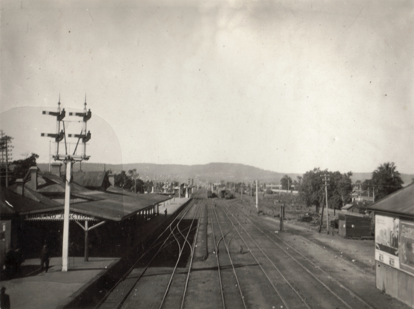
The Midland Junction railway station was an important junction station on the Eastern Railway of Western Australia until its closure in 1966. Its history started on 1 March 1886 when Frederick Broome, then Governor of Western Australia, turned the first sod. It was the first railway station in Midland Junction and was replaced by the Midland station west, across the tracks from the Midland Railway Workshops. Junction era Midland Junction was an aptly named locality and railway station, as it had the following services leaving from its platforms: * the Upper Darling Range Railway or Zig Zag railway to Kalamunda until 1949 * Mundaring (and Mundaring Weir until 1952) until 1954 * Bellevue until 1965 * Chidlow until 1965 * Midland Railway of Western Australia until 1963 It was in effect the point at which all rail services in the Western Australian network had to pass byexcept for the South West line to Bunbury. It was also a stopping point for Western Australian Gov ... [...More Info...] [...Related Items...] OR: [Wikipedia] [Google] [Baidu] |
Eastern Railway (Western Australia)
The Eastern Railway is the main railway route between Fremantle and Northam in Western Australia. It opened in stages between 1881 and 1893. The line continues east to Kalgoorlie as the Eastern Goldfields Railway. Initial section The first sod of the Fremantle-Guildford Railway was turned by Governor Ord at Guildford on 3 June 1879. The event coincided with the celebration of the 50th anniversary of settlement of Western Australia. The alignment of this first section of the railway has remained generally unchanged since it opened on 1 March 1881 and now forms part of Transperth's Fremantle Line and Midland Line. Notable changes to this section include: * Electrification of the Perth suburban rail network in 1991 * Sinking of Subiaco station in 1998 as part of Subi Centro * Sinking of the line through the former Perth Yards as part of Perth City Link The centenary of the railway was celebrated on 1 March 1981. First route The ''First Route'', from to , was opened on ... [...More Info...] [...Related Items...] OR: [Wikipedia] [Google] [Baidu] |
Land Grant
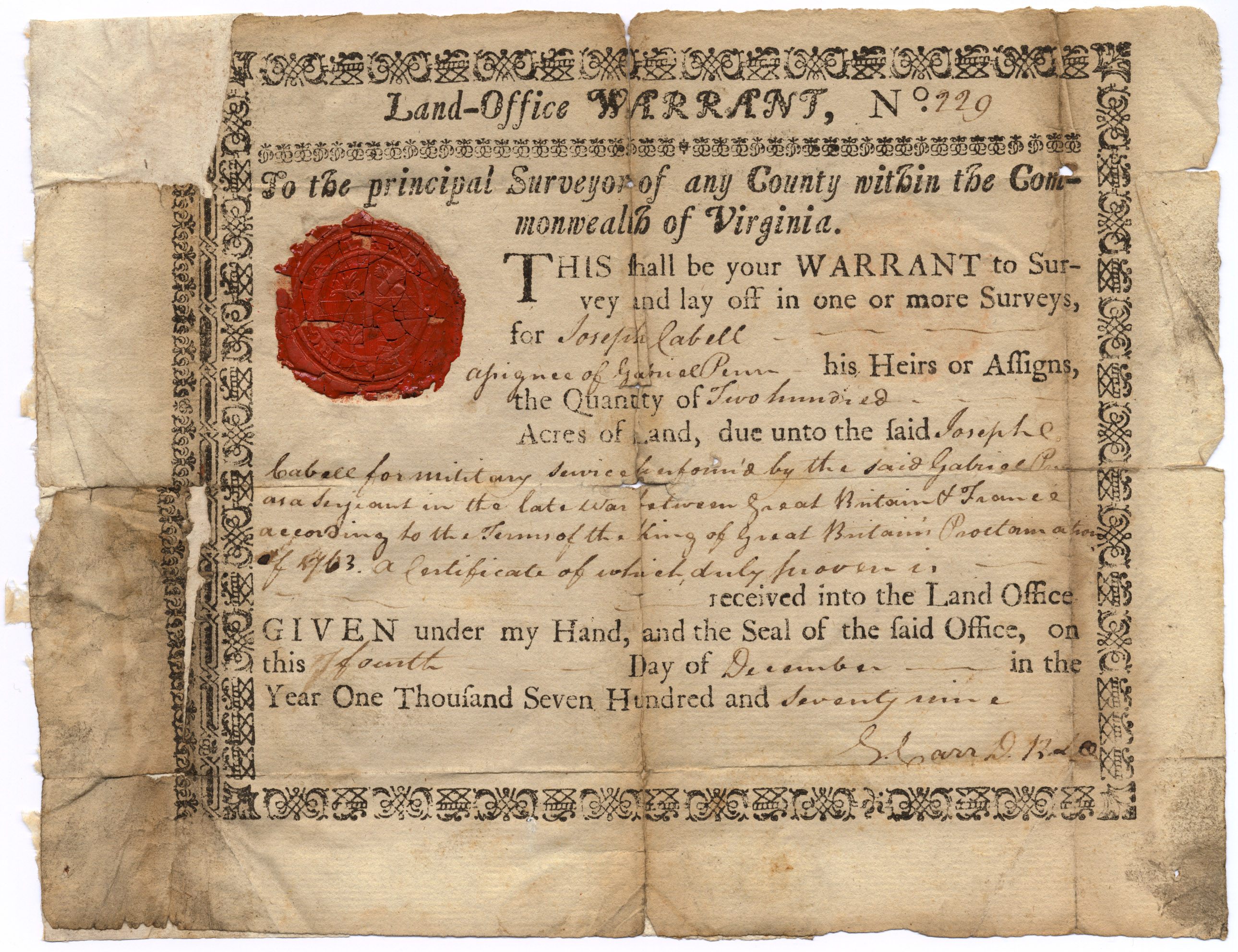
A land grant is a gift of real estate—land or its use privileges—made by a government or other authority as an incentive, means of enabling works, or as a reward for services to an individual, especially in return for military service. Grants of land are also awarded to individuals and companies as incentives to develop unused land in relatively unpopulated countries; the process of awarding land grants are not limited to the countries named below. The United States historically gave out numerous land grants as Homesteads to individuals desiring to prove a farm. The American Industrial Revolution was guided by many supportive acts of legislatures (for example, the Main Line of Public Works legislation of 1826) promoting commerce or transportation infrastructure development by private companies, such as the Cumberland Road turnpike, the Lehigh Canal, the Schuylkill Canal and the many railroads that tied the young United States together. Ancient Rome Roman soldiers were given pe ... [...More Info...] [...Related Items...] OR: [Wikipedia] [Google] [Baidu] |


