|
Mfuwe
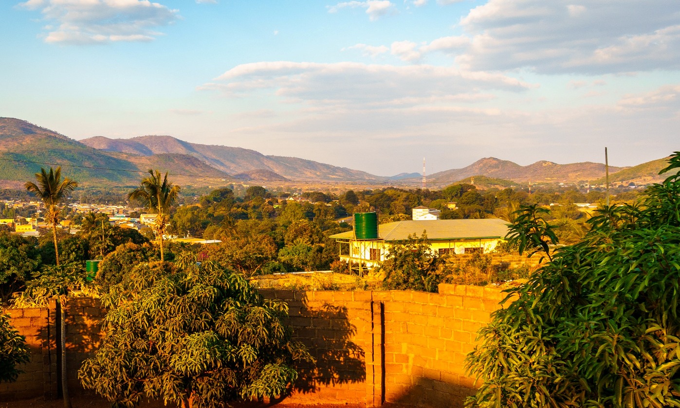
Mfuwe is the main settlement of South Luangwa National Park in the Eastern Province of Zambia, serving the tourism industry and wildlife conservation in the Luangwa Valley. It is located in Mambwe District, about west-north-west of Chipata. Mfuwe has an airport with a surfaced runway capable of taking regional international flights. This village holds the record of the highest temperature ever recorded in Zambia with set on 26 October 2011. See also *Mfuwe Airport *South Luangwa National Park *Luangwa River The Luangwa River is one of the major tributaries of the Zambezi River, and one of the four biggest rivers of Zambia. The river generally floods in the rainy season (December to March) and then falls considerably in the dry season. It is one of ... Populated places in Eastern Province, Zambia {{Zambia-geo-stub ... [...More Info...] [...Related Items...] OR: [Wikipedia] [Google] [Baidu] |
Mfuwe Airport
Mfuwe Airport is an airport serving Mfuwe, a diffuse settlement in Mambwe District in the Eastern Province in Zambia. It serves the tourism industry based on the nearby South Luangwa National Park and other wildlife areas in the Luangwa Valley. It is one of four international airports in Zambia, with seasonal international flights. Facilities The airport elevation is above mean sea level. It has one runway. Airlines and destinations See also *Transport in Zambia *List of airports in Zambia This is a list of airports in Zambia, sorted by location. Zambia, officially the Republic of Zambia, is a landlocked country in Southern Africa. The neighboring countries are the Democratic Republic of the Congo to the north, Tanzania to the nor ... References External linksSkyVector - Mfuwe Airport* * Airports in Zambia Buildings and structures in Eastern Province, Zambia {{Zambia-geo-stub ... [...More Info...] [...Related Items...] OR: [Wikipedia] [Google] [Baidu] |
South Luangwa National Park
South Luangwa National Park is in eastern Zambia, the southernmost of three national parks in the valley of the Luangwa River. It is a world-renowned wildlife haven which is known to locals simply as "the South Park."Concentrations of game along the meandering Luangwa River and its lagoons are amongst the most intense in Africa. The river teems with hippo and crocodile and provides a lifeline for one of the greatest diversities of habitat and wildlife, supporting more than 60 species of mammals and over 400 species of birds.It marks the end of the Great Rift Valley. It supports large populations of Thornicroft's giraffe, and herds of elephants and Cape buffaloes often several hundred strong. It is one of the best-known national parks in Africa for walking safaris. Founded as a game reserve in 1938, it became a national park in 1972 and now covers 9,050 km2. The Park is unfenced and bordered to the west by a steep escarpment and to the east by the Luangwa River. The Lua ... [...More Info...] [...Related Items...] OR: [Wikipedia] [Google] [Baidu] |
Luangwa Valley
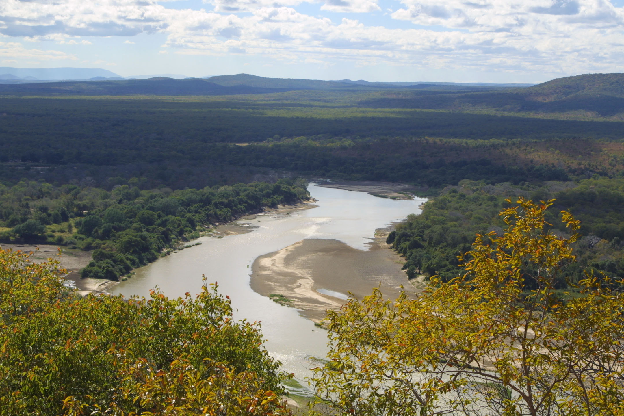
The Luangwa River is one of the major tributaries of the Zambezi River, and one of the four biggest rivers of Zambia. The river generally floods in the rainy season (December to March) and then falls considerably in the dry season. It is one of the biggest unaltered rivers in Southern Africa and the that make up the surrounding valley are home to abundant wildlife. Source and Upper-Middle Luangwa Valley ''Note: distances stated are approximate straight-line distances from source''. The Luangwa rises in the Lilonda and Mafinga Hills in north-east Zambia at an elevation of around 1500 m, near the border with Tanzania and Malawi, and flows in a southwesterly direction through a broad valley. About 150 km from its source it has dropped to an elevation of about 690 m and becomes a meandering river with a flood-plain several kilometres wide. Over the next 300 km the meanders increase, with many oxbow lakes and abandoned meanders. Near Mfuwe, the river's elevat ... [...More Info...] [...Related Items...] OR: [Wikipedia] [Google] [Baidu] |
Luangwa River
The Luangwa River is one of the major tributaries of the Zambezi River, and one of the four biggest rivers of Zambia. The river generally floods in the rainy season (December to March) and then falls considerably in the dry season. It is one of the biggest unaltered rivers in Southern Africa and the that make up the surrounding valley are home to abundant wildlife. Source and Upper-Middle Luangwa Valley ''Note: distances stated are approximate straight-line distances from source''. The Luangwa rises in the Lilonda and Mafinga Hills in north-east Zambia at an elevation of around 1500 m, near the border with Tanzania and Malawi, and flows in a southwesterly direction through a broad valley. About 150 km from its source it has dropped to an elevation of about 690 m and becomes a meandering river with a flood-plain several kilometres wide. Over the next 300 km the meanders increase, with many oxbow lakes and abandoned meanders. Near Mfuwe, the river's elevat ... [...More Info...] [...Related Items...] OR: [Wikipedia] [Google] [Baidu] |
Eastern Province, Zambia
Eastern Province is one of Zambia's ten provinces. The province lies between the Luangwa River and borders with Malawi to the east and Mozambique to the south, from Isoka in the northeast to the north of Luangwa in the south. The provincial capital is Chipata. Eastern province has an area of , locally shares border with three other provinces of the country and is divided into fifteen districts. As per the 2010 Zambian census, Eastern Province had a population of 1,592,661, accounting to 12.16% of the total Zambian population. The sex ratio was 1,030 for every 1,000 males. As of 2010, Chewa was the largest community in the region with 39.7 per cent of the total population and Chewa was the most widely spoken language with 34.6 per cent speaking it. On the tourism front, the province has four national parks. The province has two significant traditional ceremonies being the Nc'wala festival celebrated in Chipata District by the Ngoni tribe during February and the Chewa Kulamb ... [...More Info...] [...Related Items...] OR: [Wikipedia] [Google] [Baidu] |
Chipata
The city of Chipata is the administrative centre of the Eastern Province of Zambia and Chipata District. It was declared the 5th city of the country, after Lusaka, Ndola, Kitwe and Livingstone, by President Edgar Lungu on 24 February 2017. The city has undergone rapid economic and infrastructure growth in the years, leading up to city status. Location Chipata is located approximately , east of Lusaka, the capital city of Zambia. This is about west of Lilongwe, the capital city of Malawi. The geographical coordinates of Chipata are 13°38'43.0"S, 32°38'47.0"E (Latitude:13°38'43.0"S; Longitude:32°38'47.0"E). The average elevation of Chipata is , above sea level. Overview Having a modern market, a central hospital, shopping malls, a university, some colleges and a number of schools, Chipata is the business and administrative hub of the region. The town boasts a four star hotel, a golf course, an airport, and a "welcome arch". Developed areas includes Kalongwezi, Moth, and Lit ... [...More Info...] [...Related Items...] OR: [Wikipedia] [Google] [Baidu] |
Zambia
Zambia (), officially the Republic of Zambia, is a landlocked country at the crossroads of Central Africa, Central, Southern Africa, Southern and East Africa, although it is typically referred to as being in Southern Africa at its most central point. Its neighbours are the Democratic Republic of the Congo to the north, Tanzania to the northeast, Malawi to the east, Mozambique to the southeast, Zimbabwe and Botswana to the south, Namibia to the southwest, and Angola to the west. The capital city of Zambia is Lusaka, located in the south-central part of Zambia. The nation's population of around 19.5 million is concentrated mainly around Lusaka in the south and the Copperbelt Province to the north, the core economic hubs of the country. Originally inhabited by Khoisan peoples, the region was affected by the Bantu expansion of the thirteenth century. Following the arrival of European exploration of Africa, European explorers in the eighteenth century, the British colonised the r ... [...More Info...] [...Related Items...] OR: [Wikipedia] [Google] [Baidu] |
Tourism
Tourism is travel for pleasure or business; also the theory and practice of touring (other), touring, the business of attracting, accommodating, and entertaining tourists, and the business of operating tour (other), tours. The World Tourism Organization defines tourism more generally, in terms which go "beyond the common perception of tourism as being limited to holiday activity only", as people "travelling to and staying in places outside their usual environment for not more than one consecutive year for leisure and not less than 24 hours, business and other purposes". Tourism can be Domestic tourism, domestic (within the traveller's own country) or International tourism, international, and international tourism has both incoming and outgoing implications on a country's balance of payments. Tourism numbers declined as a result of a strong economic slowdown (the late-2000s recession) between the second half of 2008 and the end of 2009, and in consequence of t ... [...More Info...] [...Related Items...] OR: [Wikipedia] [Google] [Baidu] |
Wildlife Conservation
Wildlife conservation refers to the practice of protecting wild species and their habitats in order to maintain healthy wildlife species or populations and to restore, protect or enhance natural ecosystems. Major threats to wildlife include habitat destruction, degradation, fragmentation, overexploitation, poaching, pollution and climate change. The IUCN estimates that 27,000 species of the ones assessed are at risk for extinction. Expanding to all existing species, a 2019 UN report on biodiversity put this estimate even higher at a million species. It is also being acknowledged that an increasing number of ecosystems on Earth containing endangered species are disappearing. To address these issues, there have been both national and international governmental efforts to preserve Earth's wildlife. Prominent conservation agreements include the 1973 Convention on International Trade in Endangered Species of Wild Fauna and Flora (CITES) and the 1992 Convention on Biological Diversity (C ... [...More Info...] [...Related Items...] OR: [Wikipedia] [Google] [Baidu] |
Mambwe District
Mambwe District is a district of Zambia, located in Eastern Province. Mambwe District inhabits the Luangwa Valley between the 13th and 14th parallel of south latitude. The Kunda name for this area is "Malambo''. The land is bounded on the west by the Luangwa River, on the south by the Lusangazi River and on the north by the Chisitu River. It is approximately 700km east of Zambia’s capital city – Lusaka – and borders Lundazi district to the north, Mpika to the north-west, Serenje to the west and Petauke to the south-west. Katete is in the south while Chipata is on the south-east side of the district. The capital lies at Mambwe named after the great leader of the Kunda people during their migration from the Congo. In 2019, City Population, quoting figures from the Central Statistical Office, projected the population of Mambwe District to be at 96, 322 The Kunda represent about 80 percent of the population in the six Kunda chiefdoms under the Kunda chiefs namely: HRH ... [...More Info...] [...Related Items...] OR: [Wikipedia] [Google] [Baidu] |
.jpg)


