|
Melbourne Tram Route 86
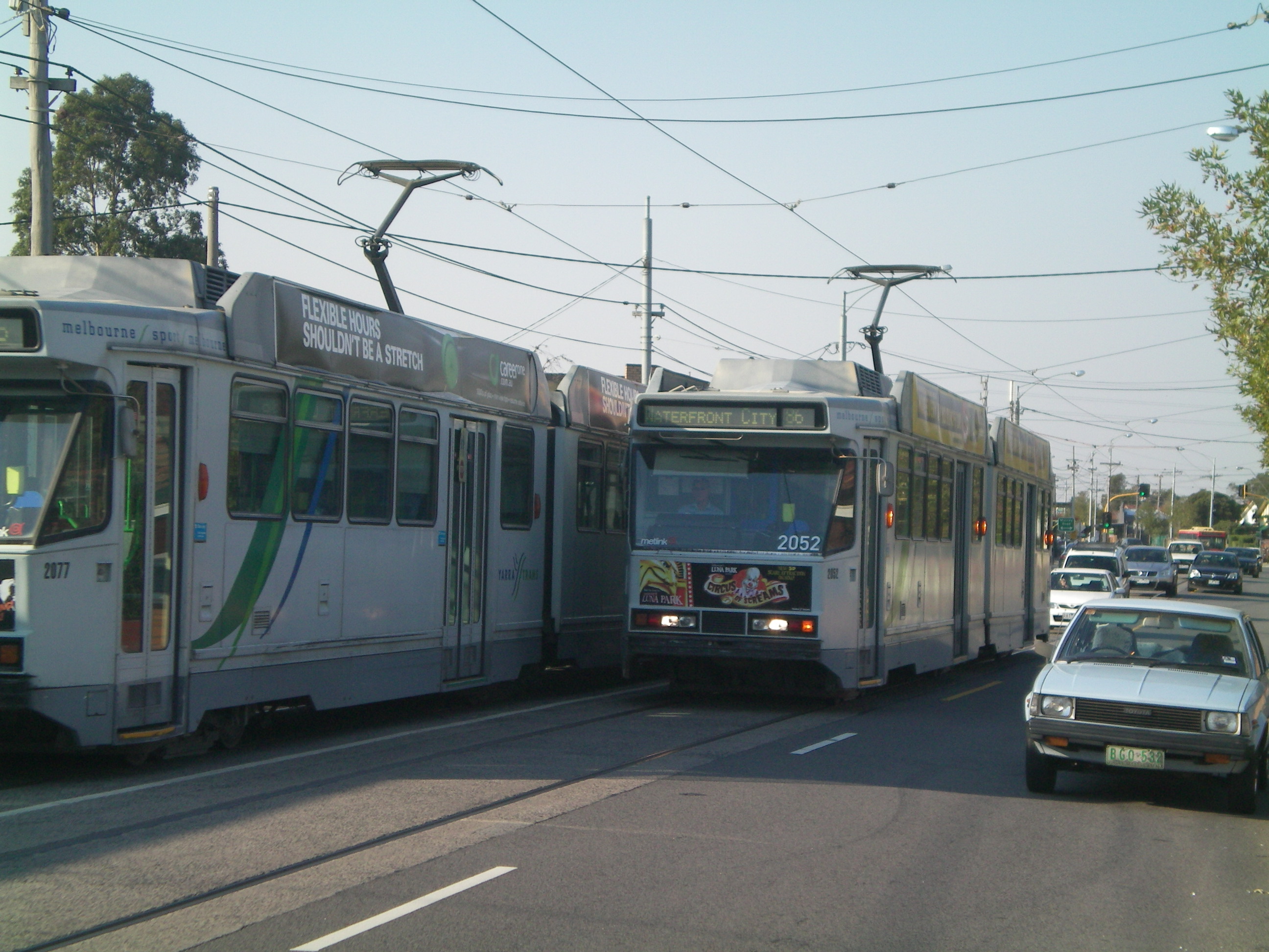
Melbourne tram route 86 is operated by Yarra Trams on the Melbourne tram network from Bundoora RMIT to Waterfront City. The 22.2 kilometre route is operated out of Preston depot with E class trams. History The line had its beginnings as two separate cable tram lines. The first was part of Melbourne’s main cable tram system, built by the Melbourne Tramway & Omnibus Company (MTOC) in the late 1880s. This system included the 'Collingwood & Clifton Hill' line, which operated along Bourke Street in the city, then Gertrude Street, Smith Street, and Queens Parade to a terminus just short of the Northcote Bridge (Merri Creek Bridge), which opened on 10 August 1887. A second line, which was a continuation of this line, was built privately by a group of Northcote land speculators, which ran from near the MTOC terminus, across the bridge, up High Street, to Miller Street/Dundas Street, the boundary between Northcote and Preston, which opened on opened on 18 February 1890. [...More Info...] [...Related Items...] OR: [Wikipedia] [Google] [Baidu] |
B-class Melbourne Tram
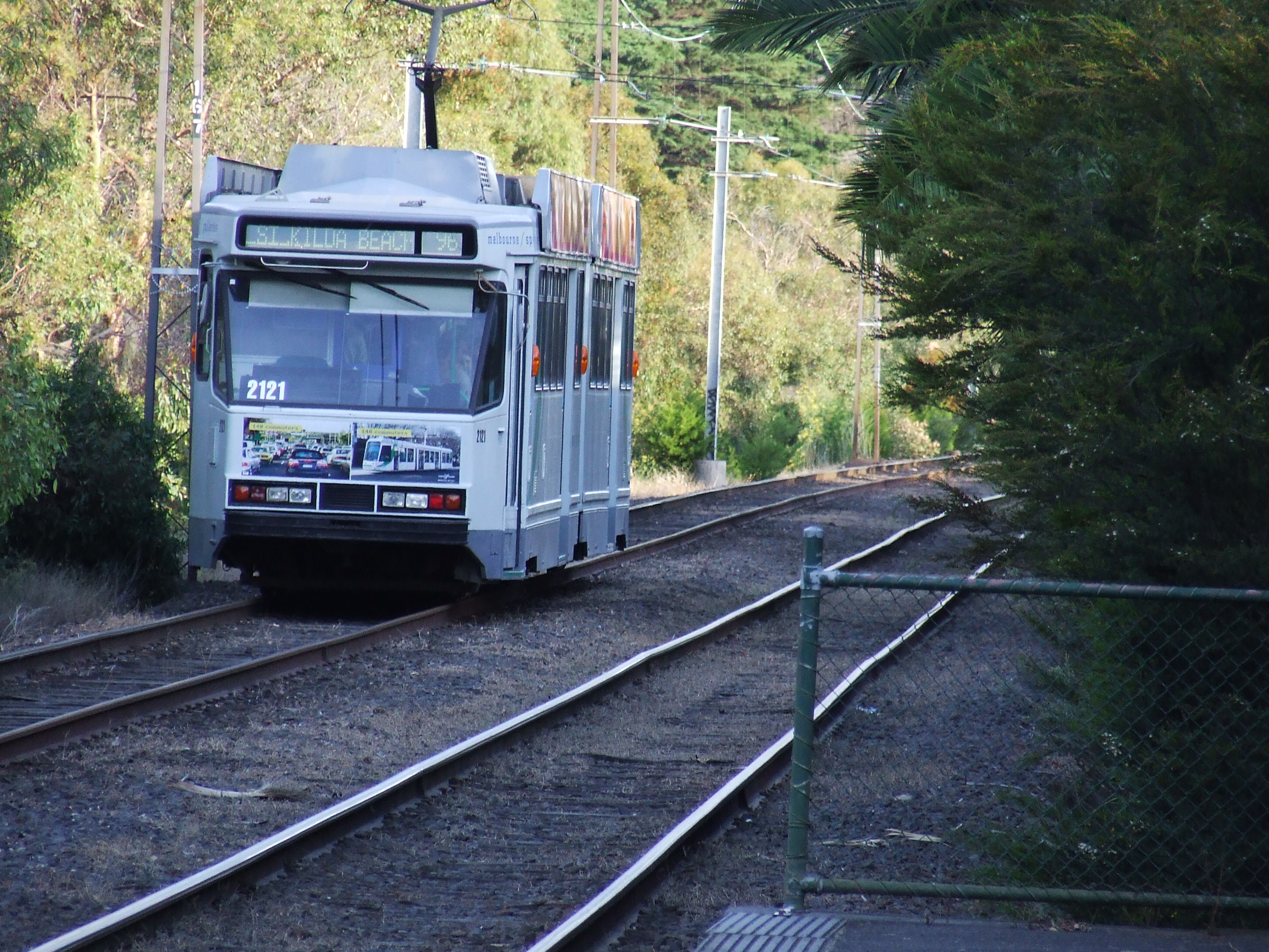
The B-class Melbourne tram is a class of two-section, three-bogie articulated class trams that operate on the Melbourne tram network. Following the introduction of two B1-class prototype trams in 1984 and 1985, a total of 130 B2-class trams were built by Comeng (later ABB), Dandenong. They were developed for the conversion of the St Kilda and Port Melbourne railway lines to light rail, and introduced by the Metropolitan Transit Authority, and later the Public Transport Corporation between 1984 and 1994. History In preparation of the conversion of the St Kilda and Port Melbourne railway lines to light rail, two prototype B1-class trams were built in 1984 and 1985 at the end of an order for A1-class trams.B1 Class B1 Class Vicsig They were followed by 130 B2-class trams built between 1987 and 1994. All ... [...More Info...] [...Related Items...] OR: [Wikipedia] [Google] [Baidu] |
Melbourne Tram Route 96
Melbourne tram route 96 is operated by Yarra Trams on the Melbourne tram network from Brunswick East to St Kilda Beach. The 13.9 kilometre route is operated out of Southbank depot with C2 and E class trams. History The line opened as a cable tram line operated by the Melbourne Tramway & Omnibus Company on 30 August 1887, operating along Bourke and Nicholson Streets. It operated until 26 October 1940, when the Bourke Street cable lines were abandoned by the Melbourne & Metropolitan Tramways Board (MMTB) in favour of double decker buses. The Bourke Street cable lines were the last cable trams to operate in Melbourne. The MMTB, unhappy with the performance of the buses, decided to reinstate trams when the buses reached life expiry, trams on the 88 (predecessor to the modern 86) started on 26 June 1955 with the first tram to Brunswick East operating on 8 April 1956. The W7 class trams were built for running on these lines and the new Z class trams first ran on route 96 in J ... [...More Info...] [...Related Items...] OR: [Wikipedia] [Google] [Baidu] |
Trolley Wire
The Sydney Tramway Museum (operated by the South Pacific Electric Railway) is Australia's oldest tramway museum and the largest in the southern hemisphere. It is located at Loftus in the southern suburbs of Sydney. History Construction of the museum at its original site on the edge of the Royal National Park commenced in August 1956. It was officially opened in March 1965 by NSW Deputy Premier Pat Hills. The facilities were basic, initially a four-track shed built with second hand materials and approximately 800 metres of running track. In 1975, the Government of New South Wales approved the museum moving to a new site across the Princes Highway adjacent to Loftus railway station. Construction commenced in April 1980, with the first trams transferred from the old site in November 1982. It officially opened on 19 March 1988. The former Railway Square tramway shelter that had been disassembled in 1973 was reassembled. The last tram left the Royal National Park in May 1989. In ... [...More Info...] [...Related Items...] OR: [Wikipedia] [Google] [Baidu] |
Transit Australia
''Transit Australia'' was a Sydney based monthly magazine covering public transport in Australia and New Zealand New Zealand ( mi, Aotearoa ) is an island country in the southwestern Pacific Ocean. It consists of two main landmasses—the North Island () and the South Island ()—and over 700 smaller islands. It is the sixth-largest island count .... It was the in-house journal of the Australia Electric Traction Association. It was founded in 1946 as ''Tram Tracks'', being retitled ''Electric Traction'' in 1949 and ''Transit Australia'' in 1987. The final issue was published in June 2018. Transit Australia References External links [...More Info...] [...Related Items...] OR: [Wikipedia] [Google] [Baidu] |
Brunswick East
Brunswick East is an inner-city suburb in Melbourne, Victoria, Australia, north of Melbourne's Central Business District, located within the City of Merri-bek local government area. Brunswick East recorded a population of 13,279 at the 2021 census. Bordered generally by Lygon Street and Holmes Street in the west; the Merri Creek in the east adjoining Northcote; Park Street, Nicholson Street and Glenlyon Road in the south adjoining Carlton North and Fitzroy North; and Moreland Road in the north adjoining Coburg. Brunswick East is a mixed-use suburb, consisting of primarily residential and commercial properties. Geography Lygon Street and Nicholson Street run along Brunswick East's western border with neighbouring Brunswick, while Park Street (one block south of the main thoroughfare of Brunswick Road) and Glenlyon Road form the southern border with Carlton North and Fitzroy North respectively. Merri Creek marks the eastern border with adjoining Northcote. Moreland Roa ... [...More Info...] [...Related Items...] OR: [Wikipedia] [Google] [Baidu] |
Lygon Street
Lygon Street is located in Melbourne, Victoria, Australia, running through the inner northern suburbs of Carlton, Carlton North, Princes Hill and Brunswick East. Lygon Street is synonymous with the Italian community of Melbourne, forming the nexus point of Little Italy. It is home to many Italian restaurants and alfresco cafés. Geography Lygon Street runs north–south through the inner northern suburbs of Melbourne. At its southernmost end, it connects to Russell Street in the Hoddle Grid; it then proceeds northward, through Carlton, Carlton North, and Brunswick East, to its intersection with Albion Street. Although the roadway itself continues, it is renamed Holmes Street for the stretch between Albion Street and Moreland Road, and later renamed again to Nicholson Street for the stretch between Moreland Road and the street's terminus at Bell Street. (Note that this is not continuous with the Nicholson Street which runs through the Melbourne CBD, Fitzroy, Carlton and B ... [...More Info...] [...Related Items...] OR: [Wikipedia] [Google] [Baidu] |
Melbourne Central Business District
The Melbourne central business district (also known colloquially as simply "The City" or "The CBD") is the city centre and main urban area of the city of Melbourne, Victoria, Australia, centred on the Hoddle Grid, the oldest part of the city laid out in 1837, and includes its fringes. The Melbourne CBD is located in the local government area of the City of Melbourne which also includes some of inner suburbs adjoining the CBD. The contemporary locality of Melbourne includes within its boundaries the Hoddle Grid plus the area of parallel streets just to the north up to Victoria Street including the Queen Victoria Market, but not the Flagstaff Gardens, and the area between Flinders Street and the Yarra River. It includes the grand boulevardes of St Kilda Road, Royal Parade and Victoria Street marking the entrance to Victoria Parade as well as extensive gardens including the Melbourne Botanical Gardens and Jolimont Yard. The Central City is the core of Greater Melbourne's me ... [...More Info...] [...Related Items...] OR: [Wikipedia] [Google] [Baidu] |
Fitzroy, Northcote & Preston Tramways Trust
The Fitzroy, Northcote & Preston Tramways Trust was a tram operator in Melbourne, Australia. History The Fitzroy, Northcote & Preston Tramways Trust (FNPTT) was established in August 1915 by Fitzroy, Northcote and Preston to operate an electric tramway from North Fitzroy north along St Georges Road to a junction at Miller Street, Preston where it split into two branches. One headed west along Miller Street and then turned north along Gilbert Road to terminate at Regent Street, West Preston. The other headed east along Miller Street, crossing over the Mernda railway line and then turned north along Plenty Road to terminate at Tyler Street, East Preston. A trial run over the lines was conducted on 27 January 1920, however before operations commenced, the FNPTT was taken over by the Melbourne & Metropolitan Tramways Board (M&MTB) on 2 February 1920, with services commencing on 1 April 1920. [...More Info...] [...Related Items...] OR: [Wikipedia] [Google] [Baidu] |
Melbourne & Metropolitan Tramways Board
The Melbourne & Metropolitan Tramways Board (MMTB) was a government-owned authority that was responsible for the tram network in Melbourne, Australia between 1919 and 1983, when it was merged into the Metropolitan Transit Authority. It had been formed by the merger of a number of smaller tramway trusts and companies that operated throughout the city. History In 1869 Francis Boardman Clapp set up the Melbourne Omnibus Company (MOC) which ran horse-drawn trams in the inner suburbs of Melbourne. The company carried five million passengers. By 1882 the company had over 1,600 horses and 178 omnibuses. In 1885 the company carried 11.7 million passengers. In 1885 Clapp's MOC was granted a 30-year exclusive franchise for a cable tram network in Melbourne, with no competing lines being permitted. Clapp reorganised the company as the Melbourne Tramway & Omnibus Company (MTOC). A total of 15 lines were built, opening progressively between 1885 and 1919. The first serious electric t ... [...More Info...] [...Related Items...] OR: [Wikipedia] [Google] [Baidu] |
Running Journal
The Tramway Museum Society of Victoria Incorporated (TMSV) owns a large collection of trams from Melbourne, Ballarat, Geelong, Adelaide, and Sydney as well as preserved buses and other work vehicles. History The TMSV was founded in 1962 with the aim of establishing an operational tramway museum. It was believed at this time that Melbourne would follow the other tram systems in Australia and abandon its tram system, which was one of the main reasons for founding the museum. In 1970, the former Station Masters residence on the now closed Bylands railway station situated on the Heathcote Junction to Bendigo railway line, was purchased. The surrounding railway precinct was leased the following year to with the goal to establish a "transport museum". The lease was purchased outright in the mid-1980s. The museum has of electric track, which was previously a part of the Heathcote Junction to Bendigo railway line. The museum initially operated a horse tramway, utilising restored an ... [...More Info...] [...Related Items...] OR: [Wikipedia] [Google] [Baidu] |
Merri Creek
The Merri Creek is a waterway in southern parts of Victoria, Australia, which flows through the northern suburbs of Northcote. It begins near Wallan north of Melbourne and flows south for 70 km until it joins the Yarra River at Dights Falls. The area where the creek meets the river was traditionally the location for large gatherings of the Wurundjeri people and is suspected to have been the location for one of the earliest land treaties in Australia between Indigenous Australians and European settlers. The creek was the site of heavy industrial use throughout much of the 20th century, being home to quarries, landfills and accepting waste runoff from neighbouring factories. This has degraded the riparian ecology of the creek leaving behind pollutants such as heavy metals and various greases. Recent decades have seen some regenerative planting and the foundation of several community groups dedicated to protecting and regenerating the creek's ecology. Etymology The unname ... [...More Info...] [...Related Items...] OR: [Wikipedia] [Google] [Baidu] |
Smith Street, Melbourne
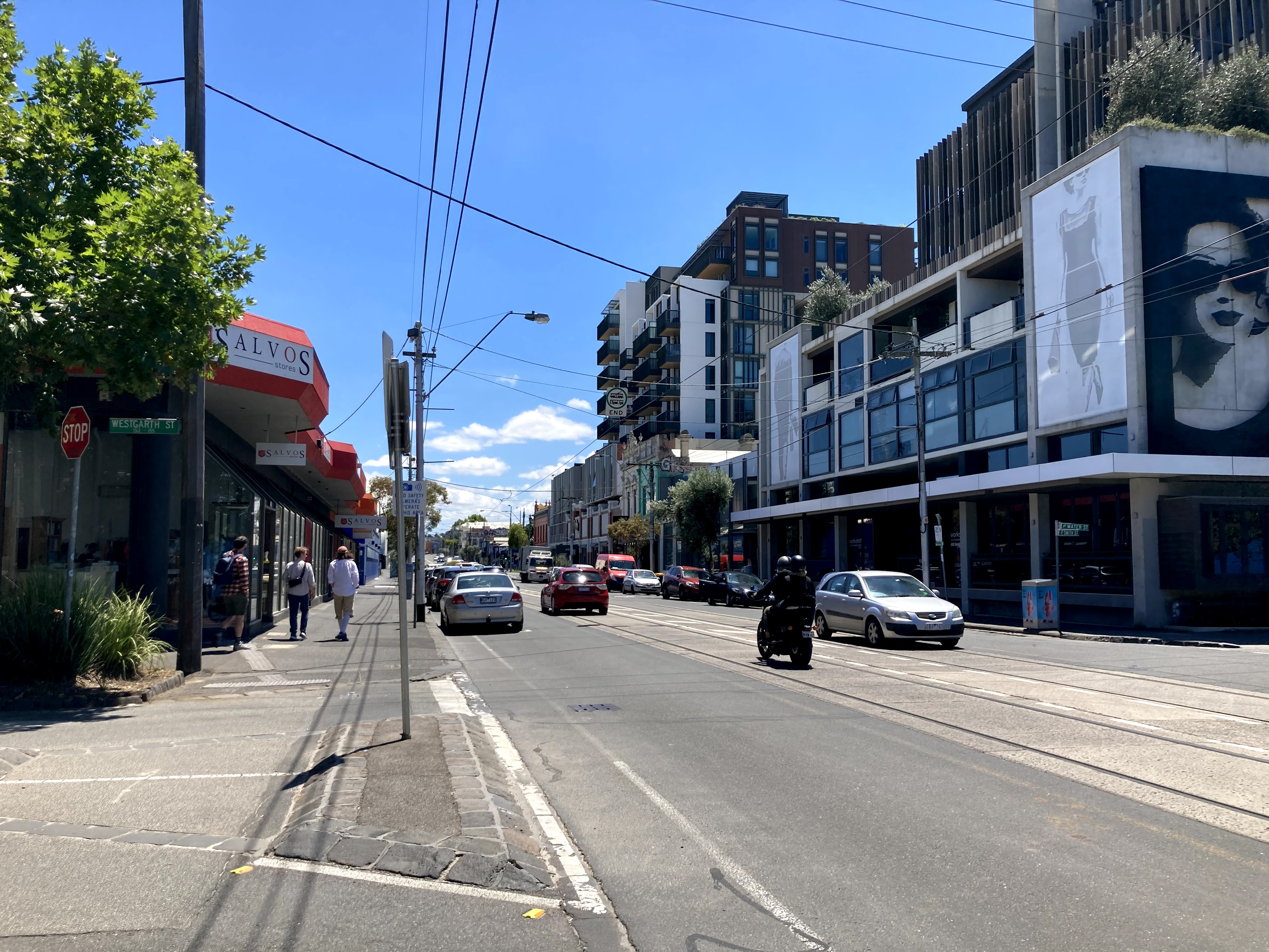
Smith Street is a street in inner northern Melbourne, running north from the city proper and separating Fitzroy from Collingwood. Geography Smith Street runs north-south from Victoria Parade at its southernmost end to Queens Parade. Between Victoria Parade and Alexandra Parade, it forms the boundary between Fitzroy, Victoria, Fitzroy and Collingwood, Victoria, Collingwood; the short segment north of Alexandra Parade is in Clifton Hill, Victoria, Clifton Hill. Smith Street is located a block east of Brunswick Street, Melbourne, Brunswick Street. From Gertrude Street to Queens Parade, Smith Street forms part of tram route Melbourne tram route 86, 86. History The road now known as Smith Street was originally a winding dirt track running from Bourke Street, Melbourne, to Heidelberg, Victoria, Heidelberg, and was known as the Eastern Road or Heidelberg Road. The road was placed on its current straight course as part of Melbourne's first suburban land subdivision of 1838. On 23 May ... [...More Info...] [...Related Items...] OR: [Wikipedia] [Google] [Baidu] |


