|
Melbourne Tram Route 72
Melbourne tram route 72 is operated by Yarra Trams on the Melbourne tram network from Melbourne University to Camberwell. The 16.8 kilometre route is operated out of Malvern depot with Z and D class trams. History Route 72 was first allocated to the line between Camberwell (Burke Road) and the City (Swanston Street) on 1 November 1970.The Camberwell Tramway ''Transit Australia'' November 1998 pages 243-248 Prior to that, the line to Camberwell was serviced by route 7. The change was at first due to operations of the Camberwell line being shifted from Malvern depot to Camberwell depot. Even though the route was subsequently returned to Malvern in August 1979, the number 72 was kept. Before 1970, Route 72 was a short-working of the Wattle Park line, for trams that terminated at Riversdale instead of Wattle Park. Trams traditionally terminated at the Victoria Street terminus, but following an accident in 1991, trams instead terminated at the Queensberry Street crossover. Due ... [...More Info...] [...Related Items...] OR: [Wikipedia] [Google] [Baidu] |
D-class Melbourne Tram
The D-class Melbourne tram is a fleet of low-floor Combino trams that operate on the Melbourne tram network. They were built by Siemens in Uerdingen, Krefeld, Germany, and are divided into two classes: the three section D1-class which was introduced between 2002 and 2004, and the five section D2-class which was introduced in 2004. The D-class was procured by M>Tram and have been operated by Yarra Trams since they took control of the entire tram network in April 2004. History To meet a franchise commitment to introduce new trams to replace Z-class trams, 59 German built Siemens, Combino low-floor trams were introduced by M>Tram. The first tram arrived for testing in August 2002, and the first four entered service in November 2002. M>Tram operations were transferred to Yarra Trams in April 2004 following negotiations with the State Government after National Express handed the M>Tram franchise back to the government in December 2002. To aid disabled access to trams from platf ... [...More Info...] [...Related Items...] OR: [Wikipedia] [Google] [Baidu] |
Victoria Street, Melbourne
Victoria Street is one of the major thoroughfares of inner Melbourne, running east–west for over six kilometres between Munster Terrace in North Melbourne and the Yarra River. The road is known as Victoria Parade for over one-and-a-half kilometres of its length (between the prominent intersections of Spring Street and Hoddle Street), distinguishable with a wide reservation and tramway down the middle. Victoria Street touches the north-east corner of the Hoddle Grid at the intersection of Latrobe Street and Spring Street, opposite the Carlton Gardens. After crossing the Yarra river over Victoria Bridge the street continues as Barkers Road. The road is well known for being an arterial road for cross-city traffic and for featuring the Queen Victoria Market, Victoria Parade hospital precinct and Melbourne's Little Saigon. Surroundings Victoria Street forms a part of the borders of several inner Melbourne suburbs, including West Melbourne, North Melbourne, Melbourne, Carlton ... [...More Info...] [...Related Items...] OR: [Wikipedia] [Google] [Baidu] |
Batman Avenue
CityLink is a network of tollways in Melbourne, Australia, linking the Tullamarine, West Gate and Monash Freeways and incorporating Bolte Bridge, Burnley Tunnel and other works. In 1996, Transurban was awarded the contract to augment two existing freeways and construct two new toll roads – labelled the Western and Southern Links– directly linking a number of existing freeways to provide a continuous, high-capacity road route to, and around, the central business district. CityLink uses a free-flow tolling electronic toll collection system, called e-TAG. CityLink is currently maintained by Lendlease Services. History The first mention of a southern and western inner city bypass was in the 1969 Melbourne Transportation Plan. The plan advocated for reservations and set aside sinking funds for the new inner city freeway system. It was one of the few freeways connecting to the inner city (along with the Eastern Freeway to Clifton Hill) which was not later abandoned. The pro ... [...More Info...] [...Related Items...] OR: [Wikipedia] [Google] [Baidu] |
Caulfield, Victoria
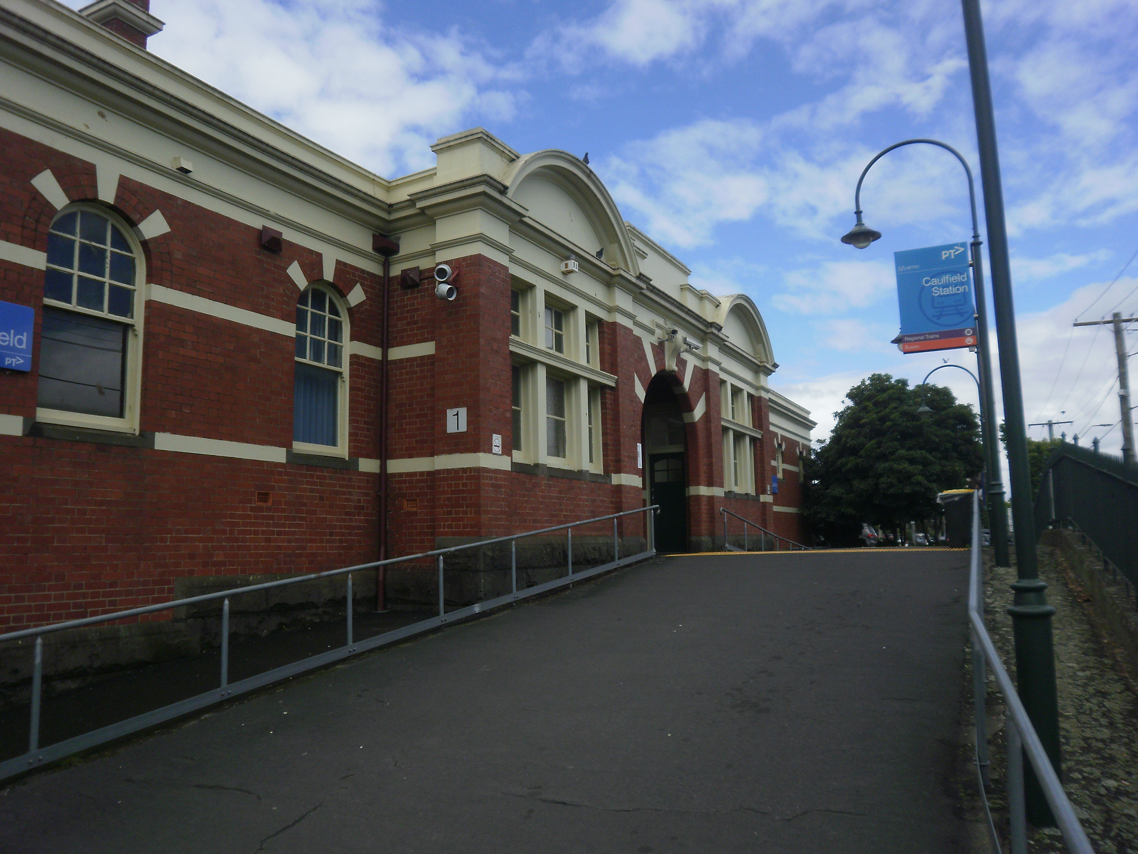
Caulfield is a suburb in Melbourne, Victoria, Australia, south-east of Melbourne's Central Business District, located within the City of Glen Eira local government area. Caulfield recorded a population of 5,748 at the 2021 census. It is bounded by Kooyong Road in the west, Glen Eira Road in the north, Glen Huntly Road in the south and Booran Road in the east. Caulfield is best known as the location of Caulfield Racecourse and the Caulfield campus of Monash University. History Toponymy The origin of the name of Caulfield is not known for certain, but the name seemed to be linked with Baron Caulfield of Ireland, perhaps through John Caulfield, a pioneer of the colony. The name Caulfield was in use by 1853, and the early maps always place it somewhere around the racecourse. Pre-European history The local Yalukit people were coastal and dependent on seafoods, so few Aboriginal relics have been found in Caulfield. Nevertheless, some contact did occur in the area between Aborigin ... [...More Info...] [...Related Items...] OR: [Wikipedia] [Google] [Baidu] |
Ivanhoe Railway Station, Melbourne
Ivanhoe railway station is located on the Hurstbridge line in Victoria, Australia. It serves the north-eastern Melbourne suburb of Ivanhoe, and opened on 8 May 1888.Ivanhoe Vicsig History Ivanhoe station opened on 8 May 1888, when the line from Clifton Hill was extended to . Like the suburb itself, the station was named after the novel '' Ivanhoe'', written in 1820 by author |
State (Bell/Springvale) Highway
State (Bell/Springvale) Highway, also known as Bell Street/Springvale Road State Highway (after its longest constituent parts), is the longest self-contained urban highway in Melbourne, Australia, linking Tullamarine Freeway and Nepean Highway through Melbourne's north-eastern suburbs. These names are not widely known to most drivers, as the entire allocation is still best known as by the names of its constituent parts: Bell Street, Banksia Street, Manningham Road, Williamsons Road, Doncaster Road, Mitcham Road, Springvale Road and Edithvale Road. This article will deal with the entire length of the corridor for sake of completion, as well to avoid confusion between declarations. Route Bell Street (and the beginning of the north-western section of the highway) starts at the interchange with CityLink and heads east as a single-carriageway four-lane road to Sydney Road in Coburg, then as a dual-carriageway road varying between 4 and 6 lanes through Preston, then along Bell-Ba ... [...More Info...] [...Related Items...] OR: [Wikipedia] [Google] [Baidu] |
Public Transport Users Association
The Public Transport Users Association is a community-based public transport lobby group in Victoria, Australia, based in Melbourne. It is run entirely by volunteers and has no full-time staff. History and aims The organisation was founded in 1976 as the Train Travellers Association, and became prominent after the controversial Lonie Report recommended huge freeway expansion and closure of most public passenger transport in the city. The Association advocates a greater role for public transport and less dependence on the private car. Key PTUA policies include: * A publicly accountable authority to provide co-ordinated planning and management of train, tram and bus services, * The favouring of sustainable transport modes over cars, through appropriate urban planning decisions, and taxation and transport project resource allocations, * Opposition to major road expansion such as the building of new freeways, * More frequent public transport services, longer operating hours and ... [...More Info...] [...Related Items...] OR: [Wikipedia] [Google] [Baidu] |
Melbourne 2030
The Metropolitan Strategy Melbourne 2030 is a Victorian Government strategic planning policy framework for the metropolitan area of Greater Melbourne, intended to cover the period 2001–2030. During this period the population of the metropolitan area is expected to grow by a million people to over 5 million. Population projections now predict Melbourne's population could reach 7 million by that time and the State Government has since changed its strategy on the policy, abandoning the urban growth boundary in the north and west of Melbourne and compromising green wedges. Introduced by the Bracks ( ALP) government, its main elements are based on well-established planning principles for Transit-oriented development: * reducing the proportion of new development occurring at low densities on Melbourne's fringe from about 60% of annual construction to 40% by redirecting new development to defined areas of established inner and middle-ring suburbs. * concentrating development within d ... [...More Info...] [...Related Items...] OR: [Wikipedia] [Google] [Baidu] |
Government Of Victoria
The Victoria State Government, also referred to as just the Victorian Government, is the state-level authority for Victoria (Australia), Victoria, Australia. Like all state governments, it is formed by three independent branches: the executive, the Supreme Court of Victoria, judicial, and the Parliament of Victoria, parliament. As a parliamentary system, parliamentary constitutional monarchy, the State Government was first formed in 1851 when Victoria first gained the right to responsible government. The Constitution of Australia regulates the relationship between the Victorian Government and the Australian Government, and cedes legislative and judicial supremacy to the federal government on conflicting matters. The Victoria State Government enforces Act of Parliament, acts passed by the parliament through government departments, statutory authorities, and other public agencies. The Government is formally presided over by the Governor of Victoria, Governor, who exercises execu ... [...More Info...] [...Related Items...] OR: [Wikipedia] [Google] [Baidu] |
Monash Freeway
The Monash Freeway is a major urban freeway in Victoria, Australia, linking Melbourne's CBD to its south-eastern suburbs and beyond to the Gippsland region. It carries up to 180,000 vehicles per day and is one of Australia's busiest freeways. The entire stretch of the Monash Freeway bears the designation M1. The freeway is named in honour of General Sir John Monash, an esteemed Australian military commander for the allies during World War I. History The Monash Freeway is an amalgamation of two initially separate freeways: the Mulgrave Freeway (initially designated Freeway Route 81) linking Warrigal Road, Chadstone to the Princes Highway in Eumemmerring; and the South Eastern Freeway (initially designated Metropolitan Route 80, then Freeway Route 80) linking Punt Road, Richmond and Toorak Road, Hawthorn East. Mulgrave Freeway Plans for a "Mulgrave By-pass Road and Eumemmerring By-pass Road" had been made as far back as 1966, between Warrigal Road in Chadstone and Pr ... [...More Info...] [...Related Items...] OR: [Wikipedia] [Google] [Baidu] |
Camberwell Railway Station, Melbourne
Camberwell railway station is the junction for the Lilydale, Belgrave and Alamein lines in Victoria, Australia. It serves the eastern Melbourne suburb of Camberwell, and it opened on 3 April 1882.Camberwell Vicsig History Camberwell station opened on 3 April 1882, when the line was extended from . It was the terminus of the line for a few months in that year, until the railway was extended to Lilydale. When the first section of the[...More Info...] [...Related Items...] OR: [Wikipedia] [Google] [Baidu] |
Prahran & Malvern Tramways Trust
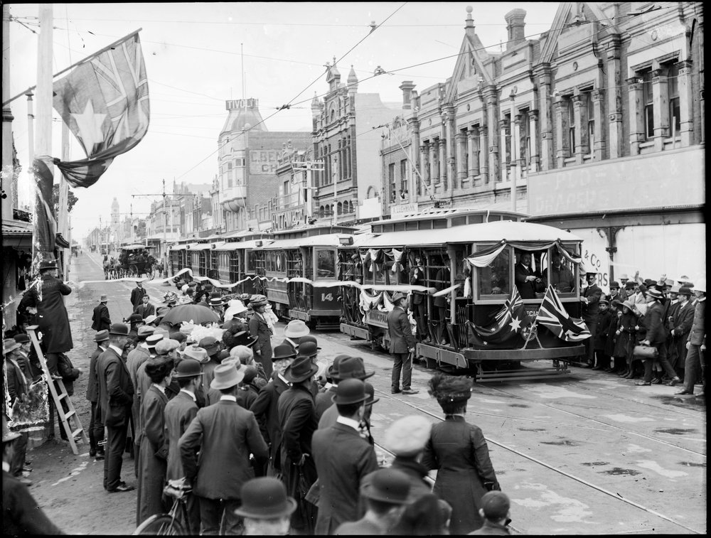
The Prahran and Malvern Tramways Trust (PMTT) was a former tram operator in Melbourne, Australia. The trust was formed in 1907, with its first line operating in 1910. Its functions were taken over by the Melbourne & Metropolitan Tramways Board in 1920. History The PMTT was formed under the ''Prahran & Malvern Tramways Trust Act 1907'' to construct and operate electric trams in the municipalities of Prahran and Malvern. The original members of the trust were Alexander Cameron (Chairman), W. O. Strangward (Secretary), H.S. Dix (Manager and Engineer), S. Bangs, William Knox MLC, Walter Lewis and Thomas Luxton. Noyes Brothers were selected as the primary contractors for the work. The first rail was laid along High Street on 20 October 1909. Malvern tram depot opened on 30 May 1910 as were the first lines: along High Street from Charles Street, Prahran to Tooronga Road and the other along Glenferrie and Wattletree Roads from High Street to Burke Road. In 1910, the PMTT was recon ... [...More Info...] [...Related Items...] OR: [Wikipedia] [Google] [Baidu] |


