|
Meadows, South Australia
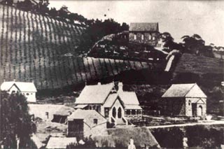
Meadows is a town in the Adelaide Hills, South Australia. It boasts several historic buildings, craft shops, a winery and bakery. Every year, the town hosts the Meadows Country Fair and Meadows Easter Fair. At the 2006 census, Meadows had a population of 752. The land incorporating Meadows was part of the Seventh Special Survey undertaken by Charles Flaxman on 31 January 1839. The 5000 hectare Kuitpo Forest Kuitpo Forest ( ) is a plantation forest in South Australia located about south-east of the Adelaide city centre. Kuipto, the first of many forest plantations in the Mount Lofty Ranges, was established in 1898 to ensure a sustainable timber ..., known for bushwalking, cycling, and horse riding, lies to the south, west and north of Meadows. The nearby Prospect Hill Museum tells the story of the regional dairy industry and includes a re-created milk room. History The land including and surrounding Meadows is alternatively known as Battunga Country, Battunga bein ... [...More Info...] [...Related Items...] OR: [Wikipedia] [Google] [Baidu] |
District Council Of Mount Barker
The Mount Barker District Council is a local government area centred on the town of Mount Barker just outside the Adelaide metropolitan area in South Australia. The council was first established in October 1853. It expanded to four times its original size on 1 May 1935 as part of a major series of council amalgamations, absorbing the District Council of Nairne and parts of the District Council of Echunga and the District Council of Macclesfield. Council The current council as of December 2019 is: Towns and localities Towns and localities in the Mount Barker District Council include: See also *List of parks and gardens in rural South Australia List of parks and gardens in rural South Australia refers to parks and gardens that located within the rural areas of South Australia as distinguished from those located within the Adelaide metropolitan area. Adelaide Hills The following p ... References External linksLocal Government Association [...More Info...] [...Related Items...] OR: [Wikipedia] [Google] [Baidu] |
Kuitpo, South Australia
Kuitpo is a locality in the Alexandrina Council Alexandrina Council is a local government area in the Fleurieu and Kangaroo Island region of South Australia. The Alexandrina Council was formed on 1 July 1997 by the amalgamation of the District Council of Port Elliot and Goolwa, the District C ... area. The 2016 Australian census which was conducted in August 2016 reports that Kuitpo had a population of 196 people. See also * Hundred of Kuitpo References Towns in South Australia {{SouthAustralia-geo-stub ... [...More Info...] [...Related Items...] OR: [Wikipedia] [Google] [Baidu] |
Charles Flaxman
Charles Flaxman (25 December 1806 – November 1869) was employed by George Angas as his chief clerk. Flaxman received a loan from Angas to invest in land in South Australia. He travelled to Australia aboard the ''Prince George'' in 1838. He took up land in Tanunda, and Flaxman Valley in the area is named after him. His death was reported on 9 November 1869.Manning notes References ** External links at |
Census In Australia
The Census in Australia, officially the Census of Population and Housing, is the national census in Australia that occurs every five years. The census collects key demographic, social and economic data from all people in Australia on census night, including overseas visitors and residents of Australian external territories, only excluding foreign diplomats. The census is the largest and most significant statistical event in Australia and is run by the Australian Bureau of Statistics (ABS). Every person must complete the census, although some personal questions are not compulsory. The penalty for failing to complete the census after being directed to by the Australian Statistician is one federal penalty unit, or . The ''Australian Bureau of Statistics Act 1975'' and ''Census and Statistics Act 1905'' authorise the ABS to collect, store, and share anonymised data. The most recent census was held on 10 August 2021, with the data planned to be released starting from mid-2022. ... [...More Info...] [...Related Items...] OR: [Wikipedia] [Google] [Baidu] |
South Australia
South Australia (commonly abbreviated as SA) is a state in the southern central part of Australia. It covers some of the most arid parts of the country. With a total land area of , it is the fourth-largest of Australia's states and territories by area, and second smallest state by population. It has a total of 1.8 million people. Its population is the second most highly centralised in Australia, after Western Australia, with more than 77 percent of South Australians living in the capital Adelaide, or its environs. Other population centres in the state are relatively small; Mount Gambier, the second-largest centre, has a population of 33,233. South Australia shares borders with all of the other mainland states, as well as the Northern Territory; it is bordered to the west by Western Australia, to the north by the Northern Territory, to the north-east by Queensland, to the east by New South Wales, to the south-east by Victoria, and to the south by the Great Australian Bight.M ... [...More Info...] [...Related Items...] OR: [Wikipedia] [Google] [Baidu] |
Kangarilla, South Australia
Kangarilla is a small rural town and locality around from Adelaide city centre, in South Australia. The area, formerly inhabited by Kaurna people, was settled by Europeans in 1840, not long after the British colonisation of South Australia. Today it lies within the City of Onkaparinga local government area, and has postcode 5157. At the , Kangarilla had a population of 896. History The land on which Kangarilla was settled by Europeans was formerly inhabited by the Kaurna people, who called it Kangkarrilla. Manning's Index reports that Norman Tindale thought that ''kanggarila'' may mean "birthplace", and that it was spelt "Kungirilla" in ''The South Australian'' on 17 March 1843. Ngarrindjeri man David Unaipon was recorded as saying that ''Kang'' means "two" and ''Ra'mulia'' means "outflow or water flowing", referring to two waterholes, but more recent sources have variously reported that the meaning in the Kaurna language is "a place where something is nurtured", and possibly " ... [...More Info...] [...Related Items...] OR: [Wikipedia] [Google] [Baidu] |
Clarendon, South Australia
Clarendon is a small town in the Adelaide Hills, about south of the Adelaide city centre and now regarded as an outer suburb of Adelaide. It lies within the City of Onkaparinga council area. The Clarendon Weir is located in the town area, on the Onkaparinga River. History The Kaurna people were the original inhabitants of the area. On 21 October 1840, Richard Blundell was granted the title to Section 801 of the Hundred of Noarlunga, after the area had been surveyed. In 1846 James Philcox purchased part of the section and subdivided it, selling the allotments and creating the town. In 1848, what remained of Section 801 was sold to Philcox's friend George Morphett, who later surveyed more allotments, and others added blocks adjacent to the town. In December 1846 the Clarendon vineyards were developed on land purchased by English benefactor William Augustine Leigh (1802–1873), one of many parcels of land bought through his agent Sir John Morphett (including two town acres ... [...More Info...] [...Related Items...] OR: [Wikipedia] [Google] [Baidu] |
Prospect Hill, South Australia
Prospect Hill is a small town in the southern Adelaide Hills of South Australia, Its major industries are forestry in Kuitpo Forest and dairy farming. There are also mountain bike trails in the area. Prospect Hill was severely impacted by the Ash Wednesday bushfires in 1983. The town lost 16 houses, the scout hall A Scout hall (also Scout hut, Scout den or Scout headquarters) is a building owned or rented and used as a meeting place by a Scout Group. General description A Scout hall typically consists of one or more large rooms which are used for games a ... and CWA hall. References Towns in South Australia {{SouthAustralia-geo-stub ... [...More Info...] [...Related Items...] OR: [Wikipedia] [Google] [Baidu] |
Bull Creek, South Australia
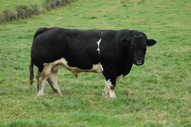
A bull is an intact (i.e., not castrated) adult male of the species '' Bos taurus'' (cattle). More muscular and aggressive than the females of the same species (i.e., cows), bulls have long been an important symbol in many religions, including for sacrifices. These animals play a significant role in beef ranching, dairy farming, and a variety of sporting and cultural activities, including bullfighting and bull riding. Due to their temperament, handling requires precautions. Nomenclature The female counterpart to a bull is a cow, while a male of the species that has been castrated is a ''steer'', '' ox'', or ''bullock'', although in North America, this last term refers to a young bull. Use of these terms varies considerably with area and dialect. Colloquially, people unfamiliar with cattle may refer to both castrated and intact animals as "bulls". A wild, young, unmarked bull is known as a ''micky'' in Australia.Sheena Coupe (ed.), ''Frontier Country, Vol. 1'' (Weldon ... [...More Info...] [...Related Items...] OR: [Wikipedia] [Google] [Baidu] |
Electoral District Of Heysen
Heysen is a single-member electoral district for the South Australian House of Assembly. It is named after Sir Hans Heysen, a prominent South Australian landscape artist. It is a 1,074 km² electoral district that takes in some of the outer southern suburbs of Adelaide before fanning south-east to include most of the Adelaide Hills, as well as farming areas some distance from the capital. It includes the localities of Aldgate, Ashbourne, Belvidere, Biggs Flat, Blackfellows Creek, Blewitt Springs, Bradbury, Bridgewater, Bugle Ranges, Bull Creek, Chapel Hill, Clarendon, Crafers, Dingabledinga, Dorset Vale, Echunga, Flaxley, Gemmells, Green Hills Range, Heathfield, Highland Valley, Hope Forest, Ironbank, Jupiter Creek, Kangarilla, Kuitpo, Kuitpo Colony, Kyeema, Longwood, Macclesfield, McHarg Creek, Meadows, Montarra, Mount Magnificent, Mylor, Paris Creek, Prospect Hill, Red Creek, Salem, Sandergrove, Scott Creek, Stirling, Strathalbyn, The Ra ... [...More Info...] [...Related Items...] OR: [Wikipedia] [Google] [Baidu] |
Paris Creek, South Australia
Paris () is the capital and most populous city of France, with an estimated population of 2,165,423 residents in 2019 in an area of more than 105 km² (41 sq mi), making it the 30th most densely populated city in the world in 2020. Since the 17th century, Paris has been one of the world's major centres of finance, diplomacy, commerce, fashion, gastronomy, and science. For its leading role in the arts and sciences, as well as its very early system of street lighting, in the 19th century it became known as "the City of Light". Like London, prior to the Second World War, it was also sometimes called the capital of the world. The City of Paris is the centre of the Île-de-France region, or Paris Region, with an estimated population of 12,262,544 in 2019, or about 19% of the population of France, making the region France's primate city. The Paris Region had a GDP of €739 billion ($743 billion) in 2019, which is the highest in Europe. According to the Economist Intellig ... [...More Info...] [...Related Items...] OR: [Wikipedia] [Google] [Baidu] |


