|
McLennan River
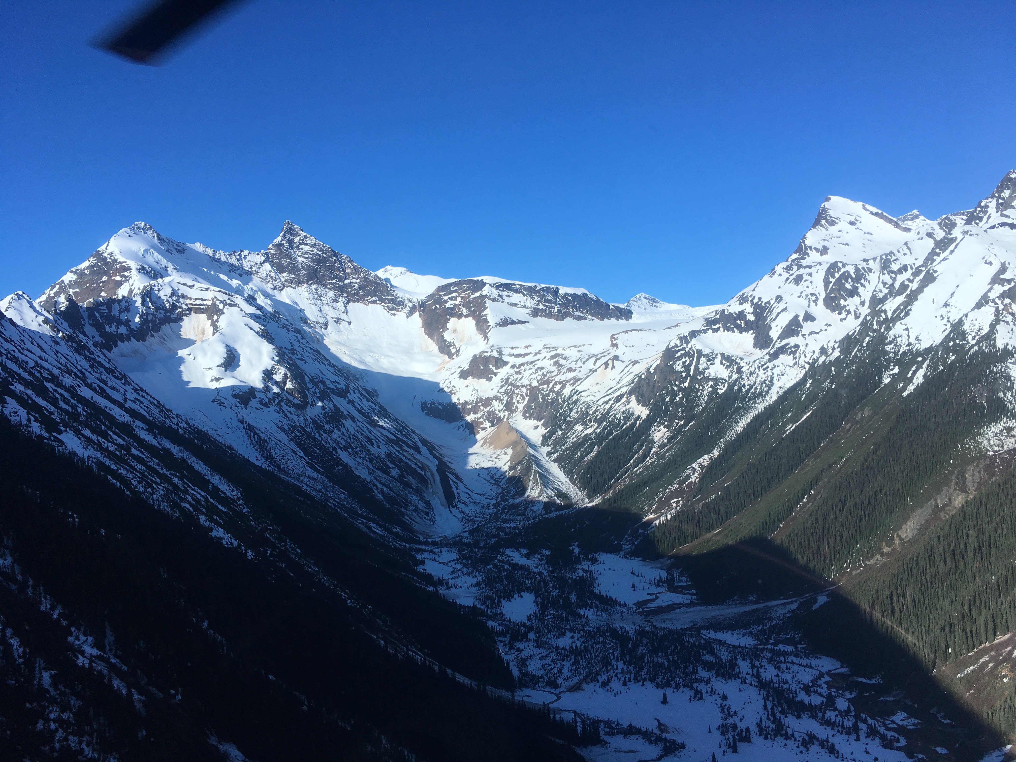
The McLennan River is a tributary of the Fraser River in the Robson Valley region of British Columbia. The river was named after an engineer on one of the Canadian Pacific Railway surveys in the 1870s. Course The McLennan River originates in the Premier Range, flowing from McLennan Glacier between Mount Stanley Baldwin and Mount Arthur Meighen. The river flows east out of the mountains into the Rocky Mountain Trench near Valemount. Then it turns northwest, flowing through the Rocky Mountain Trench, picking up tributary streams flowing from the Selwyn Range to the east and the Premier Range to the west. It joins the Fraser River at Tête Jaune Cache. See also *List of British Columbia rivers The following is a partial list of rivers of British Columbia, organized by watershed. Some large creeks are included either because of size or historical importance (See Alphabetical List of British Columbia rivers ). Also included are lakes th ... References Rivers of British C ... [...More Info...] [...Related Items...] OR: [Wikipedia] [Google] [Baidu] |
British Columbia
British Columbia (commonly abbreviated as BC) is the westernmost province of Canada, situated between the Pacific Ocean and the Rocky Mountains. It has a diverse geography, with rugged landscapes that include rocky coastlines, sandy beaches, forests, lakes, mountains, inland deserts and grassy plains, and borders the province of Alberta to the east and the Yukon and Northwest Territories to the north. With an estimated population of 5.3million as of 2022, it is Canada's third-most populous province. The capital of British Columbia is Victoria and its largest city is Vancouver. Vancouver is the third-largest metropolitan area in Canada; the 2021 census recorded 2.6million people in Metro Vancouver. The first known human inhabitants of the area settled in British Columbia at least 10,000 years ago. Such groups include the Coast Salish, Tsilhqotʼin, and Haida peoples, among many others. One of the earliest British settlements in the area was Fort Victoria, established ... [...More Info...] [...Related Items...] OR: [Wikipedia] [Google] [Baidu] |
Mount Stanley Baldwin
Mount Stanley Baldwin is a mountain located in the Premier Range of the Cariboo Mountains in the east-central interior of British Columbia, Canada. The mountain is located at the head of the Gilmour Glacier. It was originally named ''Mount Challenger'' by Allen Carpé during his 1924 ascent of the mountain. The name honours the British prime minister Stanley Baldwin who made an official visit to British Columbia in 1927, the year in which the Premier Range was dedicated and the mountain was renamed. Although the Range was originally meant to honour both British and Canadian Canadians (french: Canadiens) are people identified with the country of Canada. This connection may be residential, legal, historical or cultural. For most Canadians, many (or all) of these connections exist and are collectively the source of ... heads of government, Stanley Baldwin is the only British prime minister to be so honoured. Recent restrictions upon naming Canadian geographic features afte ... [...More Info...] [...Related Items...] OR: [Wikipedia] [Google] [Baidu] |
Rivers Of British Columbia
A river is a natural flowing watercourse, usually freshwater, flowing towards an ocean, sea, lake or another river. In some cases, a river flows into the ground and becomes dry at the end of its course without reaching another body of water. Small rivers can be referred to using names such as creek, brook, rivulet, and rill. There are no official definitions for the generic term river as applied to geographic features, although in some countries or communities a stream is defined by its size. Many names for small rivers are specific to geographic location; examples are "run" in some parts of the United States, "burn" in Scotland and northeast England, and "beck" in northern England. Sometimes a river is defined as being larger than a creek, but not always: the language is vague. Rivers are part of the water cycle. Water generally collects in a river from precipitation through a drainage basin from surface runoff and other sources such as groundwater recharge, springs, a ... [...More Info...] [...Related Items...] OR: [Wikipedia] [Google] [Baidu] |
List Of British Columbia Rivers
The following is a partial list of rivers of British Columbia, organized by watershed. Some large creeks are included either because of size or historical importance (See Alphabetical List of British Columbia rivers ). Also included are lakes that are "in-line" connecting upper tributaries of listed rivers, or at their heads. Arctic drainage Arctic Ocean via Mackenzie River drainage :''(NB Liard tributaries on Yukon side of border omitted)'' Liard River watershed * Liard River ** Petiewewtot River **Fort Nelson River *** Sahtaneh River ****Snake River ***Muskwa River ****Prophet River ***** Minaker River *****Besa River **** Tetsa River **** Chischa River ****Tuchodi River ***Sikanni Chief River ****Buckinghorse River ***Fontas River ** Dunedin River ** Beaver River **Toad River ***West Toad River *** Racing River *** Schipa River **Grayling River ** Trout River **Vents River ** Smith River ** Coal River ** Rabbit River *** Gundahoo River **Kechika River *** Red River ***Turnag ... [...More Info...] [...Related Items...] OR: [Wikipedia] [Google] [Baidu] |
Selwyn Range (British Columbia)
The Selwyn Range is a mountain range in the Canadian Rockies in British Columbia. A subrange of the Park Ranges of the Continental Ranges, it is located west of Jasper National Park, east of Valemount and south of Mount Robson Provincial Park.BivuacSelwyn Range Retrieved August 7, 2007 It was named after Alfred Selwyn, the first director of the Geological Survey of Canada. The Fraser River originates in this mountain range, near Fraser Pass. See also *Overlander Mountain *Klapperhorn Mountain Klapperhorn Mountain is a summit in British Columbia, Canada. Description Klapperhorn Mountain, elevation 2,301-meters (7,549-feet), is located in Mount Robson Provincial Park, just south and within view of the park's visitor centre. It is th ... * Mount McKirdy References * Mountain ranges of British Columbia Ranges of the Canadian Rockies {{BritishColumbiaInterior-geo-stub ... [...More Info...] [...Related Items...] OR: [Wikipedia] [Google] [Baidu] |
Valemount, British Columbia
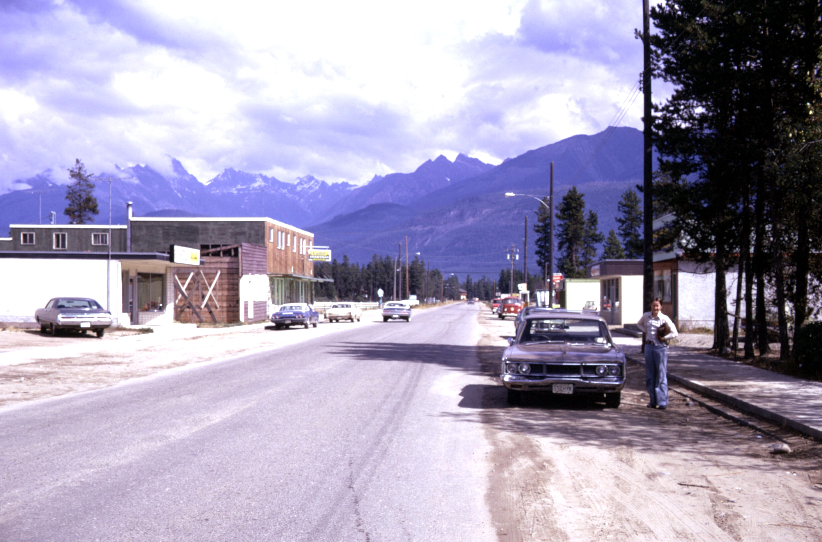
Valemount () is a village municipality of 1,018 people in east central British Columbia, Canada, from Kamloops, British Columbia. It is between the Rocky, Monashee, and Cariboo Mountains. It is the nearest community to the west of Jasper National Park, and is also the nearest community to Mount Robson Provincial Park, which features Mount Robson, the tallest mountain in the Canadian Rockies. Outdoor recreation is popular in summer and winter—hiking, skiing, snowmobiling, cross country skiing, mountain biking and horseback riding are common activities. Valemount is one of 14 designated Resort Municipalities in British Columbia. As a flag stop Via Rail's ''Canadian'' calls at the Valemount railway station two or three times (depending on the season) per week in each direction. The name Valemount was coined for the C.N.R. station there in 1927 from the words "vale" and "mount." History The land that would become Valemount is in the traditional territory of the Kootenai, Shuswap ... [...More Info...] [...Related Items...] OR: [Wikipedia] [Google] [Baidu] |
Rocky Mountain Trench
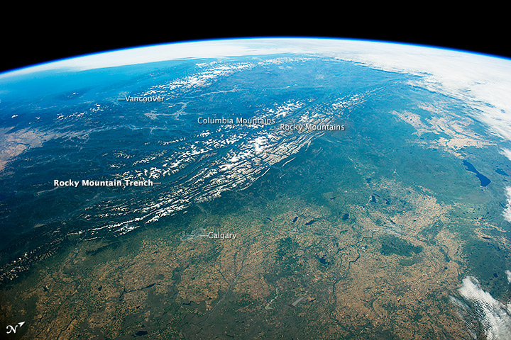
The Rocky Mountain Trench, also known as the Valley of a Thousand Peaks or simply the Trench, is a large valley on the western side of the northern part of North America's Rocky Mountains. The Trench is both visually and cartographically a striking physiographic feature extending approximately from Flathead Lake, Montana, to the Liard River, just south of the British Columbia–Yukon border near Watson Lake, Yukon. The trench bottom is wide and is above sea level. The general orientation of the Trench is an almost straight 150/330° geographic north vector and has become convenient as a visual guide for aviators heading north or south. Although some of its topography has been carved into U-shaped glacial valleys, it is primarily a byproduct of geologic faulting. The Trench separates the Rocky Mountains on its east from the Columbia Mountains and the Cassiar Mountains on its west. It also skirts part of the McGregor Plateau area of the Nechako Plateau sub-area of the ... [...More Info...] [...Related Items...] OR: [Wikipedia] [Google] [Baidu] |
Mount Arthur Meighen
Mount Arthur Meighen is a mountain located in the Premier Range of the Cariboo Mountains in the east-central interior of British Columbia, Canada. The mountain is south of the head of the McLennan River and immediately west of the town of Valemount, British Columbia. The name honours the ninth Prime Minister of Canada, Arthur Meighen, who held office for only fifteen months in 1920-1921 and three months in 1926. He died in 1960, thirty-six years after leaving office. The mountain was officially renamed after Meighen in 1962. Prior to that, it had been called "Carpé". Climate Based on the Köppen climate classification The Köppen climate classification is one of the most widely used climate classification systems. It was first published by German-Russian climatologist Wladimir Köppen (1846–1940) in 1884, with several later modifications by Köppen, notabl ..., the mountain is located in a subarctic climate zone with cold, snowy winters, and mild summers. Temperatures ... [...More Info...] [...Related Items...] OR: [Wikipedia] [Google] [Baidu] |
Mclennan River Headwall
McLennan, MacLennan and Maclennan are surnames derived from the Scottish Gaelic . Notable people with the surname include: McLennan spelling * Andrew McLennan, New Zealand musician and songwriter better known as Andrew Snoid * Andrew Robert McLennan (1871–1943), Canadian politician * Azlan McLennan (born 1975), Australian artist * Bill McLennan (born 1942), Australian statistician * Connor McLennan (born 1999), Scottish footballer * Danny McLennan (1925–2004), Scottish football player and manager * Donald R. McLennan (1873–1944), American business executive * Ethel Irene McLennan (1891–1983), Australian botanist and educator * Freddie McLennan (born 1951), Irish rugby union international * G. S. McLennan (1883–1929), Scottish bagpipe player * Gordon McLennan (politician) (1924–2011), Scottish leader of the Communist Party of Great Britain * Gordon McLennan (rugby league) (1914–1966), Australian rugby league footballer * Grant McLennan (1958–2006), Australian sin ... [...More Info...] [...Related Items...] OR: [Wikipedia] [Google] [Baidu] |
Cariboo Land District
The Cariboo Land District is a cadastral survey subdivision of the province of British Columbia, Canada, created with rest of those on Mainland British Columbia via the Lands Act of the Colony of British Columbia in 1860. The British Columbia government's BC Names system, a subdivision of GeoBC, defines a land district as "a territorial division with legally defined boundaries for administrative purposes" All land titles and surveys use the Land District system as the primary point of reference, and entries in BC Names for placenames and geographical objects are so listed. Description The Cariboo Land District is one of the original Land Districts of the province, its northern portion having been split off as the Peace River Land District, which is to its north. To is south is the Lillooet Land District and a small northerly extension of the Kamloops Subdivision Yale Land District. On its west are Ranges 3, 4 and 5 of the Coast Land District and part of the southeastern flank of t ... [...More Info...] [...Related Items...] OR: [Wikipedia] [Google] [Baidu] |
Canadian Pacific Railway
The Canadian Pacific Railway (french: Chemin de fer Canadien Pacifique) , also known simply as CPR or Canadian Pacific and formerly as CP Rail (1968–1996), is a Canadian Class I railway incorporated in 1881. The railway is owned by Canadian Pacific Railway Limited, which began operations as legal owner in a corporate restructuring in 2001. Headquartered in Calgary, Alberta, the railway owns approximately of track in seven provinces of Canada and into the United States, stretching from Montreal to Vancouver, and as far north as Edmonton. Its rail network also serves Minneapolis–St. Paul, Milwaukee, Detroit, Chicago, and Albany, New York, in the United States. The railway was first built between eastern Canada and British Columbia between 1881 and 1885 (connecting with Ottawa Valley and Georgian Bay area lines built earlier), fulfilling a commitment extended to British Columbia when it entered Confederation in 1871; the CPR was Canada's first transcontinental railway. ... [...More Info...] [...Related Items...] OR: [Wikipedia] [Google] [Baidu] |
ASTER Global Digital Elevation Model
The Advanced Spaceborne Thermal Emission and Reflection Radiometer (ASTER) is a Japanese remote sensing instrument onboard the Terra satellite launched by NASA in 1999. It has been collecting data since February 2000. ASTER provides high-resolution images of Earth in 14 different bands of the electromagnetic spectrum, ranging from visible to thermal infrared light. The resolution of images ranges between 15 and 90 meters. ASTER data is used to create detailed maps of surface temperature of land, emissivity, reflectance, and elevation. In April 2008, the SWIR detectors of ASTER began malfunctioning and were publicly declared non-operational by NASA in January 2009. All SWIR data collected after 1 April 2008 has been marked as unusable. The ASTER Global Digital Elevation Model (GDEM) is available at no charge to users worldwide via electronic download. As of 2 April 2016, the entire catalogue of ASTER image data became publicly available online at no cost. It can be downloaded ... [...More Info...] [...Related Items...] OR: [Wikipedia] [Google] [Baidu] |


.jpg)