|
McJunkin Building
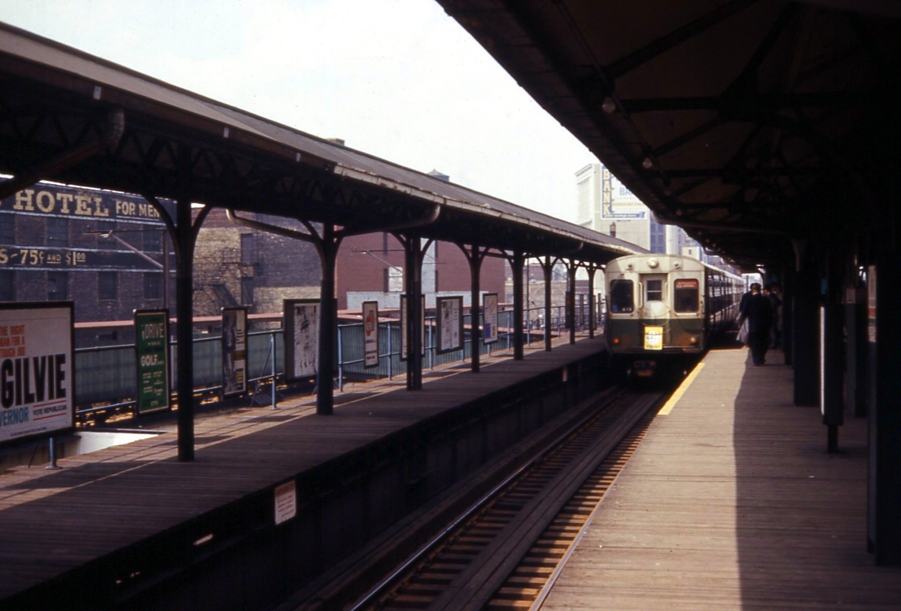
The McJunkin Building is located in Uptown, Chicago, at the corner of Wilson Avenue and Broadway. It was constructed in 1924. It is located adjacent to the Wilson station on the Chicago "L" The Chicago "L" (short for "elevated") is the rapid transit system serving the city of Chicago and some of its surrounding suburbs in the U.S. state of Illinois. Operated by the Chicago Transit Authority (CTA), it is the fourth-largest rapid tr ...; prior to 1949, that station was dual-level, with a lower ground-level portion and an upper elevated portion; access to the lower portion of the station was incorporated into the McJunkin Building. References {{coord missing, Chicago Buildings and structures in Chicago ... [...More Info...] [...Related Items...] OR: [Wikipedia] [Google] [Baidu] |
Uptown, Chicago
Uptown is one of Chicago, Illinois’ 77 community areas. Uptown's boundaries are Foster Avenue on the north; Lake Michigan on the east; Montrose (Ravenswood to Clark), and Irving Park ( Clark Street to Lake Michigan) on the south; Ravenswood (Foster to Montrose), and Clark (Montrose to Irving Park) on the west. To the north is Edgewater, to the west is Lincoln Square, and to the south is Lake View. History Early years The historical, cultural, and commercial center of Uptown is Broadway, with Uptown Square at the center. In 1900, the Northwestern Elevated Railroad constructed its terminal at Wilson and Broadway (now part of the CTA Red Line). Uptown became a summer resort town for downtown dwellers, and derived its name from the Uptown Store, which was the commercial center for the community. For a time, all northbound elevated trains from downtown ended in Uptown. Uptown became known as an entertainment destination. Charlie Chaplin, Gloria Swanson and other early ... [...More Info...] [...Related Items...] OR: [Wikipedia] [Google] [Baidu] |
Broadway (Chicago)
Broadway is a major street in Chicago's Lake View, Uptown, and Edgewater community areas on the city's North Side, running from Diversey Parkway (2800 North) to Devon Avenue (6400 North). Originally called ''Evanston Avenue'', the name of the street was changed to ''Broadway'' on August 15, 1913, as part of 467 road name changes enacted on that date. The new name was taken from New York City's famous theater district. The street runs at a mostly southeast-to-northwest diagonal direction between Diversey Parkway and Lawrence Avenue (4800 North). Between Lawrence Avenue and Devon Avenue, Broadway runs in a north-to-south direction and becomes 1200 West in place of Racine Avenue. The north–south section of Broadway is located a half-block west of and parallel to the Chicago Transit Authority's Red Line and Purple Line elevated train tracks. Broadway carries U.S. Route 14 from its terminus at Foster Avenue Foster Avenue (5200 N) is a major east-west street on the Nort ... [...More Info...] [...Related Items...] OR: [Wikipedia] [Google] [Baidu] |
Wilson Station (CTA)
Wilson is an 'L' station on the CTA's Red and Purple Lines, located at 4620 North Broadway in the Uptown neighborhood of Chicago, Illinois. History The station opened on May 31, 1900, as the northern terminus of the Northwestern Elevated Railroad. It was converted to a two level station in 1907, with a loop track to aid turning trains. Wilson became a through station in 1908 when the Northwestern Elevated Railroad was extended to in Evanston (using tracks belonging to the Chicago, Milwaukee and St. Paul Railway). The extended right-of-way allowed for a retail structure partially beneath the elevated tracks, which was designed by Frank Lloyd Wright in 1909, known as the Stohr Arcade Building. This structure only lasted until razing in 1922. The Stohr Arcade Building included "design themes that are reminiscent of the Robie House designed three years earlier". The previous station building, known as the Gerber Building, was built in 1923, shortly after the tracks to the ... [...More Info...] [...Related Items...] OR: [Wikipedia] [Google] [Baidu] |
Chicago "L"
The Chicago "L" (short for "elevated") is the rapid transit system serving the city of Chicago and some of its surrounding suburbs in the U.S. state of Illinois. Operated by the Chicago Transit Authority (CTA), it is the fourth-largest rapid transit system in the United States in terms of total route length, at long as of 2014, and the second-busiest rail mass transit system in the United States, after the New York City Subway. In 2016, the "L" had 1,492 rail cars, eight different routes, and 145 train stations. In , the system had rides, or about per weekday in . The "L" provides 24-hour service on the Red and Blue Lines and is one of only five rapid transit systems in the United States to do so.The four other rapid transit systems in the U.S. that provide 24-hour service in at least some parts of their systems are the New York City Subway, Staten Island Railway, PATH, and PATCO Speedline. The oldest sections of the "L" started operations in 1892, making it the second-olde ... [...More Info...] [...Related Items...] OR: [Wikipedia] [Google] [Baidu] |

