|
McCarthy Island (South Georgia)
McCarthy Island is an island, long, lying in the entrance to King Haakon Bay on the south side of South Georgia. It was surveyed by the South Georgia Survey in the period 1951–57, and was named by the UK Antarctic Place-Names Committee after Timothy McCarthy, a seaman on the '' Endurance'' during the British expedition under Ernest Shackleton Sir Ernest Henry Shackleton (15 February 1874 – 5 January 1922) was an Anglo-Irish Antarctic explorer who led three British expeditions to the Antarctic. He was one of the principal figures of the period known as the Heroic Age of ..., 1914–16. McCarthy accompanied Shackleton in the '' James Caird'' from Elephant Island to King Haakon Bay. See also * List of Antarctic and sub-Antarctic islands References Islands of South Georgia {{SouthGeorgia-geo-stub ... [...More Info...] [...Related Items...] OR: [Wikipedia] [Google] [Baidu] |
Timothy McCarthy (sailor)
Timothy McCarthy (15 July 1888 – 16 March 1917) was an Irish leading seaman (LB). He is best known for his service in the Imperial Trans-Antarctic Expedition of 1914–1916, for which he was awarded the Bronze Polar Medal. Biography McCarthy was born on 15 July 1888 in Kinsale, County Cork. He signed on the ''Endurance'' as an able seaman, and participated fully in the dangers and privations of the Weddell Sea, particularly after the ''Endurance'' sank and the ship's company and shore party were marooned on a nearby Drift ice, ice floe. Later, the ship's company and shore party were forced to take to lifeboat (shipboard), lifeboats, and the seamanship of the ABs became a decisive element in the survival of the entire company. Expedition commander Ernest Shackleton was impressed by McCarthy's skill during the survival journey from the northern Weddell Sea to Elephant Island, and so when the expedition leader decided to relaunch the best lifeboat into the open Southern Ocean, ... [...More Info...] [...Related Items...] OR: [Wikipedia] [Google] [Baidu] |
Endurance (1912 Ship)
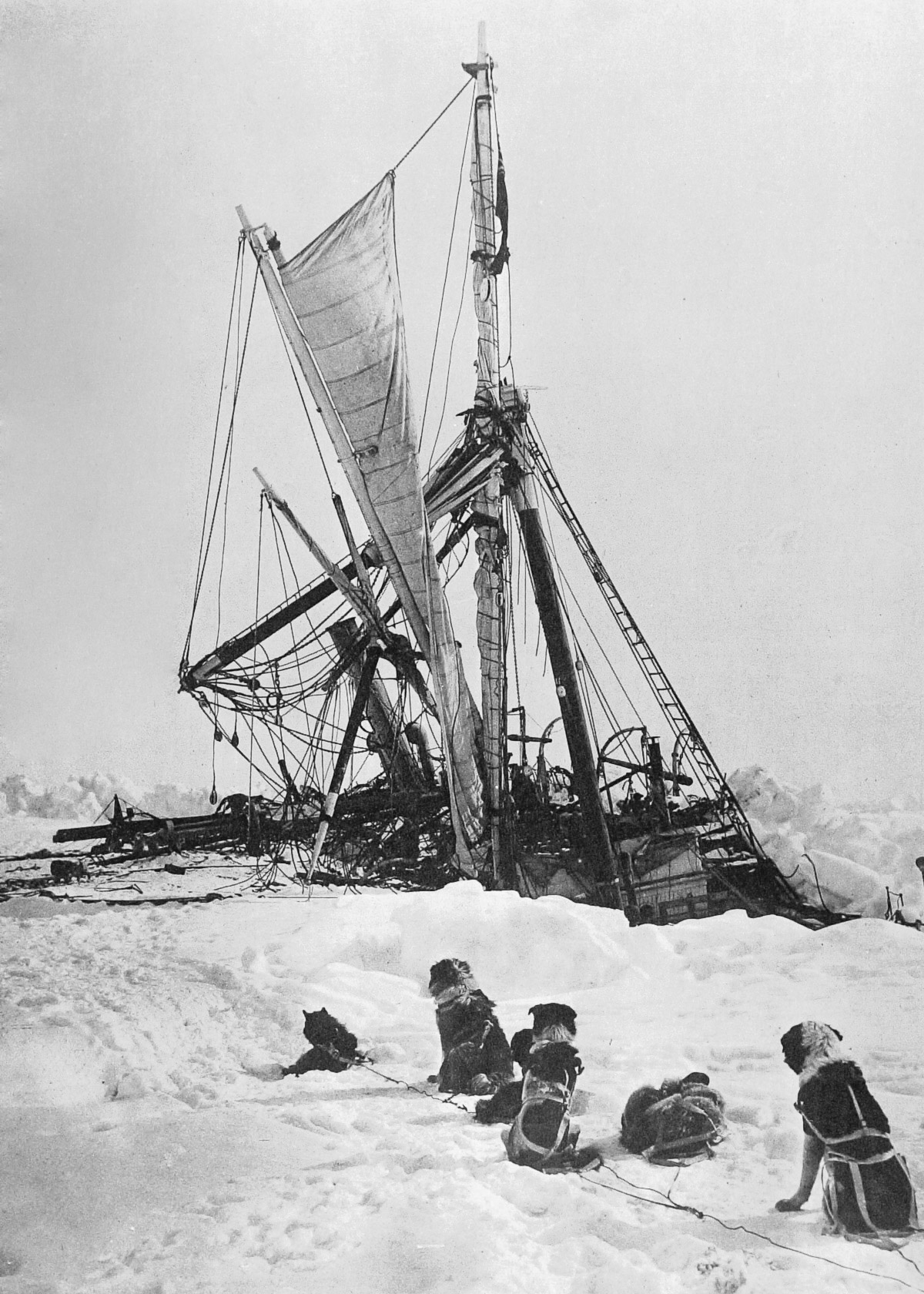
''Endurance'' was the three-masted barquentine in which Sir Ernest Shackleton and a crew of 27 men sailed for the Antarctic on the 1914–1917 Imperial Trans-Antarctic Expedition. The ship, originally named ''Polaris'', was built at Framnæs shipyard and launched in 1912 from Sandefjord in Norway. After her commissioners could no longer pay the shipyard, the ship was bought by Shackleton in January 1914 for the expedition, which would be her first voyage. A year later, she became trapped in pack ice and finally sank in the Weddell Sea off Antarctica on 21 November 1915. All of the crew survived her sinking and were eventually rescued in 1916 after using the ship's boats to travel to Elephant Island and Shackleton, the ship's captain Frank Worsley, and four others made a voyage to seek help. The wreck of ''Endurance'' was discovered on 5 March 2022, nearly 107 years after she sank, by the search team Endurance22. She lies deep, and is in good condition. The wreck is designated a ... [...More Info...] [...Related Items...] OR: [Wikipedia] [Google] [Baidu] |
King Haakon Bay
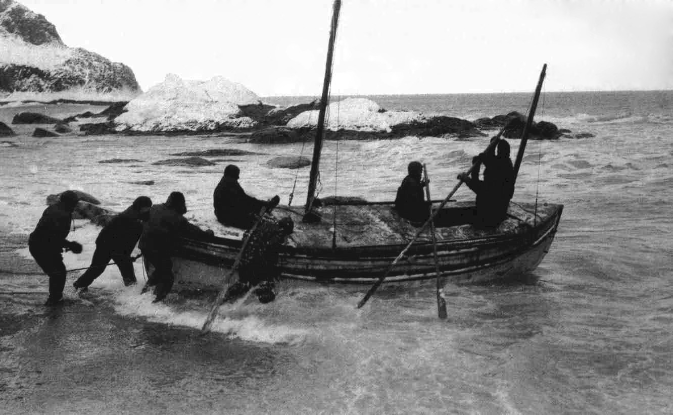
King Haakon Bay, or King Haakon Sound, is an inlet on the southern coast of the island of South Georgia. The inlet is approximately 13 km (8 miles) long and 4 km (2.5 miles) wide. The inlet was named for King Haakon VII of Norway by Carl Anton Larsen, founder of Grytviken. Queen Maud Bay, named for his queen, is nearby. Shackleton Gap, a mountain pass, connects King Haakon Bay to Possession Bay. Cave Cove, which forms part of the bay, is best known as the landing place of Ernest Shackleton in May 1916 as he sought help for his shipwrecked crew marooned on Elephant Island with the Imperial Trans-Antarctic Expedition. The '' James Caird'' landed in the cove on 10 May 1916, after its tumultuous voyage from Elephant Island. While at Cave Cove, the men fed on albatross. Henry McNeish wrote: "We have not been as comfortable for the last five weeks, We had 3 young & 1 old albatross for lunch with 1 pint of gravy which beets icall the chicken soup I ever tasted." Since ... [...More Info...] [...Related Items...] OR: [Wikipedia] [Google] [Baidu] |
South Georgia Island
South Georgia ( es, Isla San Pedro) is an island in the South Atlantic Ocean that is part of the British Overseas Territory of South Georgia and the South Sandwich Islands. It lies around east of the Falkland Islands. Stretching in the east–west direction, South Georgia is around long and has a maximum width of . The terrain is mountainous, with the central ridge rising to at Mount Paget. The northern coast is indented with numerous bays and fjords, serving as good harbours. Discovered by Europeans in 1675, South Georgia had no indigenous population due to its harsh climate and remoteness. Captain James Cook in made the first landing, survey and mapping of the island, and on 17 January 1775 he claimed it a British possession, naming it "Isle of Georgia" after King George III. Through its history, it served as a whaling and seal hunting base, with intermittent population scattered in several whaling bases, the most important historically being Grytviken. The main settleme ... [...More Info...] [...Related Items...] OR: [Wikipedia] [Google] [Baidu] |
South Georgia Survey
The South Georgia Survey was a series of expeditions to survey and map the island of South Georgia, led by Duncan Carse between 1951 and 1957. Although South Georgia had been commercially exploited as a whaling station during the first half of the 20th century, its interior was generally unknown, and maps were largely based on the original survey by James Cook, who first landed on the island in 1775. The South Georgia Survey was intended to make high-quality modern maps covering the entire island, and took place in four austral summer seasons: 1951–52, 1953–54, 1955–56, and 1956–57. The survey was funded by the Royal Geographical Society, the Falkland Islands Dependencies, Odhams Press, and other private supporters. The War Office and Ministry of Supply provided 250 man-days of cold-weather rations, along with a loan of clothing and sledging equipment. Transportation to and from South Georgia was provided on the ships used to supply the whaling stations and ferry whale o ... [...More Info...] [...Related Items...] OR: [Wikipedia] [Google] [Baidu] |
UK Antarctic Place-Names Committee
The UK Antarctic Place-Names Committee (or UK-APC) is a United Kingdom government committee, part of the Foreign and Commonwealth Office, responsible for recommending names of geographical locations within the British Antarctic Territory (BAT) and the South Georgia and the South Sandwich Islands (SGSSI). Such names are formally approved by the Commissioners of the BAT and SGSSI respectively, and published in the BAT Gazetteer and the SGSSI Gazetteer maintained by the Committee. The BAT names are also published in the international Composite Gazetteer of Antarctica maintained by Scientific Committee on Antarctic Research, SCAR. The Committee may also consider proposals for new place names for geographical features in areas of Antarctica outside BAT and SGSSI, which are referred to other Antarctic place-naming authorities, or decided by the Committee itself if situated in the unclaimed sector of Antarctica. Names attributed by the committee * Anvil Crag, named for descriptive featu ... [...More Info...] [...Related Items...] OR: [Wikipedia] [Google] [Baidu] |
Imperial Trans-Antarctic Expedition
The Imperial Trans-Antarctic Expedition of 1914–1917 is considered to be the last major expedition of the Heroic Age of Antarctic Exploration. Conceived by Sir Ernest Shackleton, the expedition was an attempt to make the first land crossing of the Antarctic continent. After Roald Amundsen's South Pole expedition in 1911, this crossing remained, in Shackleton's words, the "one great main object of Antarctic journeyings". Shackleton's expedition failed to accomplish this objective, but became recognized instead as an epic feat of endurance. Shackleton had served in the Antarctic on the ''Discovery'' expedition of 1901–1904, and had led the ''Nimrod'' expedition of 1907–1909. In this new venture he proposed to sail to the Weddell Sea and to land a shore party near Vahsel Bay, in preparation for a transcontinental march via the South Pole to the Ross Sea. A supporting group, the Ross Sea party, would meanwhile establish camp in McMurdo Sound, and from there lay a series o ... [...More Info...] [...Related Items...] OR: [Wikipedia] [Google] [Baidu] |
Ernest Shackleton
Sir Ernest Henry Shackleton (15 February 1874 – 5 January 1922) was an Anglo-Irish Antarctic explorer who led three British expeditions to the Antarctic. He was one of the principal figures of the period known as the Heroic Age of Antarctic Exploration. Born in Kilkea, County Kildare, Ireland, Shackleton and his Anglo-Irish family moved to Sydenham in suburban south London when he was ten. Shackleton's first experience of the polar regions was as third officer on Captain Robert Falcon Scott's ''Discovery'' expedition of 1901–1904, from which he was sent home early on health grounds, after he and his companions Scott and Edward Adrian Wilson set a new southern record by marching to latitude 82°S. During the ''Nimrod'' expedition of 1907–1909, he and three companions established a new record Farthest South latitude at 88°S, only 97 geographical miles (112 statute miles or 180 kilometres) from the South Pole, the largest advance to the pole in ... [...More Info...] [...Related Items...] OR: [Wikipedia] [Google] [Baidu] |
Voyage Of The James Caird
The voyage of the ''James Caird'' was a journey of from Elephant Island in the South Shetland Islands through the Southern Ocean to South Georgia, undertaken by Sir Ernest Shackleton and five companions to obtain rescue for the main body of the stranded Imperial Trans-Antarctic Expedition of 1914–1917. Historians regard the voyage of the crew in a ship's boat through the " Furious Fifties" as one of the greatest small-boat journeys ever completed. In October 1915, pack ice in the Weddell Sea had sunk the main expedition ship ''Endurance'', leaving Shackleton and his 27 companions adrift on a floe. They drifted northward until April 1916, when the floe on which they were camped broke up; they made their way in the ship's boats to Elephant Island. Shackleton decided to sail one of the boats with a small crew to South Georgia to seek help. It was not the closest human settlement but the only one that did not require them to sail into the prevailing westerlies. Of the thre ... [...More Info...] [...Related Items...] OR: [Wikipedia] [Google] [Baidu] |
Elephant Island
Elephant Island is an ice-covered, mountainous island off the coast of Antarctica in the outer reaches of the South Shetland Islands, in the Southern Ocean. The island is situated north-northeast of the tip of the Antarctic Peninsula, west-southwest of South Georgia, south of the Falkland Islands, and southeast of Cape Horn. It is within the Antarctic claims of Argentina, Chile and the United Kingdom. The Brazilian Antarctic Program maintains a shelter on the island, Goeldi, supporting the work of up to six researchers each during the summer, and formerly had another ( Wiltgen), which was dismantled in the summers of 1997 and 1998. Toponym Elephant Island's name is attributed to both its elephant head-like appearance and the sighting of elephant seals by Captain George Powell in 1821, one of the earliest sightings. However, in Russia it is still known under the name given by its discoverers in 1821 – Mordvinova Island. Geography The island is oriented approximately ... [...More Info...] [...Related Items...] OR: [Wikipedia] [Google] [Baidu] |


.jpg)