|
Mayflower Wind
SouthCoast Wind, formerly known as Mayflower Wind, is a proposed offshore wind farm in U.S. federal waters about 30 miles south of Martha’s Vineyard and 23 miles south of Nantucket, Massachusetts with an name plate capacity of 804 MW in Lease OCS-A 0521, which covers 127,388 acres. Construction is expected to start in the mid-2020s. The project is a joint venture between Shell plc subsidiary Shell Renewables and Energy Solutions (formerly Shell New Energies US LLC) and Ocean Winds (a global offshore wind collaboration of Engie and EDP Renewables). Fugro conducted a high‑resolution Geo‑data acquisition project in the lease area and along the export cable routes. Ventoline will advise on construction and cabling. Bladt Industries and Semco Maritime will construct the offshore substation. In early 2023, authorities approved a Power Purchase Agreement at 7c/kWh, however contracters viewed the agreement as insufficient. It will connect to the grid at the former Brayton Poin ... [...More Info...] [...Related Items...] OR: [Wikipedia] [Google] [Baidu] |
Outer Continental Shelf
The Outer Continental Shelf (OCS) is a feature of the geography of the United States. The OCS is the part of the internationally recognized continental shelf of the United States which does not fall under the jurisdictions of the individual U.S. states. Definition Formally, the OCS is governed by Title 43, Chapter 29 "Submerged Lands", Subchapter III "Outer Continental Shelf Lands", of the U.S. Code. The term "outer Continental Shelf" refers to all submerged land, its subsoil and seabed that belong to the United States and are lying seaward and outside the states' jurisdiction, the latter defined as the "lands beneath navigable waters" in Title 43, Chapter 29, Subchapter I, Section 1301. The United States OCS has been divided into four leasing regions: *Gulf of Mexico OCS Region *Atlantic OCS Region *Pacific OCS Region *Alaska OCS Region State jurisdiction is defined as follows: *Texas and the Gulf coast of Florida are extended 3 marine leagues (approximately 9 nautical ... [...More Info...] [...Related Items...] OR: [Wikipedia] [Google] [Baidu] |
Bureau Of Ocean Energy Management
The Bureau of Ocean Energy Management (BOEM) is an agency within the United States Department of the Interior, established in 2010 by Secretarial Order. The Outer Continental Shelf Lands Act (OCSLA) states: "...the outer Continental Shelf is a vital national resource reserve held by the Federal Government for the public, which should be made available for expeditious and orderly development, subject to environmental safeguards, in a manner which is consistent with the maintenance of competition and other national needs." BOEM and its sister agency, the Bureau of Safety and Environmental Enforcement are the agencies to which this responsibility is delegated. They exercise the oil, gas, and renewable energy-related management functions formerly under the purview of the Minerals Management Service (MMS). Specifically, BOEM activities involve resource evaluation, planning, and leasing. Directors The agency's first director, serving from June 2010 to May 2014, was Tommy Beaudreau. The ... [...More Info...] [...Related Items...] OR: [Wikipedia] [Google] [Baidu] |
Wind Farms In Massachusetts
Wind is the natural movement of air or other gases relative to a planet's surface. Winds occur on a range of scales, from thunderstorm flows lasting tens of minutes, to local breezes generated by heating of land surfaces and lasting a few hours, to global winds resulting from the difference in absorption of solar energy between the climate zones on Earth. The two main causes of large-scale atmospheric circulation are the differential heating between the equator and the poles, and the rotation of the planet (Coriolis effect). Within the tropics and subtropics, thermal low circulations over terrain and high plateaus can drive monsoon circulations. In coastal areas the sea breeze/land breeze cycle can define local winds; in areas that have variable terrain, mountain and valley breezes can prevail. Winds are commonly classified by their spatial scale, their speed and direction, the forces that cause them, the regions in which they occur, and their effect. Winds have various aspe ... [...More Info...] [...Related Items...] OR: [Wikipedia] [Google] [Baidu] |
Territorial Waters
The term territorial waters is sometimes used informally to refer to any area of water over which a sovereign state has jurisdiction, including internal waters, the territorial sea, the contiguous zone, the exclusive economic zone, and potentially the extended continental shelf. In a narrower sense, the term is used as a synonym for the territorial sea. Baseline Normally, the baseline from which the territorial sea is measured is the low-water line along the coast as marked on large-scale charts officially recognized by the coastal state. This is either the low-water mark closest to the shore, or alternatively it may be an unlimited distance from permanently exposed land, provided that some portion of elevations exposed at low tide but covered at high tide (like mud flats) is within of permanently exposed land. Straight baselines can alternatively be defined connecting fringing islands along a coast, across the mouths of rivers, or with certain restrictions across the mou ... [...More Info...] [...Related Items...] OR: [Wikipedia] [Google] [Baidu] |
East Coast Of The United States
The East Coast of the United States, also known as the Eastern Seaboard, the Atlantic Coast, and the Atlantic Seaboard, is the coastline along which the Eastern United States meets the North Atlantic Ocean. The eastern seaboard contains the coastal states and areas east of the Appalachian Mountains that have shoreline on the Atlantic Ocean, namely, Maine, New Hampshire, Massachusetts, Rhode Island, Connecticut, New York, New Jersey, Delaware, Maryland, Virginia, North Carolina, South Carolina, Georgia, and Florida.General Reference Map , , 2003. Toponymy and composition T ...[...More Info...] [...Related Items...] OR: [Wikipedia] [Google] [Baidu] |
Cape Wind
The Cape Wind Project was a proposed offshore wind farm on Horseshoe Shoal in Nantucket Sound off of Cape Cod, Massachusetts, United States. It was approvedKrasny, RosCape Wind, first U.S. offshore wind farm, approved ''Reuters'', 28 April 2010. Retrieved 2 May 2010Jackson, Derrick ZThe winds of change ''The Boston Globe'', 1 May 2010. Retrieved 2 May 2010 but then lost several key contracts and suffered several licensing and legislative setbacks. The developer, Jim Gordon of Energy Management Inc., eventually terminated the lease rights for the site in late 2017. The wind farm, an offshore wind energy project in US coastal waters, was projected to generate 1,500 gigawatt hours of electricity a year from wind power. National Grid and Northeast Utilities eventually terminated their power purchase agreements in January 2015, making it difficult to obtain necessary financing for the project to progress. The project was expected to cost $2.6 billion. Cape Wind had arranged to borrow ... [...More Info...] [...Related Items...] OR: [Wikipedia] [Google] [Baidu] |
Vineyard Wind
Vineyard Wind 1 is an offshore wind farm under construction in U.S. federal waters in the Atlantic Ocean in Bureau of Ocean Energy Management-designated Lease Area OCS-A 0520, about 13 nautical miles - south of Martha’s Vineyard and Nantucket, Massachusetts. The array will include 62 wind turbines with a nameplate capacity of 804 MW, enough power for about 400,000 homes. The Massachusetts Department of Public Utilities approved the project in 2019. Construction began on November 18, 2021. Project The project is jointly owned by Copenhagen Infrastructure Partners and Iberdrola, through a subsidiary of Avangrid Renewables. GE Wind (offshore) (a subsidiary of GE Wind Energy based in Europe) will supply the turbines. Windar Renovables will build the foundations; Prysmian Group will provide cabling. The submarine power cable will run from about 15 miles south of the southeast corner of Martha's Vineyard to Covell's Beach in Centerville in Barnstable on Cape Cod about 34 mil ... [...More Info...] [...Related Items...] OR: [Wikipedia] [Google] [Baidu] |
List Of Offshore Wind Farms In The United States
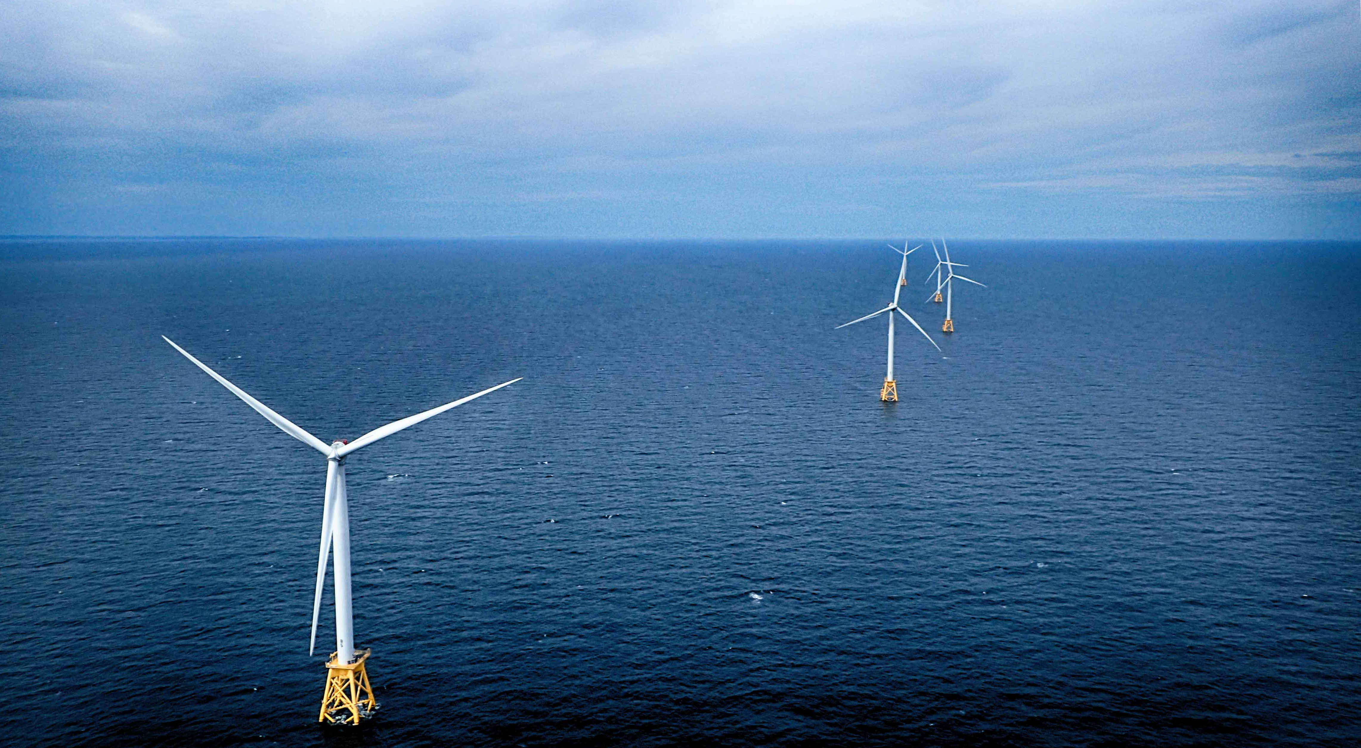
Offshore wind power is in the early stages of development in the United States. In 2016, the United States Department of Energy estimated that the country has a gross resource potential of 10,800GW of offshore wind capacity, with a "technical" resource potential of 2,058GW. Offshore wind projects are under development in wind-rich areas of the East Coast, Great Lakes, and Pacific coast. The first commercial offshore wind farm, Block Island Wind Farm, began operation in 2016. As of 2017, about 30 projects totalling 24 gigawatts (GW) of potential installed capacity were being planned. In 2021 the Biden Administration announced a target of 30 GW of offshore wind by 2030; the US currently has 0.042 GW of offshore wind power. Federal regulation and incentives The construction of an offshore wind farm involves a three-phase permitting process. First, the proponents must lease the seafloor from its owner — typically this will be Outer Continental Shelf, the federal seafloor which i ... [...More Info...] [...Related Items...] OR: [Wikipedia] [Google] [Baidu] |
List Of Offshore Wind Farms
This article lists the largest offshore wind farms that are currently operational rated by nameplate capacity. It also lists the largest offshore wind farms currently under construction, the largest proposed offshore wind farms, and offshore wind farms with notability other than size. As of 2022, Hornsea 2 in the United Kingdom is the largest offshore wind farm in the world at 1,386 MW. Largest operational offshore wind farms This is a list of offshore wind farms with at least 300 MW nameplate capacity that are currently operational. Largest under construction This is a list of wind farms with a nameplate capacity of more than 300MW currently under construction. Largest proposed The following table lists largest offshore wind farm areas (by nameplate capacity) that are only at a ''proposal'' stage, and have achieved at least some of the formal consents required before construction can begin. Other notable offshore wind farms See also * Jackup rig ... [...More Info...] [...Related Items...] OR: [Wikipedia] [Google] [Baidu] |
Massachusetts Department Of Public Utilities
The Massachusetts Department of Public Utilities is one of two Public Utilities Commissions of the Commonwealth of Massachusetts, in the Executive Office of Energy and Environmental Affairs. There are currently three members of the commission. Its major duties include the regulation of public utility companies that distribute electric power, natural gas and water to the citizens of Massachusetts. Current commissioners as of 2011 are Ann G. Berwick, chair, Jolette A. Westbrook, and David W. Cash. DPU also has some transportation oversight duties not handled by the Massachusetts Department of Transportation. Besides DPU a second department is the Massachusetts Department of Telecommunications and Cable, whose duties include the regulation of public utility companies that distribute satellite & cable television (licenses), broadband, and telecommunications services. References External links * *Dept. of Telecommunications and Cable Department of Public Utilities, Ma ... [...More Info...] [...Related Items...] OR: [Wikipedia] [Google] [Baidu] |
Martha's Vineyard
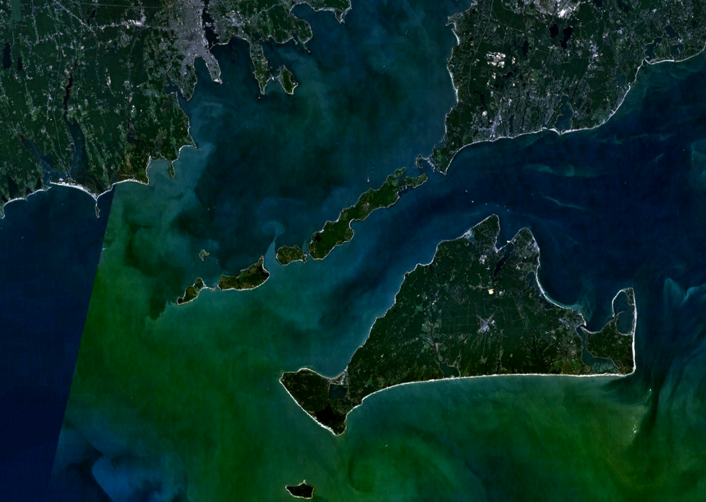
Martha's Vineyard, often simply called the Vineyard, is an island in the Northeastern United States, located south of Cape Cod in Dukes County, Massachusetts, known for being a popular, affluent summer colony. Martha's Vineyard includes the smaller adjacent Chappaquiddick Island, which is usually connected to the Vineyard. The two islands have sometimes been separated by storms and hurricanes, which last occurred from 2007 to 2015. It is the 58th largest island in the U.S., with a land area of about , and the third-largest on the East Coast, after Long Island and Mount Desert Island. Martha's Vineyard constitutes the bulk of Dukes County, which also includes the Elizabeth Islands and the island of Nomans Land (Massachusetts), Nomans Land. The Vineyard was home to one of the earliest known deaf communities in the United States; consequently, a sign language, the Martha's Vineyard Sign Language, emerged on the island among both deaf and hearing islanders. The 2010 census report ... [...More Info...] [...Related Items...] OR: [Wikipedia] [Google] [Baidu] |
Wind Power In Massachusetts
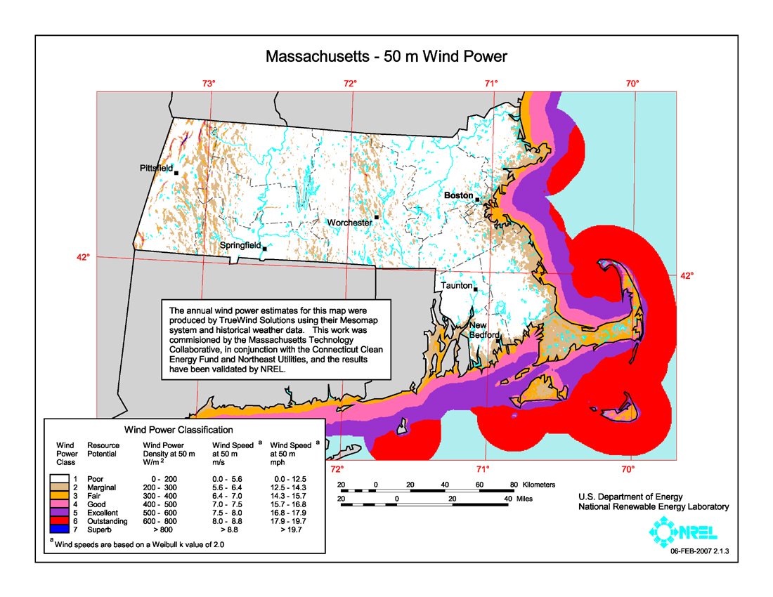
The U.S. state of Massachusetts has vast wind energy resources offshore, as well as significant resources onshore. The 2016 update to the states's Clean Energy and Climate Plan had a goal of reducing 1990 baseline greenhouse gas emissions levels by 25% by 2020. Current goals include installing 3,500 megawatts (MW) of offshore wind power in the state by 2035. However, as of Q4 2021 the state had only 120 MW of wind powered electricity generating capacity, responsible for generating 0.9% of in-state electricity production. The state has awarded contracts to two offshore projects, the 800 MW Vineyard Wind project and 804 MW Mayflower Wind project. Construction began on the Vineyard Wind 1 project on November 18, 2021, after a long fight for approval. Commonwealth Wind was selected for development in 2021, but the developer has attempted to cancel the project due to increased costs. There are eight projects planned for off the southern coast of Massachusetts, though some will deli ... [...More Info...] [...Related Items...] OR: [Wikipedia] [Google] [Baidu] |


