|
Maya Biosphere Reserve
The Maya Biosphere Reserve ( es, Reserva de la Biosfera Maya) is a nature reserve in Guatemala managed by Guatemala's National Council of Protected Areas (CONAP). The Maya Biosphere Reserve covers an area of 21,602 km², one-fifth of the country's total land area. The park is home to a large number of species of fauna including Morelet's crocodile and the ocellated turkey. It is also rich in flora including breadnut, mahogany, ''Swietenia humilis'', ''Bloma prisca'', '' Vitex gaumeri'', cedar, '' Bucida buceras'', ''Haematoxylum campechianum'', ''Rhizophora mangle'', and ''Pimenta dioica''. The area ranges from wetlands, to low mountain ranges, and has several bodies of water, including lakes, rivers, streams and cenotes. The Reserve was created in 1990 to protect the largest area of American tropical forest remaining north of the Amazon. The biosphere reserve model, implemented by UNESCO, seeks to promote a balance between human activities and the biosphere by including ... [...More Info...] [...Related Items...] OR: [Wikipedia] [Google] [Baidu] |
El Mirador
El Mirador (which translates as "the lookout", "the viewpoint", or "the belvedere") is a large pre-Columbian Middle and Late Preclassic (1000 BC - 250 AD) Mayan settlement, located in the north of the modern department of El Petén, Guatemala. It is part of the Mirador-Calakmul Karst Basin of northern Guatemala. ansen, R., Morales-Aguilar, C., Thompson, J., Ensley, R., Hernández, E., Schreiner, T., . . . Martínez, G. (2022). LiDAR analyses in the contiguous Mirador-Calakmul Karst Basin, Guatemala: An introduction to new perspectives on regional early Maya socioeconomic and political organization. Ancient Mesoamerica, 1-4 ... [...More Info...] [...Related Items...] OR: [Wikipedia] [Google] [Baidu] |
Allspice
Allspice, also known as Jamaica pepper, myrtle pepper, pimenta, or pimento, is the dried unripe berry (botany), berry of ''Pimenta dioica'', a Canopy (forest), midcanopy tree native to the Greater Antilles, southern Mexico, and Central America, now cultivated in many warm parts of the world. The name ''allspice'' was coined as early as 1621 by the English, who valued it as a spice that combined the flavours of cinnamon, nutmeg, and clove. Several unrelated fragrant shrubs are called "Carolina allspice" (''Calycanthus floridus''), "Japanese allspice" (''Chimonanthus praecox''), or "wild allspice" (''Lindera benzoin''). Production Allspice is the dried fruit of the ''Pimenta dioica'' plant. The fruits are picked when green and unripe, and are traditionally Drying (food), dried in the sun. When dry, they are brown and resemble large, smooth Black pepper, peppercorns. Fresh leaves are similar in texture to Bay Laurel, bay leaves and similarly used in cooking. Leaves and wood are o ... [...More Info...] [...Related Items...] OR: [Wikipedia] [Google] [Baidu] |
Buffer Zone
A buffer zone is a neutral zonal area that lies between two or more bodies of land, usually pertaining to countries. Depending on the type of buffer zone, it may serve to separate regions or conjoin them. Common types of buffer zones are demilitarized zones, border zones and certain restrictive easement zones and green belts. Such zones may be comprised by a sovereign state, forming a buffer state. Buffer zones have various purposes, politically or otherwise. They can be set up for a multitude of reasons, such as to prevent violence, protect the environment, shield residential and commercial zones from industrial accidents or natural disasters, or even isolate prisons. Buffer zones often result in large uninhabited regions that are themselves noteworthy in many increasingly developed or crowded parts of the world. Conservation For use in nature conservation, a buffer zone is often created to enhance the protection of areas under management for their biodiversity importance ... [...More Info...] [...Related Items...] OR: [Wikipedia] [Google] [Baidu] |
Natural Monument
A natural monument is a natural or natural/cultural feature of outstanding or unique value because of its inherent rarity, representative of aesthetic qualities or cultural significance. Under World Commission on Protected Areas guidelines, natural monuments are level III, described as: :"Areas are set aside to protect a specific natural monument, which can be a landform, sea mount, submarine cavern, geological feature such as a cave or even a living feature such as an ancient grove. They are generally quite small protected areas and often have high visitor value." This is a lower level of protection than level II (national parks) and level I (wilderness areas). The European Environment Agency's guidelines for selection of a natural monument are: * The area should contain one or more features of outstanding significance. Appropriate natural features include waterfalls, caves, craters, fossil beds, sand dunes and marine features, along with unique or representative fauna and flo ... [...More Info...] [...Related Items...] OR: [Wikipedia] [Google] [Baidu] |
El Pilar
El Pilar is an ancient Maya city center located on the Belize-Guatemala border. The site is located north of San Ignacio, Belize and can be accessed through the San Ignacio and Bullet Tree Falls on the Belize River. The name "El Pilar" is Spanish for "watering basin", reflecting the abundance of streams around the site and below its escarpment, which is rare in the Maya area. The monuments of El Pilar are at the center of a protected area known as El Pilar Archeological Reserve for Maya Flora and Fauna, declared a cultural monument in both Belize and Guatemala in 1998. El Pilar is the largest Maya site in the Belize River area with over 25 plazas and hundreds of other major buildings, covering about . Archeological discovery Archaeologist Anabel Ford first mapped El Pilar in 1983 in the course of her Belize River Archaeological Settlement Survey or BRASS project. Settlement patterns in the region suggest a hierarchy of community size and composition that was directly relat ... [...More Info...] [...Related Items...] OR: [Wikipedia] [Google] [Baidu] |
El Zotz
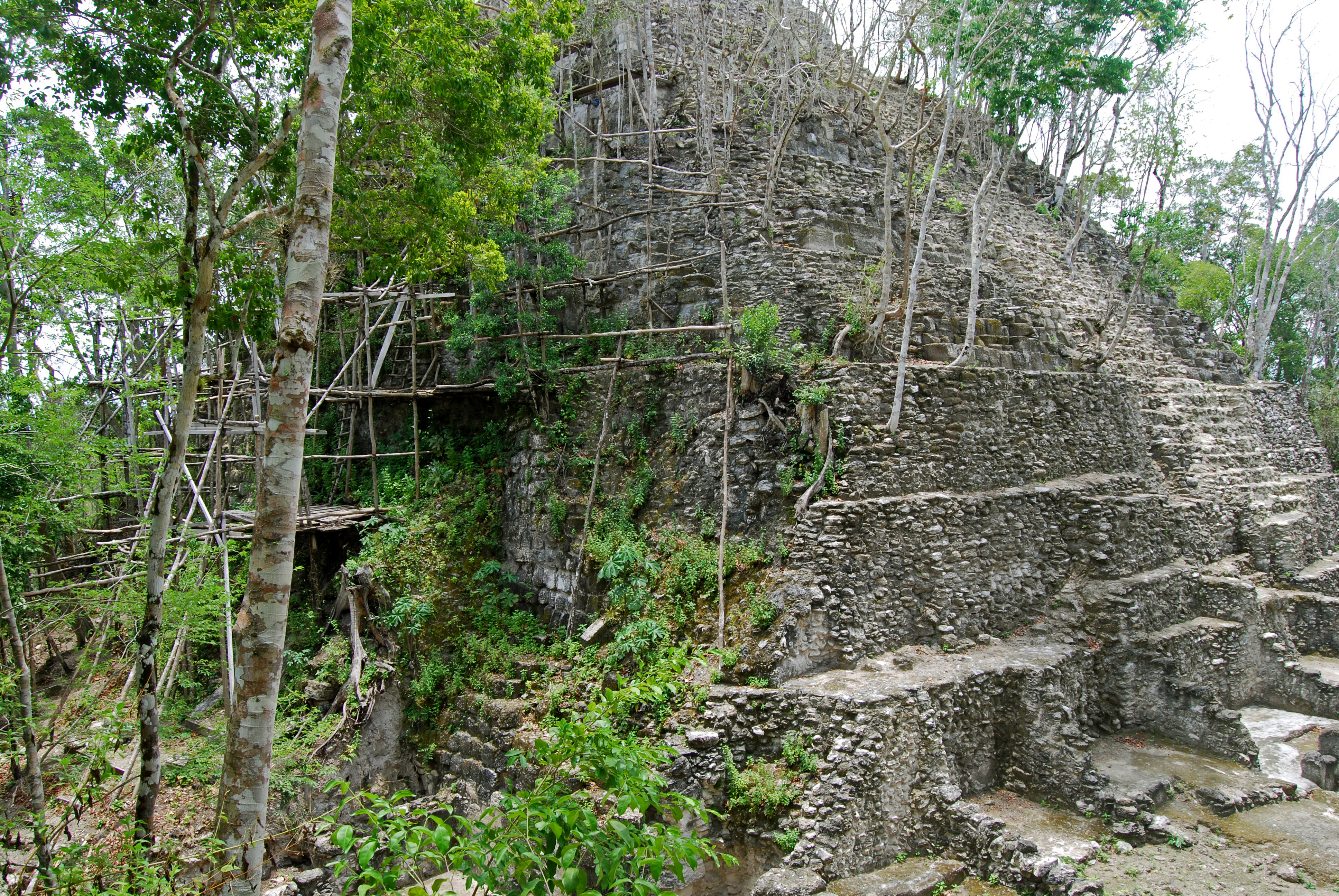
El Zotz () is a Mesoamerican archaeological site of the pre-Columbian Maya civilization, located in the Petén Basin region around west of the major center of Tikal and approximately west of Uaxactun. It is so called because of the large number of bats living in caves in the nearby cliffs (the original Mayan name was Pa'Chan). The site is located within the San Miguel la Palotada National Park bordering the Tikal National Park in the present-day department of Petén, Guatemala. It is a large Classic Period site and contains many unexcavated mounds and ruins. El Zotz shared its Emblem Glyph with the powerful city of Yaxchilan in Chiapas, Mexico, and it is likely that the Yaxchilan royal dynasty had its origin in El Zotz. The tallest temple structure is approximately 45 m (148 ft) high and is known as "El Diablo" (the devil), allegedly because the sides of the temple are dangerously steep. Conservation work has been carried out here by the University of San Carlos of ... [...More Info...] [...Related Items...] OR: [Wikipedia] [Google] [Baidu] |
Tikal
Tikal () (''Tik’al'' in modern Mayan orthography) is the ruin of an ancient city, which was likely to have been called Yax Mutal, found in a rainforest in Guatemala. It is one of the largest archeological sites and urban centers of the pre-Columbian Maya civilization. It is located in the archeological region of the Petén Basin in what is now northern Guatemala. Situated in the department of El Petén, the site is part of Guatemala's Tikal National Park and in 1979 it was declared a UNESCO World Heritage Site. Tikal was the capital of a conquest state that became one of the most powerful kingdoms of the ancient Maya. Though monumental architecture at the site dates back as far as the 4th century BC, Tikal reached its apogee during the Classic Period, c. 200 to 900. During this time, the city dominated much of the Maya region politically, economically, and militarily, while interacting with areas throughout Mesoamerica such as the great metropolis of Teotihuacan in the dista ... [...More Info...] [...Related Items...] OR: [Wikipedia] [Google] [Baidu] |
Mirador Río Azul
Mirador may refer to: Places * Mirador, Maranhão, a municipality in Maranhão, Brazil * Mirador, Paraná, a municipality in Paraná, Brazil * Mirador, Arizona, a place in Arizona, US * Mirador, California, a place in California, US * Mirador (Greenwood, Virginia), a historic home * El Mirador, a large pre-Columbian settlement in Guatemalań * Mirador Basin, a geological depression in the northern department of Petén, Guatemala * El Mirador cave (Cueva del Mirador), a cave in the Atapuerca Mountains, Spain * Mount Mirador, a mountain in the Philippines * Mount Tlaloc (Cerro Tláloc or El Mirador), a mountain in central Mexico * Quinta El Mirador, a village in Argentina Music * ''Mirador'' (Magnum album) * ''Mirador'' (Tarnation album) * "Mirador" (song), a 1989 song by Johnny Hallyday Literature * , a literature, art and politics weekly that was published in Barcelona between 1929 and 1938, see ''El Be Negre'' * ''The Mirador'' (novel) a novel by Sarah Monette Other uses ... [...More Info...] [...Related Items...] OR: [Wikipedia] [Google] [Baidu] |
Sierra Del Lacandón
The Sierra del Lacandón is a low karstic mountain range in Guatemala and Mexico. It is situated in the north-west of the department of El Petén and the south-east of Chiapas. Its highest points are located near the Mexican border at coordinates and The range consists of southeast to northwest trending ridges of folded Cretaceous limestone and dolomite hills rising above the lowlands of the Petén Basin. Sierra del Lacandón National Park The Sierra del Lacandón National Park is a national park established in 1990. It is part of the Maya Biosphere Reserve and is unique for its biodiversity. It is also considered of great importance for the Mesoamerican Biological Corridor as it connects the protected areas of northern Guatemala with those of southern Mexico, like the Montes Azules Biosphere Reserve in Chiapas. Several ancient Maya archaeological sites are located within the park boundaries. These include Piedras Negras, El Porvenir, Macabilero, La Pasadita, El Hormiguero ... [...More Info...] [...Related Items...] OR: [Wikipedia] [Google] [Baidu] |
Laguna Del Tigre
Laguna del Tigre National Park is located in northern Guatemala, in the municipality of San Andrés, Petén Department. Covering an area of 337,899 ha, makes it the largest core zone of the Maya Biosphere Reserve (MBR) and the largest national park in Guatemala and the largest protected wetlands in Central America. It also has the status of Ramsar site because of its size, wealth and characteristics of its wetland ecosystem. The vast area periodically floods, creating unique characteristics such as vast savannas and transition forests. It is also included in the convention's Montreux Register of threatened wetland sites. This biodiverse area features consisting of floodable savannas and wetlands; transition forest (which covers most of the park); high forest; and flora. Threats Analysis of aerial images in 2020, found evidence of large-scale cattle ranching in 87% of the images. Large ranches were encouraged by the government in the 1960s, and from circa 2002, narcos laundere ... [...More Info...] [...Related Items...] OR: [Wikipedia] [Google] [Baidu] |
Biotope
A biotope is an area of uniform environmental conditions providing a living place for a specific assemblage of plants and animals. ''Biotope'' is almost synonymous with the term "habitat", which is more commonly used in English-speaking countries. However, in some countries these two terms are distinguished: the subject of a habitat is a population, the subject of a biotope is a ''biocoenosis'' or "biological community". It is an English loanword derived from the German ''Biotop'', which in turn came from the Greek ''bios'' (meaning 'life') and ''topos'' ('place'). (The related word ''geotope'' has made its way into the English language by the same route, from the German '' Geotop''.) Ecology The concept of a biotope was first advocated by Ernst Haeckel (1834–1919), a German zoologist famous for the recapitulation theory. In his book ''General Morphology'' (1866), which defines the term "ecology", he stresses the importance of the concept of habitat as a prerequisite for an ... [...More Info...] [...Related Items...] OR: [Wikipedia] [Google] [Baidu] |
National Park
A national park is a nature park, natural park in use for conservation (ethic), conservation purposes, created and protected by national governments. Often it is a reserve of natural, semi-natural, or developed land that a sovereign state declares or owns. Although individual nations designate their own national parks differently, there is a common idea: the conservation of 'wild nature' for posterity and as a symbol of national pride. The United States established the first "public park or pleasuring-ground for the benefit and enjoyment of the people", Yellowstone National Park, in 1872. Although Yellowstone was not officially termed a "national park" in its establishing law, it was always termed such in practice and is widely held to be the first and oldest national park in the world. However, the Tobago Main Ridge Forest Reserve (in what is now Trinidad and Tobago; established in 1776), and the area surrounding Bogd Khan Mountain, Bogd Khan Uul Mountain (Mongolia, 1778), wh ... [...More Info...] [...Related Items...] OR: [Wikipedia] [Google] [Baidu] |


.jpg)


.jpg)