|
Mauckport, Indiana
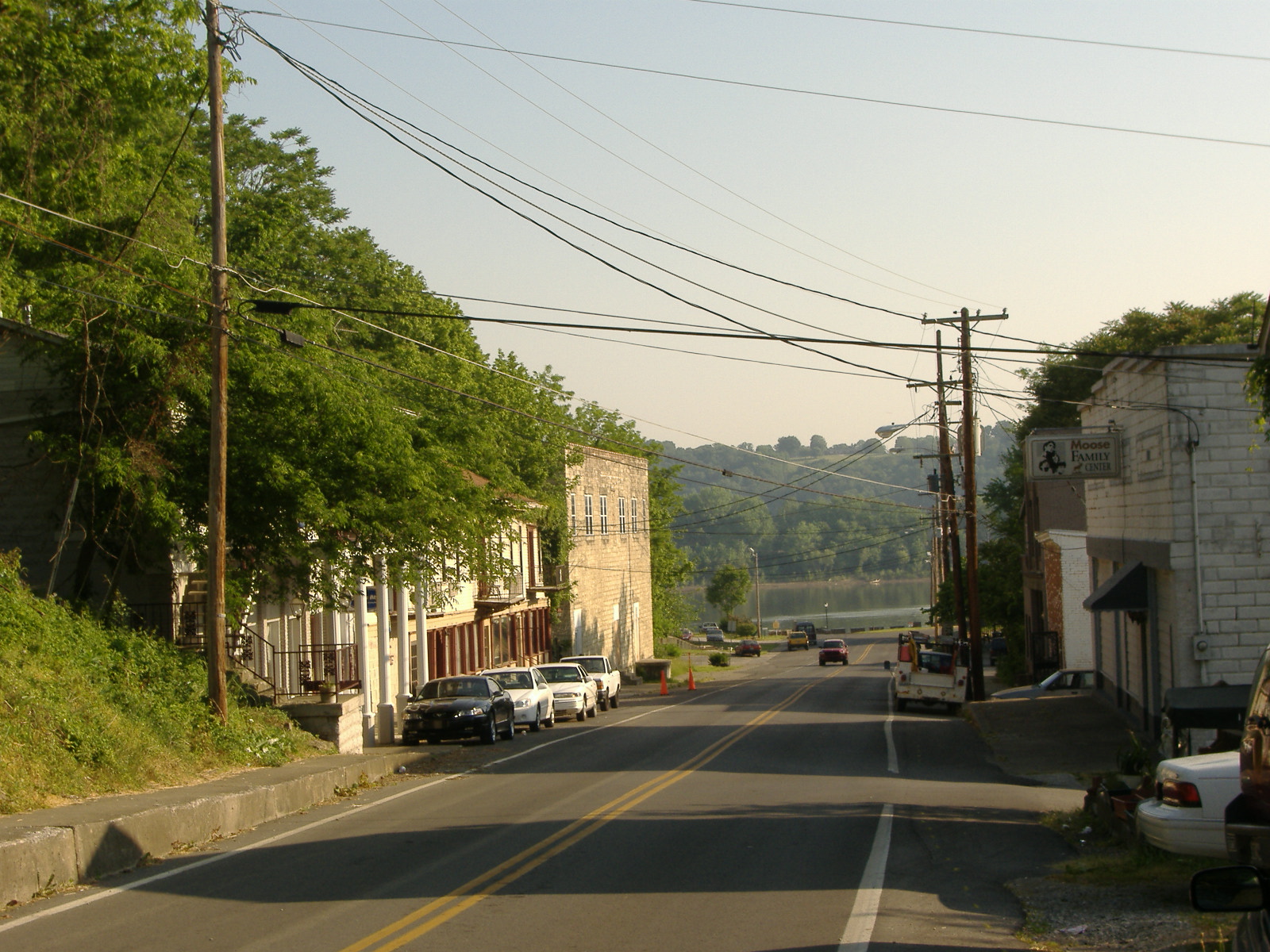
Mauckport is a town in Heth Township, Harrison County, Indiana, Heth Township, Harrison County, Indiana, Harrison County, Indiana, along the Ohio River. The population was 81 at the 2010 census. History In the earliest times Daniel Boone and his brothers, most notably Squire Boone, were regularly in the area of Mauckport. Squire Boone settled in the area in 1806. Squire Boone's remains are just north of Mauckport in the Squire Boone Caverns. The Mauckport area's earliest permanent settlers came from the Shenandoah Valley and Lancaster County, Pennsylvania. The town was named after the Maucks, a Germans, German immigrant family who first settled in that area. The town itself is built upon land granted to John Peter Mauck in an 1811 land grant. It was his son, Fredrick, who filed the original plat for the town on May 7, 1827; the town was called Mauck's Port. The original town had three streets running north to south and four streets running east to west. The original town was divid ... [...More Info...] [...Related Items...] OR: [Wikipedia] [Google] [Baidu] |
Town
A town is a human settlement. Towns are generally larger than villages and smaller than cities, though the criteria to distinguish between them vary considerably in different parts of the world. Origin and use The word "town" shares an origin with the German word , the Dutch word , and the Old Norse . The original Proto-Germanic word, *''tūnan'', is thought to be an early borrowing from Proto-Celtic *''dūnom'' (cf. Old Irish , Welsh ). The original sense of the word in both Germanic and Celtic was that of a fortress or an enclosure. Cognates of ''town'' in many modern Germanic languages designate a fence or a hedge. In English and Dutch, the meaning of the word took on the sense of the space which these fences enclosed, and through which a track must run. In England, a town was a small community that could not afford or was not allowed to build walls or other larger fortifications, and built a palisade or stockade instead. In the Netherlands, this space was a garden, mor ... [...More Info...] [...Related Items...] OR: [Wikipedia] [Google] [Baidu] |
Squire Boone Caverns
Squire Boone Caverns and Village is a cavern exploration attraction in Mauckport, Indiana (near Corydon in Southern Indiana). The park consists of a one-hour walking tour into the caverns, as well as a working pioneer village and grist mill. Park's history The cave was first discovered by Daniel Boone and his brother, Squire Boone, as they were hiding from Indians in the late 18th century. Squire would come back later to purchase the land and live near the caves in 1808 and start a grist mill at the site. The mill is on the Indiana Register of Historic Sites and Structures and still operates today. Squire Boone died in 1815 and, having so loved the caverns, requested to be buried in them, and was buried near the entrance to the cave. His remains were moved in the 20th century because of construction near his burial site and its continual disturbance by relic hunters. The coffin, which contained only bones, was moved deep into the caverns. The cave tour passes by the coffin and th ... [...More Info...] [...Related Items...] OR: [Wikipedia] [Google] [Baidu] |
Census
A census is the procedure of systematically acquiring, recording and calculating information about the members of a given population. This term is used mostly in connection with national population and housing censuses; other common censuses include censuses of agriculture, traditional culture, business, supplies, and traffic censuses. The United Nations (UN) defines the essential features of population and housing censuses as "individual enumeration, universality within a defined territory, simultaneity and defined periodicity", and recommends that population censuses be taken at least every ten years. UN recommendations also cover census topics to be collected, official definitions, classifications and other useful information to co-ordinate international practices. The UN's Food and Agriculture Organization (FAO), in turn, defines the census of agriculture as "a statistical operation for collecting, processing and disseminating data on the structure of agriculture, covering th ... [...More Info...] [...Related Items...] OR: [Wikipedia] [Google] [Baidu] |
Meade County, Kentucky
Meade County is a county located in the U.S. state of Kentucky. As of the 2020 census, the population was 30,003. Its county seat is Brandenburg. The county was founded December 17, 1823, and named for Captain James M. Meade, who was killed in action at the Battle of River Raisin during the War of 1812. Meade County is part of the Elizabethtown-Fort Knox, KY Metropolitan Statistical Area, which is included in the Louisville/Jefferson County-Elizabethtown-Madison, KY- IN Combined Statistical Area. Geography According to the United States Census Bureau, the county has a total area of , of which is land and (5.9%) is water. All of the county's northern border faces Indiana, across from the Ohio River. Outdoor attractions * Doe Run Inn * Otter Creek Outdoor Recreation Area * Meade Olin Park * Diana’s Park * Park Down By The River Adjacent counties * Hardin County (southeast) * Breckinridge County (southwest/CST Border) * Harrison County, Indiana (northeast) * Perry ... [...More Info...] [...Related Items...] OR: [Wikipedia] [Google] [Baidu] |
Tell City, Indiana
Tell City is a city in Troy Township, Perry County, in the U.S. state of Indiana, along the Ohio River. The population was 7,272 at the 2010 census. The city is the county seat of Perry County. History Tell City traces its 150+ year old roots to a meeting in Cincinnati, Ohio, in November 1856. A group of Swiss-German immigrants met there to organize a society known as the "Swiss Colonization Society." Its purpose was to obtain affordable homesteads for mechanics, shopkeepers, factory workers and small farmers in a location where all could live in harmony. The Society decided to purchase a tract of land three miles (5 km) square to be surveyed into a city plot. The group sent out to purchase the land was told to keep in mind a healthful climate, fertile soil, good water, ample timber, and a location near a navigable river and a railroad, if possible. Purchase of such a site was made in July 1857. The tract, containing , was laid out in 392 town blocks with 7,328 building lo ... [...More Info...] [...Related Items...] OR: [Wikipedia] [Google] [Baidu] |
New Albany, Indiana
New Albany is a city in Floyd County, Indiana, United States, situated along the Ohio River, opposite Louisville, Kentucky. The population was 37,841 as of the 2020 census. The city is the county seat of Floyd County. It is bounded by I-265 to the north and the Ohio River to the south, and is considered part of the Louisville, Kentucky Metropolitan Statistical Area. The mayor of New Albany is Jeff Gahan, a Democrat; he was re-elected in 2019. History Early history The land of New Albany was officially granted to the United States after the American Revolutionary War. The territory had been captured by George Rogers Clark in 1779. For his services Clark was awarded large tracts of land in Southern Indiana including most of Floyd County. After the war Clark sold and distributed some of his land to his fellow soldiers. The area of New Albany ended up in the possession of Col. John Paul. New Albany was founded in July 1813 when three brothers from New York —Joel, Abner, and ... [...More Info...] [...Related Items...] OR: [Wikipedia] [Google] [Baidu] |
Matthew E
{{disambiguation ...
Matthew may refer to: * Matthew (given name) * Matthew (surname) * ''Matthew'' (ship), the replica of the ship sailed by John Cabot in 1497 * ''Matthew'' (album), a 2000 album by rapper Kool Keith * Matthew (elm cultivar), a cultivar of the Chinese Elm ''Ulmus parvifolia'' Christianity * Matthew the Apostle, one of the apostles of Jesus * Gospel of Matthew, a book of the Bible See also * Matt (given name), the diminutive form of Matthew * Mathew, alternative spelling of Matthew * Matthews (other) * Matthew effect * Tropical Storm Matthew (other) The name Matthew was used for three tropical cyclones in the Atlantic Ocean, replacing Mitch after 1998. * Tropical Storm Matthew (2004) - Brought heavy rain to the Gulf Coast of Louisiana, causing light damage but no deaths. * Tropical Storm Matt ... [...More Info...] [...Related Items...] OR: [Wikipedia] [Google] [Baidu] |
Ohio River Flood Of 1937
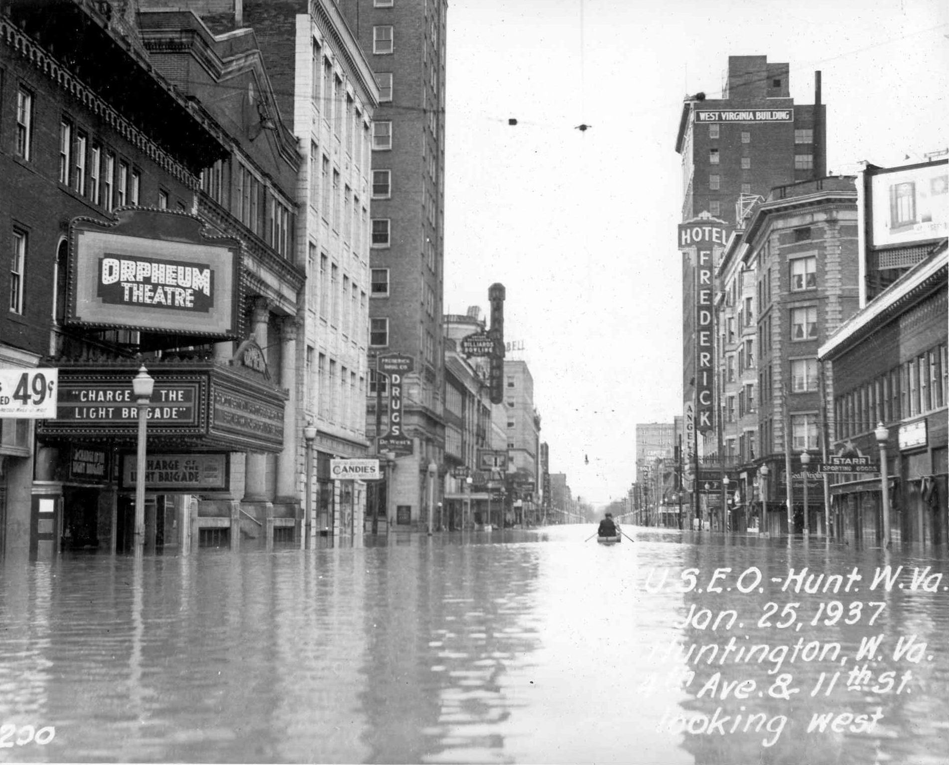
The Ohio River flood of 1937 took place in late January and February 1937. With damage stretching from Pittsburgh to Cairo, Illinois, 385 people died, one million people were left homeless and property losses reached $500 million ($10.2 billion when adjusted for inflation as of September 2022). Federal and state resources were strained to aid recovery as the disaster occurred during the depths of the Great Depression and a few years after the beginning of the Dust Bowl. Event timeline * January 5: Water levels began to rise. * January 10–18: Numerous flood warnings were issued across much of the region. * January 13–24: Near record rainfalls were recorded. * January 18: Numerous homes were flooded as the Ohio River started to overflow its banks due to the heavy rains. * January 23–24: Martial law was declared in Evansville, Indiana, where the water level was at . [...More Info...] [...Related Items...] OR: [Wikipedia] [Google] [Baidu] |
American Civil War
The American Civil War (April 12, 1861 – May 26, 1865; also known by other names) was a civil war in the United States. It was fought between the Union ("the North") and the Confederacy ("the South"), the latter formed by states that had seceded. The central cause of the war was the dispute over whether slavery would be permitted to expand into the western territories, leading to more slave states, or be prevented from doing so, which was widely believed would place slavery on a course of ultimate extinction. Decades of political controversy over slavery were brought to a head by the victory in the 1860 U.S. presidential election of Abraham Lincoln, who opposed slavery's expansion into the west. An initial seven southern slave states responded to Lincoln's victory by seceding from the United States and, in 1861, forming the Confederacy. The Confederacy seized U.S. forts and other federal assets within their borders. Led by Confederate President Jefferson Davis, ... [...More Info...] [...Related Items...] OR: [Wikipedia] [Google] [Baidu] |
Morgan's Raid
Morgan's Raid was a diversionary incursion by Confederate cavalry into the Union states of Indiana, Kentucky, Ohio and West Virginia during the American Civil War. The raid took place from June 11 to July 26, 1863, and is named for the commander of the Confederate troops, Brigadier General John Hunt Morgan. Although it caused temporary alarm in the North, the raid was ultimately classed as a failure. The raid covered more than , beginning in Tennessee and ending in northern Ohio. It coincided with the Vicksburg Campaign and the Gettysburg Campaign, and it was meant to draw Union troops away from these fronts by frightening the North into demanding its troops return home. Despite his initial successes, Morgan was thwarted in his attempts to recross the Ohio River and eventually was forced to surrender what remained of his command in northeastern Ohio near the Pennsylvania border. Morgan and other senior officers were held in the Ohio Penitentiary, but they tunneled their way ou ... [...More Info...] [...Related Items...] OR: [Wikipedia] [Google] [Baidu] |
Brandenburg, Kentucky
Brandenburg is a home rule-class city on the Ohio River in Meade County, Kentucky, in the United States. The city is southwest of Louisville. It is the seat of its county. The population was 2,643 at the 2010 census. History Brandenburg was built on a tract of land called Falling Springs, purchased in 1804 by Solomon Brandenburg. He opened a tavern around which the community grew. In 1825, the community became the seat of Meade County, but it wasn't formally incorporated by the state assembly until March 28, 1872. During the Civil War, Confederate General John Hunt Morgan crossed at Brandenburg to start his raid into Indiana in July, 1863. During the Battle of Brandenburg Crossing, two men on the Indiana side of the river were killed by cannon fire from Brandenburg. A Union gunship was deployed to block the crossing, but it ran out of ammunition and Morgan and his men were able to pass into Indiana. Brandenburg was devastated by an F5 tornado during the Super Outbreak o ... [...More Info...] [...Related Items...] OR: [Wikipedia] [Google] [Baidu] |
Corydon, Indiana
Corydon is a town in Harrison Township, Harrison County, Indiana. Located north of the Ohio River in the extreme southern part of the U.S. state of Indiana, it is the seat of government for Harrison County. Corydon was founded in 1808 and served as the capital of the Indiana Territory from 1813 to 1816. It was the site of Indiana's first constitutional convention, which was held June 10–29, 1816. Forty-three convened to consider statehood for Indiana and drafted its first state constitution. Under Article XI, Section 11, of the Indiana 1816 constitution, Corydon was designated as the capital of the state until 1825, when the seat of state government was moved to Indianapolis. During the American Civil War, Corydon was the site of the Battle of Corydon, the only official pitched battle waged in Indiana during the war. More recently, the town's numerous historic sites have helped it become a tourist destination. A portion of its downtown area is listed in the National Register o ... [...More Info...] [...Related Items...] OR: [Wikipedia] [Google] [Baidu] |
.jpg)


