|
Matsukawa Geothermal Power Plant
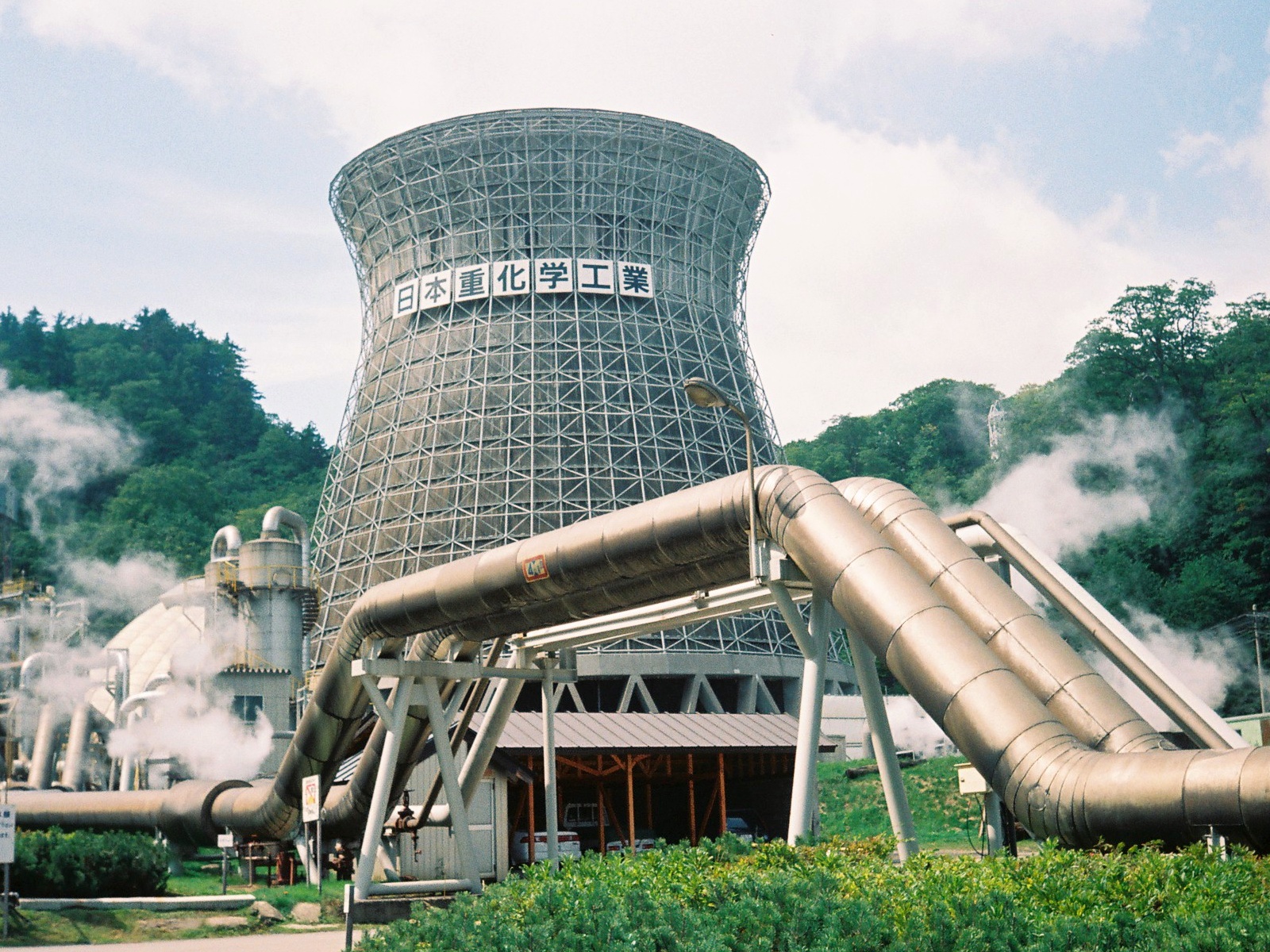
The is Japan's first commercial geothermal power station. It is located in the city of Hachimantai, Iwate Prefecture in the Tōhoku region of northern Japan. The plant is located in the Hachimantai Plateau, in the Ōu Mountains. After seams of steam were found at the Matsuo mine in 1952, plans began to utilize this resource for the generation of electric power. The plant was completed in 1966 with a total construction cost of 2 billion yen by Japan Metals & Chemicals Co., Ltd. was operated by the same company. After a corporate reorganization, the plant was turned over to Tohoku Geothermal Energy Company, a subsidiary of Tohoku Electric. In addition to power generation, the waste hot water is supplied to farmers with greenhouses for agricultural applications. In 2016, the Matsukawa Georthermal Plant was certified as one of the Mechanical Engineering Heritage sites of Japan by the Japan Society of Mechanical Engineers (JSME). As it marked its fiftieth year, the plant was ... [...More Info...] [...Related Items...] OR: [Wikipedia] [Google] [Baidu] |
Hachimantai, Iwate
is a city located in Iwate Prefecture, Japan. , the city had an estimated population of 25,076, and a population density of 29 persons per km2 in 10,531 households. The total area of the city is . Geography Hachimantai is located in the Ōu Mountains of far northwest Iwate Prefecture, bordered by Aomori Prefecture to the north and Akita Prefecture to the west. The headwaters of the Yoneshiro River are in Hachimanai. Part of Mount Hachimantai and Mount Iwate are within its borders. Parts of the city are within the borders of the Towada-Hachimantai National Park. Mount Iwate, the highest mountain in Iwate Prefecture, is on the border of Hachimantai with Shizukuishi and Takizawa. Neighboring municipalities Aomori Prefecture *Takko Akita Prefecture *Kazuno * Semboku Iwate Prefecture *Morioka * Ninohe * Takizawa * Ichinohe * Iwate *Shizukuishi Climate Hachimantai has a humid continental climate (Köppen climate classification ''Dfa''), the same as much of Hokkaido to the north, cha ... [...More Info...] [...Related Items...] OR: [Wikipedia] [Google] [Baidu] |
Tohoku Electric Power Company
is an electric utility, servicing 7.6 million individual and corporate customers in six prefectures in Tōhoku region plus Niigata Prefecture. It provides electricity at 100 V, 50 Hz, though some area use 60 Hz. Tohoku Electric Power is the fourth-largest electric utility in Japan in terms of revenue, behind TEPCO, KEPCO and Chubu Electric Power. Shareholders * Nippon Life Insurance Company 3.9% * Japan Trustee Services Bank 3.8% * The Master Trust Bank of Japan 3.6% Accidents On 11 March 2011, several nuclear reactors in Japan were badly damaged by the 2011 Tōhoku earthquake and tsunami. In the Onagawa Nuclear Power Plant a fire broke out in the turbine section of the plant. In order to make up for the loss of electricity from the damaged reactor plant, Tohoku announced it would restart a mothballed natural gas power plant. The liquefied natural gas and oil-fired No. 1 unit at the Higashi Niigata plant in Niigata prefecture has a 350-megawatt capacity and co ... [...More Info...] [...Related Items...] OR: [Wikipedia] [Google] [Baidu] |
Geothermal Power Station
Geothermal power is electrical power generated from geothermal energy. Technologies in use include dry steam power stations, flash steam power stations and binary cycle power stations. Geothermal electricity generation is currently used in 26 countries,Geothermal Energy AssociationGeothermal Energy: International Market Update May 2010, p. 4-6. while geothermal heating is in use in 70 countries. As of 2019, worldwide geothermal power capacity amounts to 15.4 gigawatts (GW), of which 23.9 percent or 3.68 GW are installed in the United States. International markets grew at an average annual rate of 5 percent over the three years to 2015, and global geothermal power capacity is expected to reach 14.5–17.6 GW by 2020. Based on current geologic knowledge and technology the Geothermal Energy Association (GEA) publicly discloses, the GEA estimates that only 6.9 percent of total global potential has been tapped so far, while the IPCC reported geothermal power potential to be ... [...More Info...] [...Related Items...] OR: [Wikipedia] [Google] [Baidu] |
Iwate Prefecture
is a prefecture of Japan located in the Tōhoku region of Honshu. It is the second-largest Japanese prefecture at , with a population of 1,210,534 (as of October 1, 2020). Iwate Prefecture borders Aomori Prefecture to the north, Akita Prefecture to the west, and Miyagi Prefecture to the south. Morioka is the capital and largest city of Iwate Prefecture; other major cities include Ichinoseki, Ōshū, and Hanamaki. Located on Japan's Pacific Ocean coast, Iwate Prefecture features the easternmost point of Honshu at Cape Todo, and shares the highest peaks of the Ōu Mountains—the longest mountain range in Japan—at the border with Akita Prefecture. Iwate Prefecture is home to famous attractions such as Morioka Castle, the Buddhist temples of Hiraizumi including Chūson-ji and Mōtsū-ji, the Fujiwara no Sato movie lot and theme park in Ōshū, and the Tenshochi park in Kitakami known for its huge, ancient cherry trees. Iwate has the lowest population density of any prefecture ... [...More Info...] [...Related Items...] OR: [Wikipedia] [Google] [Baidu] |
Tōhoku Region
The , Northeast region, or consists of the northeastern portion of Honshu, the largest island of Japan. This traditional region consists of six prefectures (''ken''): Akita, Aomori, Fukushima, Iwate, Miyagi, and Yamagata. Tōhoku retains a reputation as a remote, scenic region with a harsh climate. In the 20th century, tourism became a major industry in the Tōhoku region. History Ancient & Classical period In mythological times, the area was known as Azuma (吾妻, あづま) and corresponded to the area of Honshu occupied by the native Emishi and Ainu. The area was historically the Dewa and the Michinoku regions, a term first recorded in (654). There is some variation in modern usage of the term "Michinoku". Tōhoku's initial historical settlement occurred between the seventh and ninth centuries, well after Japanese civilization and culture had become firmly established in central and southwestern Japan. The last stronghold of the indigenous Emishi on Honshu and ... [...More Info...] [...Related Items...] OR: [Wikipedia] [Google] [Baidu] |
Mount Hachimantai
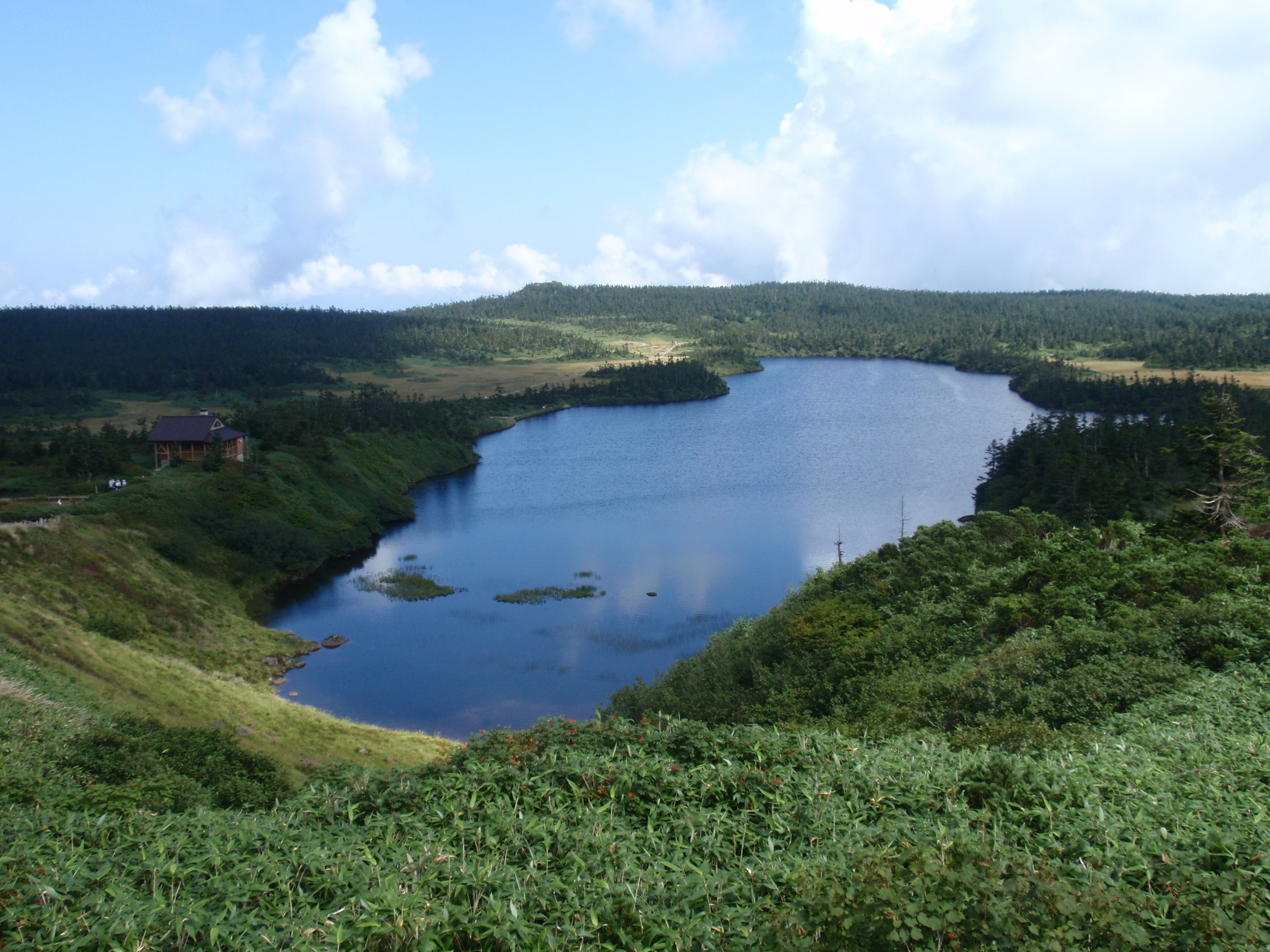
is the highest peak of a group of stratovolcanos distributed around the Hachimantai plateau in the Ōu Mountains in northern Honshū, Japan. This volcanic plateau is part of the Nasu Volcanic Zone and straddles the border between the Iwate Prefecture and Akita Prefecture. The volcano is listed as one of the 100 Famous Japanese Mountains, and forms part of the Towada-Hachimantai National Park. Etymology There are several legends concerning the origin of the name “Hachimantai”. In one legend, the late Nara period General Sakanoue no Tamuramaro pursued a group of Emishi warriors into the area, and was so impressed with the natural beauty of the region that he said it must be the abode of the ''kami'' Hachiman. In another legend, the area was named after Minamoto Yoshiie, a late Heian period warrior whose nickname was “Hachiman Tarō”. Geography Situation The Hachimantai plateau is located approximately south of Lake Towada and northeast of Lake Tazawa, within the border ... [...More Info...] [...Related Items...] OR: [Wikipedia] [Google] [Baidu] |
Ōu Mountains
The are a mountain range in the Tōhoku region of Honshū, Japan. The range is the longest range in Japan and stretches south from the Natsudomari Peninsula of Aomori Prefecture to the Nasu volcanoes at the northern boundary of the Kantō region. Though long, the range is only about wide. The highest point in the range is Mount Iwate, . The range includes several widely known mountains: Hakkōda Mountains, Mount Iwate, Mount Zaō, Mount Azuma, Mount Yakeishi, and Mount Adatara. Naming These mountains previously formed the boundary between historical provinces of Mutsu (陸奥国) and Dewa (出羽国). The ''kanji'' for the name of the mountain range was created from one ''kanji'' of the two provinces, 奥 and 羽, respectively. Geology The Ōu Mountains began to form in the Pliocene. They sit over the middle of the inner arc of the Northeastern Japan Arc. This is the result of the Pacific Plate subducting under the Okhotsk Plate The Okhotsk Plate is a minor tect ... [...More Info...] [...Related Items...] OR: [Wikipedia] [Google] [Baidu] |
Matsuo Mine
, was an iron and sulphur mine located in the village of Matsuo, Iwate Prefecture in the Tohoku region of northern Japan. The area is now part of the city of Hachimantai. The mine opened in 1914 and closed in 1979 leaving a ghost town behind. History The Hachimantai Plateau where the mine is located in Ōu Mountains of central Honshu is a volcanic area and the presence of sulphur deposits was well known from an early age; however, due to the remoteness of the area and difficulty of transport, these deposits were not exploited. Iron pyrites were discovered by local villagers in 1882 in Matsuo village. In 1911, a Yokohama-based trading company, Matsuda-ya, began modern mine development at an altitude of at the base of the peak of Higashi-Hachimantai. In 1934, the Japanese Government Railway Hanawa Line was extended to near the mine, and Ōbuke Station was established. At one point, the Matsuo mine accounted for 30% of Japan’s sulphur production and 15% of its pyrite, boastin ... [...More Info...] [...Related Items...] OR: [Wikipedia] [Google] [Baidu] |
Tohoku Electric
is an electric utility, servicing 7.6 million individual and corporate customers in six prefectures in Tōhoku region plus Niigata Prefecture. It provides electricity at 100 V, 50 Hz, though some area use 60 Hz. Tohoku Electric Power is the fourth-largest electric utility in Japan in terms of revenue, behind TEPCO, KEPCO and Chubu Electric Power. Shareholders * Nippon Life Insurance Company 3.9% * Japan Trustee Services Bank 3.8% * The Master Trust Bank of Japan 3.6% Accidents On 11 March 2011, several nuclear reactors in Japan were badly damaged by the 2011 Tōhoku earthquake and tsunami. In the Onagawa Nuclear Power Plant a fire broke out in the turbine section of the plant. In order to make up for the loss of electricity from the damaged reactor plant, Tohoku announced it would restart a mothballed natural gas power plant. The liquefied natural gas and oil-fired No. 1 unit at the Higashi Niigata plant in Niigata prefecture has a 350-megawatt capacity and cou ... [...More Info...] [...Related Items...] OR: [Wikipedia] [Google] [Baidu] |
Mechanical Engineering Heritage (Japan)
The is a list of sites, landmarks, machines, and documents that made significant contributions to the development of mechanical engineering in Japan. Items in the list are certified by the . Overview The ''Mechanical Engineering Heritage'' program was inaugurated in June 2007 in connection with the 110th anniversary of the founding of the JSME. The program recognizes machines, related systems, factories, specification documents, textbooks, and other items that had a significant impact on the development of mechanical engineering. When a certified item can no longer be maintained by its current owner, the JSME acts to prevent its loss by arranging a transfer to the National Science Museum of Japan or to a local government institution. The JSME plans to certify several items of high heritage value over years. Categories Items in the Mechanical Engineering Heritage (Japan) are classified into four categories: # Sites: Historical sites that contain heritage items. # Landmarks: ... [...More Info...] [...Related Items...] OR: [Wikipedia] [Google] [Baidu] |
Fukushima Daiichi Nuclear Disaster
The was a nuclear accident in 2011 at the Fukushima Daiichi Nuclear Power Plant in Ōkuma, Fukushima, Japan. The proximate cause of the disaster was the 2011 Tōhoku earthquake and tsunami, which occurred on the afternoon of 11 March 2011 and remains the most powerful earthquake ever recorded in Japan. The earthquake triggered a powerful tsunami, with 13–14-meter-high waves damaging the nuclear power plant's emergency diesel generators, leading to a loss of electric power. The result was the most severe nuclear accident since the Chernobyl disaster in 1986, classified as level seven on the International Nuclear Event Scale (INES) after initially being classified as level five, and thus joining Chernobyl as the only other accident to receive such classification. While the 1957 explosion at the Mayak facility was the second worst by radioactivity released, the INES ranks incidents by impact on population, so Chernobyl (335,000 people evacuated) and Fukushima (154,000 evacuate ... [...More Info...] [...Related Items...] OR: [Wikipedia] [Google] [Baidu] |
Geothermal Power In Japan
Japan has favorable sites for geothermal power because of its proximity to the Izu–Bonin–Mariana Arc. In 2007, Japan had 535.2 MW of installed electric generating capacity, about 5% of the world total. Geothermal power plays a minor role in the energy sector in the country: in 2013 it supplied 2596 GWh of electricity, representing about 0.25% of the country's total electricity supply. Development of new geothermal power stations essentially stopped since the mid 1990s, mainly due to the strong resistance from local communities. Most of the potential sites are located in government-protected areas and in tourist destinations, thanks to the presence of traditional hot springs or onsen. Local communities in these areas are often dependent on revenue from tourists visiting onsen, and are opposed to geothermal developments because of the negative impact that the industry may have on the scenery and the resulting damage to the tourism industry and the local economy. However, inter ... [...More Info...] [...Related Items...] OR: [Wikipedia] [Google] [Baidu] |


