|
Matiltan
Matiltan is a valley in Pakistan about 11 km away from Kalam. It has large glaciers, thick forests and lofty mountain peaks. The tallest peak of Falak Sar mountain can be seen from it. It is accessible through a non metalled road from Kalam by a four-wheel drive vehicle and the charming lake of Mahodand comes after this village of Kalam. See also *Usho *Utror *Gabral *Mahodand Mahodand Lake ( ur, ; ps, د ماهو ډنډ - "Lake of Fishes") is a lake located in the upper Usho, Usho Valley at a distance of about from Kalam, Swat, Kalam in Swat District of Khyber Pakhtunkhwa province of Pakistan. The lake is accessible ... References {{coord, 35.542, 72.661, type:city_region:PK, display=title Swat Kohistan Hill stations in Pakistan Tourist attractions in Swat ... [...More Info...] [...Related Items...] OR: [Wikipedia] [Google] [Baidu] |
Falak Sar (Swat)
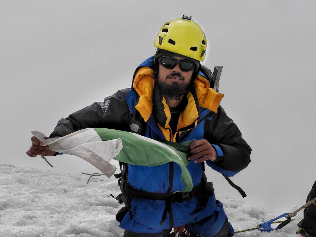
Falak Sar ( ur, فلک سر; also known as Falak Sair) is the highest mountain peak in Ushu Valley of Swat, Pakistan at an elevation of , it is considered the highest peak of the Swat district in the Hindu Kush mountains range, followed by Mankial mountain peak. Ascent History This mountain was climbed for the first time by W.K.A Berry and C.H. Tyndale-Biscoe of New Zealand in 1957 from its North ridge. The second ascent was made by Dr. Wolf Gang Stephen who also climbed Distaghil Sar and Malika Parbat. Carlo Pinelli attempted another peak in the Hindu Raj which is the only 6000 of this part of Hindu Kush. They named it Maingol Sar. Similarly, another ascent was made by a Japanese expedition from Yamaguchi University was composed of Yoshiyuki Nagahiro and Toshiyuki Akiyama. After traveling by car from Peshawar through Saidu Sharif, capital of Swat, to Matiltan, they continued on and headed up the Falak Sar valley, where at 11,000 feet on August 15 they established Base Camp. On ... [...More Info...] [...Related Items...] OR: [Wikipedia] [Google] [Baidu] |
Kalam, Swat
Kalam ( Kalami, Pashto, & ur, ) is a valley located from Mingora in the northern upper section of Swat valley along the banks of the Swat River in the Khyber Pakhtunkhwa province of Pakistan. The Swat River was formed as a result of the confluence of two major tributaries, the Gabral and Ushu river. At an elevation of about above sea level, the valley itself provides room for a plateau that is located above the river and used for farming. There are mountains that are also visible from Matiltan, a valley close to Kalam Valley, including Mount Falaksar , and another unnamed peak high.Archived aGhostarchiveand thWayback Machine Climate With a mild and generally warm and temperate climate, Kalam features a humid subtropical climate (''Cfa'') under the Köppen climate classification. The average temperature in Kalam is , while the annual precipitation averages . November is the driest month with of precipitation, while April, the wettest month, has an average precipitation ... [...More Info...] [...Related Items...] OR: [Wikipedia] [Google] [Baidu] |
Mahodand
Mahodand Lake ( ur, ; ps, د ماهو ډنډ - "Lake of Fishes") is a lake located in the upper Usho, Usho Valley at a distance of about from Kalam, Swat, Kalam in Swat District of Khyber Pakhtunkhwa province of Pakistan. The lake is accessible by a four-wheel drive vehicle, and is often utilized for fishing and boating. Geography The Mahodand Lake lies at the foothills of Hindu kush mountains at an elevation of , surrounded by the meadows, mountains and dense forests. Similarly, the banks of Mahodand lake are covered by pines and pastures that serve as a camping site during the summer. The Mahodand lake is fed by melting glaciers and springs of the Hindu Kush mountain and gives rise to Ushu Khwar, the major left tributary of the Swat River. Flora and fauna During the winter, the Mahodand lake freezes and is covered by heavy snow. In the summers, the basin of the lake is surrounded by a sheet of alpine flowers like geum, blue poppy, potentilla and gentian. Apart from it, the l ... [...More Info...] [...Related Items...] OR: [Wikipedia] [Google] [Baidu] |
Usho
Usho (also spelled Ushu) is a village in Usho Valley, Khyber Pakhtunkhwa province of Pakistan. It is situated from Kalam and km from Mingora, at the height of 2,300 meters (7,550 feet). It is accessible through a non metalled road from Kalam by jeeps only. Usho is known for its beautiful cloudy and rainy forest. Tourist attraction Mahodand lake is located from there. In winter, the famous Ushu glacier blocks the only path to the Mahodand lake and this path is only opened again in Summer, when the snow of the glacier melts and the authorities wipe of the remaining snow from the road. See also *Matiltan *Utror *Gabral *Mahodand Mahodand Lake ( ur, ; ps, د ماهو ډنډ - "Lake of Fishes") is a lake located in the upper Usho, Usho Valley at a distance of about from Kalam, Swat, Kalam in Swat District of Khyber Pakhtunkhwa province of Pakistan. The lake is accessible ... References Usho Forest Tourist attractions in Swat Swat Kohistan Swat District {{Swat-g ... [...More Info...] [...Related Items...] OR: [Wikipedia] [Google] [Baidu] |
Utror
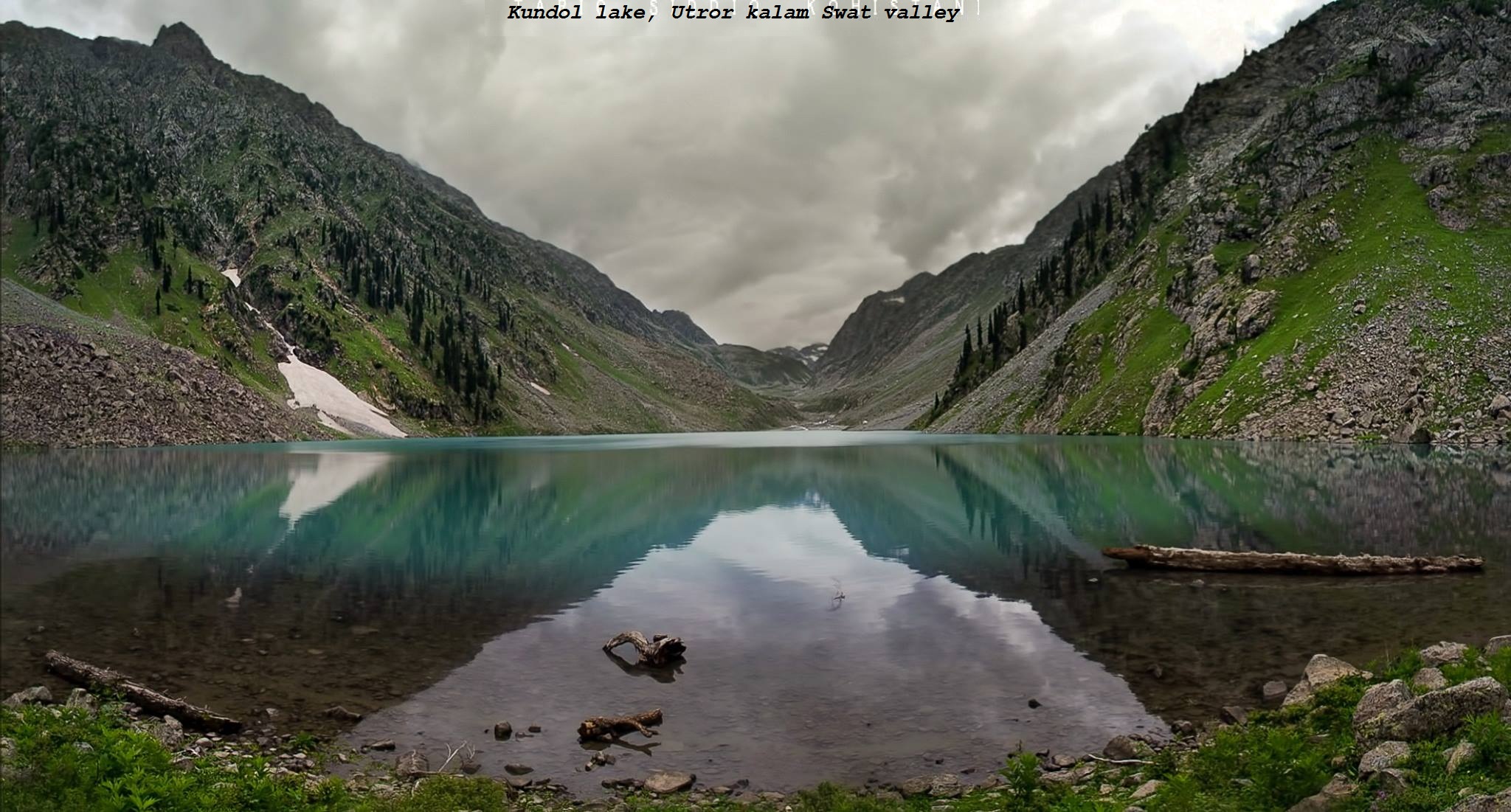
Utror, also spelt Atror, is a valley located in the Swat District of Khyber Pakhtunkhwa, Pakistan. It is surrounded by snow clad mountains, green pastures and waterfalls. The area of the valley is about . Utror is away from Kalam Valley and from Saidu Sharif. Utror is surrounded by Bhan valley on the east, Upper Dir District on the west, Kalam on the south and Gabral on the north. The altitude of the valley at Utror proper is and reaches to 2900 at Kundol Lake.Aesthetic sense of Swat, A case study of valley utror, 20000. Badogai Pass connects it to Upper Dir District. See also *Usho *Matiltan *Gabral *Mahodand Mahodand Lake ( ur, ; ps, د ماهو ډنډ - "Lake of Fishes") is a lake located in the upper Usho, Usho Valley at a distance of about from Kalam, Swat, Kalam in Swat District of Khyber Pakhtunkhwa province of Pakistan. The lake is accessible ... References {{coord, 35, 29, 30, N, 72, 28, 10, E, type:city_region:PK, display=title Tourist attractions in Sw ... [...More Info...] [...Related Items...] OR: [Wikipedia] [Google] [Baidu] |
Gabral
Gabral (also spelled Gabrāl, or Ghabral) is a village and union council in Swat District of Khyber Pakhtunkhwa province, Pakistan. It is located on the slopes of the western end of the Himalayas, at the lower end of the Gabral Valley, where the Gabral River joins the Utror River, a tributary of the Swat River. Gabral is located at an elevation of . It is about 7 km northwest (by road) from Utror, 20 km west of Kalam, and 120 km of Saidu Sharif.Gabral . Google Maps at 35.5275 N E. Accessed on 2019-03-18. The downtown area is located about 500 m north of the mouth of the Gabral River. The village consists of a few hundred houses scattered along the valley bottom, in a band 200-500 m wide, on both sides of the Gabral River, starting about 7 km north of the junction, and continuing down the Utror valley until it mer ... [...More Info...] [...Related Items...] OR: [Wikipedia] [Google] [Baidu] |
Swat Kohistan
In the United States, a SWAT team (special weapons and tactics, originally special weapons assault team) is a police tactical unit that uses specialized or military equipment and tactics. Although they were first created in the 1960s to handle riot control or violent confrontations with criminals, the number and usage of SWAT teams increased in the 1980s and 1990s during the War on Drugs and later in the aftermath of the September 11 attacks. In the United States by 2005, SWAT teams were deployed 50,000 times every year, almost 80% of the time to serve search warrants, most often for narcotics. By 2015 that number had increased to nearly 80,000 times a year. SWAT teams are increasingly equipped with military-type hardware and trained to deploy against threats of terrorism, for crowd control, hostage taking, and in situations beyond the capabilities of ordinary law enforcement, sometimes deemed "high-risk". SWAT units are often equipped with automatic and specialized fire ... [...More Info...] [...Related Items...] OR: [Wikipedia] [Google] [Baidu] |
Hill Stations In Pakistan ...
There are many hill stations in Pakistan, where there is snow in the winter. In the summer, the temperatures are much cooler than the hot areas of Punjab and Sindh. People from all over the country flock to these hill stations to enjoy the snow in winters, and to enjoy the cool summers away from the hot plains. The following is a list of hill stations: List See also * Tourism in Pakistan * Geography of Pakistan References External links Hill station in Pakistanat {{List of hill stations Hill Stations * Hill stations A hill station is a town located at a higher elevation than the nearby plain or valley. The term was used mostly in colonial Asia (particularly in India), but also in Africa (albeit rarely), for towns founded by European colonialists as refuges ... [...More Info...] [...Related Items...] OR: [Wikipedia] [Google] [Baidu] |


