|
Mat Municipality
Mat ( sq-definite, Mati, Latin: ''Mathis'') is a municipality in Dibër County, northern Albania. It was created in 2015 by the merger of the present municipalities Baz, Burrel, Derjan, Komsi, Lis, Macukull, Rukaj and Ulëz. The seat of the municipality is the town Burrel. The total population is 27,600 (2011 census), in a total area of 493.81 km2. Etymology The Albanian name ''mat'' originally meant "elevated location", "mountain place". Today's meaning in Albanian, "river bank, river shore", is a consequence of a secondary change through the common use of both the terms ''mal'', "mountain" and ''breg'', "shore", giving the meaning of "elevation". The river Mat was recorded by Roman writer Vibius Sequester (4th or 5th century AD) as ''Mathis'', following a hellenized graphic mode of the term ''mat''. It appeared in written records also as ''Mathia'' in 1380. Historical linguistic considerations suggest that Mat and the surrounding regions, including Mirdita, have been amo ... [...More Info...] [...Related Items...] OR: [Wikipedia] [Google] [Baidu] |
Socialist Party Of Albania
The Socialist Party of Albania ( sq, Partia Socialiste e Shqipërisë, PS or PSSh) is a social-democratic political party in Albania. It has been described as centre-left, to left-wing. It was founded on 13 June 1991. The PS is an associate of the Party of European Socialists and a member of the Socialist International, and holds pro-European views. History The PS' predecessor, the Party of Labour of Albania (''Partia e Punës së Shqipërisë - PPSH''), was formed in November 1941, and has been known as the Socialist Party (''Partia Socialiste - PSSH'') since 1991, when it survived in the wake of the dramatic changes that had taken place in Albania since 1989. PPSH was the Albanian Communist party under its founder and longtime leader Enver Hoxha and the only ruling party in the country since the end of World War II. Hoxha's successor Ramiz Alia was forced to introduce limited reforms in the late 1980s. On 11 December 1990, Alia announced that the PPSh had given up its monopo ... [...More Info...] [...Related Items...] OR: [Wikipedia] [Google] [Baidu] |
Vibius Sequester
Vibius Sequester (active in the 4th or 5th century AD) is the Latin author of lists of geographical names. Work ''De fluminibus, fontibus, lacubus, nemoribus, gentibus, quorum apud poëtas mentio fit'' is made up of seven alphabetical lists of geographical names mentioned by poets, especially Virgil, Ovid and Lucan. Several of the names do not appear in our copies of the poets; unless this is the result of carelessness or ignorance by the compiler, he must have had access to sources no longer extant. The lists are: # ''Flumina'' (rivers/waterways) # ''Fontes'' (springs) # ''Lacus'' (lakes) # ''Nemora'' (forests) # ''Paludes'' (marshes) # ''Montes'' (mountains) # ''Gentes'' (peoples) The work was mainly copied by Italian humanists in the second half of the 9th century. The work is best known for preserving a dactylic pentameter line quoted from Cornelius Gallus, ''uno tellures dividit amne duas'' (" Scythian Hypanis">Southern_Bug.html" ;"title="he Southern Bug">Scythian Hypa ... [...More Info...] [...Related Items...] OR: [Wikipedia] [Google] [Baidu] |
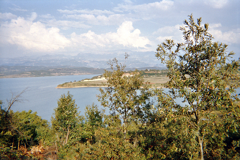
Lake Shkopeti
A lake is an area filled with water, localized in a basin, surrounded by land, and distinct from any river or other outlet that serves to feed or drain the lake. Lakes lie on land and are not part of the ocean, although, like the much larger oceans, they do form part of the Earth's water cycle. Lakes are distinct from lagoons, which are generally coastal parts of the ocean. Lakes are typically larger and deeper than ponds, which also lie on land, though there are no official or scientific definitions. Lakes can be contrasted with rivers or streams, which usually flow in a channel on land. Most lakes are fed and drained by rivers and streams. Natural lakes are generally found in mountainous areas, rift zones, and areas with ongoing glaciation. Other lakes are found in endorheic basins or along the courses of mature rivers, where a river channel has widened into a basin. Some parts of the world have many lakes formed by the chaotic drainage patterns left over from the last ice ... [...More Info...] [...Related Items...] OR: [Wikipedia] [Google] [Baidu] |
Lake Ulzë
A lake is an area filled with water, localized in a basin, surrounded by land, and distinct from any river or other outlet that serves to feed or drain the lake. Lakes lie on land and are not part of the ocean, although, like the much larger oceans, they do form part of the Earth's water cycle. Lakes are distinct from lagoons, which are generally coastal parts of the ocean. Lakes are typically larger and deeper than ponds, which also lie on land, though there are no official or scientific definitions. Lakes can be contrasted with rivers or streams, which usually flow in a channel on land. Most lakes are fed and drained by rivers and streams. Natural lakes are generally found in mountainous areas, rift zones, and areas with ongoing glaciation. Other lakes are found in endorheic basins or along the courses of mature rivers, where a river channel has widened into a basin. Some parts of the world have many lakes formed by the chaotic drainage patterns left over from the last ice ... [...More Info...] [...Related Items...] OR: [Wikipedia] [Google] [Baidu] |
Peshkopi
Peshkopi ( sq-definite, Peshkopia, Latin: ''Penestae'') is a town in Dibër County, northeastern Albania. At the 2015 local government reform it became a subdivision of the municipality Dibër. The population at the 2011 census was 13,251.2011 census results The town is located away from , the capital of , and from Macedonian border, and it sits above sea level. It is the capital of both the county ( sq, qark) and district ( sq, rreth) of Dibër. It is the only county capital in Albania that does not ... [...More Info...] [...Related Items...] OR: [Wikipedia] [Google] [Baidu] |
Milot, Kurbin
Milot is a town and a former municipality in the Lezhë County of northwestern Albania. At the 2015 local government reform it became a subdivision of the municipality Kurbin. The population at the 2011 census was 8,461.2011 census results The municipal unit of Milot is composed of the town Milot and 14 villages, including Fushë Milot, Mal i Bardhë, Vinjoll, Shkopet, Ferr-Shkopet and Skuraj. The town stands on the southern bank of the . Nearby is the well-known Zogu Bridge named after the leader |
National Road 6 (Albania)
The National Road 6 ( sq, Rruga shtetërore SH6) leads from Milot to Peshkopi. The SH6 breaks off from National Road 1 at Milot and travels through Burrel, Klos and Bulqizë to Peshkopi. The first section, between Milot and Klos, follows the Mat river valley, initially in a narrow cutting through the Skanderbeg range. North of Burrel in the hilly terrain of Mat it often travels far from the river. From Klos, the SH6 rises around 550 metres to the Bualli Pass at 842 metres above sea level. East of this, it follows the Bulqizë valley to the Drin river, which it crosses at a narrow point. At Maqellarë, there is a junction with the road to Debar in North Macedonia. There is a new by-pass at Maqellarë. From here the SH6 travels north to Peshkopi, travelling through hilly terrain far from the river once more. The first few kilometres of this road have been renovated recently. Arbër Highway Between Bulqizë and the Drin, the SH6 has been expanded into a broader, two-lane ... [...More Info...] [...Related Items...] OR: [Wikipedia] [Google] [Baidu] |
Klos, Dibër
Klos ( sq-definite, Klosi) is a town and a municipality in Mat District, northern center Albania. It was formed at the 2015 local government reform by the merger of the former municipalities Gurrë, Klos, Suç and Xibër, that became municipal units. The seat of the municipality is the town Klos. The total population is 16,618 (2011 census), in a total area of 357.72 km2. The population of the former municipality at the 2011 census was 7,873. Klos lies 28.5 kilometers (17¾ mi) 'as the crow flies' from Tirana and 14 kilometers (9 mi) from Burrel. Demographic history Klos (''Kilos'') is recorded in the Ottoman ''defter'' of 1467 as a '' hass-ı mir-liva'' and '' derbendci'' settlement in the vilayet of Mati. The village had a total of eight households represented by the following household heads: ''Kozma Kimiza'', ''Progon Shargjini'', ''Martin Doroza'', ''Gjin Doroza'', ''Dula Cukali'', ''Margjin Prifti'', ''Ilia Kimiza'', and ''Kola Kimiza''. Economy The land is ... [...More Info...] [...Related Items...] OR: [Wikipedia] [Google] [Baidu] |
Mat District
Mat District () was one of the 36 districts of Albania, which were dissolved in July 2000 and replaced by 12 newly created counties. It had a population of 61,906 in 2001, and an area of . It was named after the river Mat, which flows through the district. Its capital was the town of Burrel. Its territory is now part of Dibër County: the municipalities of Mat and Klos. Administrative divisions The district consisted of the following municipalities: * Baz *Burrel * Derjan * Gurrë *Klos * Komsi * Lis *Macukull * Rukaj * Suç * Ulëz *Xibër History In ancient times here lived a illyrian tribe named Pirustae. They were famous for their bravery and they proved this in their wars against the Roman Empire together with the Kingdom of Dardania. Mat is believed to be one of the oldest Albanian settlements, probably as old as the 2nd-5th century AD, and historical linguistic studies together with archeological evidence proves that. Some of the oldest settlements in the rive ... [...More Info...] [...Related Items...] OR: [Wikipedia] [Google] [Baidu] |
Origin Of The Albanians
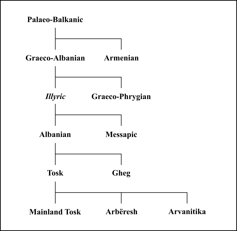
The origin of the Albanians has been the subject of historical, linguistic, archaeological and genetic studies. Albanians continuously first appear in the historical record in Byzantine sources of the 11th century. At this point, they were already fully Christianized. Albanian forms a separate branch of Indo-European, first attested in the 15th century, having evolved from one of the Paleo-Balkan languages of antiquity. The surviving pre-Christian Albanian culture shows that Albanian mythology and folklore are of Paleo-Balkanic origin and that almost all of their elements are pagan. Albanians have Paleo-Balkan origin. Theories which specifically they vary between attributing this origin to Illyrians, Thracians, Dacians, or another Paleo-Balkan people whose language was unattested; among those who support an Illyrian origin, there is a distinction between the theory of continuity from Illyrian times, and those proposing an in-migration of a different Illyrian population. T ... [...More Info...] [...Related Items...] OR: [Wikipedia] [Google] [Baidu] |
Albanians
The Albanians (; sq, Shqiptarët ) are an ethnic group and nation native to the Balkan Peninsula who share a common Albanian ancestry, culture, history and language. They primarily live in Albania, Kosovo, North Macedonia, Montenegro, Serbia as well as in Croatia, Greece, Italy and Turkey. They also constitute a large diaspora with several communities established across Europe, the Americas and Oceania. Albanians have Paleo-Balkanic origins. Exclusively attributing these origins to the Illyrians, Thracians or other Paleo-Balkan people is still a matter of debate among historians and ethnologists. The first certain reference to Albanians as an ethnic group comes from 11th century chronicler Michael Attaleiates who describes them as living in the theme of Dyrrhachium. The Shkumbin River roughly demarcates the Albanian language between Gheg and Tosk dialects. Christianity in Albania was under the jurisdiction of the Bishop of Rome until the 8th century AD. Then, dioceses ... [...More Info...] [...Related Items...] OR: [Wikipedia] [Google] [Baidu] |


_2020.jpg)

