|
Massachusetts Route 117
Route 117 is a east–west state highway in Massachusetts, running from Route 12 in Leominster in northeast Worcester County to U.S. Route 20 (US 20) in Waltham in central Middlesex County. Route description Route 117 begins in the city of Leominster, near the city center, and passes southeast along Lancaster Street before having an interchange with Interstate 190's Exit 7, just over the city line into Lancaster. In Lancaster the route heads eastward, crossing two branches of the Nashua River while having a short, quarter-mile concurrency with Route 70 south of Fort Devens. The route then crosses into Bolton, crossing Route 110 near the Bolton Flats State Wildlife Management Area. It then passes through the center of town before crossing I-495 at Exit 27. It serves as the northern terminus of Route 85 before crossing into Middlesex County and the town of Stow. In Stow, the route passes through the countryside before meeting Route 62 at the center of town. The two ro ... [...More Info...] [...Related Items...] OR: [Wikipedia] [Google] [Baidu] |
Massachusetts Department Of Transportation
The Massachusetts Department of Transportation (MassDOT) oversees roads, public transit, aeronautics, and transportation licensing and registration in the US state of Massachusetts. It was created on November 1, 2009, by the 186th Session of the Massachusetts General Court upon enactment of the ''2009 Transportation Reform Act.'' History In 2009, Governor Deval Patrick proposed merging all Massachusetts transportation agencies into a single Department of Transportation. Legislation consolidating all of Massachusetts' transportation agencies into one organization was signed into law on June 26, 2009. The newly established Massachusetts Department of Transportation (MASSDOT) assumed operations from the existing conglomeration of state transportation agencies on November 1, 2009. This change included: * Creating the Highway Division from the former Massachusetts Turnpike Authority and Massachusetts Highway Department, MassHighways. * Assuming responsibility for the planning and ... [...More Info...] [...Related Items...] OR: [Wikipedia] [Google] [Baidu] |
Massachusetts Route 110
Route 110 is a southwest–northeast state route in the U.S. state of Massachusetts. Route 110’s western terminus is at a concurrency of Route 12 and Route 140 in West Boylston, and its eastern terminus is at the junction of U.S. 1 and Route 1A in Sailsbury, a few miles from the Atlantic Ocean. Route 110 provides an alternate route for the northern part (section after Route 2) of I-495. Route description Route 110 begins at Route 12 in West Boylston, just north of the Wachusett Reservoir and the border with Worcester. The route follows north of the reservoir, passing through Sterling before entering Clinton. In Clinton, Route 110 shares a quarter-mile concurrency with Route 62 and Route 70 before heading northward, crossing the Nashua River and passing through Lancaster. The route continues into Bolton, crossing Route 117 and passing the Bolton Flats before entering the town of Harvard. Route 110 continues through the village of Still River, wrapping around B ... [...More Info...] [...Related Items...] OR: [Wikipedia] [Google] [Baidu] |
Weston, Massachusetts
Weston is a town in Middlesex County, Massachusetts, Middlesex County, Massachusetts, about 15 miles west of Boston. At the time of the 2020 United States Census, the population of Weston was 11,851. Weston was incorporated in 1713, and protection of the town's historic resources is driven by the Weston Historical Commission and Weston Historical Society. The town has one Local Historic District, 10 National Register Districts, 26 Historic Areas, and seven houses individually listed on the National Register of Historic Places. Weston's predominance as a residential community is reflected in its population density, which is among the lowest of Boston's suburbs near or within Massachusetts Route 128, Route 128. More than 2,000 acres, or 18 percent of the town's total acreage, have been preserved as parks, fields, wetlands, and forests, with 90 miles of trails for hiking, horseback riding, and cross-country skiing. Thirty-seven scenic roads, as defined by Massachusetts law, maintain ... [...More Info...] [...Related Items...] OR: [Wikipedia] [Google] [Baidu] |
Lincoln (MBTA Station)
Lincoln station is an MBTA Commuter Rail in Lincoln, Massachusetts. It serves the Fitchburg Line, and is located on Lincoln Road. There has been continuous commuter service to Lincoln since the station stop was established before 1850. A station building formerly stood on the outbound side; it was demolished by 1962. Station layout Lincoln has an unusual configuration, largely unique on the system (though similar to Waltham). The station has two side platforms A side platform (also known as a marginal platform or a single-face platform) is a platform positioned to the side of one or more railway tracks or guideways at a railway station, tram stop, or transitway. A station having dual side platforms ..., both adjacent to the outbound track but on opposite sides of the Lincoln Road grade crossing. Outbound trains stop at the north platform, while inbound trains stop opposite the south platform and passengers use two asphalt crossings to board. The configuration was made to ... [...More Info...] [...Related Items...] OR: [Wikipedia] [Google] [Baidu] |
Fitchburg Line
The Fitchburg Line is a branch of the MBTA Commuter Rail system which runs from Boston's North Station to Wachusett station in Fitchburg, Massachusetts. The line is along the tracks of the former Fitchburg Railroad, which was built across northern Massachusetts, United States, in the 1840s. Winter weekend service includes a specially equipped seasonal "ski train" to Wachusett Mountain . At long, the Fitchburg Line is the second-longest line in the system (and was the longest until the Providence/Stoughton Line's 2010 extension to T. F. Green Airport and later to Wickford Junction), and ranked as one of the worst lines in terms of on-time performance. The Fitchburg Line had the oldest infrastructure in the system, and commuter trains must share trackage with freight trains on the outer segment of the line. A $150 million project completed in 2017 included adding nine miles of double track, an extension to Wachusett, rebuilding two stations, and building a new layover yard. Only ... [...More Info...] [...Related Items...] OR: [Wikipedia] [Google] [Baidu] |
Massachusetts Route 126
Route 126 is a north–south state highway in Massachusetts. Its southern terminus is a continuation of Rhode Island Route 126 by Woonsocket, Rhode Island and its northern terminus is at Route 2 and Route 2A in Concord. Along the way it intersects several major routes including Interstate 495 (I-495) in Bellingham, Route 9 in Framingham, and U.S. Route 20 (US 20) in Wayland. Route description Route 126 begins at the Rhode Island state line, continuing into Woonsocket as Rhode Island Route 126. After a short stretch in the town of Blackstone and Worcester County, Route 126 enters the town of Bellingham and Norfolk County, heading north. In Bellingham, Route 126 has a short concurrency with Route 140 at the center of town. In the north of the town, the route turns east on Hartford Avenue, crossing I-495 at Exit 18. Shortly after entering the town of Medway, the route turns north again, crossing Route 109 shortly after that. Route 126 then enters Holliston, i ... [...More Info...] [...Related Items...] OR: [Wikipedia] [Google] [Baidu] |
Sudbury River
The Sudbury River is a tributary of the Concord River in Middlesex County, Massachusetts, in the United States.U.S. Geological Survey. National Hydrography Dataset high-resolution flowline dataThe National Map accessed October 3, 2011 Originating in the Cedar Swamp in Westborough, Massachusetts, near the boundary with Hopkinton, the Sudbury River meanders generally northeast, through Fairhaven Bay, and to its confluence with the Assabet River at Egg Rock in Concord, Massachusetts, to form the Concord River. It has a drainage area. A 1775 map identifies the river by this name as passing through the town of Sudbury, itself established 1639. On April 9, 1999, nearly of the river were "recognized for their outstanding ecology, history, scenery, recreation values, and place in American literature," by being designated as a part of the National Wild and Scenic Rivers System. The segment of the Sudbury River beginning at the Danforth Street Bridge in the town of Framingham, downs ... [...More Info...] [...Related Items...] OR: [Wikipedia] [Google] [Baidu] |
Concord, Massachusetts
Concord () is a town in Middlesex County, Massachusetts, in the United States. At the 2020 census, the town population was 18,491. The United States Census Bureau considers Concord part of Greater Boston. The town center is near where the confluence of the Sudbury and Assabet rivers forms the Concord River. The area that became the town of Concord was originally known as Musketaquid, an Algonquian word for "grassy plain." Concord was established in 1635 by a group of English settlers; by 1775, the population had grown to 1,400. As dissension between colonists in North America and the British crown intensified, 700 troops were sent to confiscate militia ordnance stored at Concord on April 19, 1775.Chidsey, p. 6. This is the total size of Smith's force. The ensuing conflict, the battles of Lexington and Concord, were the incidents (including the shot heard round the world) that triggered the American Revolutionary War. A rich literary community developed in Concord during the ... [...More Info...] [...Related Items...] OR: [Wikipedia] [Google] [Baidu] |
Sudbury, Massachusetts
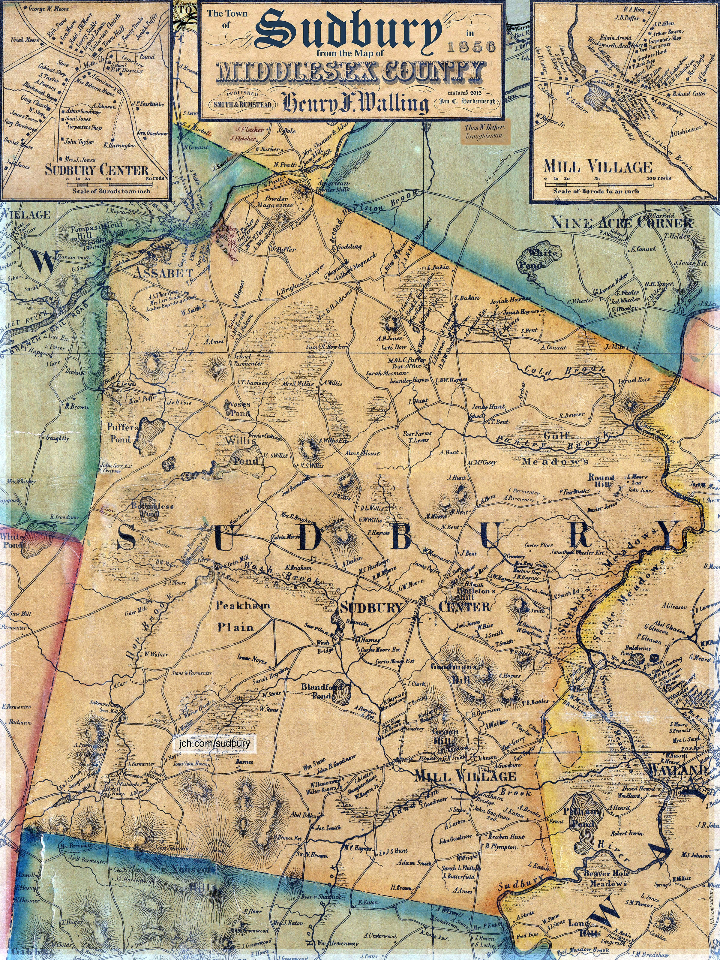
Sudbury is a town in Middlesex County, Massachusetts, United States. At the 2020 census, it had a population of 18,934. The town, located in Greater Boston's MetroWest region, has a rich colonial history. History Incorporated in 1639, the boundaries of Sudbury included (by 1653) what is now Wayland (which split off in 1780, initially as East Sudbury), and parts of present day Framingham, Marlborough, Stow and Maynard (the latter town splitting off in 1871). Nipmuc Indians lived in what is now Sudbury, including Tantamous, a medicine man, and his son Peter Jethro, who deeded a large parcel of land to Sudbury for settlement in 1684.Gutteridge, William H. (1921)''A Brief History of the Town of Maynard, Massachusetts'' Maynard, MA: Town of Maynard, p. 13-16 The original town center and meetinghouse were located near the Sudbury River at what is now known as Wayland's North Cemetery. For the residents on the west side of the river, it was a treacherous passage in the winter and ... [...More Info...] [...Related Items...] OR: [Wikipedia] [Google] [Baidu] |
Massachusetts Route 27
Route 27 is a south–north state highway in eastern Massachusetts. Its southern terminus is at Route 106 in Kingston and its northern terminus is at Route 4 in Chelmsford. Along the way it intersects several major highways including Route 24 in Brockton, U.S. Route 1 (US 1) in Walpole, Route 9 in Natick, US 20 in Wayland, and Route 2 in Acton. Route description Route 27 runs in a sweeping arc from Kingston to Chelmsford. For most of its route, it acts as an intermediate route between Interstate 95 and Interstate 495. Route 27 begins in Kingston at Route 106, approximately 1-1/4 miles west of Route 3. It heads northwest towards Brockton, passing through Pembroke, Hanson, East Bridgewater and Whitman. In Brockton the road shares a triple concurrency with Route 28 and Route 123 Eastbound (Route 123 Westbound only intersects with the route). From the center of town, Route 27 heads northwest, past the Westgate Mall, over Route 24 at Exits 33A-B (formerl ... [...More Info...] [...Related Items...] OR: [Wikipedia] [Google] [Baidu] |
Assabet River
The Assabet River is a small, long river located about west of Boston, Massachusetts, United States.U.S. Geological Survey. National Hydrography Dataset high-resolution flowline dataThe National Map, accessed October 3, 2011 The Assabet rises from a swampy area known as the Assabet Reservoir in Westborough, Massachusetts, and flows northeast before merging with the Sudbury River at Egg Rock in Concord, Massachusetts, to become the Concord River. ThOrganization for the Assabet, Sudbury and Concord Rivers (OARS) headquartered in West Concord, Massachusetts, is a non-profit organization dedicated to the preservation, protection, and enhancement of the natural and recreational features of these three rivers and their watershed. As the Concord River is a tributary of the Merrimack River, it and the Assabet and Sudbury rivers are part of the larger Merrimack River watershed. Etymology The indigenous people of this region first named the Assabet River, though the original meaning of ... [...More Info...] [...Related Items...] OR: [Wikipedia] [Google] [Baidu] |
Massachusetts Route 62
Route 62 is an east–west state route in Massachusetts. The route crosses four of the Bay State's 13 interstates (I-190, I-495, I-93, and I-95), as well as U.S. Route 1 (US 1), US 3, Route 2 and Highway 128 as it heads from the northern hills of Worcester County through the northern portions of Greater Boston, ending in the North Shore city of Beverly at Route 127. Route description Route 62 begins in Barre, in the north central hills of Worcester County, at Routes 32 and 122, at the town's commons and center. It heads northeastward into the town of Hubbardston, intersecting Route 68 before heading into Princeton. In Princeton, Route 62 has a short concurrency with Route 31. It then crosses into Sterling, intersecting with Route 140 and passing underneath Interstate 190 without interchange, before passing through the town's center concurrently with Route 12. From Sterling, Route 62 passes through the southern end of the town of Lancaster before entering Cl ... [...More Info...] [...Related Items...] OR: [Wikipedia] [Google] [Baidu] |


_map.jpg)


