|
Marys River (Oregon)
Marys River is a tributary of the Willamette River in the U.S. state of Oregon. From its source at the confluence of its east and west forks near Summit, it flows generally southeast from the Central Oregon Coast Range to Corvallis. Name The origin of the name is uncertain, although it was used as early as 1846. Lewis A. and Lewis L. McArthur, in the seventh edition of ''Oregon Geographic Names'' find no support for the suggestion that employees of the Hudson's Bay Company had earlier named the stream St. Marys River. Rather, they summarize two stories about the origin. One is that Adam E. Wimple, an early settler, named the stream for his sister. Wimple was hanged at Dallas, Oregon, in 1852 for murdering his wife, also named Mary. The other story is that Wayman St. Clair, who represented Benton County in the territorial legislature in the early 1850s, named the river for Mary Lloyd. She was said to have been the first white woman to cross the river.McArthur, pp. 614–15 In 1 ... [...More Info...] [...Related Items...] OR: [Wikipedia] [Google] [Baidu] |
United States
The United States of America (U.S.A. or USA), commonly known as the United States (U.S. or US) or America, is a country primarily located in North America. It consists of 50 states, a federal district, five major unincorporated territories, nine Minor Outlying Islands, and 326 Indian reservations. The United States is also in free association with three Pacific Island sovereign states: the Federated States of Micronesia, the Marshall Islands, and the Republic of Palau. It is the world's third-largest country by both land and total area. It shares land borders with Canada to its north and with Mexico to its south and has maritime borders with the Bahamas, Cuba, Russia, and other nations. With a population of over 333 million, it is the most populous country in the Americas and the third most populous in the world. The national capital of the United States is Washington, D.C. and its most populous city and principal financial center is New York City. Paleo-Americ ... [...More Info...] [...Related Items...] OR: [Wikipedia] [Google] [Baidu] |
Marys Peak
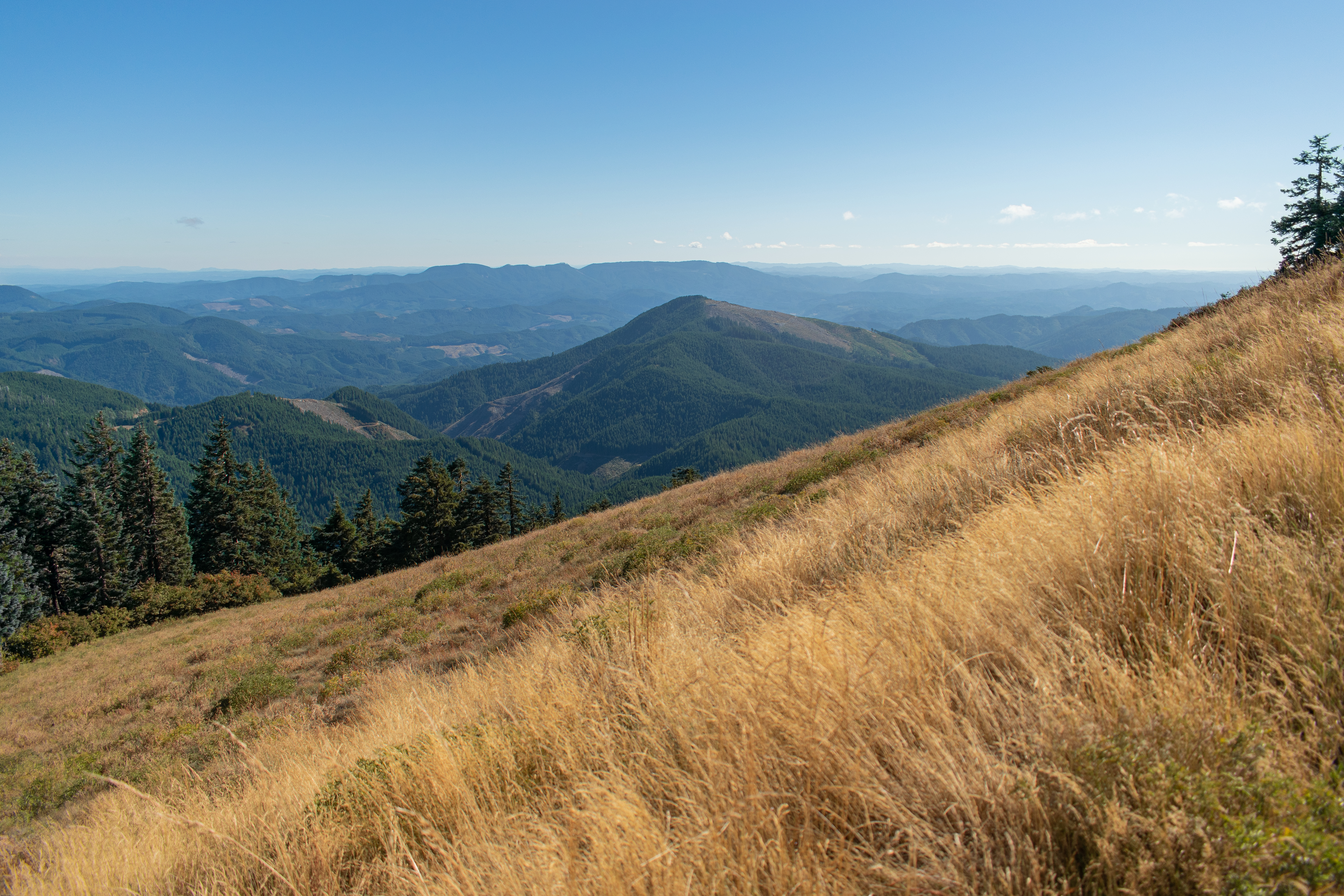
Marys Peak (formerly Mary's Peak and sometimes still spelled this way) is a mountain in Benton County, Oregon, United States, just southwest of Philomath. According to the Benton County Historical Society, the native Kalapuya called the peak tcha Timanwi, or 'place of spiritual power. It is the highest peak in the Oregon Coast Range. It is also the highest point in Benton County, and ranks eleventh in the state for prominence. The current name, given by settlers of European ancestry, may have been inspired by Mary Lloyd, who came to Oregon in 1845, and was known as the first white woman to cross the Marys River, which has its origin on the mountain, though there are alternate theories about the name. On a clear day at the top of the peak, facing east, northeast, and southeast, one can see the cities and suburbs of the Willamette Valley, as well as the Cascade Range. To the west, the Pacific Ocean is visible on clear days. The road to the peak now remains open in the winter. D ... [...More Info...] [...Related Items...] OR: [Wikipedia] [Google] [Baidu] |
Stream Gauge
A stream gauge, streamgage or stream gauging station is a location used by hydrologists or environmental scientists to monitor and test terrestrial bodies of water. Hydrometric measurements of water level surface elevation ("stage") and/or volumetric discharge (flow) are generally taken and observations of biota and water quality may also be made. The locations of gauging stations are often found on topographical maps. Some gauging stations are highly automated and may include telemetry capability transmitted to a central data logging facility. Measurement equipment Automated direct measurement of streamflow discharge is difficult at present. In place of the direct measurement of streamflow discharge, one or more surrogate measurements can be used to produce discharge values. In the majority of cases, a stage (the elevation of the water surface) measurement is used as the surrogate. Low gradient (or shallow-sloped) streams are highly influenced by variable downstream c ... [...More Info...] [...Related Items...] OR: [Wikipedia] [Google] [Baidu] |
United States Geological Survey
The United States Geological Survey (USGS), formerly simply known as the Geological Survey, is a scientific agency of the United States government. The scientists of the USGS study the landscape of the United States, its natural resources, and the natural hazards that threaten it. The organization's work spans the disciplines of biology, geography, geology, and hydrology. The USGS is a fact-finding research organization with no regulatory responsibility. The agency was founded on March 3, 1879. The USGS is a bureau of the United States Department of the Interior; it is that department's sole scientific agency. The USGS employs approximately 8,670 people and is headquartered in Reston, Virginia. The USGS also has major offices near Lakewood, Colorado, at the Denver Federal Center, and Menlo Park, California. The current motto of the USGS, in use since August 1997, is "science for a changing world". The agency's previous slogan, adopted on the occasion of its hundredt ... [...More Info...] [...Related Items...] OR: [Wikipedia] [Google] [Baidu] |
Flynn, Oregon
Flynn is an unincorporated community in Benton County, Oregon, United States. Flynn is located on U.S. Route 20 at its interchange with Oregon Route 34, just west of Philomath A philomath () is a lover of learning and studying. The term is from Greek (; "beloved", "loving", as in philosophy or philanthropy) and , (, ; "to learn", as in polymath). Philomathy is similar to, but distinguished from, philosophy in that ' ..., near the Marys River. Mass media *'' Philomath Bulletin'', weekly newspaper References Unincorporated communities in Benton County, Oregon Unincorporated communities in Oregon {{BentonCountyOR-geo-stub ... [...More Info...] [...Related Items...] OR: [Wikipedia] [Google] [Baidu] |
Oregon Route 34
Oregon Route 34 is a state highway in the U.S. state of Oregon that runs between the city of Waldport on the Oregon Coast and the city of Lebanon in the western part of the state. OR 34 traverses the Alsea Highway No. 27 from Waldport to Flynn, part of the Corvallis–Newport Highway No. 33 from Flynn to east of Corvallis, and the Corvallis–Lebanon Highway No. 210 from east of Corvallis to Lebanon, of the Oregon state highway system. In Corvallis, OR 34 includes a brief concurrency with U.S. Route 20 and OR 99W over the Pacific Highway West No. 1W. Route description Oregon Route 34 begins (at its western terminus) at its junction with U.S. Route 101 in Waldport. It follows the Alsea River through Tidewater to the community of Alsea, where it heads northeast to its junction with U.S. Route 20 near Philomath. OR 34 and US 20 share the same roadway between Philomath and the college town of Corvallis. At a grade-separated interchange in eastern Corvallis, ... [...More Info...] [...Related Items...] OR: [Wikipedia] [Google] [Baidu] |
Oregon Route 223
Oregon Route 223 is a state highway in the U.S. State of Oregon, which runs between the town of Wren, Oregon and the city of Dallas, Oregon. It is known as the Kings Valley Highway No. 191 (see Oregon highways and routes) and is long. It lies in Benton and Polk counties. Route description OR 223 begins at an intersection with U.S. Route 20 in Wren northwest of Philomath. It continues north from there, through the western edge of the Willamette Valley. In the town of Bridgeport, it intersects with OR 194. The only major city on the route is Dallas, Oregon; north of Dallas, it ends at an intersection with OR 22. Covered bridge The Ritner Creek Bridge was the last covered bridge on a state highway in Oregon. It was on OR 223 between Pedee and Kings Valley, about 15 miles south of Dallas, or 10 miles north of the junction with US 20 in Wren. Built in 1927, the bridge was replaced in 1976 and relocated just downstream and parallel to the new span. Major intersections ... [...More Info...] [...Related Items...] OR: [Wikipedia] [Google] [Baidu] |
Wren, Oregon
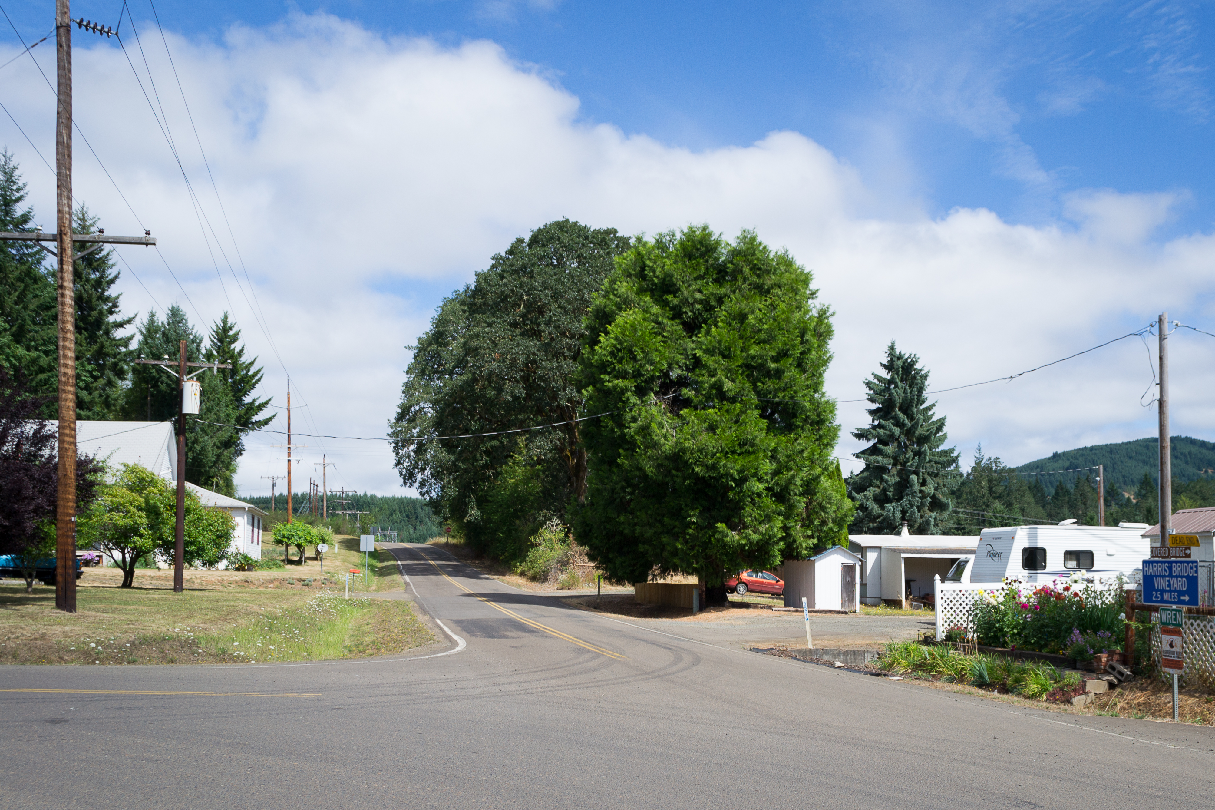
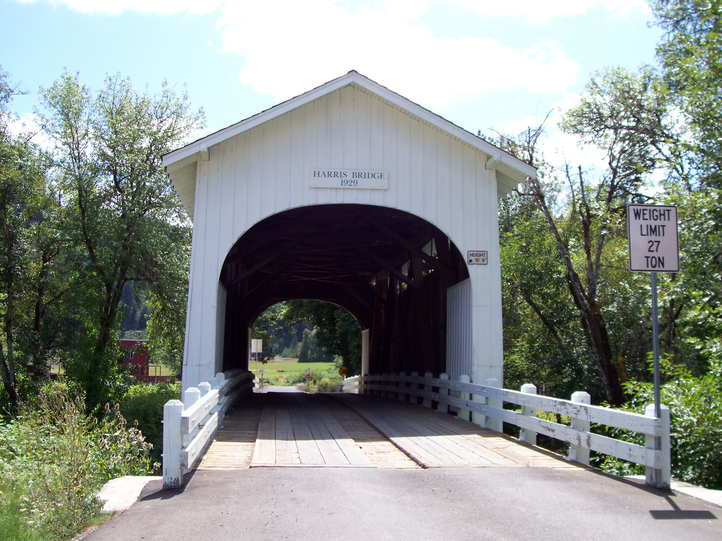
Wren is an unincorporated community in Benton County, Oregon, United States. It is located at the junction of U.S. Route 20 and Oregon Route 223 Oregon Route 223 is a state highway in the U.S. State of Oregon, which runs between the town of Wren, Oregon and the city of Dallas, Oregon. It is known as the Kings Valley Highway No. 191 (see Oregon highways and routes) and is long. It lie ... on the Marys River. Wren was named for George P. Wren, who settled in the area. The first form of the name was "Wrens", used for a station established by the Oregon Pacific Railroad in the locality in 1886. Wren had a post office from 1887 to 1968. See also * Harris Bridge (Wren, Oregon) References External links Historic photos of Wren from Salem Public Library 1886 establishments in Oregon Populated places established in 1886 Unincorporated communities in Benton County, Oregon Unincorporated communities in Oregon {{BentonCountyOR-geo-stub ... [...More Info...] [...Related Items...] OR: [Wikipedia] [Google] [Baidu] |
Harris, Oregon
Harris is an unincorporated community in Benton County, Oregon, United States. Harris lies on U.S. Route 20 U.S. Route 20 or U.S. Highway 20 (US 20) is an east–west United States Numbered Highway that stretches from the Pacific Northwest east to New England. The "0" in its route number indicates that US 20 is a major coast-to-coast route. S ... just south of its interchange with Oregon Route 223 in Wren. Unincorporated communities in Benton County, Oregon Unincorporated communities in Oregon {{BentonCountyOR-geo-stub ... [...More Info...] [...Related Items...] OR: [Wikipedia] [Google] [Baidu] |
Tumtum River
The Tumtum River is a tributary of the Marys River in Benton and Lincoln counties in the U.S. state of Oregon. The river rises in the Central Oregon Coast Range west of Burnt Woods and passes through the communities of Burnt Woods and Blodgett. It then drains into the Marys River north of Alder. The name ''Tumtum'' is a Chinook Jargon word for "heart", and the river was so-named because it was considered to be the heart of the valley through which it flowed. When the Burnt Woods post office was to be named, one of the names proposed to the Post Office Department The United States Post Office Department (USPOD; also known as the Post Office or U.S. Mail) was the predecessor of the United States Postal Service, in the form of a Cabinet department, officially from 1872 to 1971. It was headed by the postmas ... was Tumtum. References Rivers of Oregon Chinook Jargon place names Rivers of Benton County, Oregon Rivers of Lincoln County, Oregon {{Oregon-river-st ... [...More Info...] [...Related Items...] OR: [Wikipedia] [Google] [Baidu] |
Blodgett, Oregon
Blodgett is a census-designated place (CDP) and unincorporated community in Benton County, Oregon, United States, where Oregon Route 180 meets U.S. Route 20 in the Central Oregon Coast Range west of Corvallis. It is near the confluence of the Tumtum and Marys rivers. As of the 2010 census, the community had a population of 58. Blodgett was named for pioneer settler William Blodgett. The post office was established in April 1888 with the name "Emrick", for a local family, and was changed to Blodgett shortly thereafter. Its ZIP code is 97326. Blodgett is part of the Philomath School District. The 38-student Blodgett Elementary School serves kindergarten through fourth grade; older students attend schools in nearby Philomath. Demographics Climate This region experiences warm (but not hot) and dry summers, with no average monthly temperatures above . According to the Köppen Climate Classification system, Blodgett has a warm-summer Mediterranean climate A Mediterranea ... [...More Info...] [...Related Items...] OR: [Wikipedia] [Google] [Baidu] |
Oregon Route 180
Oregon Route 180 is an Oregon state highway running from the community of Eddyville to U.S. Route 20 in Blodgett. OR 180 is known as the Eddyville-Blodgett Highway No. 180 (see Oregon highways and routes). It is long and runs west–east. OR 180 was established in 2002 as part of Oregon's project to assign route numbers to highways that previously were not assigned, and, as of September 2019, was unsigned. Route description OR 180 begins at an intersection with Crystal Creek Loop (formerly US 20) in Eddyville. It heads east through Nortons, Nashville, and Summit to an intersection with US 20 in Blodgett, where it ends. History OR 180 was assigned to the undesignated part of the Eddyville-Blodgett Highway in 2002. Major intersections {{Jctbtm Related routes * U.S. Route 20 References * Oregon Department of Transportation, Descriptions of US and Oregon Routes, https://web.archive.org/web/20051102084300/http://www.oregon.gov/ODOT/HWY/TRAFFIC/TEOS_Publi ... [...More Info...] [...Related Items...] OR: [Wikipedia] [Google] [Baidu] |


