|
Market Cross
A market cross, or in Scots, a mercat cross, is a structure used to mark a market square in market towns, where historically the right to hold a regular market or fair was granted by the monarch, a bishop or a baron. History Market crosses were originally from the distinctive tradition in Early Medieval Insular art of free-standing stone standing or high crosses, often elaborately carved, which goes back to the 7th century. Market crosses can be found in many market towns in Britain. British emigrants often installed such crosses in their new cities, and several can be found in Canada and Australia. The market cross could be representing the official site for a medieval town or village market, granted by a charter, or it could have once represented a traditional religious marking at a crossroads. Design These structures range from carved stone spires, obelisks or crosses, common to small market towns such as that in Stalbridge, Dorset, to large, ornate covered structur ... [...More Info...] [...Related Items...] OR: [Wikipedia] [Google] [Baidu] |
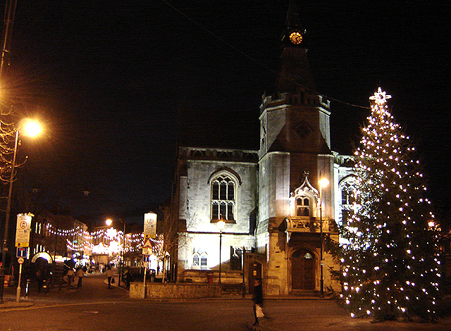
Malmesbury Market Cross
Malmesbury Market Cross is a Grade I listed, late 15th century structure in the town of Malmesbury, Wiltshire, England. __NOTOC__ Description The market cross stands in the centre of the town, at the north end of the High Street. It was built c.1490, possibly using limestone salvaged from the recently ruined part of Malmesbury Abbey, which then began just across the market square from the cross. An elaborately carved octagonal structure of the Perpendicular Period, it is recognised as one of the best preserved of its kind in England, and was made a Grade I listed building in 1949. A carving in relief of the Crucifixion and figures of several saints have survived the Reformation on the open lantern, although the lower niches for figures are now empty. Inside there is a lierne vaulted roof with carved bosses, springing from a central column with stone seating around it. There is a low wall or bench across all the outside arches except two. The building is over 40 ft. high, ... [...More Info...] [...Related Items...] OR: [Wikipedia] [Google] [Baidu] |
Malmesbury
Malmesbury () is a town and civil parish in north Wiltshire, England, which lies approximately west of Swindon, northeast of Bristol, and north of Chippenham. The older part of the town is on a hilltop which is almost surrounded by the upper waters of the Bristol Avon and one of its tributaries. Once the site of an Iron Age fort, in the early medieval period Malmesbury became the site Malmesbury Abbey, a monastery famed for its learning. It was later home to one of Alfred the Great's fortified burhs for defence against the Vikings. Æthelstan, the first king of all England, was buried in Malmesbury Abbey when he died in 939. As a market town, it became prominent in the Middle Ages as a centre for learning, focused on and around the abbey. In modern times, Malmesbury is best known for its abbey, the bulk of which forms a rare survival of the dissolution of the monasteries. The economy benefits mostly from agriculture, as well as tourism to the Cotswolds, and a Dyson facil ... [...More Info...] [...Related Items...] OR: [Wikipedia] [Google] [Baidu] |
Aberford
Aberford is a village and civil parish on the eastern outskirts of the City of Leeds metropolitan borough in West Yorkshire, England. It had a population of 1,059 at the 2001 census, increasing to 1,180 at the 2011 Census. It is situated east, north east of Leeds city centre in the LS25 Leeds postcode area. Etymology The name 'Aberford' comes from the Old English woman's name ''Ēadburg'' and ''ford'', which, then as now, meant 'ford'. The name meant 'Eadburg's ford'. This suggests the settlement's once-strategic importance. The name was recorded as ''Ædburford'' in 1176 and ''Ædburgford'' in 1177, ''Ebberford'' in the 13th century and ''Aberford'' from 1208. History Aberford was where the ancient Great North Road crossed over the Cock River (now reduced in volume as the Cock Beck). Aberford was the midway point between London and Edinburgh, being around distant from each city until the construction of the A1(M) motorway bypass starting at Hook Moor. On the north side ... [...More Info...] [...Related Items...] OR: [Wikipedia] [Google] [Baidu] |
Barrow Upon Humber
Barrow upon Humber is a village and civil parish in North Lincolnshire, England. The population (including Barrow Hann) at the 2011 census was 3,022. The village is situated near the Humber, about east from Barton-upon-Humber. The small port of Barrow Haven, north, on the railway line from Cleethorpes and Grimsby to Barton-upon-Humber handles timber from Latvia and Estonia. History Barrow contains the site of a late Anglo-Saxon monastery, which has been fully excavated. The location is now built over, but is marked by a plaque in the village. King Wulfhere gave land to Caedda (Saint Chad) in the 7th century at ''Ad Barvae'' (at the wood). It was on this site that the monastery was developed. The street adjacent to the monastery site is still known as St. Chad. A windmill, known as Rigg's Mill, was located on the western side of the village but was largely demolished in 1928. A limestone quarry existed on the south side of the village. Limestone was baked in retorts during t ... [...More Info...] [...Related Items...] OR: [Wikipedia] [Google] [Baidu] |
Barnard Castle
Barnard Castle (, ) is a market town on the north bank of the River Tees, in County Durham, Northern England. The town is named after and built around a medieval castle ruin. The town's Bowes Museum's has an 18th-century Silver Swan automaton exhibit and paintings by Goya and El Greco. It sits on the opposite bank to Startforth and is south-west of the county town of Durham. Nearby towns include Bishop Auckland to the north-east, Darlington to the east and Richmond in North Yorkshire to the south-east. The largest employer is GlaxoSmithKline, with a manufacturing facility on the town's outskirts. History Before the Norman conquest the upper half of Teesdale had been combined into an Anglo-Norse estate which was centred upon the ancient village of Gainford and mortgaged to the Earls of Northumberland. The first Norman Bishop of Durham, Bishop Walcher, was murdered in 1080. This led to the surrounding country being attacked and laid waste by the Norman overlords. Further ... [...More Info...] [...Related Items...] OR: [Wikipedia] [Google] [Baidu] |
Banbury
Banbury is a historic market town on the River Cherwell in Oxfordshire, South East England. It had a population of 54,335 at the 2021 Census. Banbury is a significant commercial and retail centre for the surrounding area of north Oxfordshire and southern parts of Warwickshire and Northamptonshire which are predominantly rural. Banbury's main industries are motorsport, car components, electrical goods, plastics, food processing and printing. Banbury is home to the world's largest coffee-processing facility (Jacobs Douwe Egberts), built in 1964. The town is famed for Banbury cakes, a spiced sweet pastry dish. Banbury is located north-west of London, south-east of Birmingham, south-east of Coventry and north-west of Oxford. History Toponymy The name Banbury may derive from "Banna", a Saxon chieftain said to have built a stockade there in the 6th century (or possibly a byname from ang, bana meaning ''felon'', ''murderer''), and / meaning ''settlement''. In Anglo Saxon i ... [...More Info...] [...Related Items...] OR: [Wikipedia] [Google] [Baidu] |
Aylburton
Aylburton is a village and civil parish in the Forest of Dean district of Gloucestershire, England, on the A48 road about two miles south-west of Lydney. According to the 2001 census it had a population of 689, increasing to 711 at the 2011 census. The centre of the Village is a Conservation area. There are elements of medieval buildings in The Cross, and a Cruck frame hall was later converted to a terrace of cottages. History of Aylburton Aylburton lies on the line of the old Roman and medieval road. Limited archaeological excavations during permitted developments and the signs of garden soil improvement (compared to neighbouring fields, including the playing field) show long standing occupation. During the Roman period most of the slopes of the parish were originally covered in woodland and the bank of the River Severn was more than 1 km closer to the main road, with around half of the current "levels" being reclaimed before about 450 AD. The area would have been do ... [...More Info...] [...Related Items...] OR: [Wikipedia] [Google] [Baidu] |
Askrigg
Askrigg is a small village and civil parish in Wensleydale in the Yorkshire Dales National Park. It is part of the Richmondshire district of North Yorkshire, England. The village and its parish are located in Upper Wensleydale, west of Leyburn, and east of Hawes. It is west of the county town of Northallerton. History The village is mentioned in the ''Domesday Book'' as ''Ascric''. At the time of the Norman invasion the manor was held by ''Arnketil''. Afterwards the lands were owned on behalf of the Crown by ''Count Alan of Brittany'' who granted then lordship of the manor to ''Gospatric, son of Arnketil''. By 1251 the manor had come to the ''Fitz Hugh'' family who were also lords of ''Ravenworth'' and stayed with them until the 16th century. In the early 16th century the manor became the possession of Sir Thomas Parr. His son William died without issue in 1571 when it became the property of the Crown. In 1664 the manorial rights were leased from the Crown by the ''Metcalf ... [...More Info...] [...Related Items...] OR: [Wikipedia] [Google] [Baidu] |
Austwick
Austwick is a village and civil parish in the Craven district of North Yorkshire, England, about north-west of Settle. The village is on the edge of the Yorkshire Dales National Park. Before local government reorganisation in 1974, Austwick parish was within Settle Rural District which was in the County of the West Riding of Yorkshire. According to the Austwick & Lawkland Tithe Map of 21 October 1851 the parish has an area of of which around a quarter is uncut moorland. The highest point within the parish is at Lord's Seat on Simon Fell at . History The area around Austwick has been inhabited by humans for over 4,000 years. Archaeological finds in and around the village include prehistoric burial places, a large Bronze Age settlement, and even an Iron Age settlement. The area surrounding Austwick has many ancient remains including extensive walls and structures constructed of slate, limestone, and sandstone. At one time, Austwick, Clapham, Lawkland, and Newby were indepe ... [...More Info...] [...Related Items...] OR: [Wikipedia] [Google] [Baidu] |
Ashbourne, Derbyshire
Ashbourne is a market town in the Derbyshire Dales district in Derbyshire, England. Its population was measured at 8,377 in the 2011 census and was estimated to have grown to 9,163 by 2019. It has many historical buildings and independent shops. The town offers a historic annual Shrovetide football match. Its position near the southern edge of the Peak District makes it the closest town to Dovedale, to which Ashbourne is sometimes referred to as the gateway. The town is west of Derby, south-east of Buxton, east of Stoke-on-Trent, south-south-east of Manchester, south-west of Sheffield and north of Lichfield. Nearby towns include Matlock, Uttoxeter, Leek, Cheadle and Bakewell. History The town's name derives from the Old English ''æsc-burna'' meaning "stream with ash trees". Ashbourne was granted a market charter in 1257. In medieval times it was a frequent rest stop for pilgrims walking "St Non's Way" to the shrine of Saint Fremund at Dunstable in Bedfordshire. T ... [...More Info...] [...Related Items...] OR: [Wikipedia] [Google] [Baidu] |
Ambleside
Ambleside is a town and former civil parish, now in the parish of Lakes, Cumbria, Lakes, in Cumbria, in North West England. Historic counties of England, Historically in Westmorland, it marks the head (and sits on the east side of the northern headwater) of Windermere, England's largest natural lake. In the Lake District National Park, it is south of the highest road pass in the Lake District, Kirkstone Pass and both places are the meeting point of well-marked paths and mountain hiking trails. In 2020 it had an estimated population of 2596. In 1961 the parish had a population of 2562. Economy Local government services Ambleside is co-administered by South Lakeland District Council and in minor matters forms part of the Lakes, Cumbria, Lakes Civil parishes in England, civil parish. The other main co-administration is Cumbria County Council. Ambleside was formerly a Township (England), township, in 1866 Ambleside became a civil parish in its own right until it was abolished on 1 ... [...More Info...] [...Related Items...] OR: [Wikipedia] [Google] [Baidu] |
Alston, Cumbria
Alston is a town in Cumbria, England, within the civil parish of Alston Moor on the River South Tyne. It shares the title of the 'highest market town in England', at about above sea level, with Buxton, Derbyshire. Despite its altitude, the town is easily accessible via the many roads which link the town to Weardale, Teesdale, and towns in Cumbria such as Penrith via Hartside Pass, as well as Tynedale. Historically part of Cumberland, Alston lies within the North Pennines, a designated Area of Outstanding Natural Beauty. Much of the town centre is a designated Conservation Area which includes several listed buildings. Geography Alston lies within the North Pennines Area of Outstanding Natural Beauty, more than by road from the nearest town, Haltwhistle, and is surrounded by moorland. Nearby villages include Garrigill and Nenthead. It is around west of Newcastle upon Tyne, south east of Carlisle, north east of Penrith, and south west of Hexham. Situated at the crossroads/j ... [...More Info...] [...Related Items...] OR: [Wikipedia] [Google] [Baidu] |


.jpg)
