|
Mapleton-Fall Creek, Indianapolis
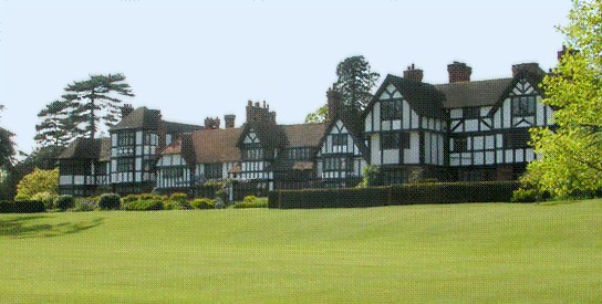
Mapleton-Fall Creek is a historic neighborhood in Indianapolis, bounded on the east and south by Fall Creek Parkway South Drive, by Meridian Street on the west, and by 38th Street on the north. The population was 3,460 as of the 2000 Census. History Mapleton-Fall Creek was platted in the late 1870s. Middle-class to upper-middle class residents moved northward as the city expanded. They were attracted to the area due to its shaded, tree-lined streets and abundance of streetcar lines. In the 1950s, well-to-do African Americans began moving into the neighborhood and comprised the majority of Mapleton Fall-Creek residents by 1970. Compared to other Indianapolis neighborhoods, Mapleton Fall-Creek has retained much of its original infrastructure and housing stock. Present day The neighborhood boasting towering trees, winding boulevards, and a wonderful blend of start of the 20th century homes that feature details and designs of the Tudor Revival, Colonial Revival, and Arts and ... [...More Info...] [...Related Items...] OR: [Wikipedia] [Google] [Baidu] |
Indianapolis
Indianapolis (), colloquially known as Indy, is the state capital and most populous city of the U.S. state of Indiana and the seat of Marion County. According to the U.S. Census Bureau, the consolidated population of Indianapolis and Marion County was 977,203 in 2020. The "balance" population, which excludes semi-autonomous municipalities in Marion County, was 887,642. It is the 15th most populous city in the U.S., the third-most populous city in the Midwest, after Chicago and Columbus, Ohio, and the fourth-most populous state capital after Phoenix, Arizona, Austin, Texas, and Columbus. The Indianapolis metropolitan area is the 33rd most populous metropolitan statistical area in the U.S., with 2,111,040 residents. Its combined statistical area ranks 28th, with a population of 2,431,361. Indianapolis covers , making it the 18th largest city by land area in the U.S. Indigenous peoples inhabited the area dating to as early as 10,000 BC. In 1818, the Lenape relinquished their ... [...More Info...] [...Related Items...] OR: [Wikipedia] [Google] [Baidu] |
IndyGo
The Indianapolis Public Transportation Corporation, branded as IndyGo, is a public transit agency and municipal corporation of the City of Indianapolis in the U.S. state of Indiana. It operates fixed-route buses, bus rapid transit, microtransit, and paratransit services. IndyGo has managed and operated the city's public bus transit system since 1975. In , the system had a ridership of , or about per weekday as of . History IndyGo's history begins in 1953 when the city's streetcar system was converted to bus routes, most of which followed the same routes as used by the streetcars. The city of Indianapolis took over public transportation in 1975 and established the Indianapolis Public Transportation Corporation to administer bus services. The corporation originally operated buses under the name Metro Bus; the IndyGo name was adopted in 1996. Portions of the system were briefly privatized in the 1990s, but the move proved unpopular, and all operations were ultimately taken o ... [...More Info...] [...Related Items...] OR: [Wikipedia] [Google] [Baidu] |
Community Development
The United Nations defines community development as "a process where community members come together to take collective action and generate solutions to common problems." It is a broad concept, applied to the practices of civic leaders, activists, involved citizens, and professionals to improve various aspects of communities, typically aiming to build stronger and more resilient local communities. Community development is also understood as a professional discipline, and is defined by the International Association for Community Development as "a practice-based profession and an academic discipline that promotes participative democracy, sustainable development, rights, economic opportunity, equality and social justice, through the organisation, education and empowerment of people within their communities, whether these be of locality, identity or interest, in urban and rural settings". Community development seeks to empower individuals and groups of people with the skills they nee ... [...More Info...] [...Related Items...] OR: [Wikipedia] [Google] [Baidu] |
Fall Creek Place
Fall Creek Place is one of many revitalized neighborhoods in inner Indianapolis, Indiana, United States. The neighborhood is bounded by Meridian Street on the west, Fall Creek Parkway on the north, just east of College Avenue on the east, and 22nd Street on the south. Before the project's Phase IV began in 2006, its eastern boundary was Park Avenue. The neighborhood consists of narrow, tree lined streets. Victorian homes from the late 19th century are the most prevalent house type as well as new homes built in period design. In the 1980s, the neighborhood fell into serious disrepair; entire city blocks were left abandoned. In 2001, city efforts to redevelop the area into a mixed-income residential community began. In 2003, the U.S. Department of Housing and Urban Development awarded Indianapolis with a Homeownership Zone Award for the way the city used a $4 million HUD grant to stimulate other public and private investment in the Fall Creek Place redevelopmen Also in 2003, t ... [...More Info...] [...Related Items...] OR: [Wikipedia] [Google] [Baidu] |
Meridian-Kessler, Indianapolis
Meridian-Kessler is a residential neighborhood located about north of downtown Indianapolis. It is bounded on the north by Kessler Boulevard, on the east by the Monon Trail greenway corridor, on the south by 38th Street, and to the west by Meridian Street. Meridian Street forms a shared boundary with the adjacent Butler-Tarkington neighborhood. Beginning in the very late 1890s, a few wealthy individuals built a smattering of country estates along Meridian Street and neighboring streets north of Maple Road, which is now called 38th Street. However, the area remained mostly open farmland. A few of the original farmhouses still stand, with the oldest one dating back to 1832. In 1905, landscape architect George Kessler redesigned Maple Road into a grand urban parkway as part of his ambitious plan to form a network of parks and boulevards in Indianapolis. Also in 1905, Indianapolis annexed Meridian Street from Maple Road/38th Street up to the town of Broad Ripple, a distance of al ... [...More Info...] [...Related Items...] OR: [Wikipedia] [Google] [Baidu] |
Gentrification
Gentrification is the process of changing the character of a neighborhood through the influx of more Wealth, affluent residents and businesses. It is a common and controversial topic in urban politics and urban planning, planning. Gentrification often increases the Value (economics), economic value of a neighborhood, but the resulting Demography, demographic displacement may itself become a major social issue. Gentrification often sees a shift in a neighborhood's racial or ethnic composition and average Disposable household and per capita income, household income as housing and businesses become more expensive and resources that had not been previously accessible are extended and improved. The gentrification process is typically the result of increasing attraction to an area by people with higher incomes spilling over from neighboring cities, towns, or neighborhoods. Further steps are increased Socially responsible investing, investments in a community and the related infrastruct ... [...More Info...] [...Related Items...] OR: [Wikipedia] [Google] [Baidu] |
Monon Trail
The Monon Trail (known as the Monon Greenway in Carmel) is a rail trail located entirely within the state of Indiana. The Monon Railroad was a popular railroad line connecting the cities of Chicago and Indianapolis, with stops at major settlements along its route. After the decline of railroad travel and the sale of the company in 1987, the portion of the line between Indianapolis and Delphi, Indiana, was abandoned. In Northwest Indiana, the trail is long, running through Lake County from Munster to Hammond. In the Indianapolis area, the trail consists of running through Hamilton and Marion counties, connecting Indianapolis, Carmel and Westfield. The trail has been extended to Sheridan, making the total length . The first portions of the trail were created in the late 1990s, but it has been consistently extended in both of its segments since then. The trail is a shared use path complete with trailheads, park amenities and local attractions near it. Northwest Indiana segmen ... [...More Info...] [...Related Items...] OR: [Wikipedia] [Google] [Baidu] |
Tudorbethan Architecture
Tudor Revival architecture (also known as mock Tudor in the UK) first manifested itself in domestic architecture in the United Kingdom in the latter half of the 19th century. Based on revival of aspects that were perceived as Tudor architecture, in reality it usually took the style of English vernacular architecture of the Middle Ages that had survived into the Tudor period. The style later became an influence elsewhere, especially the British colonies. For example, in New Zealand, the architect Francis Petre adapted the style for the local climate. In Singapore, then a British colony, architects such as R. A. J. Bidwell pioneered what became known as the Black and White House. The earliest examples of the style originate with the works of such eminent architects as Norman Shaw and George Devey, in what at the time was considered Neo-Tudor design. Tudorbethan is a subset of Tudor Revival architecture that eliminated some of the more complex aspects of Jacobethan in favour of ... [...More Info...] [...Related Items...] OR: [Wikipedia] [Google] [Baidu] |
Meridian Street (Indianapolis)
Meridian Street is the primary north–south street in Indianapolis, Indiana. US 31 formerly ran along North Meridian Street for much of its length in the city of Indianapolis, before being re-routed to a segment of Interstate 465. Meridian Street serves as the axis separating east addresses from west addresses, and intersects Monument Circle and Washington Street in downtown. North of downtown, Meridian continues through several prominent city neighborhoods, such as the Midtown commercial district, the Old Northside, Herron-Morton, Butler–Tarkington, Meridian-Kessler, and Arden, as well as the towns of Meridian Hills and Williams Creek. Meridian Street also passes through several historic districts: the North Meridian Street Historic District, the Old Northside Historic District, the Shortridge–Meridian Street Apartments Historic District, the Washington Street–Monument Circle Historic District, and the Indianapolis Union Station-Wholesale District. In 1919, propert ... [...More Info...] [...Related Items...] OR: [Wikipedia] [Google] [Baidu] |
Fin De Siècle
() is a French term meaning "end of century,” a phrase which typically encompasses both the meaning of the similar English idiom "turn of the century" and also makes reference to the closing of one era and onset of another. Without context, the term is typically used to refer to the end of the 19th century. This period was widely thought to be a period of social degeneracy, but at the same time a period of hope for a new beginning. The "spirit" of often refers to the cultural hallmarks that were recognized as prominent in the 1880s and 1890s, including ennui, cynicism, pessimism, and "a widespread belief that civilization leads to decadence.” The term is commonly applied to French art and artists, as the traits of the culture first appeared there, but the movement affected many European countries. The term becomes applicable to the sentiments and traits associated with the culture, as opposed to focusing solely on the movement's initial recognition in France. The ideas ... [...More Info...] [...Related Items...] OR: [Wikipedia] [Google] [Baidu] |
List Of Indianapolis Neighborhoods
This list of Indianapolis neighborhoods provides a general overview of neighborhoods, districts, and subdivisions located in the city of Indianapolis, Indiana, United States. Nine townships form the broadest geographic divisions within Marion County and Indianapolis. For statistical purposes, the consolidated city-county is organized into 99 smaller "neighborhood areas," some of which overlap township boundaries. Most neighborhood areas contain numerous individual districts, subdivisions, and some semi-autonomous towns. In total, some 500 self-identified neighborhood associations are registered in the City’s Registered Community Organization system. Typical of American cities in the Midwest, Indianapolis urbanized in the late-19th and early-20th centuries, resulting in the development of relatively dense, well-defined neighborhoods clustered around streetcar corridors, especially in Center Township. The economic attainability of private automobiles influenced the city's develop ... [...More Info...] [...Related Items...] OR: [Wikipedia] [Google] [Baidu] |


