|
Manthai
Manthai ( ta, மாந்தை, translit=Māntai) is a coastal town and an ancient harbor situated in the Mannar district, of the Northern Province of Sri Lanka. Manthai functioned as the main port of the Anuradhapura Kingdom throughout its history. Historically known as ''Manthottam'' in Tamil and ''Manthota'' or ''Mahathiththa'' in Sinhalese, it is an important religious site in the island for the Hindus, due to the Ketheeswaram Kovil, one of the five Ishwarams dedicated to Shiva in the island.Arumugam pp-15 Etymology The name Manthai does not occur in any of the early works and it is a recent name use for the ancient port of Mahatittha.pp. 33-34 In early Sinhalese inscriptions and literature (5th century - 12th century), Mahatittha is referred to as Matota, Mahavoti, Mahaputu, Mahavutu, Mavatutota, and Mahapatana.pp. 75-79 In the Tamil poems of about the 7th, 8th and 9th centuries and in the Cola inscriptions of the 11th century, the Tamilised form of Matottam has been used ... [...More Info...] [...Related Items...] OR: [Wikipedia] [Google] [Baidu] |
Ketheeswaram Temple
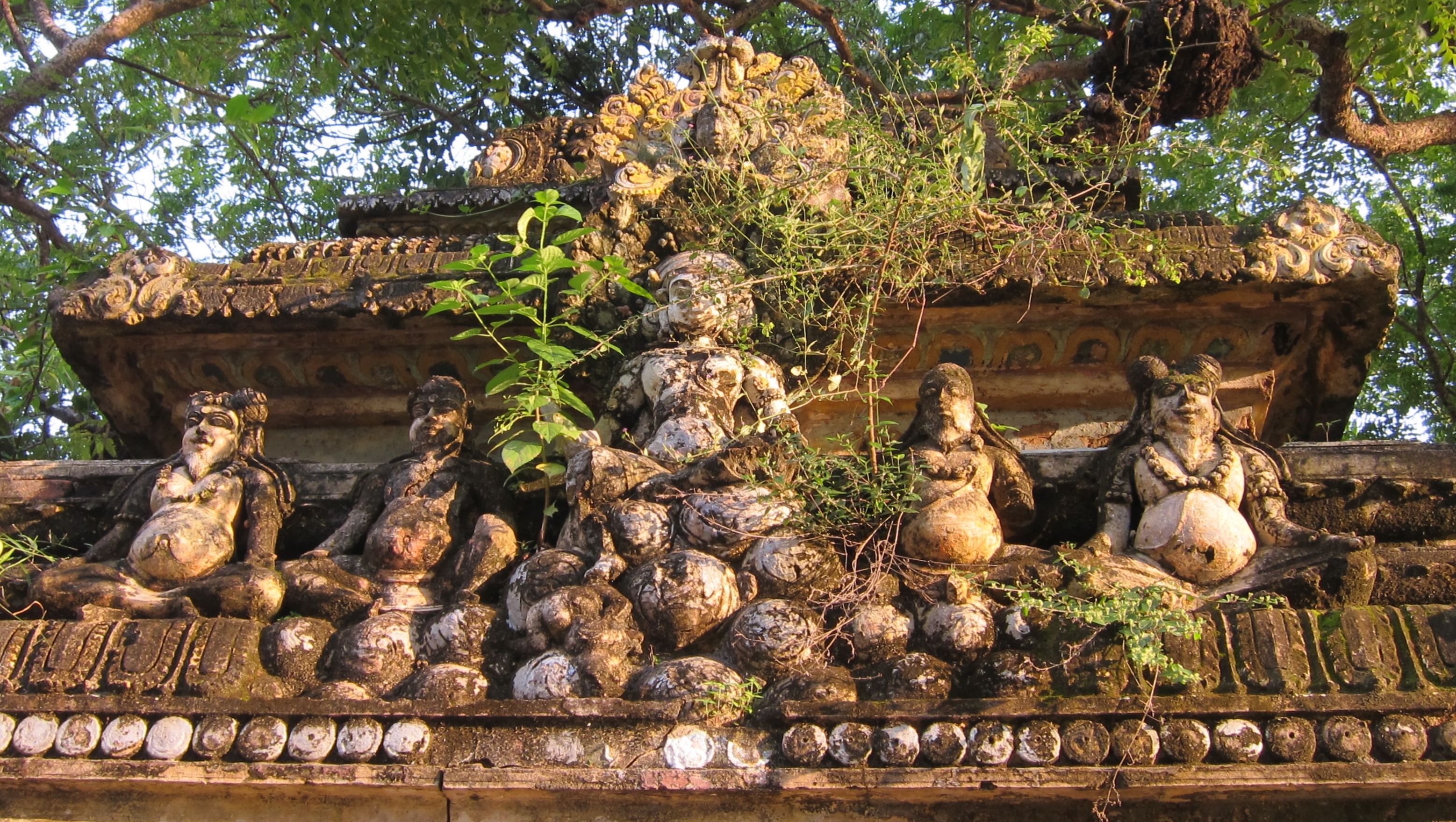
Ketheeswaram temple ( ta, திருக்கேதீசுவரம் Tirukkētīsvaram) is an ancient Hindu temple in Mannar, Northern Province, Sri Lanka. It is the oldest temple in Sri Lanka with at least 1400 years of evidence. Overlooking the ancient Tamil port towns of Manthai and Kudiramalai, the temple has lain in ruins, been restored, renovated and enlarged by various royals and devotees throughout its history. Tirukkētīsvaram is one of the Pancha Ishwarams dedicated to the Hindu deity Shiva and is venerated by Shaivas throughout the continent. Throughout its history, the temple has been administered and frequented by Sri Lankan Hindu Tamils. Its famous tank, the Palavi tank, is of ancient antiquity and was restored from the ruins. Tirukkētīsvaram is one of the 275 Paadal Petra Sthalams of Shiva glorified in the poems of the ''Tevaram''. Literary and inscriptional evidence of the post classical period (300BC-1500AD) attests to the upkeep of the temple duri ... [...More Info...] [...Related Items...] OR: [Wikipedia] [Google] [Baidu] |
Mannar District
Mannar District ( ta, மன்னார் மாவட்டம் ''Maṉṉār Māvaṭṭam''; si, මන්නාරම දිස්ත්රික්කය) is one of the 25 districts of Sri Lanka, the second level administrative division of the country. The district is administered by a District Secretariat headed by a District Secretary (previously known as a Government Agent) appointed by the central government of Sri Lanka. The capital of the district is Mannar, which is located on Mannar Island. History Between the 5th century BC and 13th century AD, what is now Mannar District was part of Rajarata. Parts Mannar District were thereafter part of the pre-colonial Jaffna kingdom. The district then came under Portuguese, Dutch and British control. In 1815 the British gained control of the entire island of Ceylon. They divided the island into three ethnic based administrative structures: Low Country Sinhalese, Kandyan Sinhalese and Tamil. The district was part of the ... [...More Info...] [...Related Items...] OR: [Wikipedia] [Google] [Baidu] |
Divisional Secretariats Of Sri Lanka
The districts of Sri Lanka are divided into administrative sub-units known as ''divisional secretariats''. These were originally based on the feudal counties, the ''korale''s and ''rata''s. They were formerly known as 'D.R.O. Divisions' after the 'Divisional Revenue Officer'. Later the D.R.O.s became 'Assistant Government Agents' and the Divisions were known as 'A.G.A. Divisions'. Currently, the Divisions are administered by a 'Divisional Secretary', and are known as 'D.S. Divisions'. The 331 divisions are listed below, by district: Divisional secretariats See also * Provinces of Sri Lanka * Districts of Sri Lanka In Sri Lanka, districts ( si, දිස්ත්රික්ක, ''Distrikka'', ta, மாவட்டம், ''Māvaṭṭam'') are the second-level administrative divisions, and are included in a province. There are 25 districts o ... References External links Divisional Secretariats Portal {{Sri Lanka topics Sri Lanka geography-rel ... [...More Info...] [...Related Items...] OR: [Wikipedia] [Google] [Baidu] |
Mannar, Sri Lanka
Mannar ( ta, மன்னார், translit=Maṉṉār, si, මන්නාරම, translit=Mannārama, formerly spelled Manar) is the main town of Mannar District, Northern Province, Sri Lanka. It is governed by an Urban Council. The town is located on Mannar Island overlooking the Gulf of Mannar and is home to the historic Ketheeswaram temple. In the Tamil language, Mannar means the ''raised place f sand' which is though to have come from the geology of Mannar Island which was formed by the accumulation of sand. History Formerly the town was renowned as a centre of pearl fishing, mentioned in the 2nd-century CE Periplus of the Erythraean Sea. Mannar is known for its baobab trees and for its fort, built by the Portuguese in 1560 and taken by the Dutch in 1658 and rebuilt; its ramparts and bastions are intact, though the interior is largely destroyed. Visually, the modern town is dominated by its churches, Hindu temples and mosques.Edward Aves, ''Sri Lanka'' (Footprint Travel ... [...More Info...] [...Related Items...] OR: [Wikipedia] [Google] [Baidu] |
Pancha Ishwarams
The Pancha Ishwarams (five abodes of Shiva) ( ta, பஞ்ச ஈஸ்வரங்கள், translit=Pancha Eeswarankal) are five coastal ancient kovils (temples) built in dedication to the Hindu supreme being Ishwara in the form of the god Shiva, located along the circumference of Sri Lanka. The most sacred pilgrimage complexes for Sri Lankan Tamil devotees of Hinduism, they adhere to the ancient Saiva Siddhanta philosophy with central shrines for Shiva in each temple. Initial construction was by royal architects of the Naga kingdom (Nayanar). The Shiva lingams in each kovil are recorded as being Ravana's installations, while one of his descendants, the ancient Yaksha queen Kuveni was a devotee of Ishwara. Eventually, the kovils became international focal points of their classical era capitals in their respective districts, maintaining their own historical records, traditions and broad influence across Asia. Figures such as Agastya, Rama, Ravana and Arjuna - featured with th ... [...More Info...] [...Related Items...] OR: [Wikipedia] [Google] [Baidu] |
Raja Raja Chola I
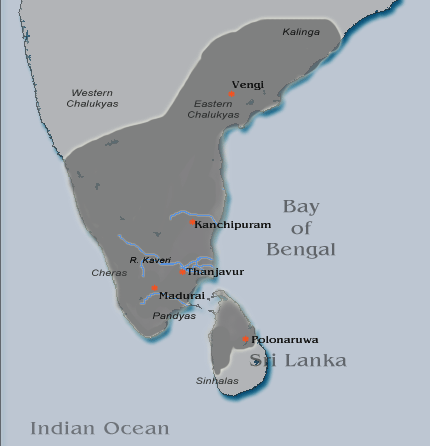
Rajaraja I (947 CE – 1014 CE), born Arunmozhi Varman or Arulmozhi Varman and often described as Raja Raja the Great or Raja Raja Chozhan was a Chola emperor who reigned from 985 CE to 1014 CE. He was the most powerful Tamil king in South India during his reign and is remembered for reinstating the Chola influence and ensuring its supremacy across the Indian Ocean. His extensive empire included vast regions of the Pandya country, the Chera country and northern Sri Lanka. He also acquired Lakshadweep and Thiladhunmadulu atoll, and part of the northern-most islands of the Maldives in the Indian Ocean. Campaigns against the Western Gangas and the Chalukyas extended the Chola authority as far as the Tungabhadra River. On the eastern coast, he battled with the Chalukyas for the possession of Vengi.A Journey through India's Past by Chandra Mauli Mani p.51 Rajaraja I, being an able administrator, also built the great Rajarajeshwaram Temple at the Chola capital Thanjavur. The ... [...More Info...] [...Related Items...] OR: [Wikipedia] [Google] [Baidu] |
Chola Dynasty
The Chola dynasty was a Tamils, Tamil thalassocratic Tamil Dynasties, empire of southern India and one of the longest-ruling dynasties in the history of the world. The earliest datable references to the Chola are from inscriptions dated to the 3rd century BCE during the reign of Ashoka of the Maurya Empire. As one of the Three Crowned Kings of Tamilakam, along with the Chera dynasty, Chera and Pandya dynasty, Pandya, the dynasty continued to govern over varying territories until the 13th century CE. The Chola Empire was at its peak under the Medieval Cholas in the mid-9th century CE. The heartland of the Cholas was the fertile valley of the Kaveri River. They ruled a significantly larger area at the height of their power from the later half of the 9th century till the beginning of the 13th century. They unified peninsular India south of the Tungabhadra River, and held the territory as one state for three centuries between 907 and 1215 CE.K. A. Nilakanta Sastri, ''A Histo ... [...More Info...] [...Related Items...] OR: [Wikipedia] [Google] [Baidu] |
International Trade
International trade is the exchange of capital, goods, and services across international borders or territories because there is a need or want of goods or services. (see: World economy) In most countries, such trade represents a significant share of gross domestic product (GDP). While international trade has existed throughout history (for example Uttarapatha, Silk Road, Amber Road, scramble for Africa, Atlantic slave trade, salt roads), its economic, social, and political importance has been on the rise in recent centuries. Carrying out trade at an international level is a complex process when compared to domestic trade. When trade takes place between two or more states factors like currency, government policies, economy, judicial system, laws, and markets influence trade. To ease and justify the process of trade between countries of different economic standing in the modern era, some international economic organizations were formed, such as the World Trade Organization ... [...More Info...] [...Related Items...] OR: [Wikipedia] [Google] [Baidu] |
East Africa
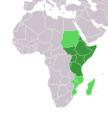
East Africa, Eastern Africa, or East of Africa, is the eastern subregion of the African continent. In the United Nations Statistics Division scheme of geographic regions, 10-11-(16*) territories make up Eastern Africa: Due to the historical Omani Empire and colonial territories of the British East Africa Protectorate and German East Africa, the term ''East Africa'' is often (especially in the English language) used to specifically refer to the area now comprising the three countries of Kenya, Tanzania, and Uganda. However, this has never been the convention in many other languages, where the term generally had a wider, strictly geographic context and therefore typically included Djibouti, Eritrea, Ethiopia, and Somalia.Somaliland is not included in the United Nations geoscheme, as it is internationally recognized as a part of Somalia. *Tanzania, Kenya, Uganda, Rwanda, Burundi, Democratic Republic of Congo and South Sudan are members of the East African Community. The firs ... [...More Info...] [...Related Items...] OR: [Wikipedia] [Google] [Baidu] |
Red Sea
The Red Sea ( ar, البحر الأحمر - بحر القلزم, translit=Modern: al-Baḥr al-ʾAḥmar, Medieval: Baḥr al-Qulzum; or ; Coptic: ⲫⲓⲟⲙ ⲛ̀ϩⲁϩ ''Phiom Enhah'' or ⲫⲓⲟⲙ ⲛ̀ϣⲁⲣⲓ ''Phiom ǹšari''; Tigrinya: ቀይሕ ባሕሪ ''Qeyih Bahri''; ) is a seawater inlet of the Indian Ocean, lying between Africa and Asia. Its connection to the ocean is in the south, through the Bab el Mandeb strait and the Gulf of Aden. To its north lie the Sinai Peninsula, the Gulf of Aqaba, and the Gulf of Suez (leading to the Suez Canal). It is underlain by the Red Sea Rift, which is part of the Great Rift Valley. The Red Sea has a surface area of roughly 438,000 km2 (169,100 mi2), is about 2250 km (1398 mi) long, and — at its widest point — 355 km (220.6 mi) wide. It has an average depth of 490 m (1,608 ft), and in the central ''Suakin Trough'' it reaches its maximum depth of . The Red Sea also has exten ... [...More Info...] [...Related Items...] OR: [Wikipedia] [Google] [Baidu] |
Persian Gulf
The Persian Gulf ( fa, خلیج فارس, translit=xalij-e fârs, lit=Gulf of Persis, Fars, ), sometimes called the ( ar, اَلْخَلِيْجُ ٱلْعَرَبِيُّ, Al-Khalīj al-ˁArabī), is a Mediterranean sea (oceanography), mediterranean sea in Western Asia. The body of water is an extension of the Indian Ocean located between Iran and the Arabian Peninsula.United Nations Group of Experts on Geographical NameWorking Paper No. 61, 23rd Session, Vienna, 28 March – 4 April 2006. accessed October 9, 2010 It is connected to the Gulf of Oman in the east by the Strait of Hormuz. The Shatt al-Arab river delta forms the northwest shoreline. The Persian Gulf has many fishing grounds, extensive reefs (mostly rocky, but also Coral reef, coral), and abundant pearl oysters, however its ecology has been damaged by industrialization and oil spills. The Persian Gulf is in the Persian Gulf Basin, which is of Cenozoic origin and related to the subduction of the Arabian Plate u ... [...More Info...] [...Related Items...] OR: [Wikipedia] [Google] [Baidu] |

9.jpg)


