|
Manazuru Station
is a passenger railway station located in the town of Manazuru, Kanagawa Prefecture, Japan, operated by the East Japan Railway Company (JR East). Lines Manazuru Station is served by the Tōkaidō Main Line, and is located 95.8 rail kilometers from Tokyo Station. Station layout Manazuru Station has a single island platform serving two tracks, connected to the station building by a footbridge. The station has a "Midori no Madoguchi" service counter. Platforms Station history Manazuru Station was opened on July 11, 1887 for both freight and passenger service on the Atami Line of the Japan National Railways. With the opening of the Tanna Tunnel, the Atami Line became the Tōkaidō Main Line on December 1, 1934. Regularly scheduled freight services were discontinued in 1970, and parcel services by 1972. Freight services were resumed in March 1987. With the dissolution and privatization of the JNR on April 1, 1987, the station came under the control of the East Japan Railway ... [...More Info...] [...Related Items...] OR: [Wikipedia] [Google] [Baidu] |
Manazuru, Kanagawa
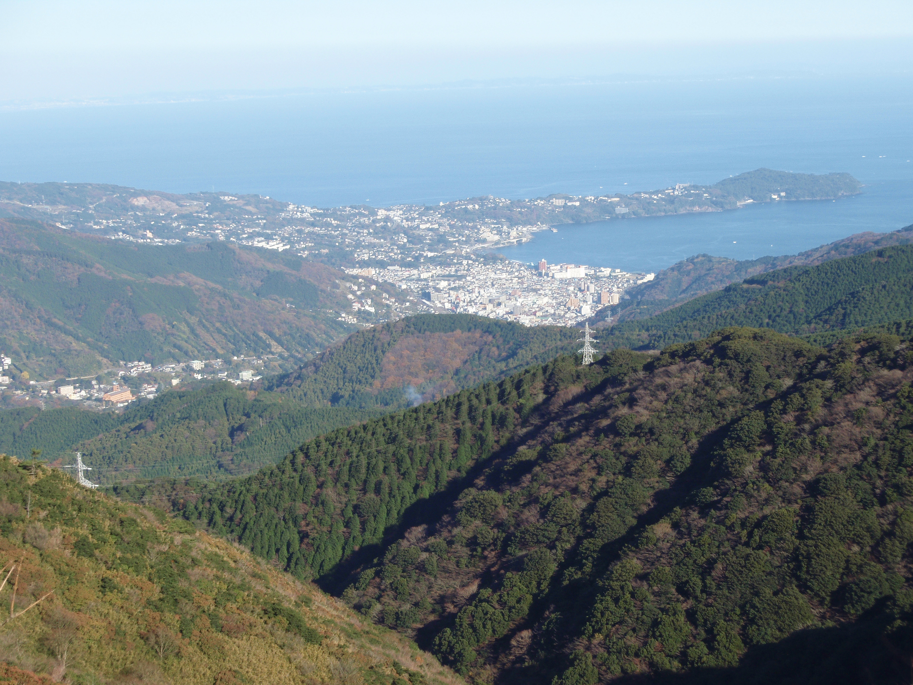
is a town located in Kanagawa Prefecture, Japan. , the town had an estimated population of 6,949 and a population density of 1000 persons per km². The total area of the town is . Geography Located in the southeast of Mount Hakone, the consists of the small Manazuru Peninsula, which extends into Sagami Bay from the southeast to the northwest, sandwiched between Odawara City in the north and Yugawara Town in the south. The Manazuru Peninsula is a lava plateau with a steep coast and The town area is generally rugged with few flat areas. The urban area is at the base of the peninsula, with Manazuru Station to the northwest, Iwa Fishing Port and Iwo Beach to the east, and Manazuru Port to the southeast. There are many quarries in the mountains north of the city. Mandarin oranges are cultivated in the hills along the northern coast. The northwestern part of the town is part of a mountainous area that extends to the outer ring of the Hakone volcano. The town is within the Manazuru Han ... [...More Info...] [...Related Items...] OR: [Wikipedia] [Google] [Baidu] |
IC Card
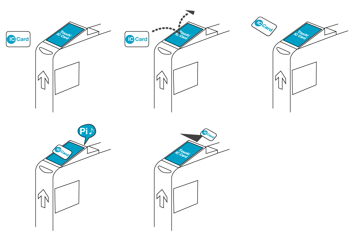
A smart card, chip card, or integrated circuit card (ICC or IC card) is a physical electronic authentication device, used to control access to a resource. It is typically a plastic credit card-sized card with an embedded integrated circuit (IC) chip. Many smart cards include a pattern of metal contacts to electrically connect to the internal chip. Others are contactless, and some are both. Smart cards can provide personal identification, authentication, data storage, and application processing. Applications include identification, financial, mobile phones (SIM), public transit, computer security, schools, and healthcare. Smart cards may provide strong security authentication for single sign-on (SSO) within organizations. Numerous nations have deployed smart cards throughout their populations. The universal integrated circuit card, or SIM card, is also a type of smart card. , 10.5billion smart card IC chips are manufactured annually, including 5.44billion SIM card IC chips. Hist ... [...More Info...] [...Related Items...] OR: [Wikipedia] [Google] [Baidu] |
Suica
is a prepaid rechargeable contactless smart card, electronic money used as a fare card on train lines in Japan, launched on November 18, 2001. The card can be used interchangeably with JR West's ICOCA in the Kansai region and San'yō region in Okayama, Hiroshima, and Yamaguchi prefectures, and also with JR Central's TOICA, JR Kyushu's SUGOCA, Nishitetsu's Nimoca, and Fukuoka City Subway's Hayakaken area in Fukuoka City and its suburb areas. The card is also increasingly being accepted as a form of electronic money for purchases at stores and kiosks, especially within train stations. As of 2018, JR East reports 69.4 million Suica UID's have been issued, usable at 476,300 point of sale locations, with 6.6 million daily transactions. Since Suica is completely interchangeable with Pasmo (see ''Interoperation'' for the complete listing of companies and lines that accept Suica) in the greater Tokyo area, it is supported on virtually any train, tramway, and bus system (excluding v ... [...More Info...] [...Related Items...] OR: [Wikipedia] [Google] [Baidu] |
Turnstile
A turnstile (also called a turnpike, gateline, baffle gate, automated gate, turn gate in some regions) is a form of gate which allows one person to pass at a time. A turnstile can be configured to enforce one-way human traffic. In addition, a turnstile can restrict passage only to people who insert a coin, ticket, pass, or other method of payment. Modern turnstiles incorporate biometrics, including retina scanning, fingerprints, and other individual human characteristics which can be scanned. Thus a turnstile can be used in the case of paid access (sometimes called a faregate or ticket barrier when used for this purpose), for example to access public transport, a pay toilet, or to restrict access to authorized people, for example in the lobby of an office building. History Turnstiles were originally used, like other forms of stile, to allow human beings to pass while keeping sheep or other livestock penned in. The use of turnstiles in most modern applications has been credit ... [...More Info...] [...Related Items...] OR: [Wikipedia] [Google] [Baidu] |
Privatization
Privatization (also privatisation in British English) can mean several different things, most commonly referring to moving something from the public sector into the private sector. It is also sometimes used as a synonym for deregulation when a heavily regulated private company or industry becomes less regulated. Government functions and services may also be privatised (which may also be known as "franchising" or "out-sourcing"); in this case, private entities are tasked with the implementation of government programs or performance of government services that had previously been the purview of state-run agencies. Some examples include revenue collection, law enforcement, water supply, and prison management. Another definition is that privatization is the sale of a state-owned enterprise or municipally owned corporation to private investors; in this case shares may be traded in the public market for the first time, or for the first time since an enterprise's previous nationaliz ... [...More Info...] [...Related Items...] OR: [Wikipedia] [Google] [Baidu] |
Tanna Tunnel
is a railroad tunnel in Shizuoka Prefecture, Japan operated by JR Central’s Tōkaidō Main Line. This 7.8 km long tunnel shortened the trunk route between Tokyo and Kobe by omitting a detour round the mountains between Atami and Numazu. History The initial routing of the Tōkaidō Main Line railway connecting Tokyo with Osaka avoided the Hakone mountains between Shizuoka and Kanagawa Prefectures by a long loop north to Gotemba and then south to Numazu. This is the line now called the Gotemba Line and the same routing followed by the Tōmei Expressway vehicular highway to this day. Recognizing that this loop through Gotemba was a major bottleneck in the rail system, the Japanese Railroad Ministry issued a contract in 1918 to the Kajima Corporation to build a tunnel. The project was heralded as a major public works endeavor that would boost the Japanese economy out of its post-World War I economic recession. However, construction of the 7,804-meter tunnel proved to be extr ... [...More Info...] [...Related Items...] OR: [Wikipedia] [Google] [Baidu] |
Japan National Railway
The abbreviated JNR or , was the business entity that operated Japan's national railway network from 1949 to 1987. Network Railways As of June 1, 1949, the date of establishment of JNR, it operated of narrow gauge () railways in all 46 prefectures of Japan. This figure expanded to in 1981 (excluding Shinkansen), but later reduced to as of March 31, 1987, the last day of JNR. JNR operated both passenger and freight services. Shinkansen Shinkansen, the world's first high-speed railway was debuted by JNR in 1964. By the end of JNR in 1987, four lines were constructed: ; Tōkaidō Shinkansen: , completed in 1964 ; Sanyō Shinkansen: , completed in 1975 ; Tōhoku Shinkansen: , as of 1987 ; Jōetsu Shinkansen: , completed in 1982 Buses JNR operated bus lines as feeders, supplements or substitutions of railways. Unlike railway operation, JNR Bus was not superior to other local bus operators. The JR Bus companies are the successors of the bus operation of JNR. Ships JNR op ... [...More Info...] [...Related Items...] OR: [Wikipedia] [Google] [Baidu] |
Takasaki Line
The Takasaki Line ( ja, 高崎線, ) is a Japanese railway line which connects Ōmiya Station in Saitama, Saitama Prefecture and Takasaki Station in Takasaki, Gunma Prefecture. It is owned and operated by the East Japan Railway Company (JR East). All services on the line (excluding through Shonan-Shinjuku Line trains) run to/from Ueno Station is a major railway station in Tokyo's Taitō ward. It is the station used to reach the Ueno district and Ueno Park—which contains Tokyo National Museum, The National Museum of Western Art, Ueno Zoo, Tokyo University of the Arts and other fam ... in Tokyo via the Tōhoku Main Line. The line was extended to Tokyo Station via the Ueno-Tokyo Line that opened in March 2015. As the Takasaki Line serves many major cities within Saitama Prefecture, it is a vital means of transport within the prefecture. Japan National Route 17, National Route 17 and its historical predecessor, the Nakasendō, run parallel to the line. Services Services on ... [...More Info...] [...Related Items...] OR: [Wikipedia] [Google] [Baidu] |
Utsunomiya Line
The Utsunomiya Line ( ja, 宇都宮線, ) is the name given to a 163.5 kilometer section of the Tōhoku Main Line between Tokyo Station in Tokyo and Kuroiso Station in Nasushiobara, Tochigi, Japan. It is part of the East Japan Railway Company (JR East) network. Services Services on the Utsunomiya Line are typically divided into three categories: services to or from Ueno, Shōnan–Shinjuku Line services, and Ueno–Tokyo Line services. Between Ueno and Ōmiya, trains share the track with the Takasaki Line, both of which serve as ''de facto'' express services compared to the parallel Keihin–Tōhoku Line. Northbound services mostly terminate at or , with some at . Southbound trains mostly travel through the Shōnan–Shinjuku Line to on the Yokosuka Line, or the Ueno–Tokyo Line to on the Tōkaidō Line, with a few trains terminating at Ueno. The fastest service on the line, the rapid ''Rabbit'', makes the run between Ueno and Utsunomiya in 1 hour and 26 minutes. Serv ... [...More Info...] [...Related Items...] OR: [Wikipedia] [Google] [Baidu] |
Itō Line
The Itō Line ( ja, 伊東線, ) is a railway line owned by the East Japan Railway Company (JR East) which connects Atami and Itō Stations, along the east coast of Izu Peninsula in Shizuoka Prefecture, Japan. From Itō, the line continues south to Shimoda under the privately owned and operated Izu Kyūkō Line. Station list Rolling stock * Local trains ** E231 series 10-car EMUs (Ito・ Tokaido・ Ueno-Tokyo Lines) ** E233 series 10-car EMUs (Ito・Tokaido・Ueno-Tokyo Lines) ** Izukyu 2100 series 7-car EMUs (Ito・Izukyu Lines) ** Izukyu 8000 series 3-car or 6-car coupled EMUs (Ito・Izukyu Lines) * Limited express ** 185 series 7-car or 10-car EMUs (''Odoriko'') ** E257-2000 series (''Odoriko'') ** E261 series ''Saphir Odoriko'' ** Izukyu 2100 series 7-car or 8-car EMUs ( ''Resort Odoriko'') * Sightseeing trains ** 651-1000 series 4-car EMUs (''Izu Craile'') *** A rebuilt four-car 651 series resort train set named '' Izu Craile''( ja, 伊豆クレイル, links=no) ente ... [...More Info...] [...Related Items...] OR: [Wikipedia] [Google] [Baidu] |
Ashigarashimo District, Kanagawa
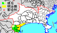
is a district of Japan located in western Kanagawa Prefecture, Japan. Most of the mountainous district is sparsely populated, and is part of the Fuji-Hakone-Izu National Park. The majority of the area of the city of Odawara was formerly part of Ashigarashimo District. As of 2009, the district had an estimated population of 48,713 and a density of 346 persons per km2. The total area was 140.73 km2. Towns and villages *Hakone *Yugawara *Manazuru History Ashigarashimo District was one of the ancient subdivisions of Sagami Province, per the Nara period Ritsuryō system, under the name as . The area was under control of the later Hōjō clan in the Sengoku period, and part of Odawara Domain during the Edo period. Following disasters caused by eruptions of nearby Mount Fuji, a portion also came to be held as ''tenryō'' territory administered by the Tokugawa shogunate. Timeline After the Meiji Restoration, it initially formed part of the short-lived Ashigara Prefecture, befo ... [...More Info...] [...Related Items...] OR: [Wikipedia] [Google] [Baidu] |


.jpg)


.jpg)

