|
Majahual
Costa Maya is a small tourist region in the municipality of Othón P. Blanco in the state of Quintana Roo, Mexico, the only state bounded by the Caribbean Sea to its east. This municipality is close to Chetumal (capital of the state) on the border with Belize. The area was generally undeveloped but has been growing rapidly since construction of a large pier to accommodate cruise ships. Costa Maya is also the name of a subdivision near the village of Mahahual. The beach extends from Xcalak in the south to the southern border of Sian Ka'an in the north, a distance of approximately . Xcalak is approximately south of the Costa Maya cruise port, and the fishing village of Mahahual is only about away. Cruise ships can easily be seen from the village. Mahahual has soft sand beaches, grass thatched palapas, and a coral reef a short distance off-shore called Banco Chinchorro, as well as several bars, restaurants, and shops. A new development called New Mahahual is being created directly ... [...More Info...] [...Related Items...] OR: [Wikipedia] [Google] [Baidu] |
Hurricane Dean
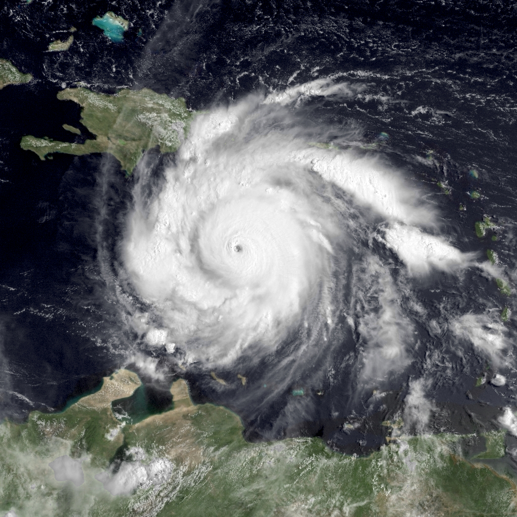
Hurricane Dean was the strongest tropical cyclone of the 2007 Atlantic hurricane season. It was the most intense North Atlantic hurricane since Hurricane Wilma of 2005, tying for eighth overall. Additionally, it made the fourth most intense Atlantic hurricane landfall. A Cape Verde hurricane that formed on August 13, 2007, Dean took a west-northwest path from the eastern Atlantic Ocean through the Saint Lucia Channel and into the Caribbean. It strengthened into a major hurricane, reaching Category 5 status on the Saffir–Simpson hurricane wind scale before passing just south of Jamaica on August 20. The storm made landfall on the Yucatán Peninsula on August 21 at peak intensity. It crossed the peninsula and emerged into the Bay of Campeche weakened, but still remained a hurricane. It strengthened briefly before making a second landfall near Tecolutla in the Mexican state of Veracruz on August 22. Dean drifted to the northwest, weakening into a remnant low which d ... [...More Info...] [...Related Items...] OR: [Wikipedia] [Google] [Baidu] |
Tourist
Tourism is travel for pleasure or business; also the theory and practice of touring, the business of attracting, accommodating, and entertaining tourists, and the business of operating tours. The World Tourism Organization defines tourism more generally, in terms which go "beyond the common perception of tourism as being limited to holiday activity only", as people "travelling to and staying in places outside their usual environment for not more than one consecutive year for leisure and not less than 24 hours, business and other purposes". Tourism can be domestic (within the traveller's own country) or international, and international tourism has both incoming and outgoing implications on a country's balance of payments. Tourism numbers declined as a result of a strong economic slowdown (the late-2000s recession) between the second half of 2008 and the end of 2009, and in consequence of the outbreak of the 2009 H1N1 influenza virus, but slowly recovered until the COVID-19 ... [...More Info...] [...Related Items...] OR: [Wikipedia] [Google] [Baidu] |
Kohunlich
Kohunlich (X-làabch'e'en in Modern Mayan) is a large archaeological site of the pre-Columbian Maya civilization, located on the Yucatán Peninsula in the state of Quintana Roo about 25 km east of the Rio Bec region, and about 65 km west of Chetumal on Highway 186, and 9 km south of the road. The original name of the site is unknown. The actual Spanish name does not actually derive from Mayan but from the English ''Cohune Ridge'' where cohune palm grew. In 1912 this place was known as Clarksville, referring to the nearby logging camp that was 3 kilometers north of the site. Background The site covers about , surrounded by dense sub-tropical rainforest, and it contains almost 200 mounds, that remain largely unexcavated. The city was elaborately planned and engineered, with raised platforms and pyramids, citadels, courtyards and plazas surrounded with palace platforms, all laid out to channel drainage into a system of cisterns and an enormous reservoir to collect ra ... [...More Info...] [...Related Items...] OR: [Wikipedia] [Google] [Baidu] |
Maya Civilization
The Maya civilization () of the Mesoamerican people is known by its ancient temples and glyphs. Its Maya script is the most sophisticated and highly developed writing system in the pre-Columbian Americas. It is also noted for its art, architecture, mathematics, calendar, and astronomical system. The Maya civilization developed in the Maya Region, an area that today comprises southeastern Mexico, all of Guatemala and Belize, and the western portions of Honduras and El Salvador. It includes the northern lowlands of the Yucatán Peninsula and the highlands of the Sierra Madre, the Mexican state of Chiapas, southern Guatemala, El Salvador, and the southern lowlands of the Pacific littoral plain. Today, their descendants, known collectively as the Maya, number well over 6 million individuals, speak more than twenty-eight surviving Mayan languages, and reside in nearly the same area as their ancestors. The Archaic period, before 2000 BC, saw the first developments in agricul ... [...More Info...] [...Related Items...] OR: [Wikipedia] [Google] [Baidu] |
Slash And Burn
Slash-and-burn agriculture is a farming method that involves the cutting and burning of plants in a forest or woodland to create a field called a swidden. The method begins by cutting down the trees and woody plants in an area. The downed vegetation, or "slash", is then left to dry, usually right before the rainiest part of the year. Then, the biomass is burned, resulting in a nutrient-rich layer of ash which makes the soil fertile, as well as temporarily eliminating weed and pest species. After about three to five years, the plot's productivity decreases due to depletion of nutrients along with weed and pest invasion, causing the farmers to abandon the field and move to a new area. The time it takes for a swidden to recover depends on the location and can be as little as five years to more than twenty years, after which the plot can be slashed and burned again, repeating the cycle. In Bangladesh and India, the practice is known as jhum or jhoom. Slash-and-burn is a type of shif ... [...More Info...] [...Related Items...] OR: [Wikipedia] [Google] [Baidu] |
Native Americans In The United States
Native Americans, also known as American Indians, First Americans, Indigenous Americans, and other terms, are the Indigenous peoples of the mainland United States ( Indigenous peoples of Hawaii, Alaska and territories of the United States are generally known by other terms). There are 574 federally recognized tribes living within the US, about half of which are associated with Indian reservations. As defined by the United States Census, "Native Americans" are Indigenous tribes that are originally from the contiguous United States, along with Alaska Natives. Indigenous peoples of the United States who are not listed as American Indian or Alaska Native include Native Hawaiians, Samoan Americans, and the Chamorro people. The US Census groups these peoples as " Native Hawaiian and other Pacific Islanders". European colonization of the Americas, which began in 1492, resulted in a precipitous decline in Native American population because of new diseases, wars, ethni ... [...More Info...] [...Related Items...] OR: [Wikipedia] [Google] [Baidu] |
Westerdam
MS ''Westerdam'' is a owned by Holland America Line. She is the third ship of the class to be operated by the line, as well as being the third ship to bear the name ''Westerdam''. Her sister ships are , , and . The beginning of the four ships' names represent the four directions of the compass in Dutch. Construction and career ''Westerdam'' was christened on 25 April 2004 in Venice, Italy by Dutch actress Renée Soutendijk. As with all Vista-class ships, ''Westerdam'' is equipped with a CODAG power plant and an Azipod propulsion system. The theme of her art collection is Dutch heritage in the New World. Paintings of historic Dutch ships, such as Henry Hudson's ''Halve Maen'' (Half Moon), and various sculptures and statues are displayed throughout the ship. Contemporary pieces include an original Andy Warhol portrait and sculptures by Sedona artist Susanna Holt. In an April 2007 refit 34 cabins were added as well as modifications to several public areas of the ship. On 10 May ... [...More Info...] [...Related Items...] OR: [Wikipedia] [Google] [Baidu] |
Holland America
Holland America Line is an American-owned cruise line, a subsidiary of Carnival Corporation & plc headquartered in Seattle, Washington, United States. Holland America Line was founded in Rotterdam, Netherlands, and from 1873 to 1989, it operated as a Dutch shipping line, a passenger line, a cargo line and a cruise line operating primarily between the Netherlands and North America. As part of the company's legacy, it was directly involved in the transport of many hundreds of thousands of emigrants from the Netherlands to North America. Holland America has been a subsidiary of Carnival Corporation since 1989. History Dutch shipping and passenger line (1873–1989) Holland America Line was founded in 1873, as the Nederlandsch-Amerikaansche Stoomvaart Maatschappij (Dutch-American Steamship Company), in short Holland-Amerika Lijn, a shipping and passenger line. It was headquartered in Rotterdam, in the building which is now the Hotel New York. It provided service from its Europea ... [...More Info...] [...Related Items...] OR: [Wikipedia] [Google] [Baidu] |
Uxmal
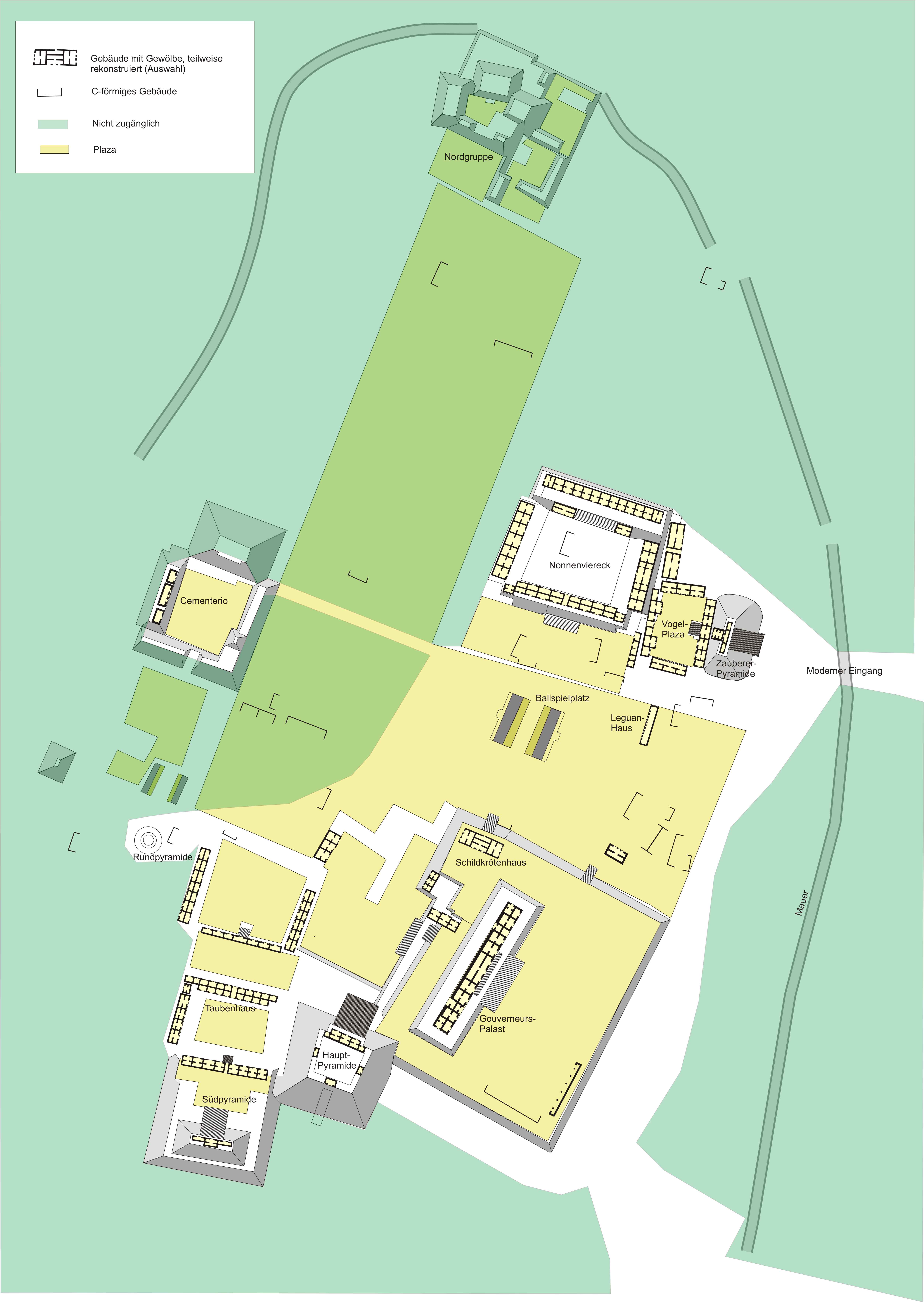
Uxmal (Yucatec Maya: ''Óoxmáal'' ) is an ancient Maya city of the classical period located in present-day Mexico. It is considered one of the most important archaeological sites of Maya culture, along with Palenque, Chichen Itza and Calakmul in Mexico, Caracol and Xunantunich in Belize, and Tikal in Guatemala. It is located in the Puuc region of the eastern Yucatán Peninsula, and is considered one of the Maya cities most representative of the region's dominant architectural style. It has been designated a UNESCO World Heritage Site in recognition of its significance. Uxmal is located 62 km south of Mérida, capital of Yucatán state in Mexico. Its buildings are noted for their size and decoration. Ancient roads called ''sacbes'' connect the buildings, and also were built to other cities in the area such as Chichén Itzá in modern-day Mexico, Caracol and Xunantunich in modern-day Belize, and Tikal in modern-day Guatemala. Its buildings are typical of the Puuc style, wi ... [...More Info...] [...Related Items...] OR: [Wikipedia] [Google] [Baidu] |
Chichen Itza
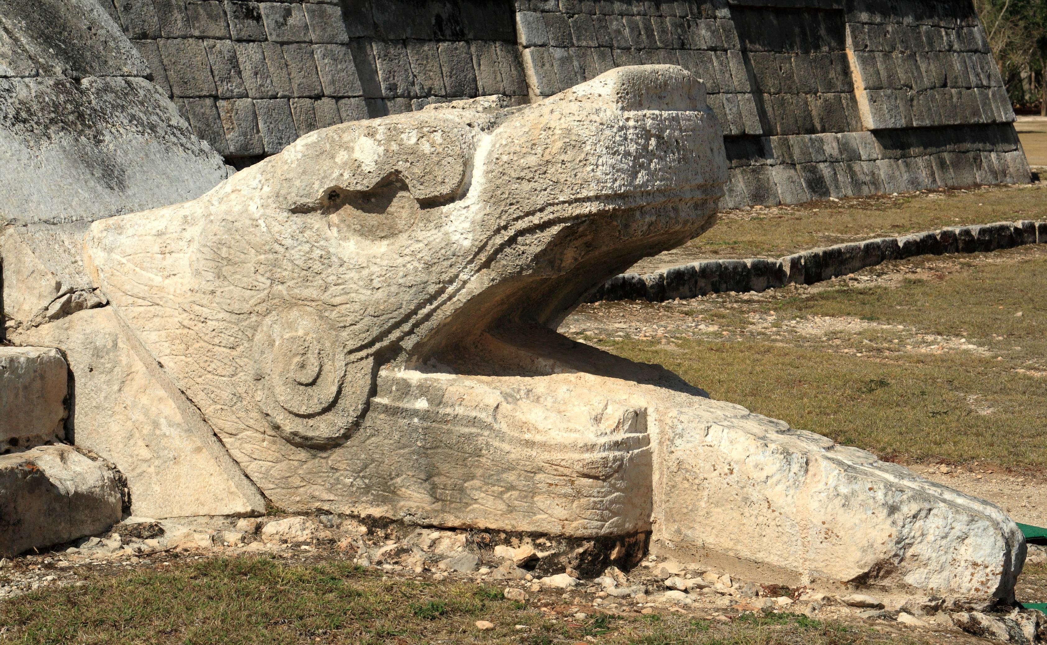
Chichen Itza , es, Chichén Itzá , often with the emphasis reversed in English to ; from yua, Chiʼchʼèen Ìitshaʼ () "at the mouth of the well of the Itza people" was a large pre-Columbian city built by the Maya people of the Terminal Classic period. The archeological site is located in Tinúm Municipality, Yucatán State, Mexico. Chichen Itza was a major focal point in the Northern Maya Lowlands from the Late Classic (c. AD 600–900) through the Terminal Classic (c. AD 800–900) and into the early portion of the Postclassic period (c. AD 900–1200). The site exhibits a multitude of architectural styles, reminiscent of styles seen in central Mexico and of the Puuc and Chenes styles of the Northern Maya lowlands. The presence of central Mexican styles was once thought to have been representative of direct migration or even conquest from central Mexico, but most contemporary interpretations view the presence of these non-Maya styles more as the result of cultural ... [...More Info...] [...Related Items...] OR: [Wikipedia] [Google] [Baidu] |
Coba
Coba ( es, Cobá) is an ancient Maya city on the Yucatán Peninsula, located in the Mexican state of Quintana Roo. The site is the nexus of the largest network of stone causeways of the ancient Maya world, and it contains many engraved and sculpted stelae that document ceremonial life and important events of the Late Classic Period (AD 600–900) of Mesoamerican civilization. The adjacent modern village bearing the same name, reported a population of 1,278 inhabitants in the 2010 Mexican federal census. The ruins of Coba lie 47 km (approx. 29 mi) northwest of Tulum, in the State of Quintana Roo, Mexico. The geographical coordinates of Coba Group (main entrance for tourist area of the archaeological site) are North 19° 29.6’ and West 87° 43.7’. The archaeological zone is reached by a two-kilometer branch from the asphalt road connecting Tulum with Nuevo Xcán (a community of Lázaro Cárdenas, another municipality of Quintana Roo) on the Valladolid to Cancún hig ... [...More Info...] [...Related Items...] OR: [Wikipedia] [Google] [Baidu] |


.jpg)