|
Mahadev Peak
Mahadev Peak is a mountain peak in the vicinity of New Theed in Srinagar District of Indian administered Jammu and Kashmir. It is part of the Zabarwan Range. It is visible in most parts of Srinagar city. It is also known as the peak of Srinagar. It is covered with snow for almost half of the year. The Tarsar and Marsar lakes lie on the eastern side of this mountain. Other than Mahadev peak, places like Mamneth, Astanmarg, Ledwas, Burzwas, are well known among the trekkers. Route It can be climbed through Faqir Gujri, near Scholars' School, Dara Theed Harwan. The trek can be both a day trek as well as a night trek with a night stay at Ledwas. The trek has moderate difficulty. We have to cross several small streams on our way to Ledwas, which is always enjoyable. Nomads can be seen grazing the cattle with their horses carrying essentials. See also * New Theed * Dachigam National Park Dachigam National Park is a national park located, from Srinagar city in Srinagar di ... [...More Info...] [...Related Items...] OR: [Wikipedia] [Google] [Baidu] |
Kashmir Valley
The Kashmir Valley, also known as the ''Vale of Kashmir'', is an intermontane valley concentrated in the Kashmir Division of the Indian- union territory of Jammu and Kashmir. The valley is bounded on the southwest by the Pir Panjal Range and on the northeast by the main Himalayas range. It is approximately long and wide, and drained by the Jhelum River. Geography The Kashmir Valley lies between latitude 33° and 35°N, and longitude 73° and 76°E. The valley is wide and covers in area. It is bounded by sub-ranges of the Western Himalayas: the Great Himalayas bound it in the northeast and separate it from the Tibetan plateau, whereas the Pir Panjal Range in the Lesser Himalayas bounds it on the west and the south, and separates it from the Punjab Plain. The valley has an average elevation of above sea-level, but the surrounding Pir Panjal range has an average elevation of . The Jhelum River is the main river of the Valley. It originates at Verinag; its most importa ... [...More Info...] [...Related Items...] OR: [Wikipedia] [Google] [Baidu] |
Zabarwan Range
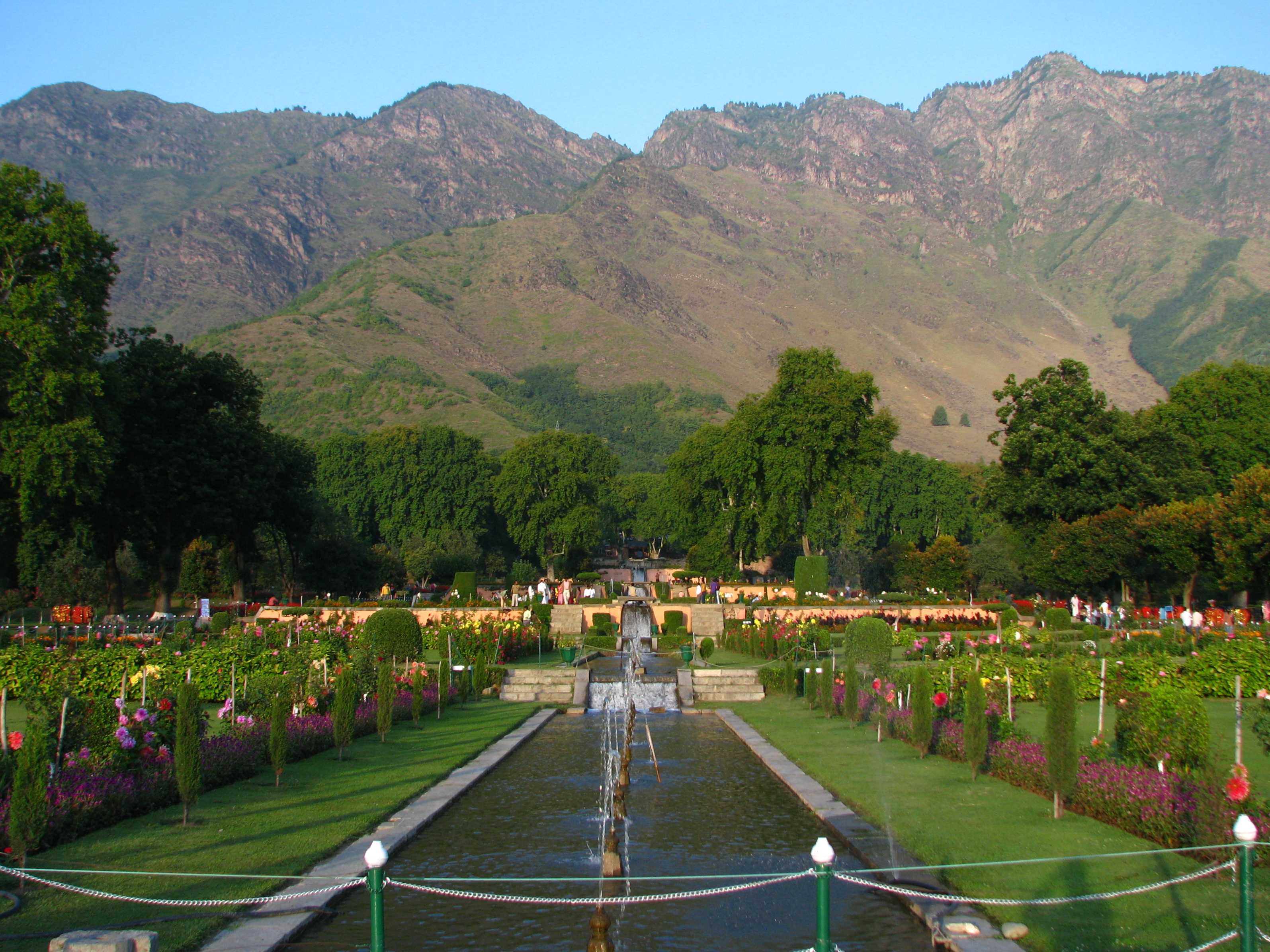
The Zabarwan Range is a short (20 mi (32 km) long) sub-mountain range between Pir Panjal and Great Himalayan Range in the central part of the Kashmir Valley in the Union Territory of Jammu and Kashmir in India. Geography The Zabarwan Range borders the central part of the Kashmir Valley in the east. Literally it is the mountain range between Sind Valley and Lidder Valley on the north and south, and between the Zanskar Range and Jehlum Valley on the east and west, respectively. Specifically the range is known to be what overlooks the Dal Lake and holds the Mughal gardens of Srinagar. The north end of the range lies in Ganderbal, while the south end lies in Pampore. The Shankaracharya Temple is built on the edge of the central part of the Zabarwan Range. The highest peak of this range is Mahadev Peak at , which forms the distant background of the eastern mountain wall. On the northern slopes of the central part of the range there are three Mughal gardens built by Emp ... [...More Info...] [...Related Items...] OR: [Wikipedia] [Google] [Baidu] |
Mountain Peak
A summit is a point on a surface that is higher in elevation than all points immediately adjacent to it. The topographic terms acme, apex, peak (mountain peak), and zenith are synonymous. The term (mountain top) is generally used only for a mountain peak that is located at some distance from the nearest point of higher elevation. For example, a big, massive rock next to the main summit of a mountain is not considered a summit. Summits near a higher peak, with some prominence or isolation, but not reaching a certain cutoff value for the quantities, are often considered ''subsummits'' (or ''subpeaks'') of the higher peak, and are considered part of the same mountain. A pyramidal peak is an exaggerated form produced by ice erosion of a mountain top. Summit may also refer to the highest point along a line, trail, or route. The highest summit in the world is Mount Everest with a height of above sea level. The first official ascent was made by Tenzing Norgay and Sir Edmund Hillary ... [...More Info...] [...Related Items...] OR: [Wikipedia] [Google] [Baidu] |
New Theed
New Theed is a notified area in Srinagar city known for its historical significance and natural surroundings. Location It is located about 20km from Srinagar city center. It is a well-known tourist attraction within the city. The gateway to the Dachigam National Park. The base point for undertaking trekking to the adjacent Mahadev Mountain peak. The land's topography is mountainous and is enclosed by Dachigam National Park on the east side. From the south side, there is the famous Harwan Garden below the foothills of the Zabarwan Range, which is also the entry point to the area. It hosts the Heritage Chestnut Garden and a Sericulture nursery. There is also a branch unit of Jammu and Kashmir Bank along with an ATM service. Education The area consists of the following schools: * Government Boys High School. * Famous Abhay Mission Secondary School. * Sayed Mirak Shah Memorial School. History The history of Haripora Harwan, commonly known as New Theed, dates back to t ... [...More Info...] [...Related Items...] OR: [Wikipedia] [Google] [Baidu] |
Indian-administered Jammu And Kashmir
Kashmir () is the northernmost geographical region of the Indian subcontinent. Until the mid-19th century, the term "Kashmir" denoted only the Kashmir Valley between the Great Himalayas and the Pir Panjal Range. Today, the term encompasses a larger area that includes the Indian-administered territories of Jammu and Kashmir and Ladakh, the Pakistani-administered territories of Azad Kashmir and Gilgit-Baltistan, and the Chinese-administered territories of Aksai Chin and the Trans-Karakoram Tract. Quote: "Kashmir, region of the northwestern Indian subcontinent. It is bounded by the Uygur Autonomous Region of Xinjiang to the northeast and the Tibet Autonomous Region to the east (both parts of China), by the Indian states of Himachal Pradesh and Punjab to the south, by Pakistan to the west, and by Afghanistan to the northwest. The northern and western portions are administered by Pakistan and comprise three areas: Azad Kashmir, Gilgit, and Baltistan, ... The southern and southe ... [...More Info...] [...Related Items...] OR: [Wikipedia] [Google] [Baidu] |
Srinagar
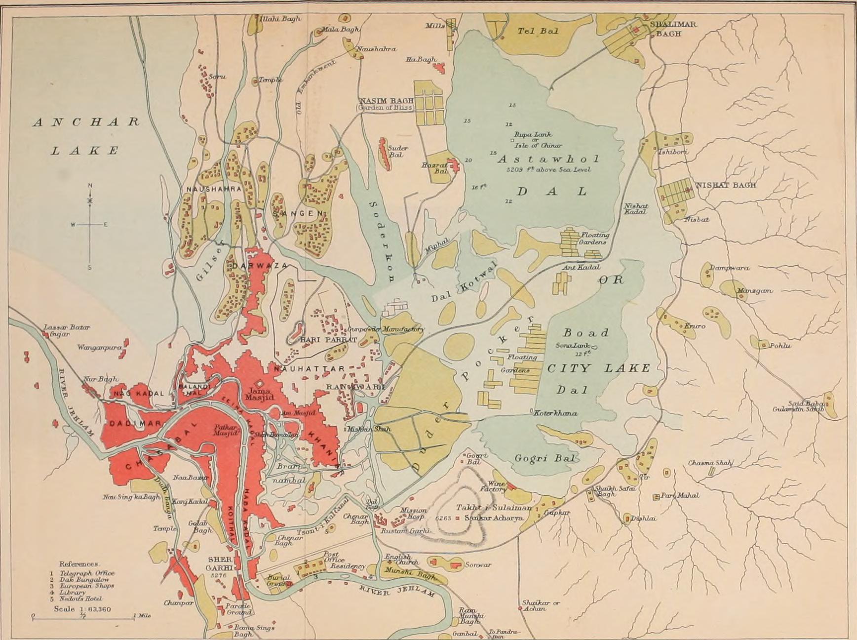
Srinagar (English: , ) is the largest city and the summer capital of Jammu and Kashmir, India. It lies in the Kashmir Valley on the banks of the Jhelum River, a tributary of the Indus, and Dal and Anchar lakes. The city is known for its natural environment, gardens, waterfronts and houseboats. It is known for traditional Kashmiri handicrafts like the Kashmir shawl (made of pashmina and cashmere wool), and also dried fruits. It is the 31st-most populous city in India, the northernmost city in India to have over one million people, and the second-largest metropolitan area in the Himalayas (after Kathmandu, Nepal). Origin of name The earliest records, such as Kalhana's ''Rajatarangini'', mentions the Sanskrit name ''shri-nagara'' which have been interpreted distinctively by scholars in two ways: one being ''sūrya-nagar'', meaning "''City of the Surya''" (trans) ''"City of Sun''" and other being ''"The city of "Shri''" (श्री), the Hindu goddess of wealth, meaning "' ... [...More Info...] [...Related Items...] OR: [Wikipedia] [Google] [Baidu] |
Tarsar Lake
The Tarsar Lake or Tar Sar is an almond-shaped, oligotrophic alpine lake situated in between Sindh and Lidder valleys. On its west side lies Dachigam National Park, and on its south side lies Tral. The shortest route for reaching it, is from Surfraw Ganderbal, but it has a difficult terrain. Other trek routes to the lake are from Lidderwat and Nagaberan forest areas which fall in south Kashmir. Geography The Tarsar Lake is dominated by the peaks of the Kolahoi mountain some 20 km to the east. The lake is separated by a mountain with a minimum peak elevation of from another lake of the same nature known as Marsar Lake, which is in the vicinity of Dachigam National Park. Together these two lakes are referred to as the twin sisters. The 16th-century Kashmiri ruler Yusuf Shah Chak mentioned the twin lakes in his poetry, writing to his beloved: The Tarsar Lake is drained by an outlet stream which falls into the Lidder River at Lidderwat, 15 km to the east. Being the nea ... [...More Info...] [...Related Items...] OR: [Wikipedia] [Google] [Baidu] |
Marsar Lake
The Marsar Lake is an oligotrophic alpine lake located in Tral valley of Pulwama district in Jammu and Kashmir, India. It is famous for its scenic beauty. It also falls in the close vicinity of Aru valley in Pahalgam. The lake is separated by a mountain with a minimum peak elevation of from another lake of the same nature known as Tarsar Lake. Due to their close proximity and similar physical characteristics, the two lakes are often called as the "twin sisters". The site has over the years become a famous tourist destination. Tarsar-Marsar Trek is one of the highly opted treks of the Kashmir Valley. A stream emerges from this lake, which travels through the Dachigam valley and enters Srinagar near Harwan garden where it fills the Sarband reservoir. This stream (Dagwan Nallah) is joined by another stream which flows from Mount Mahadeo near the Telbal village and from thereon it is called the Telbal nallah which is the primary source of the Dal Lake. References See also *Tarsar ... [...More Info...] [...Related Items...] OR: [Wikipedia] [Google] [Baidu] |
Dachigam National Park
Dachigam National Park is a national park located, from Srinagar city in Srinagar district of Jammu and Kashmir, India on the east side of Dal Lake. It covers an area of 161, 62.16(updated recently) by hgtian student SIJ. The name of the park literally stands for "ten villages" which is in the memory of the ten villages that were relocated for its formation. These ten villages were living in this region before the World War I in the beginning of 20th century. The main gate entrance is very close to the New Theed general bus stand on the either side of Darul Uloom Kousaria. The park has been a protected area since 1910, first under the care of the Maharaja of Jammu and Kashmir and later under the observation of the concerned government authorities. It was initially created to ensure a supply of clean drinking water for Srinagar. It was upgraded and declared a National Park in 1981. Topography Dachigam National park is located in the Zabarwan Range of the western Himalayas. ... [...More Info...] [...Related Items...] OR: [Wikipedia] [Google] [Baidu] |
Mountains Of Jammu And Kashmir
A mountain is an elevated portion of the Earth's crust, generally with steep sides that show significant exposed bedrock. Although definitions vary, a mountain may differ from a plateau in having a limited summit area, and is usually higher than a hill, typically rising at least 300 metres (1,000 feet) above the surrounding land. A few mountains are isolated summits, but most occur in mountain ranges. Mountains are formed through tectonic forces, erosion, or volcanism, which act on time scales of up to tens of millions of years. Once mountain building ceases, mountains are slowly leveled through the action of weathering, through slumping and other forms of mass wasting, as well as through erosion by rivers and glaciers. High elevations on mountains produce colder climates than at sea level at similar latitude. These colder climates strongly affect the ecosystems of mountains: different elevations have different plants and animals. Because of the less hospitable terrain and ... [...More Info...] [...Related Items...] OR: [Wikipedia] [Google] [Baidu] |


