|
Maesbury Castle
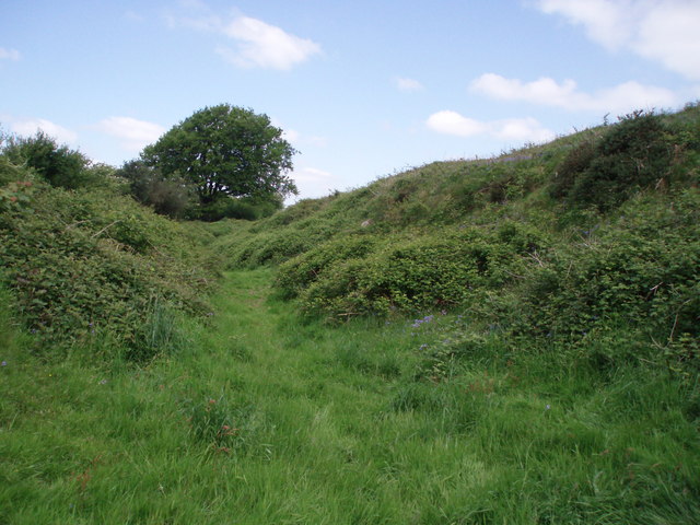
Maesbury Castle is an Iron Age hill fort within the parish of Croscombe on the Mendip Hills, just north of Shepton Mallet, Somerset, England. It has been listed as a Scheduled Ancient Monument. The name is derived from ''maes'', meaning ''field'' or ''plain'' in Brythonic Welsh, and ''burh'', meaning fort in Old English. There is also a record of the name ''Merksburi'' in 705 AD, meaning ''boundary fort''. The area was a boundary between the Romano-British Celts and West Saxons during the period 577-652 AD, when the nearby Wansdyke fortification comprised part of the border. The enclosure has an area of , and lies at a height of 292 m (950 ft), with views in many directions. This includes the Somerset Levels to Glastonbury Tor and Brent Knoll which are the closest and probably the most easily identifiable landmarks from the site. The fort has a single rampart up to 6 m high, with an outer ditch (univallate). Entrances are to the south-east and north-east (with pos ... [...More Info...] [...Related Items...] OR: [Wikipedia] [Google] [Baidu] |
Croscombe
Croscombe is a village and civil parish west of Shepton Mallet and from Wells, in the Mendip district of Somerset, England. It is situated on the A371 road in the valley of the River Sheppey. Croscombe has a village hall, a shop, a public house, a Church, a chapel and a school. History North-east of the village and within the parish boundary is Maesbury Castle, an Iron Age hill fort. It was first recorded in 706 when King Ine of Wessex referred to the village as ''Correges Cumb''. The parish of Croscombe was part of the Whitstone Hundred. Croscombe emerged in the 16th and 17th centuries with a boom in the wool trade. During this period many houses, cottages and hostelries were built and the church was reconstructed. During the Industrial Revolution, silk, mining, quarrying and milling replaced the wool trade. In 1848 the River Sheppey powered two mills for grinding corn, one for winding silk, and another used as a stocking manufactory. The Old Manor was built around ... [...More Info...] [...Related Items...] OR: [Wikipedia] [Google] [Baidu] |
Wansdyke (earthwork)
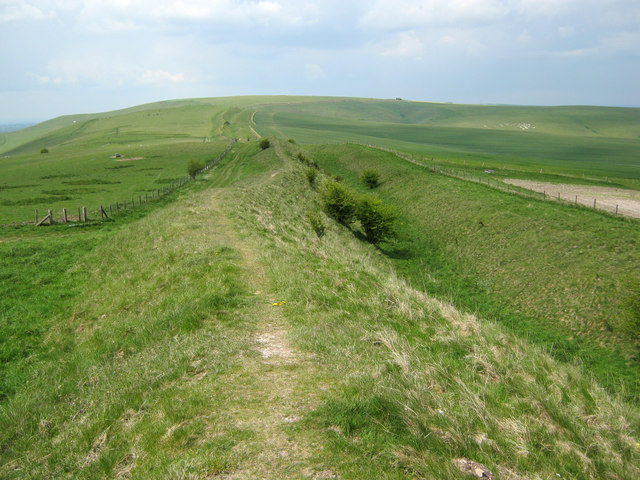
Wansdyke (from ''Woden's Dyke'') is a series of early medieval defensive linear earthworks in the West Country of England, consisting of a ditch and a running embankment from the ditch spoil, with the ditching facing north. There are two main parts: an eastern dyke which runs between Savernake Forest, West Woods and Morgan's Hill in Wiltshire, and a western dyke which runs from Monkton Combe to the ancient hill fort of Maes Knoll in historic Somerset. Between these two dykes there is a middle section formed by the remains of the London to Bath Roman road. There is also some evidence in charters that it extended west from Maes Knoll to the coast of the Severn Estuary but this is uncertain. It may possibly define a post-Roman boundary. Usage Wansdyke consists of two sections, long with some gaps in between. East Wansdyke is an impressive linear earthwork, consisting of a ditch and bank running approximately east–west, between Savernake Forest and Morgan's Hill. West Wansd ... [...More Info...] [...Related Items...] OR: [Wikipedia] [Google] [Baidu] |
List Of Hill Forts And Ancient Settlements In Somerset
Somerset is a ceremonial county in South West England. It is a rural county of rolling hills, such as the Mendip Hills, Quantock Hills and Exmoor National Park, and large flat expanses of land including the Somerset Levels. Modern man came to what is now known as Somerset during the Early Upper Palaeolithic era. In the Neolithic era, from about 3500 BC, there is evidence of farming when people started to manage animals and grow crops on farms cleared from the woodland, rather than act purely as hunter gatherers. It is also likely that extraction and smelting of mineral ores to make tools, weapons, containers and ornaments in bronze and then iron started in the late Neolithic and into the Bronze and Iron Ages. The construction of hillforts began in Britain in the Late Bronze and Early Iron Age, roughly the start of the first millennium BC. The reason for their emergence, and their purpose, has been a subject of debate. It has been argued that they could have been military si ... [...More Info...] [...Related Items...] OR: [Wikipedia] [Google] [Baidu] |
List Of Hill Forts In England ...
See also *List of hill forts in Scotland *List of hill forts in Wales *Iron Age, British Iron Age, prehistory References ;Bibliography * Further reading * * * External links * A crowd-sourced project to map the hillforts of Britain and Ireland. {{DEFAULTSORT:List Of Hill Forts In England List of hill forts Iron Age sites in England Hill forts England Hill forts A hillfort is a type of earthwork used as a fortified refuge or defended settlement, located to exploit a rise in elevation for defensive advantage. They are typically European and of the Bronze Age or Iron Age. Some were used in the post-Roma ... [...More Info...] [...Related Items...] OR: [Wikipedia] [Google] [Baidu] |
Maes Knoll
Maes Knoll (sometimes Maes tump or Maes Knoll tump) is an Iron Age hill fort in Somerset, England, located at the eastern end of the Dundry Down ridge, south of the city of Bristol and north of the village of Norton Malreward near the eastern side of Dundry Hill. It is a Scheduled Ancient Monument. Background Hill forts developed in the Late Bronze and Early Iron Age, roughly the start of the first millennium BC. The reason for their emergence in Britain, and their purpose, has been a subject of debate. It has been argued that they could have been military sites constructed in response to invasion from continental Europe, sites built by invaders, or a military reaction to social tensions caused by an increasing population and consequent pressure on agriculture. The dominant view since the 1960s has been that the increasing use of iron led to social changes in Britain. Deposits of iron ore were distant from the tin and copper ore necessary to make bronze, so that tradin ... [...More Info...] [...Related Items...] OR: [Wikipedia] [Google] [Baidu] |
Devonian
The Devonian ( ) is a geologic period and system of the Paleozoic era, spanning 60.3 million years from the end of the Silurian, million years ago (Mya), to the beginning of the Carboniferous, Mya. It is named after Devon, England, where rocks from this period were first studied. The first significant adaptive radiation of life on dry land occurred during the Devonian. Free-sporing vascular plants began to spread across dry land, forming extensive forests which covered the continents. By the middle of the Devonian, several groups of plants had evolved leaves and true roots, and by the end of the period the first seed-bearing plants appeared. The arthropod groups of myriapods, arachnids and hexapods also became well-established early in this period, after starting their expansion to land at least from the Ordovician period. Fish reached substantial diversity during this time, leading the Devonian to often be dubbed the Age of Fishes. The placoderms began dominating ... [...More Info...] [...Related Items...] OR: [Wikipedia] [Google] [Baidu] |
Old Red Sandstone
The Old Red Sandstone is an assemblage of rocks in the North Atlantic region largely of Devonian age. It extends in the east across Great Britain, Ireland and Norway, and in the west along the northeastern seaboard of North America. It also extends northwards into Greenland and Svalbard. These areas were a part of the ancient continent of Euramerica, Euramerica/Laurussia. In Britain it is a lithostratigraphy, lithostratigraphic unit (a sequence of rock strata) to which Stratigraphy, stratigraphers accord Geological unit#Lithostratigraphic units, supergroup status and which is of considerable importance to early paleontology. For convenience the short version of the term, ORS is often used in literature on the subject. The term was coined to distinguish the sequence from the younger New Red Sandstone which also occurs widely throughout Britain. Sedimentology The Old Red Sandstone describes a suite of sedimentary rocks deposited in a variety of environments during the Devonian ... [...More Info...] [...Related Items...] OR: [Wikipedia] [Google] [Baidu] |
Channel 4
Channel 4 is a British free-to-air public broadcast television network operated by the state-owned enterprise, state-owned Channel Four Television Corporation. It began its transmission on 2 November 1982 and was established to provide a fourth television service in the United Kingdom. At the time, the only other channels were the television licence, licence-funded BBC One and BBC Two, and a single commercial broadcasting network ITV (TV network), ITV. The network's headquarters are based in London and Leeds, with creative hubs in Glasgow and Bristol. It is publicly owned and advertising-funded; originally a subsidiary of the Independent Broadcasting Authority (IBA), the station is now owned and operated by Channel Four Television Corporation, a public corporation of the Department for Digital, Culture, Media and Sport, which was established in 1990 and came into operation in 1993. Until 2010, Channel 4 did not broadcast in Wales, but many of its programmes were re-broadcast ... [...More Info...] [...Related Items...] OR: [Wikipedia] [Google] [Baidu] |
Barry Cunliffe
Sir Barrington Windsor Cunliffe, (born 10 December 1939), known as Barry Cunliffe, is a British archaeologist and academic. He was Professor of European Archaeology at the University of Oxford from 1972 to 2007. Since 2007, he has been an Emeritus Professor. Biography Cunliffe's decision to become an archaeologist was sparked at the age of nine by the discovery of Roman remains on his uncle's farm in Somerset. After studying at Portsmouth Northern Grammar School (now the Mayfield School) and reading archaeology and anthropology at St John's College, Cambridge, he became a lecturer at the University of Bristol in 1963. Fascinated by the Roman remains in nearby Bath he embarked on a programme of excavation and publication. In 1966 he became an unusually young professor when he took the chair at the newly founded Department of Archaeology at the University of Southampton. There he became involved in the excavation (1961–1968) of the Fishbourne Roman Palace in Sussex. Anot ... [...More Info...] [...Related Items...] OR: [Wikipedia] [Google] [Baidu] |
1st Millennium BC
The 1st millennium BC, also known as the last millennium BC, was the period of time lasting from the years 1000 BC to 1 BC (10th to 1st centuries BC; in astronomy: JD – ). It encompasses the Iron Age in the Old World and sees the transition from the Ancient Near East to classical antiquity. World population roughly doubled over the course of the millennium, from about 100 million to about 200–250 million.Klein Goldewijk, K. , A. Beusen, M. de Vos and G. van Drecht (2011). The HYDE 3.1 spatially explicit database of human induced land use change over the past 12,000 years, Global Ecology and Biogeography20(1): 73–86. pbl.nl. Goldewijk et al. (2011) estimate 188 million as of AD 1, citing a literature range of 170 million (low) to 300 million (high). Out of the estimated 188M, 116M are estimated for Asia (East, South/Southeast and Central Asia, excluding Western Asia), 44M for Europe and the Near East, 15M for Africa (including Egypt and Roman North Africa), 12M for Me ... [...More Info...] [...Related Items...] OR: [Wikipedia] [Google] [Baidu] |


