|
Ma On Shan Village
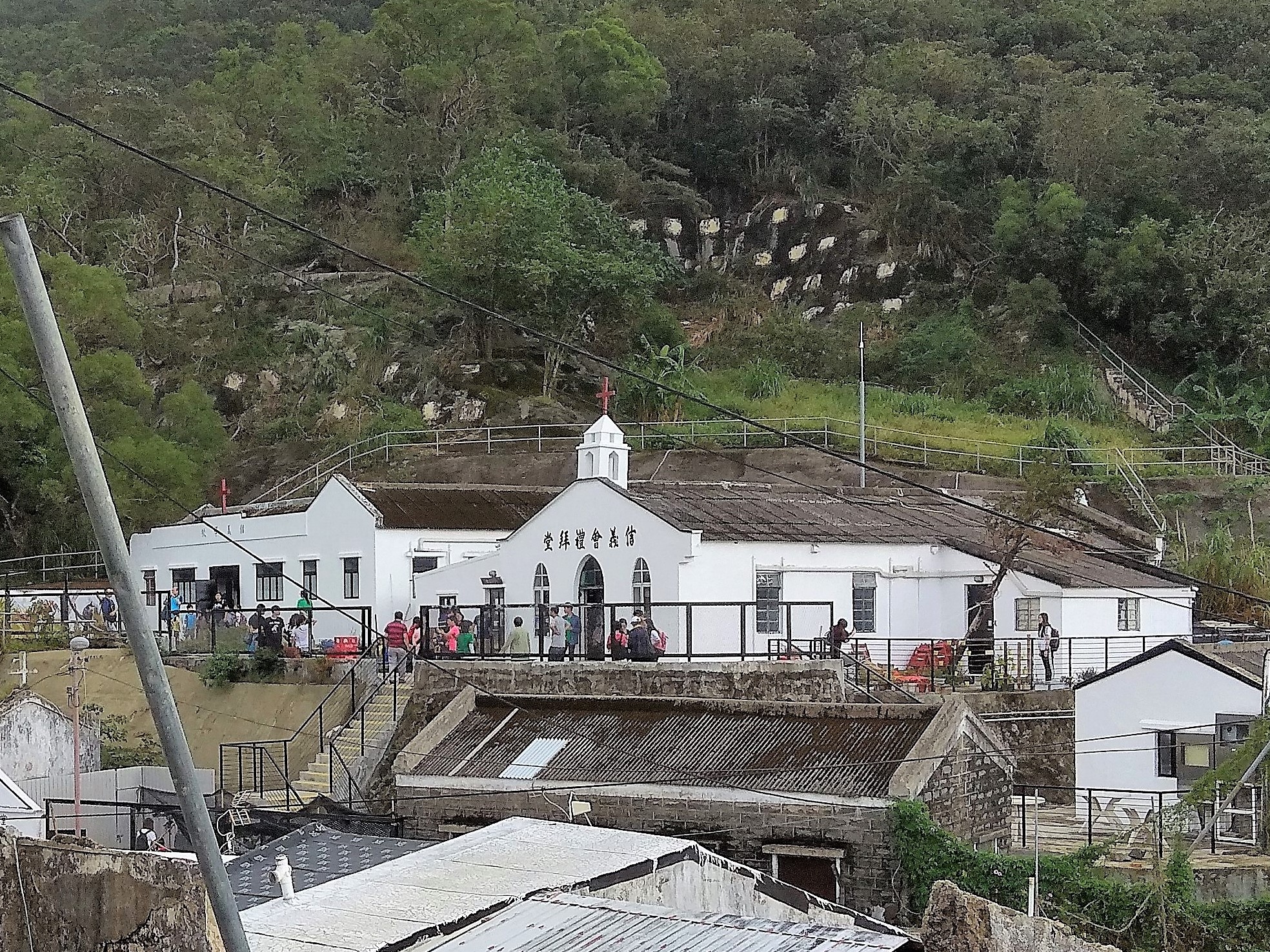
Ma On Shan Village or Ma On Shan Tsuen () is a mining village in the hills of Ma On Shan, Sha Tin District, Hong Kong. The village grew around the activity of the Ma On Shan Iron Mine, which reached its peak during the 1950s-60s and ceased operation in 1976. It had historically two churches, St. Joseph's Church and Lutheran Yan Kwong Church. Administration Ma On Shan Tsuen is a recognized village under the New Territories Small House Policy. Demographics At its peak, after a rapid growth in the 1950s, the village had more than 10,000 inhabitants. The small village saw a large number of new arrivals after changes in the methods of iron ore mining were implemented in 1953. Nearly all of the new arrivals were refugees from Mainland China, who worked as miners and came to live in the area with their families.Antiquities Advisory Board. Historic Building AppraisalSt. Joseph's Church, Ma On Shan Tsuen Road/ref> The exploitation of the mine ended in 1976 and the miners subsequently ... [...More Info...] [...Related Items...] OR: [Wikipedia] [Google] [Baidu] |
Lutheran Yan Kwong Church 02
Lutheranism is one of the largest branches of Protestantism, identifying primarily with the theology of Martin Luther, the 16th-century German monk and Protestant Reformers, reformer whose efforts to reform the theology and practice of the Catholic Church launched the Reformation, Protestant Reformation. The reaction of the government and church authorities to the international spread of his writings, beginning with the ''Ninety-five Theses'', divided Western Christianity. During the Reformation, Lutheranism became the state religion of numerous states of northern Europe, especially in northern Germany, Scandinavia and the then-Livonian Order. Lutheran clergy became civil servants and the Lutheran churches became part of the state. The split between the Lutherans and the Roman Catholics was made public and clear with the 1521 Edict of Worms: the edicts of the Diet (assembly), Diet condemned Luther and officially banned citizens of the Holy Roman Empire from defending or propagatin ... [...More Info...] [...Related Items...] OR: [Wikipedia] [Google] [Baidu] |
Open-pit Mining
Open-pit mining, also known as open-cast or open-cut mining and in larger contexts mega-mining, is a surface mining technique of extracting rock or minerals from the earth from an open-air pit, sometimes known as a borrow. This form of mining differs from extractive methods that require tunnelling into the earth, such as long wall mining. Open-pit mines are used when deposits of commercially useful ore or rocks are found near the surface. It is applied to ore or rocks found at the surface because the overburden is relatively thin or the material of interest is structurally unsuitable for tunnelling (as would be the case for cinder, sand, and gravel). In contrast, minerals that have been found underground but are difficult to retrieve due to hard rock, can be reached using a form of underground mining. To create an open-pit mine, the miners must determine the information of the ore that is underground. This is done through drilling of probe holes in the ground, then plotting ea ... [...More Info...] [...Related Items...] OR: [Wikipedia] [Google] [Baidu] |
Ngong Ping, Ma On Shan
Ngong Ping () is a plateau in Ma On Shan, New Territories, Hong Kong. Located within Ma On Shan Country Park, it is administratively part of Sha Tin District. History Ngong Ping was historically the site of a village. It is still a recognized village under the New Territories Small House Policy. At the time of the 1911 census, the population of Ngong Ping was 9. The number of males was 7. Campsite Ngong Ping has a camp site with 20 spots for tents for overnight camping, offering barbeques pits, benches, tables and drains as well as dry pit toilets. The campsite area is hilly surrounded by grass, rocks and low lying shrubs. Access Users of the campsite can reach the area by minibus from Sunshine City in Yiu On Estate or Sai Kung Town then walk from the bus terminus from Ma On Shan Village and Po Lo Che respectively. The MacLehose Trail The MacLehose Trail is a 100-kilometre hiking trail that crosses much of the New Territories, Hong Kong, starting from Pak Tam Chung, Sa ... [...More Info...] [...Related Items...] OR: [Wikipedia] [Google] [Baidu] |
Ma On Shan Country Trail
The Ma On Shan Country Trail () is a hiking trail in Ma On Shan Country Park, Hong Kong, running from Ma On Shan Village to Tai Shui Tseng () via Ngong Ping.Agriculture, Fisheries and Conservation DepartmentMa On Shan Country Park/ref> See also * List of hiking trails in Hong Kong Many named hiking trails have been established in Hong Kong: Hong Kong Island * Hong Kong Trail * Wilson Trail (stages 1 and 2) * Tai Tam Country Trail * Pottinger Peak Country Trail * Hong Pak Country Trail * Aberdeen Tree Walk * Tai Tam ... References External links * Hiking trails in Hong Kong Ma On Shan {{HongKong-stub ... [...More Info...] [...Related Items...] OR: [Wikipedia] [Google] [Baidu] |
Transport Department
The Transport Department of the Government of Hong Kong is a department of the Hong Kong Civil Service, civil service responsible for transportation-related policy in Hong Kong. The department is under the Transport and Logistics Bureau. The Transport Department was created on 1 December 1968 as a separate department within the Hong Kong Government. Prior to 1968 it was assigned to the Transport Office under the Chief Secretary for Administration, Colonial Secretary's department. History The Transport Office was founded in 1965 within the Colonial Secretariat, initially with a staff of 23. The office was set up in response to the territory's worsening traffic problems, and was modelled after the systems in Britain and other Commonwealth countries, with the new department taking responsibility for vehicle registration and driver licensing. In 1968, it was spun off as a separate government department, and was renamed as the Transport Department. In 1974, the department's headquart ... [...More Info...] [...Related Items...] OR: [Wikipedia] [Google] [Baidu] |
Sai Sha Road
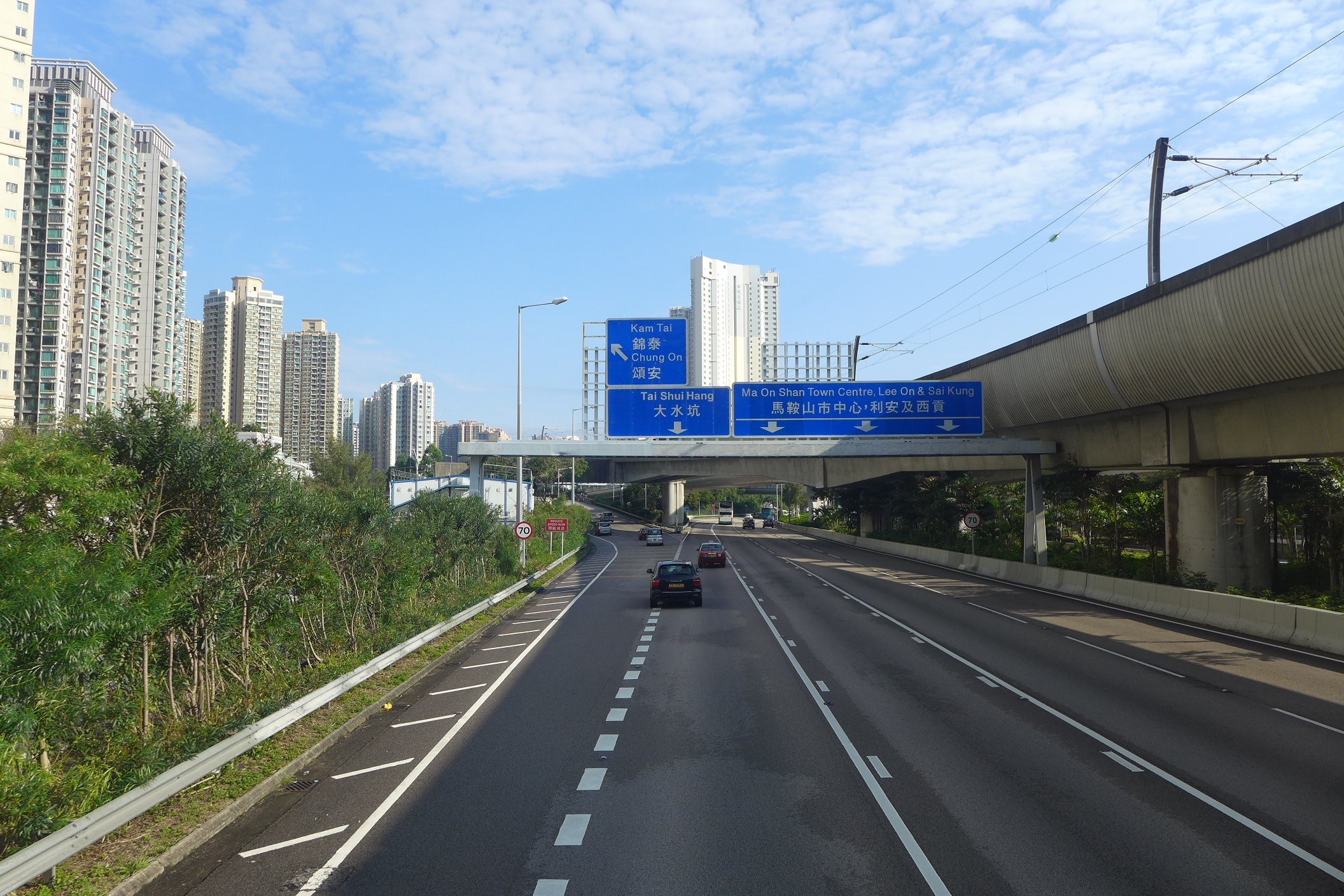
Sai Sha Road () is a main road connecting Sai Kung Town, Sai Kung and Ma On Shan (town), Ma On Shan. It begins at the roundabout at Sai Kung Town, Mak Pin, Sai Kung and passes through Three Fathoms Cove and Shap Sze Heung before traversing the new town of Ma On Shan and Wu Kai Sha and ending at Hang Tak Street in Tai Shui Hang. The MTR Tuen Ma line track section between Heng On station and Wu Kai Sha station is placed directly above Sai Sha Road. Other than MTR stations, several estates lie next to the road. The length of the road is approximately 11.2 km. Despite the road having close to no slope, it includes many bends. History Construction of the road began in the late 1970s. It originally stretched from Tai Mong Tsai to Nai Chung, hence the original name of the road was Nai Chung Access Road. In 1986, its name was altered to Sai Sha Road and has retained this name since then. Two years later, it was open to traffic, with the connection between Sha Tin New Town and Ma On Shan ... [...More Info...] [...Related Items...] OR: [Wikipedia] [Google] [Baidu] |
Ma On Shan Road
Ma On Shan Road () is a major road in the new town of Ma On Shan in the New Territories of Hong Kong. The road extends northward from Tate's Cairn Highway near Tai Shui Hang along the eastern bank of the Shing Mun River. It ends in the north when it joins Sai Sha Road near Wu Kai Sha. Its branch road, the Ma On Shan Bypass, redirects traffic between Sha Tin and Sai Kung North away from the town centre near the Heng On Estate. It is the primary thoroughfare to Ma On Shan. A short section of the road north of Tate's Cairn Highway is an expressway. See also *Ma On Shan *Sai Sha Road *List of streets and roads in Hong Kong The following are incomplete lists of notable expressways, tunnels, bridges, roads, avenues, streets, crescents, Town square, squares and bazaars in Hong Kong. Many roads on the Hong Kong Island conform to the contours of the hill landscape. S ... Ma On Shan Sha Tin District Roads in the New Territories {{HK-road-stub ... [...More Info...] [...Related Items...] OR: [Wikipedia] [Google] [Baidu] |
Ma On Shan Station
Ma On Shan () is an elevated station on the of Hong Kong. It is located above Sai Sha Road, at the town centre of Ma On Shan, between Sunshine City and Bayshore Towers. It also serves other residential areas like Kam Ying Court and Chung On Estate; it also serves over ten schools, and is in close proximity with Ma On Shan Park and other parks. The pattern featured on the platform pillar and glass barrier symbolizes the abandoned iron mine that used to be in Ma On Shan peak. History On 21 December 2004, Ma On Shan station opened with other KCR Ma On Shan Rail stations. On 14 February 2020, was extended south to a new terminus in , as part of the first phase of the Shatin to Central Link Project. The Ma On Shan Line was renamed ''Tuen Ma line Phase 1'' at the time. Ma On Shan station became an intermediate station on this temporary new line. On 27 June 2021, ''Tuen Ma line Phase 1'' subsequently merged with the West Rail line in East Kowloon to form the new , as part o ... [...More Info...] [...Related Items...] OR: [Wikipedia] [Google] [Baidu] |
Heritage Conservation In Hong Kong
This article details the history and status of Heritage conservation in Hong Kong, as well as the role of various stakeholders. An indication of the size of the built heritage in Hong Kong is given by a territory-wide survey conducted by the Antiquities and Monuments Office (AMO) between 1996 and 2000, which recorded some 8,800 buildings. The preservation of Intangible Cultural Heritage is also an emerging theme. Government agencies and legislation In alphabetical order: * Antiquities Advisory Board (AAB) * Antiquities and Monuments Office * Antiquities and Monuments Ordinance * Commissioner for Heritage's Office (CHO), set up on 25 April 2008 under the Development Bureau * Hong Kong Government's Central Conservation Section * Urban Renewal Authority Historic buildings As of 20 May 2016, there were 114 declared monuments in Hong Kong, and as of February 2013, there were 917 graded historic buildings (153 Grade I, 322 Grade II, 442 Grade III), of which 203 were owned by the Gover ... [...More Info...] [...Related Items...] OR: [Wikipedia] [Google] [Baidu] |
University Of Hong Kong
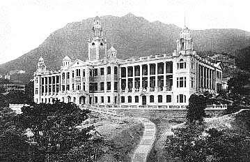
The University of Hong Kong (HKU) (Chinese: 香港大學) is a public research university in Hong Kong. Founded in 1887 as the Hong Kong College of Medicine for Chinese, it is the oldest tertiary institution in Hong Kong. HKU was also the first university established by the British in East Asia. As of December 2022, HKU ranks 21st internationally and third in Asia by '' QS'', and 31st internationally and fourth in Asia by ''Times Higher Education''. It has been ranked as the most international university in the world as well as one of the most prestigious universities in Asia. Today, HKU has ten academic faculties with English as the main language of instruction. The University of Hong Kong was also the first team in the world to successfully isolate the coronavirus SARS-CoV, the causative agent of SARS. History Founding The origins of The University of Hong Kong can be traced back to the Hong Kong College of Medicine for Chinese founded in 1887 by Ho Kai later known a ... [...More Info...] [...Related Items...] OR: [Wikipedia] [Google] [Baidu] |
Landslide
Landslides, also known as landslips, are several forms of mass wasting that may include a wide range of ground movements, such as rockfalls, deep-seated grade (slope), slope failures, mudflows, and debris flows. Landslides occur in a variety of environments, characterized by either steep or gentle slope gradients, from mountain ranges to coastal cliffs or even underwater, in which case they are called submarine landslides. Gravity is the primary driving force for a landslide to occur, but there are other factors affecting slope stability that produce specific conditions that make a slope prone to failure. In many cases, the landslide is triggered by a specific event (such as a heavy rainfall, an earthquake, a slope cut to build a road, and many others), although this is not always identifiable. Causes Landslides occur when the slope (or a portion of it) undergoes some processes that change its condition from stable to unstable. This is essentially due to a decrease in the She ... [...More Info...] [...Related Items...] OR: [Wikipedia] [Google] [Baidu] |

.jpg)


