|
M5 Highway (Russia)
The Russian route M5 (also known as the ''Ural Highway'') is a major trunk road running across a distance of 1879 km from Moscow to the Ural Mountains. It is part of the European route E30 and the Trans-Siberian Highway. The section from Yekaterinburg to Chelyabinsk is also part of AH7 and the section from Chelyabinsk to Moscow is also part of AH6. The highway starts at the crossing of the Moscow Ring Road and Volgogradsky Prospekt and runs southeast through Lyubertsy, crossing the Oka River at Kolomna. The Ural Highway continues across nine regions of Russia, passing through a dangerous mountain stretch before terminating at Chelyabinsk. The road continues from Chelyabinsk further east to Omsk, Novosibirsk, Irkutsk as the Russian route R254. Route :0 km Moscow :23 km Chulkovo :44 km Bronnitsy :70 km Stepanshchino :93 km Kolomna :116 km Lukhovitsy :''Ryazan Oblast'' :181 km Ryazan :302 km Putyatino :345 km Shatsk :'' Mordvinia'' :440 km Zubova Polyana :''Penza Oblast'' : ... [...More Info...] [...Related Items...] OR: [Wikipedia] [Google] [Baidu] |
Lukhovitsy
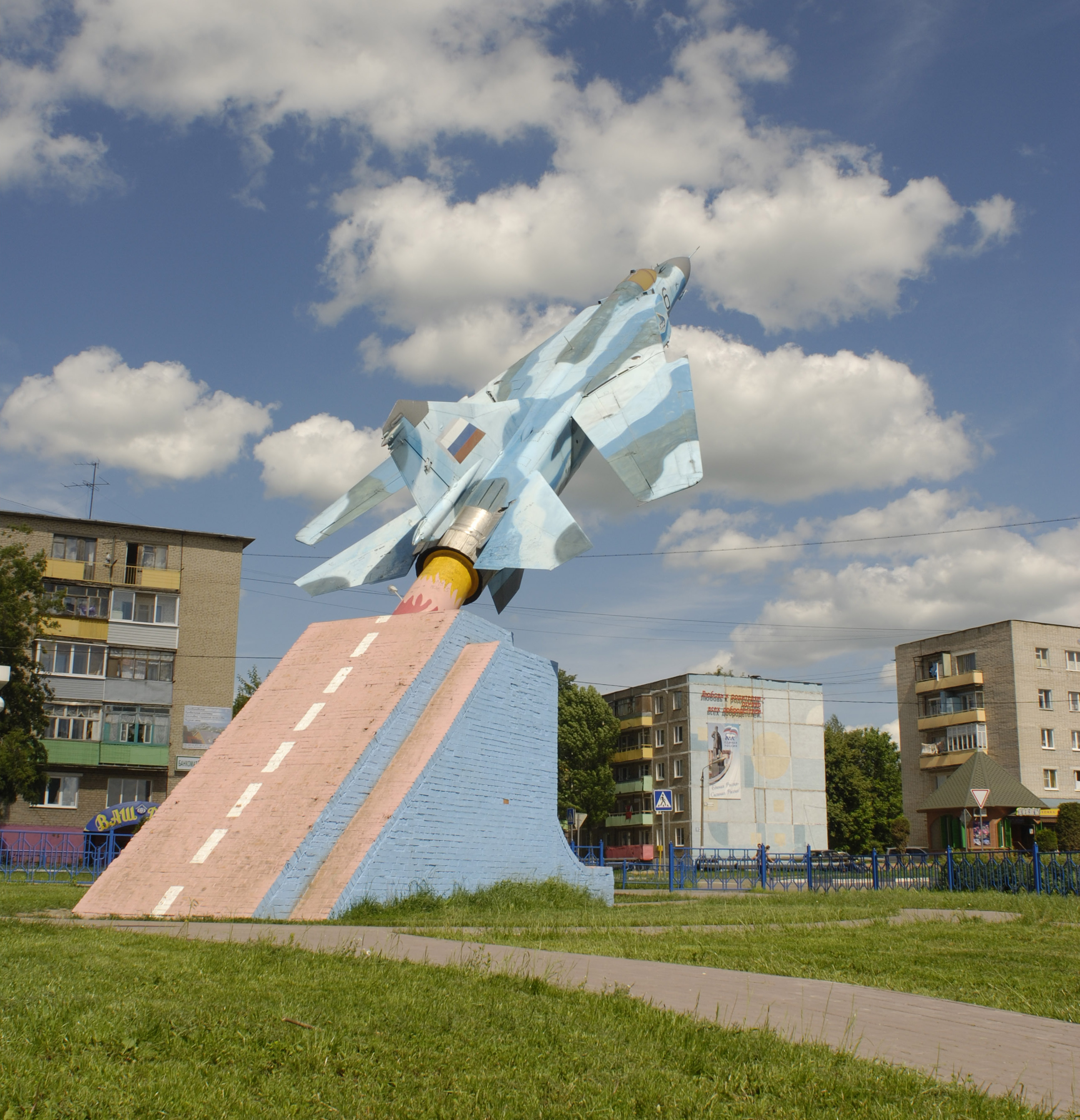
Lukhovitsy (russian: Лухови́цы) is a town and the administrative center of Lukhovitsky District in Moscow Oblast, Russia, located on the Oka River southeast of Moscow. Population: History It was first mentioned in 1594 as the settlement of Glukhovichi (), a votchina of a Ryazan archbishop. It used to be called Lukhovichi () until the mid-1920s. In 1957, it was granted town status. The town grew rapidly after the transfer of testing (and later production) facilities of the Mikoyan design bureau. Administrative and municipal status Within the framework of administrative divisions, Lukhovitsy serves as the administrative center of Lukhovitsky District.Resolution #123-PG As an administrative division, it is, together with the settlement of stantsii Chernaya, incorporated within Lukhovitsky District as the Town of Lukhovitsy. As a municipal division, the Town of Lukhovitsy is incorporated within Lukhovitsky Municipal District as Lukhovitsy Urban Settlement.Law #180/ ... [...More Info...] [...Related Items...] OR: [Wikipedia] [Google] [Baidu] |
Mezhdurechensk
Mezhdurechensk (russian: Междуреченск) is the name of several inhabited localities in Russia. ;Urban localities *Mezhdurechensk, Kemerovo Oblast, a city in Kemerovo Oblast; administratively incorporated as a city under oblast jurisdiction *Mezhdurechensk, Komi Republic, an urban-type settlement in Udorsky District of the Komi Republic * Mezhdurechensk, Samara Oblast, an urban-type settlement in Syzransky District of Samara Oblast Samara Oblast ( rus, Сама́рская о́бласть, r=Samarskaya oblast, p=sɐˈmarskəjə ˈobləsʲtʲ) is a federal subject of Russia (an oblast). Its administrative center is the city of Samara. From 1935 to 1991, it was known as Kuyb ... ;Rural localities * Mezhdurechensk, Ivanovo Oblast, a '' selo'' in Teykovsky District of Ivanovo Oblast See also * Mezhdurechensky (inhabited locality) * Mezhdurechye {{Set index article, populated places in Russia ... [...More Info...] [...Related Items...] OR: [Wikipedia] [Google] [Baidu] |
Syzran
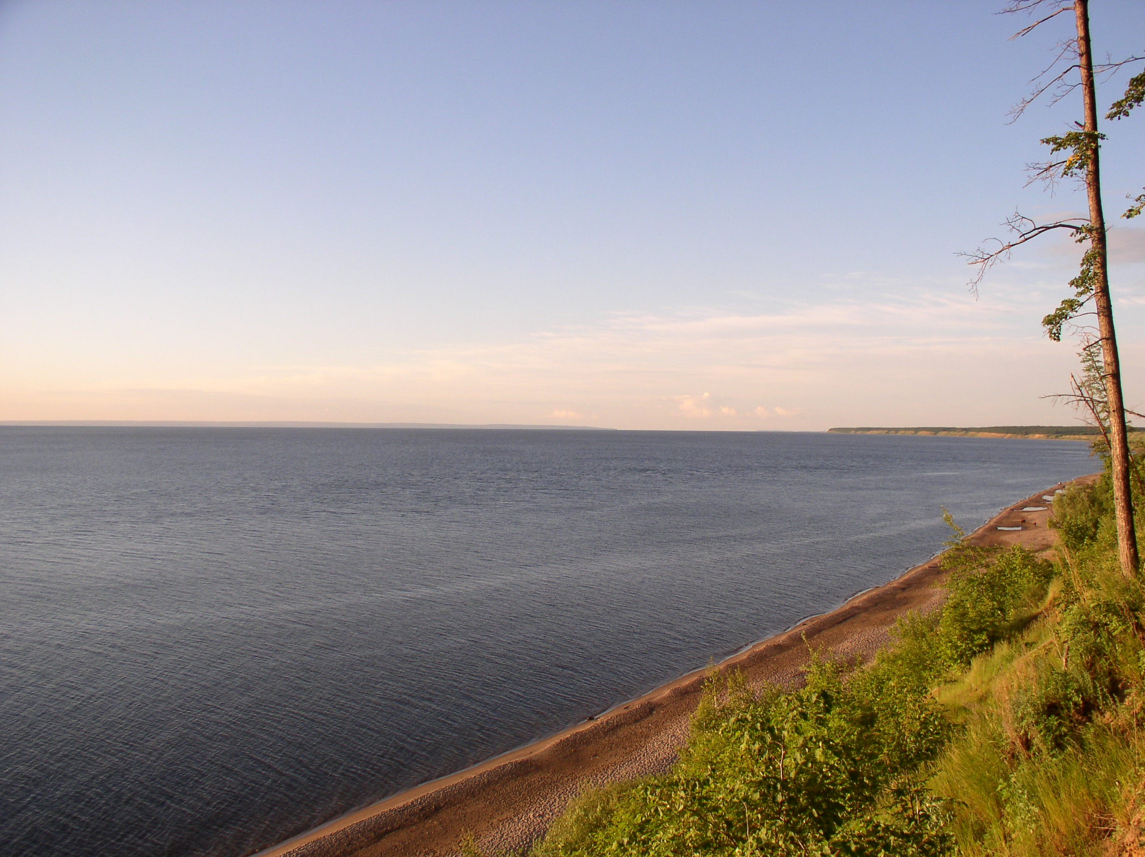
Syzran ( rus, Сызрань, p=ˈsɨzrənʲ) is the third largest city in Samara Oblast, Russia, located on the right bank of Saratov Reservoir of the Volga River. Population: History Founded in 1683 as a fortress, Syzran grew into an important trading center and was granted town status in 1796. One tower from the 17th-century fortress still stands. It is also the site of Syzran Bridge, once the longest bridge in Europe. Administrative and municipal status Within the framework of administrative divisions, Syzran serves as the administrative center of Syzransky District, even though it is not a part of it. As an administrative division, it is, together with three rural localities, incorporated separately as the city of oblast significance of Syzran—an administrative unit with the status equal to that of the districts.Charter of Samara Oblast'' As a municipal division, the city of oblast significance of Syzran is incorporated as Syzran Urban Okrug.Law #189-GD Economy The c ... [...More Info...] [...Related Items...] OR: [Wikipedia] [Google] [Baidu] |
Samara Oblast
Samara Oblast ( rus, Сама́рская о́бласть, r=Samarskaya oblast, p=sɐˈmarskəjə ˈobləsʲtʲ) is a federal subjects of Russia, federal subject of Russia (an oblast). Its administrative center is the types of inhabited localities in Russia, city of Samara. From 1935 to 1991, it was known as Kuybyshev Oblast ( rus, Ку́йбышевская о́бласть, r=Kuybyshevskaya Oblast, p=ˈkujbɨʂɨfskəjə ˈobləsʲtʲ). As of the Russian Census (2010), 2010 Census, the population of the oblast was 3,215,532. The oblast borders Tatarstan in the north, Orenburg Oblast in the east, Kazakhstan (West Kazakhstan Province) in the south, Saratov Oblast in the southwest and Ulyanovsk Oblast in the west. History The Samara region contains a remarkable succession of archaeological cultures from 7000 BC to 4000 BC. These sites have revealed Europe's earliest pottery (Elshanka culture), the world's oldest horse burial and signs of horse worship (the Syezzheye cemeter ... [...More Info...] [...Related Items...] OR: [Wikipedia] [Google] [Baidu] |
Ulyanovsk Oblast
Ulyanovsk Oblast (russian: Ульяновская область, ''Ul’janovskaja oblast’'') is a federal subject of Russia (an oblast). It is located in the Volga Federal District. Its administrative center is the city of Ulyanovsk. Population: 1,292,799 ( 2010 Census). Geography Ulyanovsk Oblast borders with Chuvashia (N), Tatarstan (NE), Samara Oblast (E), Saratov Oblast (S), Penza Oblast (W), and Mordovia (NW). It is located on the northern edge of Central Steppes. A quarter of its territory is covered with deciduous forests; the rest is covered with steppes and meadows. The oblast is divided in half by the Volga River. Hilly areas to the west of the Volga are known as Volga Upland (elevations up to 358 m (1,175 ft) ). Eastern part of the oblast is mostly flat. The water table occupies about 6% of territory. Ulyanovsk Oblast has moderately continental, highly volatile climate. Temperature averages at +19 °C (66 °F) in July, and −11 °C (1 ... [...More Info...] [...Related Items...] OR: [Wikipedia] [Google] [Baidu] |
Kuznetsk
Kuznetsk (russian: Кузне́цк) is a town in Penza Oblast, Russia, located in the foothills of the Volga Upland, mainly on the left bank of the Truyov River. Population: Administrative and municipal status Within Russia's framework of administrative divisions, Kuznetsk serves as the administrative center of Kuznetsky District, even though it does not form a part of it.Law #774-ZPO As an administrative division, it is incorporated separately as the town of oblast significance of Kuznetsk—an administrative unit with the status equal to that of the districts. As a municipal division, the town of oblast significance of Kuznetsk is incorporated as Kuznetsk Urban Okrug.Law #690-ZPO History founded the settlement of Truyovo on the river in 1699. It became known as Truyovo-Voskresenskoe and then as Naryshkino. An ukaz of Catherine II renamed the village as ''Kuznetsk'' in November 1780. Twin towns and sister cities Kuznetsk is twinned with: * Gyula, Hungary ... [...More Info...] [...Related Items...] OR: [Wikipedia] [Google] [Baidu] |
Penza
Penza ( rus, Пе́нза, p=ˈpʲɛnzə) is the largest city and administrative center of Penza Oblast, Russia. It is located on the Sura River, southeast of Moscow. As of the 2010 Census, Penza had a population of 517,311, making it the 38th-largest city in Russia. Etymology The city name is a hydronym and means in mdf, Пенза, Penza, end of swampy river () from ''pen'' 'end of (Genetive)' and ''sa(ra)'' 'swampy river' Geography Urban layout This central quarter occupies the territory on which the wooden fortress Penza was once located, therefore it is sometimes called the Serf. The architectural concept of the old fortress, erected on the eastern slope of the mountain above the river, predetermined the direction of the first streets. The direction and location of the first streets were set by the passage towers of the fortress and the orientation of its walls. This is how the first six streets of the city were formed. Subsequently, the names were fixed to them: Govern ... [...More Info...] [...Related Items...] OR: [Wikipedia] [Google] [Baidu] |
Nizhny Lomov
Nizhny Lomov (russian: Ни́жний Ломо́в) is a town and the administrative center of Nizhnelomovsky District in Penza Oblast, Russia, located on the Lomov River ( Oka's basin), on the M5 Highway northwest of Penza, the administrative center of the oblast. Population: History It was founded as an outpost in 1636 as part of the Belgorod Line defense system.http://www.nlomov.net/PlanGoroda.htm It was later known as Lomovskaya '' sloboda'', Lomovsky ''posad'', and the village of Nizhny Lomov. Town status was granted to it in 1780. Administrative and municipal status Within the framework of administrative divisions, Nizhny Lomov serves as the administrative center of Nizhnelomovsky District.Law #774-ZPO As an administrative division, it is incorporated within Nizhnelomovsky District as the town of district significance Town of district significance is an administrative division of a district in a federal subject of Russia. It is equal in status to a selsoviet or ... [...More Info...] [...Related Items...] OR: [Wikipedia] [Google] [Baidu] |
Spassk, Penza Oblast
Spassk (russian: Спасск) is a town and the administrative center of Spassky District in Penza Oblast, Russia. Population: History In 1648, an uncultivated field was discovered in Shatsky Uyezd and was given to a nearby monastery. In 1663, a village was established there, called Bogdanovo (). In 1779, it was renamed Spassk and made the seat of an uyezd by a decree of Catherine the Great. However, soon it became apparent that confusion would result since several other towns in Russia shared the name (notably Spassk-Ryazansky) and the town was officially renamed Spassk-na-Studentse (). In 1925, a communist party conference in the uyezd resolved that the town be renamed Bednodemyanovsk () in honor of the poet Demyan Bedny. Bedny himself never visited the town, but was said to maintain a lively correspondence with its inhabitants. In 2005, the original name of the town was restored,Law #128-FZ and the district was also renamed. Administrative and municipal status Within the ... [...More Info...] [...Related Items...] OR: [Wikipedia] [Google] [Baidu] |
Penza Oblast
Penza Oblast (russian: Пе́нзенская о́бласть, ''Penzenskaya oblast'') is a federal subject of Russia (an oblast). Its administrative center is the city of Penza. As of the 2010 Census, its population was 1,386,186. Geography The highest point of Penza Oblast is an unnamed hill of the Khvalynsk Mountains reaching above sea level located at the southeastern end, near Neverkino. Main rivers Penza Oblast has over 3000 rivers; the overall length is 15,458 km. The biggest rivers are: * Sura; *Moksha; *Khopyor. * Penza River gave its name to the city of Penza. Fauna There are 316 species of vertebrates within the region, including: *about 10 species of amphibians; *about 200 species of birds; *about 8 species of reptiles; *about 68 species of mammals (fox, rabbit, ferret, badger, squirrel). Seven existing species of mammals were already acclimatized on land: the American mink, muskrat, raccoon dog, wild boar, Siberian roe deer, red deer and Sika d ... [...More Info...] [...Related Items...] OR: [Wikipedia] [Google] [Baidu] |
Mordvinia
The Republic of Mordovia (russian: Респу́блика Мордо́вия, r=Respublika Mordoviya, p=rʲɪsˈpublʲɪkə mɐrˈdovʲɪjə; mdf, Мордовия Республиксь, ''Mordovija Respublikś''; myv, Мордовия Республикась, ''Mordovija Respublikaś'') is a republic of Russia, located in Eastern Europe. Its capital is the city of Saransk. As of the 2010 Census, the population of the republic was 834,755. Ethnic Russians (53.1%) and Mordvins (39.8%) account for the majority of the population. History Early history The earliest archaeological signs of modern humans in the area of Mordovia are from the Neolithic era. Mordvins are mentioned in written sources from the 6th century. Later, Mordvins were under the influence of both Volga Bulgaria and the Kievan Rus. Mordvin princes sometimes raided Muroma and Volga Bulgaria and often despoiled each other's holdings. Mongol rule The Mongols conquered vast areas of Eastern Europe in the 13th cent ... [...More Info...] [...Related Items...] OR: [Wikipedia] [Google] [Baidu] |


