|
Morar, Moidart And Ardnamurchan National Scenic Area
Morar, Moidart and Ardnamurchan is a National scenic area (Scotland), national scenic area (NSA) covering the coastal scenery of three peninsulas in the western Scottish Highlands, Highlands of Scotland: Ardnamurchan, Moidart and Morar. It is one of 40 such areas in Scotland, which are defined so as to identify areas of exceptional scenery and to ensure its protection from inappropriate development by restricting certain forms of development. The Morar, Moidart and Ardnamurchan NSA covers 36,956 hectares, ha in total, consisting of 17,220 ha of land with a further 19,736 ha being marine (i.e. below low tide). National scenic areas are primarily designated due to the scenic qualities of an area, however NSAs may well have other special qualities, for example related to culture, history, archaeology, geology or wildlife. Areas with such qualities may be protected via other national and international designations that overlap with the NSA designation. Morar, Moidart and ... [...More Info...] [...Related Items...] OR: [Wikipedia] [Google] [Baidu] |
Glenuig
Glenuig ( , gd, Gleann Ùige) is a small village in Moidart, Lochaber, Highland, on the west coast of Scotland. It is around west of Fort William and from Ardnamurchan Point. Geography Glenuig is a tiny community of just over thirty folk located in the parish of Moidart in remote west Lochaber. Nowadays it is taken to include the neighbouring settlements of Samalaman and Alt Ruadh, and contains 21 houses in permanent occupation plus four holiday homes. In a wider sense it includes the nearby hamlets of Roshven and Lochailort, bringing the population over a distance of to just over fifty. Access to Glenuig by public road was only made possible in 1966, and mains electricity arrived in 1983. A growing population of young people saw the revival of Glenuig Village Hall Committee in 1982, running the village hall situated in the old School Room. In 1993 the Hall Committee changed to become Glenuig Community Association. History The area has been inhabited for thousands of years ... [...More Info...] [...Related Items...] OR: [Wikipedia] [Google] [Baidu] |
Glen Strathfarrar
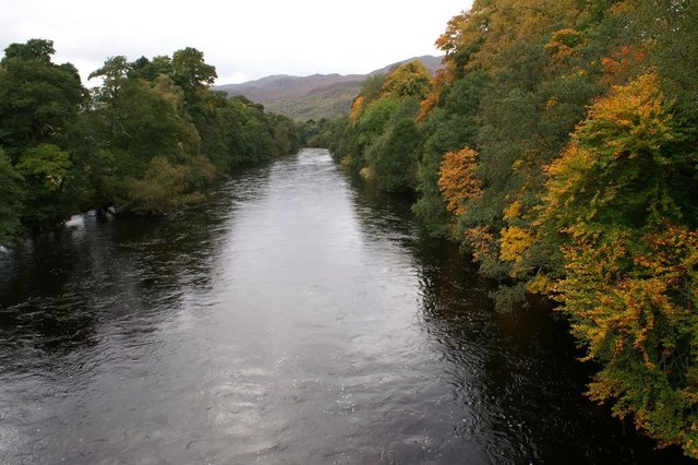
Glen Strathfarrar ( gd, Srath Farair) is a glen in the Highland region of Scotland, near Loch Ness. The Glen is part of the Affric-Beauly hydro-electric power scheme, with a dam at Loch Monar and a 9 km tunnel carrying water to an underground power station at Deanie; a second dam just below Loch Beannacharan feeds a tunnel carrying water to Culligran power station (also underground). The Monar dam at Loch Monar is the largest arch dam in Britain. The central section of Glen Strathfarrar (covering 4027 ha) is designated as a national scenic area, one of forty such areas in Scotland, which have been defined so as to identify areas of exceptional scenery and to ensure its protection from inappropriate development. The area covered by the NSA represents the section of the glen least affected by the hydro-electric scheme, and includes the Culligran Falls. Etymology Glen Strathfarrar is named for the River Farrar, recorded in Roman times as ''Varrar''. The name is from ' ... [...More Info...] [...Related Items...] OR: [Wikipedia] [Google] [Baidu] |
Castle Tioram
Castle Tioram () ( gd, Caisteal Tioram, meaning "dry castle") is a ruined castle that sits on the tidal island Eilean Tioram in Loch Moidart, Lochaber, Highland, Scotland. It is located west of Acharacle, approximately from Fort William. Though hidden from the sea, the castle controls access to Loch Shiel. It is also known to the locals as "Dorlin Castle". The castle is a scheduled monument. History Castle Tioram was one of Somerled's castles in his time (the twelfth century), though some may date it from the thirteenth or fourteenth century. It appears to have originally been a principal stronghold of Clann Ruaidhrí. Eilean Tioram, the island the fortress sits upon, is first recorded in a charter of Cairistíona Nic Ruaidhrí, daughter of Ailéan mac Ruaidhrí. According to early modern tradition, preserved by the seventeenth-century '' Sleat History'', the castle was erected by Ailéan's granddaughter, Áine Nic Ruaidhrí. The castle certainly served as the seat of the lat ... [...More Info...] [...Related Items...] OR: [Wikipedia] [Google] [Baidu] |
Seven Men Of Moidart
The Seven Men of Moidart, in Jacobite folklore, were seven followers of Charles Edward Stuart who accompanied him at the start of his 1745 attempt to reclaim the thrones of Great Britain and Ireland for the House of Stuart. The group included English, Scots and Irish subjects of varying backgrounds linked mostly by their involvement in pro-Stuart intrigues. Although some had military experience, most of the men were relatively elderly by the standards of the time; some were already infirm and little suited to the rigours of campaigning. The seven accompanied Charles on the French privateer '' Du Teillay'', initially landing on Eriskay; the group later reached the mainland at Kinlochmoidart. In the early 19th century a row of beech trees was planted at Kinlochmoidart in commemoration of the events.The Seven Men of Moidart [...More Info...] [...Related Items...] OR: [Wikipedia] [Google] [Baidu] |
Charles Edward Stuart
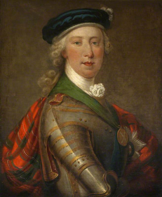
Charles Edward Louis John Sylvester Maria Casimir Stuart (20 December 1720 – 30 January 1788) was the elder son of James Francis Edward Stuart, grandson of James II and VII, and the Stuart claimant to the thrones of England, Scotland and Ireland from 1766 as Charles III. During his lifetime, he was also known as "the Young Pretender" and "the Young Chevalier"; in popular memory, he is known as Bonnie Prince Charlie. Born in Rome to the exiled Stuart court, he spent much of his early and later life in Italy. In 1744, he travelled to France to take part in a planned invasion to restore the Stuart monarchy under his father. When the French fleet was partly wrecked by storms, Charles resolved to proceed to Scotland following discussion with leading Jacobites. This resulted in Charles landing by ship on the west coast of Scotland, leading to the Jacobite rising of 1745. The Jacobite forces under Charles initially achieved several victories in the field, including the Battle of ... [...More Info...] [...Related Items...] OR: [Wikipedia] [Google] [Baidu] |
Jacobite Rising Of 1745
The Jacobite rising of 1745, also known as the Forty-five Rebellion or simply the '45 ( gd, Bliadhna Theàrlaich, , ), was an attempt by Charles Edward Stuart to regain the Monarchy of Great Britain, British throne for his father, James Francis Edward Stuart. It took place during the War of the Austrian Succession, when the bulk of the British Army was fighting in mainland Europe, and proved to be the last in Jacobite risings, a series of revolts that began in Jacobite rising of 1689, 1689, with major outbreaks in 1708, Jacobite rising of 1715, 1715 and Jacobite rising of 1719, 1719. Charles launched the rebellion on 19 August 1745 at Glenfinnan in the Scottish Highlands, capturing Edinburgh and winning the Battle of Prestonpans in September. At a council in October, the Scots agreed to invade England after Charles assured them of substantial support from English Jacobitism, Jacobites and a simultaneous French landing in Southern England. On that basis, the Jacobite Army (1745) ... [...More Info...] [...Related Items...] OR: [Wikipedia] [Google] [Baidu] |
Single-track Road
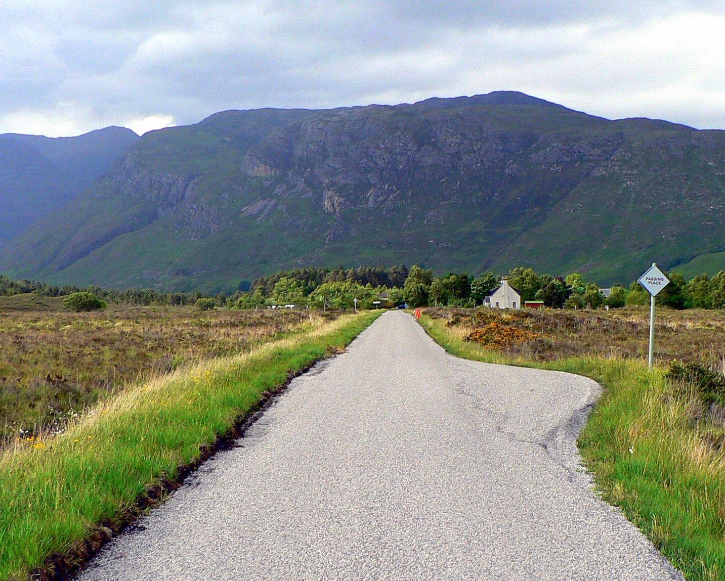
A single-track road or one-lane road is a road that permits two-way travel but is not wide enough in most places to allow vehicles to pass one another (although sometimes two compact cars can pass). This kind of road is common in rural areas across the United Kingdom and elsewhere. To accommodate two-way traffic, many single-track roads, especially those officially designated as such, are provided with passing places (United Kingdom) or pullouts or turnouts (United States), or simply wide spots in the road, which may be scarcely longer than a typical car using the road. The distance between passing places varies considerably, depending on the terrain and the volume of traffic on the road. The railway equivalent for passing places are passing loops. In Scotland The term is widely used in Scotland, particularly the Highlands, to describe such roads. Passing places are generally marked with a diamond-shaped white sign with the words "passing place" on it. New signs tend to be sq ... [...More Info...] [...Related Items...] OR: [Wikipedia] [Google] [Baidu] |
Loch Nan Uamh
The Sound of Arisaig Lochaber, Scotland, separates the Arisaig peninsula to the north from the Moidart peninsula to the south. At the eastern, landward end, the sound is divided by Ardnish into two sea lochs. Loch nan Uamh lies to the north of Ardnish, Loch Ailort to the south. There are a number of small islands in the sound, of which Eilean nan Gobhar and Samalaman Island, both near to Glenuig on the south shore, are the largest. The A830 road, called the Road to the Isles, runs along the east end of Loch Ailort, and then crosses Ardnish before turning westwards along the north shore of Loch nan Uamh and the sound proper. The West Highland Line follows the same route. The A861 road follows the south shore of Loch Ailort and the sound proper as far west as Glenuig. The Prince's Cairn, marking the spot where Bonnie Prince Charlie finally left Scotland after the unsuccessful Jacobite rising of 1745, on 20 September 1746, overlooks Loch nan Uamh. The sound is a marine Special Area ... [...More Info...] [...Related Items...] OR: [Wikipedia] [Google] [Baidu] |
Dumfries And Galloway
Dumfries and Galloway ( sco, Dumfries an Gallowa; gd, Dùn Phrìs is Gall-Ghaidhealaibh) is one of 32 unitary council areas of Scotland and is located in the western Southern Uplands. It covers the counties of Scotland, historic counties of Dumfriesshire, Kirkcudbrightshire, and Wigtownshire, the latter two of which are collectively known as Galloway. The administrative centre and largest settlement is the town of Dumfries. The second largest town is Stranraer, on the North Channel (Great Britain and Ireland), North Channel coast, some to the west of Dumfries. Following the 1975 reorganisation of local government in Scotland, the three counties were joined to form a single regions and districts of Scotland, region of Dumfries and Galloway, with four districts within it. The districts were abolished in 1996, since when Dumfries and Galloway has been a unitary local authority. For lieutenancy areas of Scotland, lieutenancy purposes, the area is divided into three lieutenancy a ... [...More Info...] [...Related Items...] OR: [Wikipedia] [Google] [Baidu] |
Highland Council
The Highland Council (' ), the political body covering the Highland local authority created in 1995, comprises 21 wards, each electing three or four councillors by the single transferable vote system, which creates a form of proportional representation. The total number of councillors is 74, and the main meeting place and main offices are at the Highland Council Headquarters in Glenurquhart Road, Inverness. Current administration The most recent election of the council was on 5 May 2022. The largest group elected were 22 councillors from the SNP, who were joined by 21 independent, 15 Liberal Democrat, 10 Conservative, 4 Green and 2 Labour councillors. This was the first time since the Council's inception that independent councillors did not form the largest grouping. Following the election, the SNP and the 17-member Highland Independent group formed the administration. Three other independents changed their label to reflect their locality (Caithness, Inverness, and Sutherland ... [...More Info...] [...Related Items...] OR: [Wikipedia] [Google] [Baidu] |
Subdivisions Of Scotland
For local government purposes, Scotland is divided into 32 areas designated as "council areas" ( gd, comhairlean), which are all governed by single-tier authorities designated as "councils". They have the option under the Local Government (Gaelic Names) (Scotland) Act 1997 of being known (but not re-designated) as a "''comhairle''" when opting for a Gaelic name; only ''Comhairle nan Eilean Siar'' (Council of the Western Isles) has chosen this option, whereas the Highland Council (''Comhairle na Gàidhealtachd'') has adopted its Gaelic form alongside its English equivalent informally. The council areas have been in existence since 1 April 1996, under the provisions of the Local Government etc. (Scotland) Act 1994. Historically, Scotland was divided into 34 counties or shires. Although these no longer have any administrative function, they are still used to some extent in Scotland for cultural and geographical purposes, and some of the current council areas are named after the ... [...More Info...] [...Related Items...] OR: [Wikipedia] [Google] [Baidu] |
National Park Authority
A national park authority is a special term used in Great Britain for legal bodies charged with maintaining a national park of which, as of October 2021, there are ten in England, three in Wales and two in Scotland. The powers and duties of all such authorities are similar, but their work varies depending on where they are situated. National park authorities were set up by the Environment Act 1995. __NOTOC__ List of national park authorities England *Peak District National Park Authority *Lake District National Park Authority *Dartmoor National Park Authority * North York Moors National Park Authority *Yorkshire Dales National Park Authority *Exmoor National Park Authority *Northumberland National Park Authority *Broads Authority *New Forest National Park Authority * South Downs National Park Authority Wales *Snowdonia National Park Authority * Pembrokeshire Coast National Park Authority *Brecon Beacons National Park Authority Scotland * Loch Lomond and The Trossachs National P ... [...More Info...] [...Related Items...] OR: [Wikipedia] [Google] [Baidu] |


