|
Mississippi Paddlefish
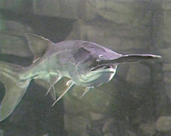
The American paddlefish (''Polyodon spathula,'' also known as a Mississippi paddlefish, spoon-billed cat, or spoonbill) is a species of ray-finned fish. It is the only living species of paddlefish (Polyodontidae). This family is most closely related to the sturgeons; together they make up the order Acipenseriformes, which are one of the most primitive living groups of ray-finned fish. Fossil records of other paddlefish species date back 125 million years to the Early Cretaceous, with records of ''Polyodon'' extending back 65 million years to the early Paleocene. The American paddlefish is a smooth-skinned freshwater fish with an almost entirely cartilaginous skeleton and a paddle-shaped rostrum (snout), which extends nearly one-third its body length. It has been referred to as a freshwater shark because of its heterocercal tail or caudal fin resembling that of sharks, though it is not closely related. The American paddlefish is a highly derived fish because it has evo ... [...More Info...] [...Related Items...] OR: [Wikipedia] [Google] [Baidu] |
Bernard Germain De Lacépède
Bernard-Germain-Étienne de La Ville-sur-Illon, comte de Lacépède or La Cépède (; 26 December 17566 October 1825) was a French naturalist and an active freemason. He is known for his contribution to the Comte de Buffon's great work, the ''Histoire Naturelle''. Biography Lacépède was born at Agen in Guienne. His education was carefully conducted by his father, and the early perusal of Buffon's Natural History ('' Histoire naturelle, générale et particulière'') awakened his interest in that branch of study, which absorbed his chief attention. His leisure he devoted to music, in which, besides becoming a good performer on the piano and organ, he acquired considerable mastery of composition, two of his operas (which were never published) meeting with the high approval of Gluck; in 1781–1785 he also brought out in two volumes his ''Poétique de la musique''. Meantime he wrote two treatises, ''Essai sur l'électricité'' (1781) and ''Physique générale et particuliè ... [...More Info...] [...Related Items...] OR: [Wikipedia] [Google] [Baidu] |
Caudal Fin
Fins are distinctive anatomical features composed of bony spines or rays protruding from the body of a fish. They are covered with skin and joined together either in a webbed fashion, as seen in most bony fish, or similar to a flipper, as seen in sharks. Apart from the tail or caudal fin, fish fins have no direct connection with the spine and are supported only by muscles. Their principal function is to help the fish swim. Fins located in different places on the fish serve different purposes such as moving forward, turning, keeping an upright position or stopping. Most fish use fins when swimming, flying fish use pectoral fins for gliding, and frogfish use them for crawling. Fins can also be used for other purposes; male sharks and mosquitofish use a modified fin to deliver sperm, thresher sharks use their caudal fin to stun prey, reef stonefish have spines in their dorsal fins that inject venom, anglerfish use the first spine of their dorsal fin like a fishing rod to lu ... [...More Info...] [...Related Items...] OR: [Wikipedia] [Google] [Baidu] |
Habitat Destruction
Habitat destruction (also termed habitat loss and habitat reduction) is the process by which a natural habitat becomes incapable of supporting its native species. The organisms that previously inhabited the site are displaced or dead, thereby reducing biodiversity and species abundance. Habitat destruction is the leading cause of biodiversity loss. Fragmentation and loss of habitat have become one of the most important topics of research in ecology as they are major threats to the survival of endangered species. Activities such as harvesting natural resources, industrial production and urbanization are human contributions to habitat destruction. Pressure from agriculture is the principal human cause. Some others include mining, logging, trawling, and urban sprawl. Habitat destruction is currently considered the primary cause of species extinction worldwide. Environmental factors can contribute to habitat destruction more indirectly. Geological processes, climate change, introdu ... [...More Info...] [...Related Items...] OR: [Wikipedia] [Google] [Baidu] |
Overfishing
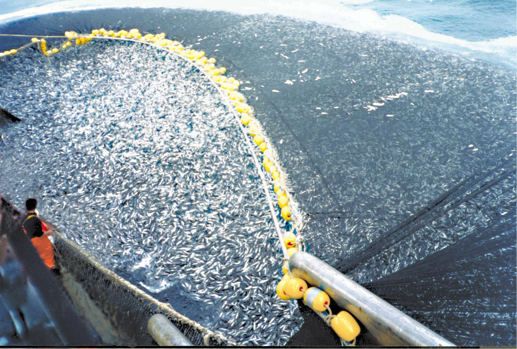
Overfishing is the removal of a species of fish (i.e. fishing) from a body of water at a rate greater than that the species can replenish its population naturally (i.e. the overexploitation of the fishery's existing fish stock), resulting in the species becoming increasingly underpopulated in that area. Overfishing can occur in water bodies of any sizes, such as ponds, wetlands, rivers, lakes or oceans, and can result in resource depletion, reduced biological growth rates and low biomass levels. Sustained overfishing can lead to critical depensation, where the fish population is no longer able to sustain itself. Some forms of overfishing, such as the overfishing of sharks, has led to the upset of entire marine ecosystems. Types of overfishing include: growth overfishing, recruitment overfishing, ecosystem overfishing. The ability of a fishery to recover from overfishing depends on whether its overall carrying capacity and the variety of ecological conditions are suitable for t ... [...More Info...] [...Related Items...] OR: [Wikipedia] [Google] [Baidu] |
Lake Huron
Lake Huron ( ) is one of the five Great Lakes of North America. Hydrology, Hydrologically, it comprises the easterly portion of Lake Michigan–Huron, having the same surface elevation as Lake Michigan, to which it is connected by the , Straits of Mackinac. It is shared on the north and east by the Canadian province of Ontario and on the south and west by the U.S. state of Michigan. The name of the lake is derived from early French explorers who named it for the Wyandot people, Huron people inhabiting the region. The Huronian glaciation was named from evidence collected from Lake Huron region. The northern parts of the lake include the North Channel (Ontario), North Channel and Georgian Bay. Saginaw Bay is located in the southwest corner of the lake. The main inlet is the St. Marys River (Michigan–Ontario), St. Marys River, and the main outlet is the St. Clair River. Geography By surface area, Lake Huron is the second-largest of the Great Lakes, with a surface area of — ... [...More Info...] [...Related Items...] OR: [Wikipedia] [Google] [Baidu] |
Great Lakes
The Great Lakes, also called the Great Lakes of North America, are a series of large interconnected freshwater lakes in the mid-east region of North America that connect to the Atlantic Ocean via the Saint Lawrence River. There are five lakes, which are Lake Superior, Superior, Lake Michigan, Michigan, Lake Huron, Huron, Lake Erie, Erie, and Lake Ontario, Ontario and are in general on or near the Canada–United States border. Hydrologically, lakes Lake Michigan–Huron, Michigan and Huron are a single body joined at the Straits of Mackinac. The Great Lakes Waterway enables modern travel and shipping by water among the lakes. The Great Lakes are the largest group of freshwater lakes on Earth by total area and are second-largest by total volume, containing 21% of the world's surface fresh water by volume. The total surface is , and the total volume (measured at the low water datum) is , slightly less than the volume of Lake Baikal (, 22–23% of the world's surface fresh water ... [...More Info...] [...Related Items...] OR: [Wikipedia] [Google] [Baidu] |
Gulf Coast Of The United States
The Gulf Coast of the United States, also known as the Gulf South, is the coastline along the Southern United States where they meet the Gulf of Mexico. The coastal states that have a shoreline on the Gulf of Mexico are Texas, Louisiana, Mississippi, Alabama, and Florida, and these are known as the ''Gulf States''. The economy of the Gulf Coast area is dominated by industries related to energy, petrochemicals, fishing, aerospace, agriculture, and tourism. The large cities of the region are (from west to east) Brownsville, Corpus Christi, Houston, Galveston, Beaumont, Lake Charles, Lafayette, Baton Rouge, New Orleans, Gulfport, Biloxi, Mobile, Pensacola, Navarre, St. Petersburg, and Tampa. All are the centers or major cities of their respective metropolitan areas and many of which contain large ports. Geography The Gulf Coast is made of many inlets, bays, and lagoons. The coast is intersected by numerous rivers, the largest of which is the Mississippi River. Much of the l ... [...More Info...] [...Related Items...] OR: [Wikipedia] [Google] [Baidu] |
Oxbow Lake
An oxbow lake is a U-shaped lake or pool that forms when a wide meander of a river is cut off, creating a free-standing body of water. In South Texas, oxbows left by the Rio Grande are called '' resacas''. In Australia, oxbow lakes are called billabongs. The word "oxbow" can also refer to a U-shaped bend in a river or stream, whether or not it is cut off from the main stream. Geology An oxbow lake forms when a meandering river erodes through the neck of one of its meanders. This takes place because meanders tend to grow and become more curved over time. The river then follows a shorter course that bypasses the meander. The entrances to the abandoned meander eventually silt up, forming an oxbow lake. Because oxbow lakes are stillwater lakes, with no current flowing through them, the entire lake gradually silts up, becoming a bog or swamp and then evaporating completely. When a river reaches a low-lying plain, often in its final course to the sea or a lake, it meanders wi ... [...More Info...] [...Related Items...] OR: [Wikipedia] [Google] [Baidu] |
Braided River
A braided river, or braided channel, consists of a network of river channels separated by small, often temporary, islands called braid bars or, in English usage, ''aits'' or ''eyots''. Braided streams tend to occur in rivers with high sediment loads or coarse grain sizes, and in rivers with steeper slopes than typical rivers with straight or meandering channel patterns. They are also associated with rivers with rapid and frequent variation in the amount of water they carry, i.e., with "flashy" rivers, and with rivers with weak banks. Braided channels are found in a variety of environments all over the world, including gravelly mountain streams, sand bed rivers, on alluvial fans, on river deltas, and across depositional plains. Description A braided river consists of a network of multiple shallow channels that diverge and rejoin around ephemeral ''braid bars''. This gives the river a fancied resemblance to the interweaved strands of a braid. The braid bars, also known as channel ... [...More Info...] [...Related Items...] OR: [Wikipedia] [Google] [Baidu] |
Mississippi River
The Mississippi River is the second-longest river and chief river of the second-largest drainage system in North America, second only to the Hudson Bay drainage system. From its traditional source of Lake Itasca in northern Minnesota, it flows generally south for to the Mississippi River Delta in the Gulf of Mexico. With its many tributaries, the Mississippi's watershed drains all or parts of 32 U.S. states and two Canadian provinces between the Rocky and Appalachian mountains. The main stem is entirely within the United States; the total drainage basin is , of which only about one percent is in Canada. The Mississippi ranks as the thirteenth-largest river by discharge in the world. The river either borders or passes through the states of Minnesota, Wisconsin, Iowa, Illinois, Missouri, Kentucky, Tennessee, Arkansas, Mississippi, and Louisiana. Native Americans have lived along the Mississippi River and its tributaries for thousands of years. Most were hunter-ga ... [...More Info...] [...Related Items...] OR: [Wikipedia] [Google] [Baidu] |
Yangtze River
The Yangtze or Yangzi ( or ; ) is the longest list of rivers of Asia, river in Asia, the list of rivers by length, third-longest in the world, and the longest in the world to flow entirely within one country. It rises at Jari Hill in the Tanggula Mountains (Tibetan Plateau) and flows in a generally easterly direction to the East China Sea. It is the List of rivers by discharge, seventh-largest river by discharge volume in the world. Its drainage basin comprises one-fifth of the land area of China, and is home to nearly one-third of the demographics of China, country's population. The Yangtze has played a major role in the history of China, history, culture of China, culture, and economy of China. For thousands of years, the river has been used for water, irrigation, sanitation, transportation, industry, boundary-marking, and war. The prosperous Yangtze Delta generates as much as 20% of historical GDP of China, China's GDP. The Three Gorges Dam on the Yangtze is the list ... [...More Info...] [...Related Items...] OR: [Wikipedia] [Google] [Baidu] |
Chinese Paddlefish
The Chinese paddlefish (''Psephurus gladius''; : literal translation: "white sturgeon"), also known as the Chinese swordfish, is an Extinction, extinct species of fish that was formerly native to the Yangtze and Yellow River basins in China. With records of specimens over and possibly in length, it was one of the largest species of Fresh water, freshwater fish. It was the only species in the genus ''Psephurus'' and one of two Holocene, recent species of paddlefish (Polyodontidae), the other being the American paddlefish (''Polyodon spathula''). It was an anadromous species, meaning that it spent part of its adult life at sea, while migrating upriver to Spawn (biology), spawn. The Chinese paddlefish was officially declared extinct in 2022, with an estimated time of extinction to be by 2005, and no later than 2010, although it had become functionally extinct by 1993. The main cause of its extinction was the construction of the Gezhouba Dam, Gezhouba and Three Gorges Dam, Three Go ... [...More Info...] [...Related Items...] OR: [Wikipedia] [Google] [Baidu] |

.png)


