|
Martin Creek (Chestatee River Tributary)
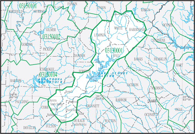
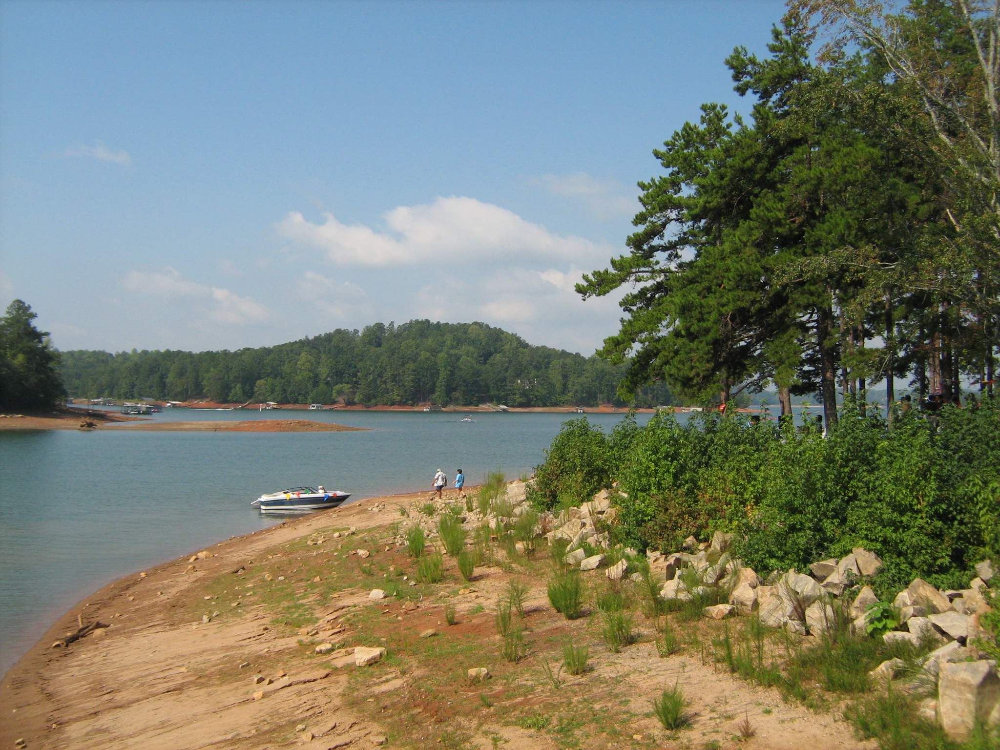
Martin Creek is a stream in Georgia, and is a tributary of the Chestatee River. The creek is approximately long. file geodatabase (GDB) at ftp://rockyftp.cr.usgs.gov/vdelivery/Datasets/Staged/Hydro/FileGDB101/ Course Martin Creek rises in western Hall County, in the middle of a peninsula formed by the Chestatee River arm of Lake Lanier to the west, the Chattahoochee River arm of the lake to the east, and State Route 53 to the north. The area contains no other named or unnamed creeks except for Martin Creek. The creek heads south, then southwest, for approximately 1.2 miles, and flows into the Chestatee River and Lake Lanier just north of the confluence of the Chestatee River and Chattahoochee River arms of the lake, where it merges into the submerged Chestatee River. Sub-watershed details The creek watershed and associated waters is designated by the United States Geological Survey as sub-watershed Watershed is a hydrological term, which has been adopted in other field ... [...More Info...] [...Related Items...] OR: [Wikipedia] [Google] [Baidu] |
Georgia (U
Georgia most commonly refers to: * Georgia (country), a country in the Caucasus region of Eurasia * Georgia (U.S. state), a state in the Southeast United States Georgia may also refer to: Places Historical states and entities * Related to the country in the Caucasus ** Kingdom of Georgia, a medieval kingdom ** Georgia within the Russian Empire ** Democratic Republic of Georgia, established following the Russian Revolution ** Georgian Soviet Socialist Republic, a constituent of the Soviet Union * Related to the US state ** Province of Georgia, one of the thirteen American colonies established by Great Britain in what became the United States ** Georgia in the American Civil War, the State of Georgia within the Confederate States of America. Other places * 359 Georgia, an asteroid * New Georgia, Solomon Islands * South Georgia and the South Sandwich Islands Canada * Georgia Street, in Vancouver, British Columbia, Canada * Strait of Georgia, British Columbia, Canada United K ... [...More Info...] [...Related Items...] OR: [Wikipedia] [Google] [Baidu] |
Drainage Basin
A drainage basin is an area of land where all flowing surface water converges to a single point, such as a river mouth, or flows into another body of water, such as a lake or ocean. A basin is separated from adjacent basins by a perimeter, the '' drainage divide'', made up of a succession of elevated features, such as ridges and hills. A basin may consist of smaller basins that merge at river confluences, forming a hierarchical pattern. Other terms for a drainage basin are catchment area, catchment basin, drainage area, river basin, water basin, and impluvium. In North America, they are commonly called a watershed, though in other English-speaking places, "watershed" is used only in its original sense, that of a drainage divide. In a closed drainage basin, or endorheic basin, the water converges to a single point inside the basin, known as a sink, which may be a permanent lake, a dry lake, or a point where surface water is lost underground. Drainage basins are similar ... [...More Info...] [...Related Items...] OR: [Wikipedia] [Google] [Baidu] |
Apalachicola Basin
The ACF River Basin is the drainage basin, or watershed, of the Apalachicola River, Chattahoochee River, and Flint River, in the Southeastern United States. This area is alternatively known as simply the Apalachicola Basin and is listed by the United States Geological Survey as basin HUC 031300, as well as sub-region HUC 0313. It is located in the South Atlantic-Gulf Water Resource Region South is one of the cardinal directions or compass points. The direction is the opposite of north and is perpendicular to both east and west. Etymology The word ''south'' comes from Old English ''sūþ'', from earlier Proto-Germanic ''*sunþaz ..., which is listed as HUC 03. The basin is further sub-divided into 14 sub-basins. Geography The ACF River Basin begins in the mountains of northeast Georgia, and drains much of metro Atlanta, most of west Georgia and southwest Georgia and adjoining counties of southeast Alabama, before it splits the central part of the Florida Panhandle and ... [...More Info...] [...Related Items...] OR: [Wikipedia] [Google] [Baidu] |
South Atlantic-Gulf Water Resource Region
South is one of the cardinal directions or Points of the compass, compass points. The direction is the opposite of north and is perpendicular to both east and west. Etymology The word ''south'' comes from Old English ''sūþ'', from earlier Proto-Germanic language, Proto-Germanic ''*sunþaz'' ("south"), possibly related to the same Proto-Indo-European language, Proto-Indo-European root that the word ''sun'' derived from. Some languages describe south in the same way, from the fact that it is the direction of the sun at noon (in the Northern Hemisphere), like Latin meridies 'noon, south' (from medius 'middle' + dies 'day', cf English meridional), while others describe south as the right-hand side of the rising sun, like Biblical Hebrew תֵּימָן teiman 'south' from יָמִין yamin 'right', Aramaic תַּימנַא taymna from יָמִין yamin 'right' and Syriac ܬܰܝܡܢܳܐ taymna from ܝܰܡܝܺܢܳܐ yamina (hence the name of Yemen, the land to the south/right of the ... [...More Info...] [...Related Items...] OR: [Wikipedia] [Google] [Baidu] |
Georgia State Route 306
State Route 306 (SR 306) is a west-to-east state route located entirely in Forsyth County, Georgia. The route connects Cumming, the county seat in central Forsyth County, with the northeastern portion of the county, which is bordered to the east by Lake Lanier, and Gainesville, located east of the lake in Hall County. Route description From its western terminus at SR 20 northwest of Cumming, the route, locally known as Sawnee Drive for this portion, runs west to meet SR 9 just north of downtown Cumming, connecting SR 20 and SR 9 without having to travel through the heart of Cumming. SR 306 and SR 9 are then co-signed on their way northeast toward the community of Coal Mountain, before SR 306 departs SR 9 and travels to the east to its interchange with US 19/ SR 400 at exit 17, which is the northernmost interchange of SR 400's controlled access portion. SR 306 continues northeast, now known as Keith Bridge Ro ... [...More Info...] [...Related Items...] OR: [Wikipedia] [Google] [Baidu] |
Gainesville, Georgia
The city of Gainesville is the county seat of Hall County, Georgia, United States. As of the 2020 census, the city had a population of 42,296. Because of its large number of poultry processing plants, it is often called the "Poultry Capital of the World." Gainesville is the principal city of, and is included in, the Gainesville, Georgia Metropolitan Statistical Area, which is included in the Atlanta-Sandy Springs-Gainesville, Georgia Combined Statistical Area. History Gainesville was established as "Mule Camp Springs" by European-American settlers in the early 1800s. Less than three years after the organization of Hall County on December 15, 1818, Mule Camp Springs was renamed "Gainesville" on April 21, 1821. It was named in honor of General Edmund P. Gaines, a hero of the War of 1812 and a noted military surveyor and road-builder. Gainesville was selected to be the county seat and chartered by the Georgia General Assembly on November 30, 1821. A gold rush that began in nearby L ... [...More Info...] [...Related Items...] OR: [Wikipedia] [Google] [Baidu] |
Hydrologic Unit
A hydrological code or hydrologic unit code is a sequence of numbers or letters (a ''geocode'') that identify a hydrological unit or feature, such as a river, river reach, lake, or area like a drainage basin (also called watershed in North America) or catchment. One system, developed by Strahler, known as the Strahler stream order, ranks streams based on a hierarchy of tributaries. Each segment of a stream or river within a river network is treated as a node in a tree, with the next segment downstream as its parent. When two first-order streams come together, they form a second-order stream. When two second-order streams come together, they form a third-order stream, and so on. Another example is the system of assigning IDs to watersheds devised by Otto Pfafstetter, known as the Pfafstetter Coding System or the Pfafstetter System. Drainage areas are delineated in a hierarchical fashion, with "level 1" watersheds at continental scales, subdivided into smaller level 2 watersheds, ... [...More Info...] [...Related Items...] OR: [Wikipedia] [Google] [Baidu] |
United States Geological Survey
The United States Geological Survey (USGS), formerly simply known as the Geological Survey, is a scientific agency of the United States government. The scientists of the USGS study the landscape of the United States, its natural resources, and the natural hazards that threaten it. The organization's work spans the disciplines of biology, geography, geology, and hydrology. The USGS is a fact-finding research organization with no regulatory responsibility. The agency was founded on March 3, 1879. The USGS is a bureau of the United States Department of the Interior; it is that department's sole scientific agency. The USGS employs approximately 8,670 people and is headquartered in Reston, Virginia. The USGS also has major offices near Lakewood, Colorado, at the Denver Federal Center, and Menlo Park, California. The current motto of the USGS, in use since August 1997, is "science for a changing world". The agency's previous slogan, adopted on the occasion of its hundredt ... [...More Info...] [...Related Items...] OR: [Wikipedia] [Google] [Baidu] |
Georgia State Route 53
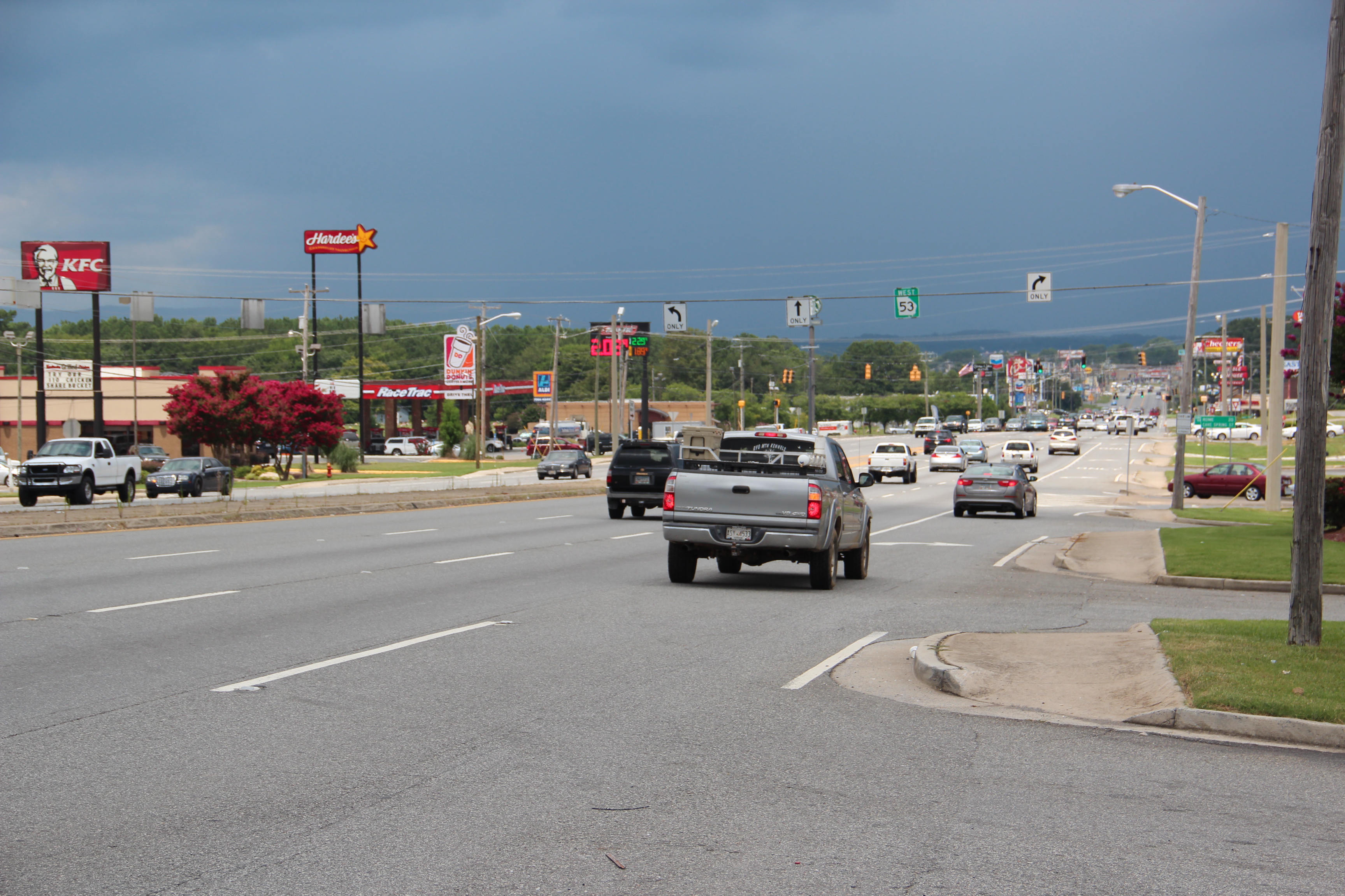
State Route 53 (SR 53) is a west-to-east state highway located in the northern part of the U.S. state of Georgia. The highway travels from the Alabama state line west of Cave Spring northeast, then east, then southeast to US 129 Bus./ US 441 Bus./ SR 15/ SR 24 Bus. in Watkinsville. Route description Western terminus to Dawsonville From its western terminus at the Alabama state line, SR 53 travels east through Floyd County, co-signed with US 411. After a brief concurrency with SR 100 in Cave Spring, US 411 and SR 53 continue northeast to the community of Six Mile. There, the routes become co-signed with US 27 and SR 1, and all four travel north to Rome. In Rome, US 411 departs to the east, and US 27/SR 1/SR 53 travel north, joined by SR 20. Just to the east of downtown, SR 53 departs from the other routes and travels northeast, running parallel to the Oostanaula River and t ... [...More Info...] [...Related Items...] OR: [Wikipedia] [Google] [Baidu] |
Chestatee River
The Chestatee River (variant spellings Chestatie, Chestetee, Chostatee, Chosteta, Chestotee; none in modern use) is a file geodatabase (GDB) at ftp://rockyftp.cr.usgs.gov/vdelivery/Datasets/Staged/Hydro/FileGDB101/ river in the Appalachian Mountains of northern Georgia, USA. The word "Chestatee" is a Cherokee word meaning roughly "pine torch place" or "place of lights", because they would use bonfires along the riverbanks to light their torches. They would then use these torches for hunting deer and other wild game in the forest. The Chestatee Regional Library System takes its name from the river, as do Chestatee High School and Middle School in Gainesville. In a nod to the origins of the name, CHS strives to be "a place of light" to their students. Course It begins at the confluence of Dicks Creek and Frogtown Creek (near the junction of U.S. 19 and U.S. 129) in northeastern Lumpkin County, flowing down by the county seat and former Georgia Gold Rush town of Dahlonega, ... [...More Info...] [...Related Items...] OR: [Wikipedia] [Google] [Baidu] |
Chattahoochee River
The Chattahoochee River forms the southern half of the Alabama and Georgia border, as well as a portion of the Florida - Georgia border. It is a tributary of the Apalachicola River, a relatively short river formed by the confluence of the Chattahoochee and Flint Flint, occasionally flintstone, is a sedimentary cryptocrystalline form of the mineral quartz, categorized as the variety of chert that occurs in chalk or marly limestone. Flint was widely used historically to make stone tools and start fir ... rivers and emptying from Florida into Apalachicola Bay in the Gulf of Mexico. The Chattahoochee River is about long. The Chattahoochee, Flint, and Apalachicola rivers together make up the Apalachicola–Chattahoochee–Flint River Basin (ACF River Basin). The Chattahoochee makes up the largest part of the ACF's drainage basin. Course The River source, source of the Chattahoochee River is located in Jacks Gap at the southeastern foot of Jacks Knob, in the very southeaste ... [...More Info...] [...Related Items...] OR: [Wikipedia] [Google] [Baidu] |


