|
Maak's Or Monk's Well
The Maak's or Monk's Well is situated beside the Carmel Water in Kilmaurs, East Ayrshire. (NS 4114 4112), Scotland. A possible 'Holy Well', it was once a public water supply for the villagers and residents of the old castle at Kilmaurs Place. Introduction The Maak's, Mack's or Monk's Well's waters once ran into the Carmel Water beneath Kilmaurs Place within the Morton Park, Kilmaurs. Originally it may have supplied the residents of Kilmaurs Place. The well is mentioned as being a source of water for the village in 1709 and 1831. It was maintained as a public water supply using council funds. Famous for never drying up even in the driest summer, despite the great demands once placed upon it by the locals, in 2013 the well ceased running into the Carmel Water, possibly following damage incurred whilst new railings were being installed alongside path and the bank of the Carmel Burn. Description The source is now capped with a large stone slab (55.637669 -4.528186) and sits ... [...More Info...] [...Related Items...] OR: [Wikipedia] [Google] [Baidu] |
River Irvine
The River Irvine ( gd, Irbhinn) is a river that flows through southwest Scotland. Its watershed is on the Lanarkshire border of Ayrshire at an altitude of above sea-level, near Loudoun Hill, Drumclog Moss, Drumclog, and SW by W of Strathaven. It flows westward, dividing the old district of Cunninghame from that of Kyle, until it reaches the sea via Irvine Harbour in the form of the Firth of Clyde, and flows into Irvine Bay by the town of Irvine, North Ayrshire, Irvine. It has many tributaries, some of which form parish, district and other boundaries. Etymology ''Irvine'' was first recorded in 1258 as ''Yrewyn'', and several etymologies have been proposed. According to Groome,*McNaught, Duncan (1912). ''Kilmaurs Parish and Burgh''. Pub. A.Gardner. ''Irvine'' is derived from the Gaelic ''iar-an'' meaning 'westward-flowing' river. A Common Brittonic, Brittonic origin is also possible. The root ''*arb-īno'', meaning "wild turnip" has been suggested (c.f. Welsh language, Welsh ''er ... [...More Info...] [...Related Items...] OR: [Wikipedia] [Google] [Baidu] |
Kilmaurs
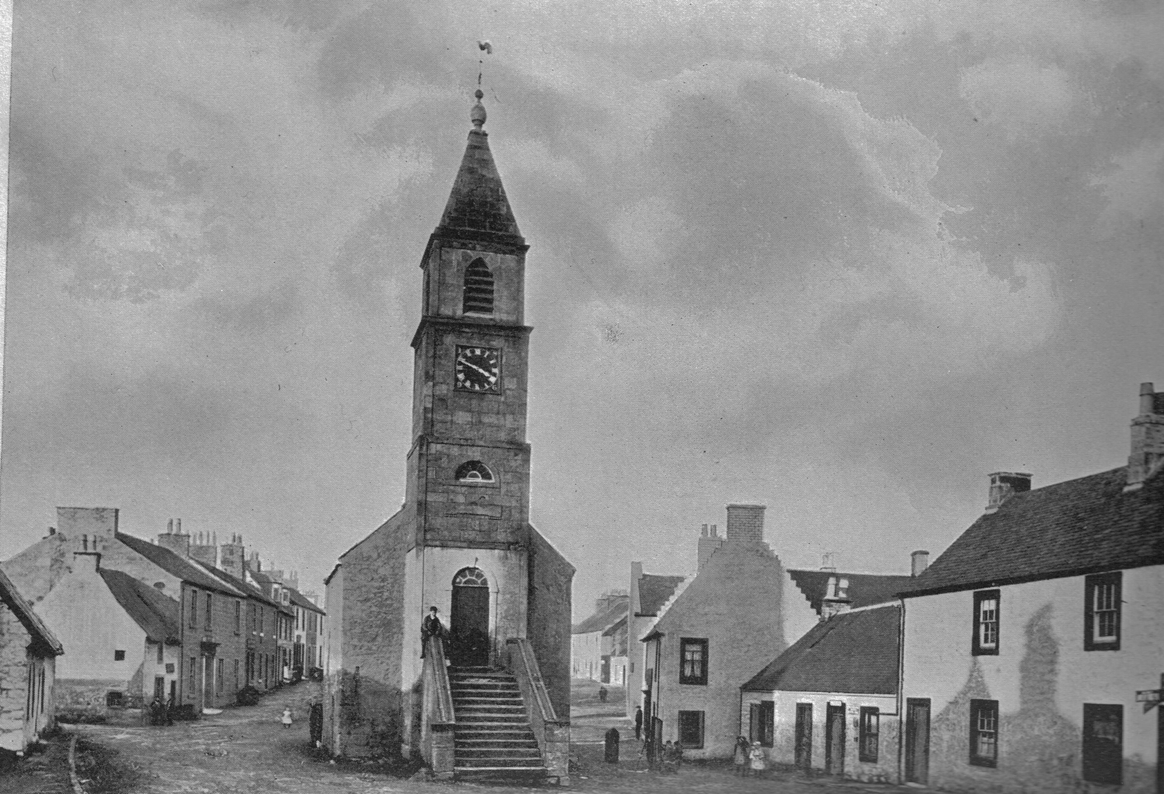
Kilmaurs () is a village in East Ayrshire, Scotland which lies just outside of the largest settlement in East Ayrshire, Kilmarnock. It lies on the Carmel Water, southwest of Glasgow. Population recorded for the village in the 2001 Census recorded 2,601 people resided in the village It was in the Civil Parish of Kilmaurs. History Kilmaurs was known as the hamlet of Cunninghame until the 13th century.Groome, Francis H. (1903). ''Ordnance Gazetteer of Scotland.'' Pub. Caxton. London. P. 938.Tranter, Nigel (1965), ''The Fortified House in Scotland. V. 3. South-West Scotland.'' Pub. Oliver & Boyd. P. 40. The population in 1874 was 1,145. Alex Young suggested that the name Kilmaurs comes from the Gaelic meaning Hill of the Great Cairn.Young, Alex F.(2001). Old Kilmaurs and Fenwick. . Young’s suggestion for the Gaelic origins of the placename Kilmaurs is extremely unlikely. Earliest medieval records refer to an early medieval church dedicated to a saint (probably a Saint Maura) c ... [...More Info...] [...Related Items...] OR: [Wikipedia] [Google] [Baidu] |
East Ayrshire
East Ayrshire ( sco, Aest Ayrshire; gd, Siorrachd Àir an Ear) is one of thirty-two council areas of Scotland. It shares borders with Dumfries and Galloway, East Renfrewshire, North Ayrshire, South Ayrshire and South Lanarkshire. The headquarters of the council are located on London Road, Kilmarnock. With South Ayrshire and the mainland areas of North Ayrshire, it formed the former county of Ayrshire. The wider geographical region of East Ayrshire has a population of 122,100 at the last 2011 census, making it the 16th most populous local authority in Scotland. Spanning a geographical area of , East Ayrshire is the 14th-largest local authority in Scotland in terms of geographical area. The majority of the population of East Ayrshire live within and surrounding the main town, Kilmarnock, having a population of over 46,000 people at the 2011 census. Other large population areas in East Ayrshire include Cumnock, the second-largest town in terms of population and area, and smalle ... [...More Info...] [...Related Items...] OR: [Wikipedia] [Google] [Baidu] |
Carmel Footbridge Kilmaurs
Carmel may refer to: * Carmel (biblical settlement), an ancient Israelite town in Judea * Mount Carmel, a coastal mountain range in Israel overlooking the Mediterranean Sea * Carmelites, a Roman Catholic mendicant religious order Carmel may also refer to: Arts, entertainment, and media * Carmel (band) * ''Carmel'' (2011 film), a drama film starring Josh Hutcherson and Hayden Panettiere * '' Carmel: Who Killed Maria Marta?'', a 2020 Argentinian true crime documentary miniseries directed by Alejandro Hartmann Businesses * Carmel Agrexco, an Israeli exporter of agricultural produce * Carmel Ventures, an Israeli venture capital firm * Carmel Winery, an Israeli vineyard and winery * Autocars Co. or Carmel automobile, an Israeli manufacturer of fiberglass-shelled cars Places Australia * Carmel, Western Australia, a suburb of Perth, Western Australia Israel and Near East * Carmel, Har Hebron, an Israeli settlement in the West Bank * Carmel City, a Druze town in Haifa, Israel * Carme ... [...More Info...] [...Related Items...] OR: [Wikipedia] [Google] [Baidu] |
Ordnance Survey
, nativename_a = , nativename_r = , logo = Ordnance Survey 2015 Logo.svg , logo_width = 240px , logo_caption = , seal = , seal_width = , seal_caption = , picture = , picture_width = , picture_caption = , formed = , preceding1 = , dissolved = , superseding = , jurisdiction = Great BritainThe Ordnance Survey deals only with maps of Great Britain, and, to an extent, the Isle of Man, but not Northern Ireland, which has its own, separate government agency, the Ordnance Survey of Northern Ireland. , headquarters = Southampton, England, UK , region_code = GB , coordinates = , employees = 1,244 , budget = , minister1_name = , minister1_pfo = , chief1_name = Steve Blair , chief1_position = CEO , agency_type = , parent_agency = , child1_agency = , keydocument1 = , website = , footnotes = , map = , map_width = , map_caption = Ordnance Survey (OS) is the national mapping agency for Great Britain. The agency's name indicates its original military purpose (se ... [...More Info...] [...Related Items...] OR: [Wikipedia] [Google] [Baidu] |
Lady's Well
Lady's Well or Our Lady's Well is a common name in the United Kingdom and Ireland for a holy well, usually dedicated to the Virgin Mary. Examples include: * Lady's Well, Auchmannoch * Dundalk#Places of interest * Effin#Wells * Gwladys's well in Tredegar * Hermitage, Dorset * Holystone, Northumberland * Honiley#History * Ladywell Fields#History of the park * Lancing, West Sussex#Location * Lands of Tour and Kirkland#Lady's Well * Mevagissey#History and toponymy * Mulhuddart#Built heritage * Newtowncashel#Attractions * Our Lady's Well, Hempsted * Roman Catholic Archdiocese of Tuam#Local pilgrimages * Slane Castle#History * Stow of Wedale#The church * Wellingborough#History * Woolpit#Our Lady of Woolpit See also * Lady Well * Ladywell Ladywell is a locale in Lewisham in South East London, England, and a ward in the London Borough of Lewisham between Brockley, Crofton Park and Lewisham proper. It has ample green space including Ladywell Fields and Hilly Fields which ... [...More Info...] [...Related Items...] OR: [Wikipedia] [Google] [Baidu] |
Lady's Well, Auchmannoch
The Lady's Well is a natural spring surmounted by a large cross that stands beside the Stra Burn Ford (NS254630) near Auchmannoch House in the Parish of Sorn, East Ayrshire, Scotland. It is associated with the Virgin Mary as a curative well, a Wishing Well and also a Clootie well, additionally Mary Queen of Scots is said to have once watered her horse here. A large red sandstone cross was erected here at an unrecorded date. The well is also said to have acquired its name through "''..one of the ladies of Auchmannoch family drinking water exclusively from here.''" History In the 12th century a grant of lands including Auchmannoch was made to the monks of Melrose Abbey by Alan, the High Steward. Early in the 15th century a family of Campbells descended from the Campbells of Loudoun Castle held the lands from the church, a 1565 charter from the Commendator of Melrose shows that Campbell and Margaret Campbell renewed their possession of the 'Lands of Auchmannoch' in 1565 and held th ... [...More Info...] [...Related Items...] OR: [Wikipedia] [Google] [Baidu] |
Religion In Scotland
As of the 2011 census, Christianity was the largest religion in Scotland with the 53.8% of the Scottish population identifying as Christian when asked: "What religion, religious denomination or body do you belong to?", an 11.3% decline from 65.1% in 2001. The Church of Scotland, a Presbyterian denomination often known as The Kirk, is recognised in law as the national church of Scotland. It is not an established church and is independent of state control. However, it is the largest religious grouping in Scotland, with 32.4% of the population according to the 2011 census. The other major Christian church is the Catholic Church, the form of Christianity in Scotland prior to the Reformation, which accounts for 15.9% of the population and is especially important in West Central Scotland and parts of the Highlands. Scotland's third largest church is the Scottish Episcopal Church. There are also multiple smaller Presbyterian churches, all of which either broke away from the Church of ... [...More Info...] [...Related Items...] OR: [Wikipedia] [Google] [Baidu] |
Holy Wells In Scotland
Sacred describes something that is dedicated or set apart for the service or worship of a deity; is considered worthy of spiritual respect or devotion; or inspires awe or reverence among believers. The property is often ascribed to objects (a " sacred artifact" that is venerated and blessed), or places (" sacred ground"). French sociologist Émile Durkheim considered the dichotomy between the sacred and the profane to be the central characteristic of religion: "religion is a unified system of beliefs and practices relative to ''sacred things'', that is to say, things set apart and forbidden." Durkheim, Émile. 1915. ''The Elementary Forms of the Religious Life''. London: George Allen & Unwin. . In Durkheim's theory, the sacred represents the interests of the group, especially unity, which are embodied in sacred group symbols, or using team work to help get out of trouble. The profane, on the other hand, involve mundane individual concerns. Etymology The word ''sacred'' desce ... [...More Info...] [...Related Items...] OR: [Wikipedia] [Google] [Baidu] |


