|
Lyndhurst Draw
The Lyndhurst Draw is a railroad bridge crossing the Passaic River between Clifton and Lyndhurst in northeastern New Jersey. Built in 1903, it is owned and operated by New Jersey Transit Rail Operations (NJT). The swing bridge is situated between the Lyndhurst and Delawanna stations of NJT's Main Line, from its origination point at Hoboken Terminal, and from the river's mouth at Newark Bay. Norfolk Southern Railway uses the bridge to access Croxton Yard to the east across the New Jersey Meadowlands. The bridge is required by federal regulations to open on 24-hour notice. It is listed on the New Jersey Register of Historic Places (ID#2950). The lower of the long Passaic River downstream of the Dundee Dam is tidally influenced and navigable. Rail service across the river was originally oriented to bringing passengers and freight from the points west over the Hackensack Meadows to Bergen Hill, where tunnels and cuts provided access terminals on the Hudson River. The ... [...More Info...] [...Related Items...] OR: [Wikipedia] [Google] [Baidu] |
County Route 507 (New Jersey)
County Route 507 (CR 507) is a county highway in the U.S. state of New Jersey. The highway extends from Harrison Avenue ( CR 508) on the Kearny-Harrison town line to the New York state line in Mahwah. Between Ho-Ho-Kus and Mahwah, this highway is known as Franklin Turnpike. At its northern terminus, County Route 507 continues north into New York as Orange Avenue, which is a portion of U.S. Route 202 (US 202). Route description Harrison to Carlton Hill County Route 507 begins at an intersection with County Route 508 (Harrison Avenue) in the community of Harrison, New Jersey. The highway progresses northward as Schuyler Street, weaving northward through downtown Harrison. A short distance later, Route 507 passes West Hudson Park and turns to the northeast, entering a mainly commercial district of Harrison. The route soon enters Kearny, the westernmost district in Hudson County and its Arlington district. There, Route 507 continues as Schuyler Av ... [...More Info...] [...Related Items...] OR: [Wikipedia] [Google] [Baidu] |
Croxton Yard
Croxton may refer to: Places *Croxton, Cambridgeshire, England *Croxton, Lincolnshire, England *Croxton, Jersey City, New Jersey, USA *Croxton, Norfolk, England *Croxton, Staffordshire, England *Croxton Kerrial, a village and parish in Leicestershire, England *Croxton railway station, Melbourne, Australia Other *Croxton Play of the Sacrament *Croxton Records, a record label founded by Mick Thomas and Nick Corr *Croxton (automobile), a List of defunct automobile manufacturers of the United States, defunct USA car manufacturer {{disambiguation, geo ... [...More Info...] [...Related Items...] OR: [Wikipedia] [Google] [Baidu] |
Paterson, New Jersey
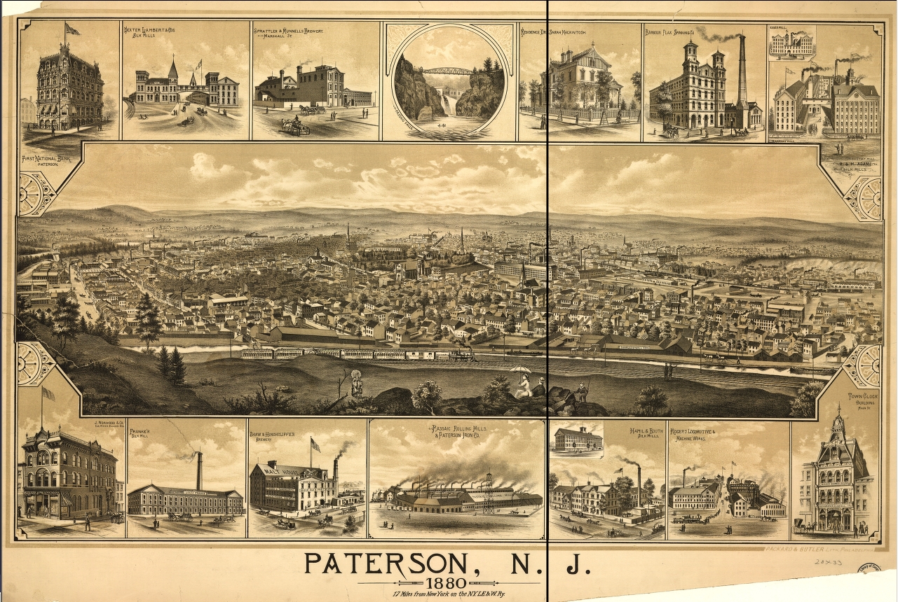
Paterson ( ) is the largest City (New Jersey), city in and the county seat of Passaic County, New Jersey, Passaic County, in the U.S. state of New Jersey.New Jersey County Map New Jersey Department of State. Accessed July 10, 2017. As of the 2020 United States census, its population was 159,732, rendering it New Jersey's List of municipalities in New Jersey, third-most-populous city. The United States Census Bureau, Census Bureau's Population Estimates Program calculated that the city's population was 157,794 in 2021, ranking the city as the List of United States cities by population, 163rd-most-populous in the country. Paterson is known as the Silk City for its dominant role in silk production during the latter half of the 19th century.Thoma ... [...More Info...] [...Related Items...] OR: [Wikipedia] [Google] [Baidu] |
Erie Lackawanna
The Erie Lackawanna Railway , known as the Erie Lackawanna Railroad until 1968, was formed from the 1960 merger of the Erie Railroad and the Delaware, Lackawanna & Western Railroad. The official motto of the line was "The Friendly Service Route". Like many railroads in the northeast already financially vulnerable from the expanding U.S. Interstate Highway System, the line was severely weakened fiscally by the extent, duration and record flood levels due to Hurricane Agnes in 1972. It would never recover. Most of the corporation's holdings became part of Conrail in 1976, ending its sixteen years as an independent operating railroad company. History Formation and early success The Interstate Commerce Commission approved the merger on Sept. 13, 1960, and on Oct. 17 the Erie Railroad and Delaware, Lackawanna and Western Railroad merged to form the Erie Lackawanna Railroad. The EL struggled for most of the 16 years it existed. The two railroads that created it were steadily losing ... [...More Info...] [...Related Items...] OR: [Wikipedia] [Google] [Baidu] |
Erie Railroad
The Erie Railroad was a railroad that operated in the northeastern United States, originally connecting New York City — more specifically Jersey City, New Jersey, where Erie's Pavonia Terminal, long demolished, used to stand — with Lake Erie, at Dunkirk, New York. It expanded west to Chicago with its 1865 merger with the former Atlantic and Great Western Railroad, also known as the New York, Pennsylvania and Ohio Railroad (NYPANO RR). Its mainline route proved influential in the development and economic growth of the Southern Tier of New York State, including cities such as Binghamton, Elmira, and Hornell. The Erie Railroad repair shops were located in Hornell and was Hornell's largest employer. Hornell was also where Erie's mainline split into two routes, one northwest to Buffalo and the other west to Chicago. On October 17, 1960, the Erie merged with former rival Delaware, Lackawanna & Western Railroad to form the Erie Lackawanna Railroad. The Hornell repair shops were c ... [...More Info...] [...Related Items...] OR: [Wikipedia] [Google] [Baidu] |
Boonton Branch
The Boonton Branch refers to the railroad line in New Jersey that was completed in 1870 and ran 34 miles (54.8 km) from Hoboken to East Dover Junction as part of the Morris & Essex Railroad (M&E). Although the branch hosted commuter trains (and to a lesser extent, passenger trains), the line was primarily built as a freight bypass line. The term "branch", therefore, is somewhat of a misnomer since the Boonton Branch was built to higher mainline standards than the Morristown Line, the line that it bypassed. As a result, the Boonton Branch better meets the definition of a "cut-off" rather than a branch. Some of the towns that the Boonton Branch passed through included Lyndhurst, Passaic, Clifton, Paterson, Wayne, Lincoln Park, Mountain Lakes, and its namesake, Boonton. History and construction By the end of the American Civil War in 1865, the management of the Morris & Essex Railroad had recognized that the Morristown Line was inadequate as a freight line. The line wa ... [...More Info...] [...Related Items...] OR: [Wikipedia] [Google] [Baidu] |
Delaware, Lackawanna, And Western Railroad
The Delaware, Lackawanna and Western Railroad (also known as the DL&W or Lackawanna Railroad) was a U.S. Class 1 railroad that connected Buffalo, New York, and Hoboken, New Jersey (and by ferry with New York City), a distance of . Incorporated in Pennsylvania in 1853 primarily for the purpose of providing a connection between the anthracite coal fields of Pennsylvania's Coal Region and the large markets for coal in New York City. The railroad gradually expanded both East and West, eventually linking Buffalo with New York City. Like most coal-focused railroads in Northeastern Pennsylvania (e.g., Lehigh Valley Railroad, New York, Ontario and Western Railroad and the Lehigh & New England Railroad), the DL&W was profitable during the first half of the twentieth century, but its margins were gradually hurt by declining Pennsylvania coal traffic, especially following the 1959 Knox Mine Disaster and competition from trucks following the expansion of the Interstate Highway System in the ... [...More Info...] [...Related Items...] OR: [Wikipedia] [Google] [Baidu] |
Railroad Terminals Serving New York City
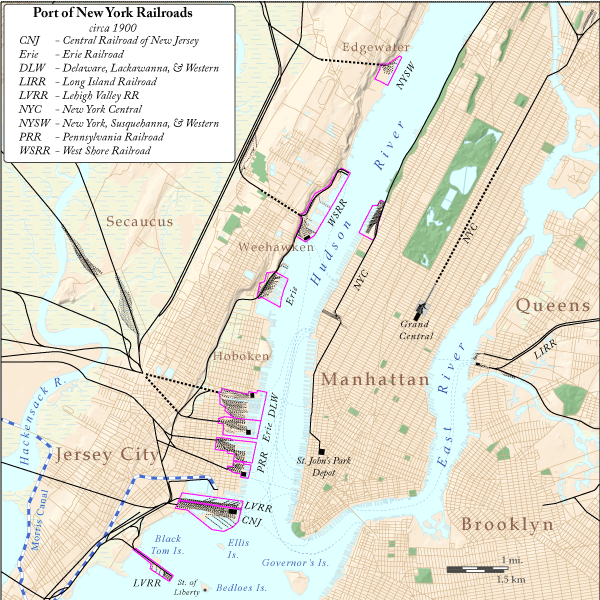
The table below shows all railroad lines that have served New York City and what terminal they used. A red background indicates that the railroad owned a part or full share of the terminal. See also *North River (Hudson River) *Bergen Hill *Timeline of Jersey City area railroads *List of ferries across the Hudson River in New York City The following ferries once crossed the North River (Hudson River) between New York City and New Jersey. There was no ferry service between 1967 and 1989, when it was restarted by New York Waterway. Row and Sail Horse ferries Team boat ... ReferencesPRR Chronology {{NYC terminals [...More Info...] [...Related Items...] OR: [Wikipedia] [Google] [Baidu] |
List Of Bridges, Tunnels, And Cuts In Hudson County, New Jersey
This is a list of vehicular and rail bridges, tunnels, and cuts in Hudson County, New Jersey. Located in the northeastern part of New Jersey Hudson lies at the heart of the Port of New York and New Jersey and is a major crossroads of the New York Metropolitan area and Northeast Megalopolis. Located on two peninsulas, formerly known as Bergen Neck and New Barbadoes Neck, it has extensive waterfront along the Hudson River, Upper New York Bay, Kill van Kull, Newark Bay and the Hackensack and Passaic Rivers. The main part of Hudson lies on Bergen Hill, the southern emergence of the Hudson Palisades, starting at sea level at Bergen Point and rising to 260 feet travelling through Bayonne, Jersey City and North Hudson. Secaucus and most of West Hudson are part of the New Jersey Meadowlands. Listings are generally from south to north. __TOC__ Hudson River Kill van Kull and Newark Bay Hackensack River Passaic River Bergen Hill-Hudson Palisades Meadowlan ... [...More Info...] [...Related Items...] OR: [Wikipedia] [Google] [Baidu] |
Bergen Hill
Bergen Hill refers to the lower Hudson Palisades in New Jersey, where they emerge on Bergen Neck, which in turn is the peninsula between the Hackensack and Hudson Rivers, and their bays. In Hudson County, it reaches a height of 260 feet. Rail Defining features of Bergen Hill include the 19th century and early 20th century railroad rights-of-way. Cuts and tunnels created to provide access to the terminals and ferries on the North River (Hudson River) and Upper New York Bay, and eventually under the river. From south to north they are: * The Central Railroad of New Jersey lines traveled on the CRRNJ Newark Bay Bridge across Newark Bay and through Bayonne and Greenville to its Communipaw Terminal. Portions are used by the Hudson Bergen Light Rail. * The Jersey City, Newark and Western Railway (later the Lehigh Valley Terminal Railway) freight line on the bridge over Newark Bay and across Pamrapo is now used by CSX Transportation as the National Docks Secondary to Port Jersey a ... [...More Info...] [...Related Items...] OR: [Wikipedia] [Google] [Baidu] |
Navigability
A body of water, such as a river, canal or lake, is navigable if it is deep, wide and calm enough for a water vessel (e.g. boats) to pass safely. Such a navigable water is called a ''waterway'', and is preferably with few obstructions against direct traverse that needed avoiding, such as Rock (geology), rocks, reefs or trees. Bridges built over waterways must have sufficient air draft, clearance. High discharge (hydrology), flow speed may make a channel (geography), channel unnavigable due to risk of ship collisions. Waters may be unnavigable because of ice, particularly in winter or high-latitude regions. Navigability also depends on context: a small river may be navigable by smaller craft such as a motorboat or a kayak, but unnavigable by a larger cargo ship, freighter or cruise ship. Shallow rivers may be made navigable by the installation of canal locks, locks that regulate flow and increase upstream water level, or by dredging that deepens parts of the stream bed. Inland w ... [...More Info...] [...Related Items...] OR: [Wikipedia] [Google] [Baidu] |
Tide
Tides are the rise and fall of sea levels caused by the combined effects of the gravity, gravitational forces exerted by the Moon (and to a much lesser extent, the Sun) and are also caused by the Earth and Moon orbiting one another. Tide tables can be used for any given locale to find the predicted times and amplitude (or "tidal range"). The predictions are influenced by many factors including the alignment of the Sun and Moon, the #Phase and amplitude, phase and amplitude of the tide (pattern of tides in the deep ocean), the amphidromic systems of the oceans, and the shape of the coastline and near-shore bathymetry (see ''#Timing, Timing''). They are however only predictions, the actual time and height of the tide is affected by wind and atmospheric pressure. Many shorelines experience semi-diurnal tides—two nearly equal high and low tides each day. Other locations have a diurnal cycle, diurnal tide—one high and low tide each day. A "mixed tide"—two uneven magnitude ... [...More Info...] [...Related Items...] OR: [Wikipedia] [Google] [Baidu] |


