|
Luvua River
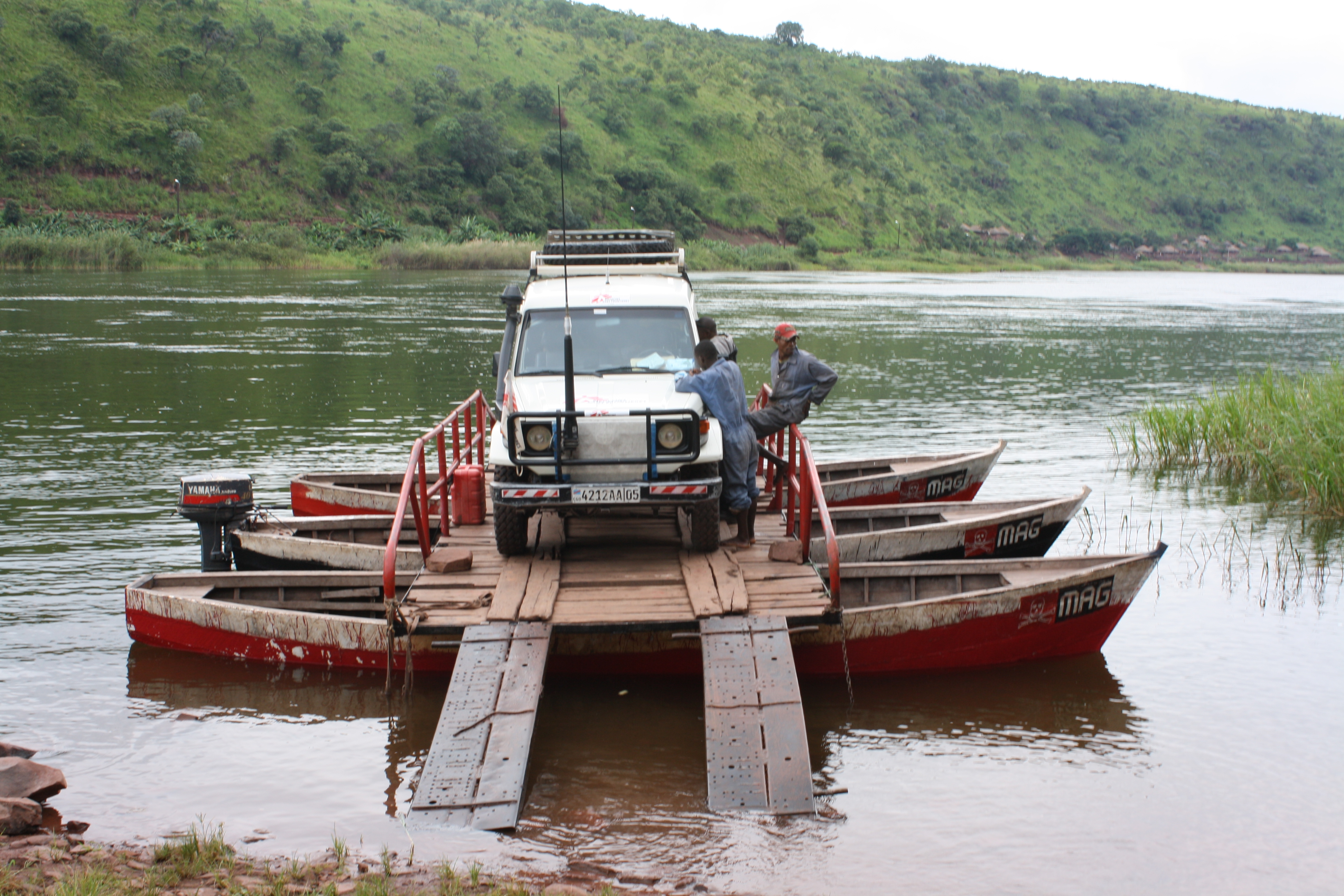
The Luvua River (or ''Lowa River'') is a river in the Katanga Province of the Democratic Republic of the Congo (DRC). It flows from the northern end of Lake Mweru on the Zambia-Congo border in a northwesterly direction for to its confluence with the Lualaba River opposite the town of Ankoro. The Lualaba becomes the Congo River below the Boyoma Falls. Course Lake Mweru, at an elevation of about , is a floodplain lake that has been formed by a process of erosion where the wind has carried off alluvium. The Luvua River leaves the north end of the lake at Pweto in the DRC. The river flows about northwest to Ankoro, where it meets the Lualaba. The middle course of the river is obstructed by a series of rapids, torrents and cataracts as it drops down from the plateau into the Congo Basin. At Piana Mwanga the falls are used to generate electricity for the Manono and Kitotolo mines. The river can be navigated in shallow-draft boats for of its lower course below Kiambi. The Luvua has ... [...More Info...] [...Related Items...] OR: [Wikipedia] [Google] [Baidu] |
Pweto
Pweto is a town in the Haut-Katanga Province of the Democratic Republic of the Congo (DRC). It is the administrative center of Pweto Territory. The town was the scene of a decisive battle in December 2000 during the Second Congo War which resulted in both sides making more active efforts to achieve peace. Pweto and the surrounding region were devastated during the war. little had been done to restore infrastructure or rebuild the economy. The town is served by Pweto Airport. Location Pweto lies at the north end of Lake Mweru on the border with Zambia. The Luvua River, a headstream of the Congo River, leaves the lake just west of Pwetu to flow north to its confluence with the Lualaba River opposite the town of Ankoro. Where the Luvua exits the lake it runs through a series of violent rapids, falling several meters from the lake level. The Mitumba mountains rise to the west, forming a giant barrier between the lake and the Congo Basin broken by the Luvua valley. A fertile plain str ... [...More Info...] [...Related Items...] OR: [Wikipedia] [Google] [Baidu] |
Tertiary
Tertiary ( ) is a widely used but obsolete term for the geologic period from 66 million to 2.6 million years ago. The period began with the demise of the non-avian dinosaurs in the Cretaceous–Paleogene extinction event, at the start of the Cenozoic Era, and extended to the beginning of the Quaternary glaciation at the end of the Pliocene Epoch. The time span covered by the Tertiary has no exact equivalent in the current geologic time system, but it is essentially the merged Paleogene and Neogene periods, which are informally called the Early Tertiary and the Late Tertiary, respectively. The Tertiary established the Antarctic as an icy island continent. Historical use of the term The term Tertiary was first used by Giovanni Arduino during the mid-18th century. He classified geologic time into primitive (or primary), secondary, and tertiary periods based on observations of geology in Northern Italy. Later a fourth period, the Quaternary, was applied. In the early d ... [...More Info...] [...Related Items...] OR: [Wikipedia] [Google] [Baidu] |
Miombo
The Miombo woodland is a tropical and subtropical grasslands, savannas, and shrublands biome (in the World Wide Fund for Nature scheme) located primarily in Central Africa. It includes four woodland savanna ecoregions (listed below) characterized by the dominant presence of ''Brachystegia'' and ''Julbernardia'' species of trees, and has a range of climates ranging from humid to semi-arid, and tropical to subtropical or even temperate. The trees characteristically shed their leaves for a short period in the dry season to reduce water loss and produce a flush of new leaves just before the onset of the wet season with rich gold and red colours masking the underlying chlorophyll, reminiscent of autumn colours in the temperate zone. The woodland gets its name from ''miombo'' (plural, singular ''muombo''), the Bemba word for ''Brachystegia'' species. Other Bantu languages of the region, such as Swahili and Shona, have related if not identical words, such as Swahili ''miyombo'' (singular ... [...More Info...] [...Related Items...] OR: [Wikipedia] [Google] [Baidu] |
Rivers Of The Democratic Republic Of The Congo
A river is a natural flowing watercourse, usually freshwater, flowing towards an ocean, sea, lake or another river. In some cases, a river flows into the ground and becomes dry at the end of its course without reaching another body of water. Small rivers can be referred to using names such as Stream#Creek, creek, Stream#Brook, brook, rivulet, and rill. There are no official definitions for the generic term river as applied to Geographical feature, geographic features, although in some countries or communities a stream is defined by its size. Many names for small rivers are specific to geographic location; examples are "run" in some parts of the United States, "Burn (landform), burn" in Scotland and northeast England, and "beck" in northern England. Sometimes a river is defined as being larger than a creek, but not always: the language is vague. Rivers are part of the water cycle. Water generally collects in a river from Precipitation (meteorology), precipitation through a ... [...More Info...] [...Related Items...] OR: [Wikipedia] [Google] [Baidu] |


