|
Loutro (island)
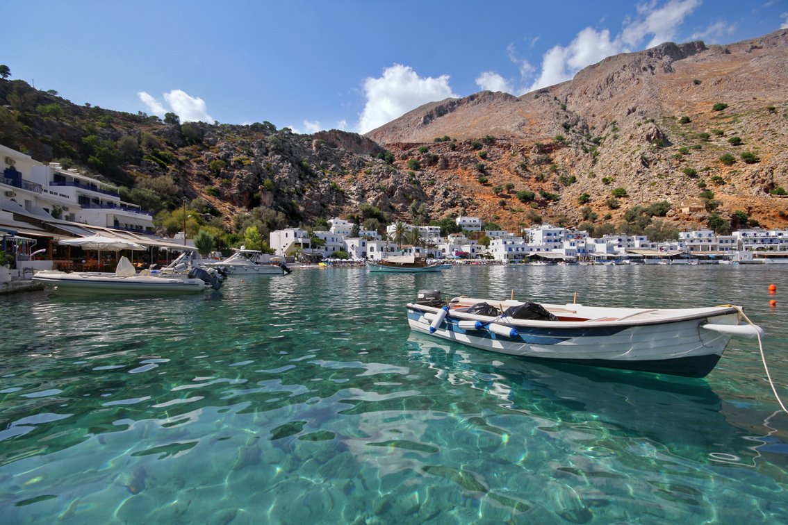
Loutro ( el, Λουτρό) is a rocky islet in the gulf of Loutro on the southwest coast of Crete in the Libyan Sea. The islet can be found close to the end of the Mouri cape. Administratively, it is part of the municipality of Sfakia. The coastal village of Loutro is approximately south of Chania. The gulf of Loutro was once used for shipbuilding and by merchant ships. Ancient Foinikas Loutro is believed to be part of ancient Foinikas and the port of ancient Anopolis. It became the winter harbour of Sfakia. The gulf and the islet make a natural harbour where ships can be safe even in the worst of weather. Shipbuilding The gulf of Loutro was once used for shipbuilding by the people of Sfakia and the local sailors used to travel throughout the Mediterranean, and as far away as Russia, from Loutro. Shipbuilding, sailing, and navigation contributed to the local economy.Detorakis, Turkish rule in Crete, p. 355 One of the successful shipbuilders and shipowners was Ioannis Vlachos, w ... [...More Info...] [...Related Items...] OR: [Wikipedia] [Google] [Baidu] |
Modern Regions Of Greece
The regions of Greece ( el, περιφέρειες, translit=periféries) are the country's thirteen first-level administrative entities, each comprising several second-level units, originally known as prefectures and, since 2011, as regional units. History The current regions were established in July 1986 (the presidential decree officially establishing them was signed in 1987), by decision of the interior minister, Menios Koutsogiorgas, as second-level administrative entities, complementing the prefectures (Law 1622/1986). Ν.1622/86 "Τοπική Αυτοδιοίκηση - Περιφερειακή Ανάπτυξη - Δημοκρατικός Προγραμματισμός", (ΦΕΚ 92/τ.Α΄/14-7-1986) Before 1986, there was a traditional division into broad historical–geographical regions (γεωγραφικά διαμερίσματα), which, however, was often arbitrary; not all of the pre-1986 traditional historical-geographic regions had official administrative bodie ... [...More Info...] [...Related Items...] OR: [Wikipedia] [Google] [Baidu] |
Crete
Crete ( el, Κρήτη, translit=, Modern: , Ancient: ) is the largest and most populous of the Greek islands, the 88th largest island in the world and the fifth largest island in the Mediterranean Sea, after Sicily, Sardinia, Cyprus, and Corsica. Crete rests about south of the Greek mainland, and about southwest of Anatolia. Crete has an area of and a coastline of 1,046 km (650 mi). It bounds the southern border of the Aegean Sea, with the Sea of Crete (or North Cretan Sea) to the north and the Libyan Sea (or South Cretan Sea) to the south. Crete and a number of islands and islets that surround it constitute the Region of Crete ( el, Περιφέρεια Κρήτης, links=no), which is the southernmost of the 13 top-level administrative units of Greece, and the fifth most populous of Greece's regions. Its capital and largest city is Heraklion, on the north shore of the island. , the region had a population of 636,504. The Dodecanese are located to the no ... [...More Info...] [...Related Items...] OR: [Wikipedia] [Google] [Baidu] |
Regional Units Of Greece
The 74 regional units of Greece ( el, περιφερειακές ενότητες, ; sing. , ) are the country's Seventy-four second-level administrative units. They are divisions of the country's 13 regions, and are further divided into municipalities. They were introduced as part of the Kallikratis administrative reform on 1 January 2011 and are comparable in area and, in the mainland, coterminous with the 'pre-Kallikratis' prefectures of Greece During the first administrative division of independent Greece in 1833–1836 and again from 1845 until their abolition with the Kallikratis reform in 2010, the prefectures ( el, νομοί, sing. νομός, translit=nomoi, sing. nomós) were .... List References {{Articles on second-level administrative divisions of European countries Regional units Greece transport-related lists Subdivisions of Greece ... [...More Info...] [...Related Items...] OR: [Wikipedia] [Google] [Baidu] |
Chania (regional Unit)
Chania ( el, Περιφερειακή ενότητα Χανίων) is one of the four regional units of Greece, regional units of Crete; it covers the westernmost quarter of the island. Its capital is the city of Chania. Chania borders only one other regional unit: that of Rethymno (regional unit), Rethymno to the east. The western part of Crete is bounded to the north by the Sea of Crete, Cretan Sea, and to the west and south by the Mediterranean Sea. The regional unit also includes the southernmost island of Europe, Gavdos. Geography Chania regional unit, often informally termed 'Western Crete', is a part of the island which includes the districts of Apokoronas, Sfakia, and Selino in the far South West corner. Other towns in the Chania prefecture include Sfakia#Hora Sfakion, Hora Sfakion, Kastelli-Kissamos, Kissamos, Palaiochora, Maleme, Vryses, Vamos, Georgioupolis and Kalives. The natural park of Samariá Gorge, a tourist attraction and a refuge for the rare Cretan wild goat ... [...More Info...] [...Related Items...] OR: [Wikipedia] [Google] [Baidu] |
Loutro, Chania
Loutro ( el, Λουτρό) (Greek: "Bath") lies on the south coast of Chania regional unit in west Crete, between Chora Sfakion and Agia Roumeli, the exit to the Samaria Gorge. The whole area is known as Sfakia. The village got its name from the Greek word for "bath," for the many ancient baths found in the area. History Loutro is the site of the ancient city of Phoenix (Finikas), which was the port town of ancient Anopolis, and an important harbour in Hellenistic and Roman times. It later became the wintertime port of the town of Sfakia because of its natural protection during harsh weather. Today nothing remains of ancient Phoenix except the name preserved by the small village in the bay west of Loutro. Later the Saracen pirates used Loutro as a lair from which to attack the ships sailing south of Crete. The Venetians managed to drive out the Saracens and fortified Loutro with a small fortress whose ruins are still visible today. Another fortress preserved in better condition ... [...More Info...] [...Related Items...] OR: [Wikipedia] [Google] [Baidu] |
Libyan Sea
The Libyan Sea (Greek , Latin ''Libycum Mare'', Arabic البحر الليبي) is the portion of the Mediterranean Sea north of the African coast of ancient ''Libya'', i.e. Cyrenaica, and Marmarica (the coast of what is now eastern Libya and western Egypt, between Tobruk and Alexandria). This designation was used by ancient geographers describing the southern Mediterranean, but the term is also used by modern travel writers and cartographers. The southern coastline of Crete which borders the Libyan Sea includes the Asterousia Mountains and Mesara Plain; this area is the locus of considerable ancient Bronze Age settlement including the sites of Kommos, Hagia Triada and Phaistos. Not counting Crete, other islands in the Libyan Sea are Gavdos, Gavdopoula, Koufonisi, and Chrysi. To the east is the Levantine Sea, to the north the Ionian Sea, and to the west the Strait of Sicily. See also *Asterousia Mountains The Asterousia Mountains are a range in southern Crete separa ... [...More Info...] [...Related Items...] OR: [Wikipedia] [Google] [Baidu] |
Sfakia
Sfakiá ( el, Σφακιά) is a mountainous area in the southwestern part of the island of Crete, in the Chania regional unit. It is considered to be one of the few places in Greece that have never been fully occupied by foreign powers. With a 2011 census population of 1,889 inhabitants living on a land area of , Sfakia is one of the largest and least densely populated municipalities on the island of Crete. The etymology of its name is disputed. According to the prevailing theory, it relates to its rugged terrain, deriving from the ancient Greek word ''σφαξ'', meaning land chasm or gorge. Description The road from Chania to Sfakiá crosses the island from north to south, through the village of Vryses. From this village the route crosses the White Mountains ( Lefká Óri) to Hóra Sfakíon () by the Libyan Sea. Halfway from Vrisses to Hóra Sfakíon is the fertile plateau of Askifou, surrounded by high mountain peaks. From here to Hóra Sfakíon the road is particularly s ... [...More Info...] [...Related Items...] OR: [Wikipedia] [Google] [Baidu] |
Chania
Chania ( el, Χανιά ; vec, La Canea), also spelled Hania, is a city in Greece and the capital of the Chania regional unit. It lies along the north west coast of the island Crete, about west of Rethymno and west of Heraklion. The municipality has 108,642 inhabitants (2011). This consists of the city of Chania and several nearby areas, including Kounoupidiana (pop. 8,620), Mournies (pop. 7,614), Souda (pop. 6,418), Nerokouros (pop. 5,531), Daratsos (pop. 4,732), Perivolia (pop. 3,986), Galatas (pop. 3,166) and Aroni (pop. 3,003). History Early history Chania is the site of the Minoan settlement the Greeks called Kydonia, the source of the word quince. It appears on Linear B as ''ku-do-ni-ja''. Some notable archaeological evidence for the existence of this Minoan city below some parts of today's Chania was found by excavations in the district of Kasteli in the Old Town. This area appears to have been inhabited since the Neolithic era. The city reemerged after the end ... [...More Info...] [...Related Items...] OR: [Wikipedia] [Google] [Baidu] |
Loutro Crete
Loutro (Greek: Λουτρό) may refer to several places in Greece: *Loutro (island), a rocky islet near the southwestern coast of Crete *Loutro, Aetolia-Acarnania, a village in Aetolia-Acarnania *Loutro, Chania, a village in the Chania regional unit of Crete * Loutro, Karditsa, a village in the municipality Sofades, Karditsa regional unit * Loutro, Elassona, a village in the municipality Elassona, Larissa regional unit * Loutro, Larissa, a village in the municipality Larissa, Larissa regional unit * Loutro, Messenia, a village in Messenia *Kato Loutro, a village in the municipality Xylokastro-Evrostina, Corinthia *Palaio Loutro Palaio Loutro (Greek: Παλαιό Λουτρό) is a small mountain village in Messenia, Peloponnese, Southern Greece. It is located a few kilometres from Chora, the site of Nestor's Palace, and the seaside port of Pylos. Palaio Loutro means " ..., a village in Messenia See also * Loutros (other) {{geodis ... [...More Info...] [...Related Items...] OR: [Wikipedia] [Google] [Baidu] |
Anopolis
Anopolis ( grc, Ἀνώπολις) was a town and ''polis'' (city-state) of ancient Crete The history of Crete goes back to the 7th millennium BC, preceding the ancient Minoan civilization by more than four millennia. The palace-based Minoan civilization was the first civilization in Europe. After the Minoan civilization was devasta .... Stephanus of Byzantium claims Anopolis an earlier name of, rather than a predecessor settlement to, Araden (Ἀραδήν) Its site is located near modern Anopoli. References Populated places in ancient Crete Former populated places in Greece Cretan city-states {{AncientCrete-geo-stub ... [...More Info...] [...Related Items...] OR: [Wikipedia] [Google] [Baidu] |
Daskalogiannis
Ioannis Vlachos (), better known as Daskalogiannis (; 1722/30 – 17 June 1771) was a wealthy shipbuilder and shipowner who led a Cretan revolt against Ottoman rule in the 18th century.Detorakis, Turkish rule in Crete, p. 357 Life and career Ioannis Vlachos was born in Anopolis village in Sfakia, a semi-autonomous region of Crete, in 1722 or 1730. His father, who was also a wealthy shipowner, sent him to be educated abroad. Due to his education, his compatriots called him "''Daskalos''" (teacher), hence his nickname ''Daskalogiannis'', literally "John the Teacher." He is referred to as a town clerk in 1750, as chairman of the region of Sfakia in 1765, and as the owner of four, three-mast merchant ships.Detorakis, Turkish rule in Crete, p. 358 These would have sailed from Prosyalo and the gulf of Loutro. Daskalogiannis knew Emmanouil Benakis at Mani and it is likely that Benakis introduced him to Count Orlov who Catherine the Great had sent to the Peloponnese in 1769 to instig ... [...More Info...] [...Related Items...] OR: [Wikipedia] [Google] [Baidu] |
List Of Islands Of Greece
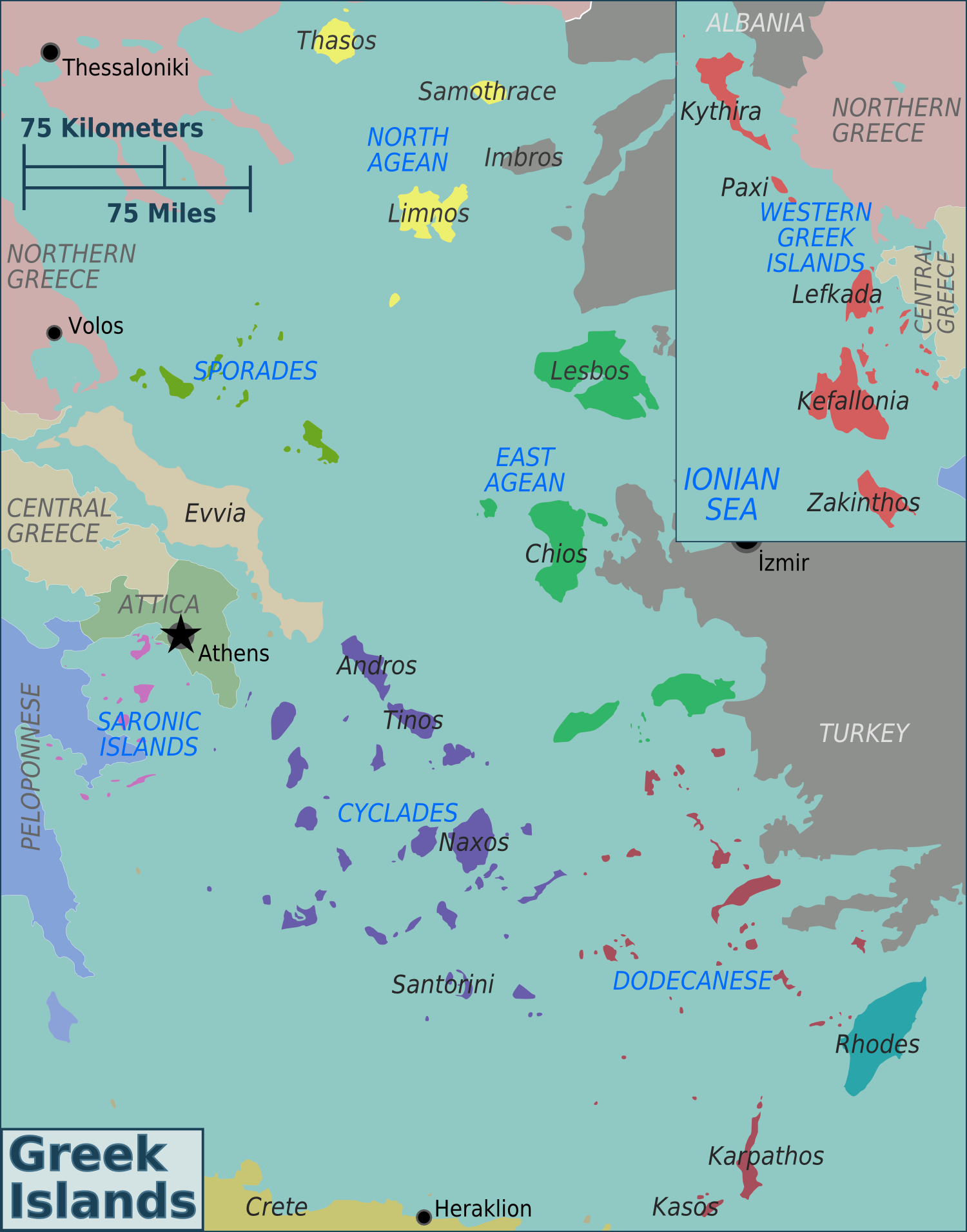
Greece has many islands, with estimates ranging from somewhere around 1,200 to 6,000, depending on the minimum size to take into account. The number of inhabited islands is variously cited as between 166 and 227. The largest Greek island by area is Crete, located at the southern edge of the Aegean Sea. The second largest island is Euboea or Evvia, which is separated from the mainland by the 60m-wide Euripus Strait, and is administered as part of the Central Greece region. After the third and fourth largest Greek islands, Lesbos and Rhodes, the rest of the islands are two-thirds of the area of Rhodes, or smaller. The Greek islands are traditionally grouped into the following clusters: the Argo-Saronic Islands in the Saronic Gulf near Athens; the Cyclades, a large but dense collection occupying the central part of the Aegean Sea; the North Aegean islands, a loose grouping off the west coast of Turkey; the Dodecanese, another loose collection in the southeast between Crete and T ... [...More Info...] [...Related Items...] OR: [Wikipedia] [Google] [Baidu] |


