|
London Greenways
{{unreferenced, date=November 2012 Many green routes have been planned in London which come within the international definition of a greenway but most of them come under other designations in London. The exception is The Greenway in Newham. Some of the other planned routes which could be described as greenways are: the Thames Path, the South East London Green Chain, the Ridgeway (Thamesmead), the Capital Ring and the Parkland Walk. The planning of long-distance routes in London began with County of London Plan by Patrick Abercrombie. He saw a deficiency of open space as one of the four main defects of London and believed it could be remedied by planning green corridors, green wedges etc. See also * Cycling in London * List of cycle routes in London * Parks and open spaces in London External linksThe Capital Ring |
Greenway (landscape)
A greenway is usually a shared-use path along a strip of undeveloped land, in an urban or rural area, set aside for recreational use or environmental protection. Greenways are frequently created out of disused railways, canal towpaths, utility or similar rights of way, or derelict industrial land. Greenways also can also be linear parks, and can serve as wildlife corridors. The path's surface may be paved and often serves multiple users: walkers, runners, bicyclists, skaters and hikers. A characteristic of greenways, as defined by the European Greenways Association, is "ease of passage": that is that they have "either low or zero gradient", so that they can be used by all "types of users, including mobility impaired people". In Southern England, the term also refers to ancient trackways or green lanes, especially those found on chalk downlands, like the Ridgeway. Definition Greenways are vegetated, linear, and multi-purpose. They incorporate a footpath and/or bikeway wit ... [...More Info...] [...Related Items...] OR: [Wikipedia] [Google] [Baidu] |
Greenway, London
The Greenway is a long footpath and cycleway in London, mostly in the London Borough of Newham, on the embankment containing the Joseph Bazalgette Northern Outfall Sewer. Route The western end of the Greenway is Victoria Park, London (London Borough of Tower Hamlets). The route runs alongside Wick Lane, under the East Cross Route to Fish Island. It then crosses the River Lea into Newham, continuing to Stratford and West Ham. The eastern end is at Royal Docks Road in Beckton. The Capital Ring Walk (section 14) follows the Greenway for most of its distance, and forms part 4 of the 2012 Jubilee Greenway The western half of the Greenway embankment is roughly at house eaves height giving a view over the surrounding flat area (see gallery pictures). Between Stratford High Street and Beckton the route is flat. There is a renewed tarmac surface along its full length, with grass kept short on either side and bushes/trees on the embankment sides. The tarmac area is the width of a ... [...More Info...] [...Related Items...] OR: [Wikipedia] [Google] [Baidu] |
Thames Path
The Thames Path is a National Trail following the River Thames from its source near Kemble, Gloucestershire, Kemble in Gloucestershire to the Woolwich foot tunnel, south east London. It is about long. A path was first proposed in 1948 but it only opened in 1996. The Thames Path's entire length can be walked, and a few parts can be cycled. Some parts of the Thames Path, particularly west of Oxford, are subject to flooding during the winter. The river is also Tide, tidal downstream from Teddington Lock and the lower parts of these paths may be underwater if there is a particularly high tide, although the Thames Barrier protects London from catastrophic flooding. The Thames Path uses the river towpath between Inglesham and Putney and available paths elsewhere. Historically, towpath traffic crossed the river using many ferry, ferries, but few of these crossings exist now and some diversion from the towpath is necessary. Description and access to the river The general aim of the pa ... [...More Info...] [...Related Items...] OR: [Wikipedia] [Google] [Baidu] |
South East London Green Chain
The South East London Green Chain, also known as the Green Chain Walk, is a linked system of open spaces between the River Thames and Crystal Palace Park in London, England. In 1977 four London boroughs and the Greater London Council created this Green Chain of 300 open spaces to protect them from building activity. The four London boroughs are Bexley, Bromley, Lewisham and Greenwich. More recently it has been extended to include sections in Southwark. Many parts of the system are also part of the Capital Ring route. The system begins at three places on the River Thames: Thames Barrier, Thamesmead, and the riverside at Erith. There are various circular walks along the route, and there is an offshoot from the main route to Chislehurst; and the next section reaches Crystal Palace via Bromley. From there it goes north with branches to Dulwich and Nunhead. The major open spaces in the Chain are: * Lesnes Abbey * Bostall Heath and Woods * Parks in Charlton including Maryon P ... [...More Info...] [...Related Items...] OR: [Wikipedia] [Google] [Baidu] |
Capital Ring
The Capital Ring is a strategic walking route promoted by London's 33 local councils, led by the City of London Corporation in partnership with the Greater London Authority and its functional body for regional transport, Transport for London, through which much of the funding is provided. It is called a "ring" because the route completely encircles inner and central London. The official start of the route is the Woolwich foot tunnel, but the nature of the route means that it can be started or finished at any point. The route signs feature a logo showing Big Ben in a ring of arrows. The idea originated in 1990 at one of the early meetings of the London Walking Forum, and the route was completed in September 2005. It passes through green areas of urban and suburban London. Route sections Some Capital Ring sections start and/or end at public transport stops. However, most sections involve a further signposted 'Capital Ring Link' to the nearest train or underground station. Addi ... [...More Info...] [...Related Items...] OR: [Wikipedia] [Google] [Baidu] |
Parkland Walk
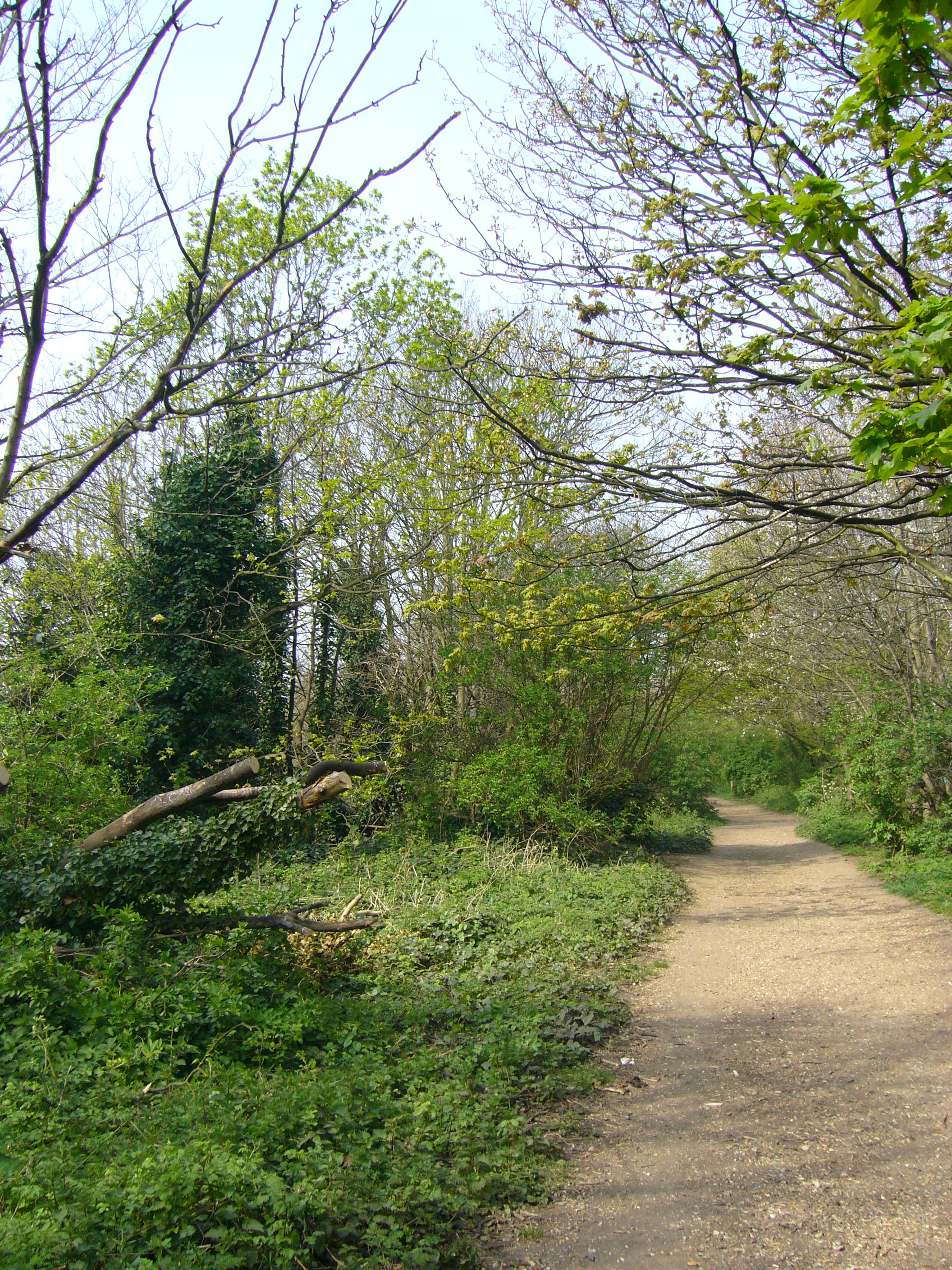
The Parkland Walk is a linear green pedestrian and cycle route in London, which follows the course of the railway line that used to run between Finsbury Park and Alexandra Palace, through Stroud Green, Crouch End, Highgate and Muswell Hill. It is often mistakenly described as 4.5 miles long, but even taking in the gap between the two sections it still only totals 3.1 miles (5.0 km). The route follows the bridges and cuttings of the line, but avoids the closed surface section of Highgate station and its adjoining tunnels, which are closed to walkers for safety reasons. The walk is almost all in Haringey, but a short stretch between Crouch Hill and Crouch End Hill is in Islington and this section incorporates Crouch Hill Park. The walk is a local nature reserve and a Site of Metropolitan Importance for Nature Conservation. It was declared a local nature reserve in 1990 and is London's longest such reserve. Between Finsbury Park and Highgate, the path forms part of the Capi ... [...More Info...] [...Related Items...] OR: [Wikipedia] [Google] [Baidu] |
County Of London Plan
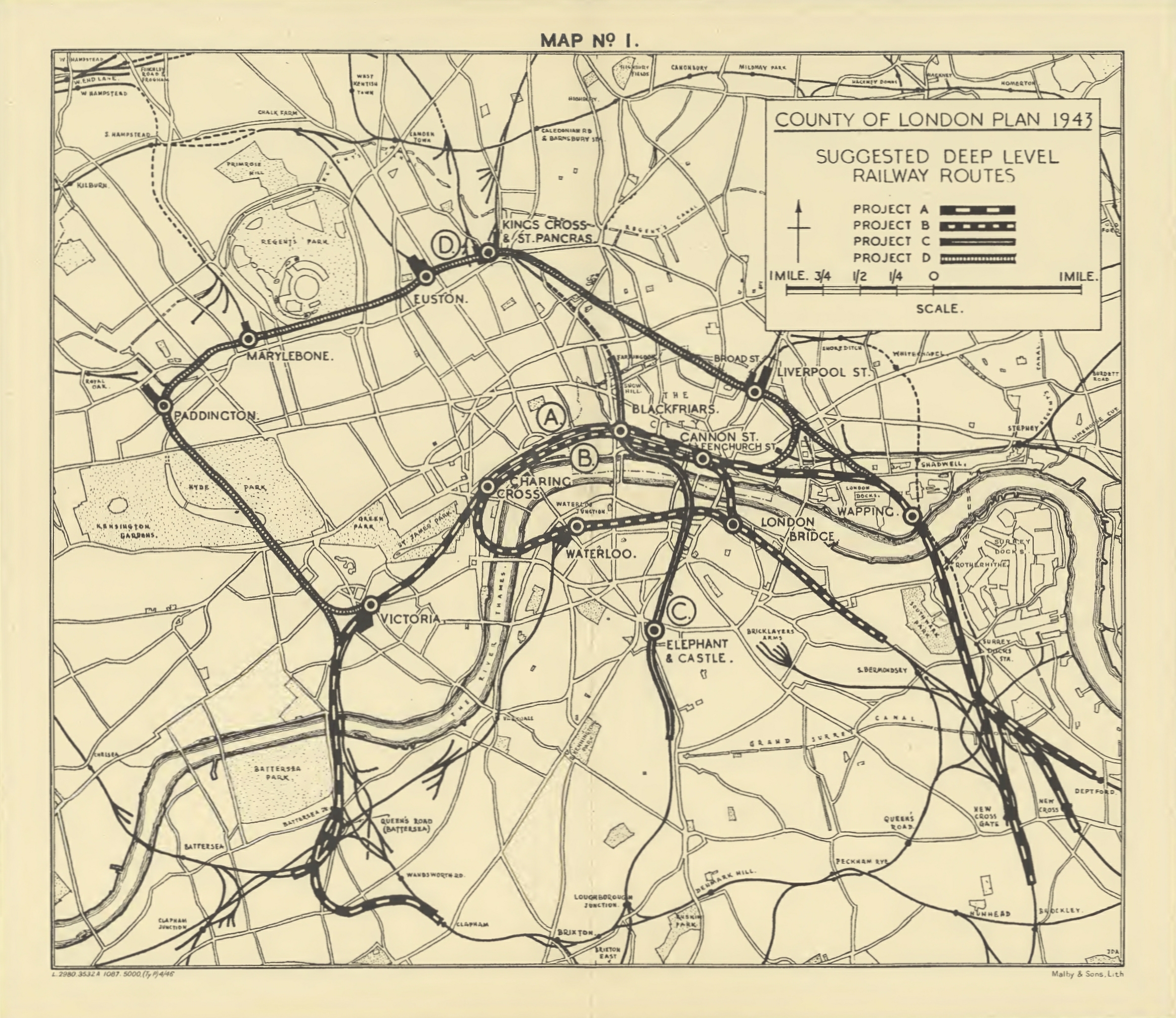
The County of London Plan was prepared for the London County Council in 1943 by John Henry Forshaw (1895–1973) and Sir Leslie Patrick Abercrombie (1879–1957) Its main purpose was to point out the main directions of development and reconstruction of London, which in the past decades had faced big changes and irregular growth. It was prepared in anticipation of the end of World War II and the reconstruction after bomb damage and large movements of population. It focused on five problems, for which it proposed solutions: * traffic congestion * depressed housing * inadequacy and maldistribution of open spaces * jumble of houses and industries * sprawl, and suburbanisation of surrounding country towns Ring roads One of the solutions was to create ring roads around the capital. Construction would have involved considerable disruption, even through parts of the city damaged by bombs, and the roads were not built, but the "C Ring" (the third ring out from the city centre) ... [...More Info...] [...Related Items...] OR: [Wikipedia] [Google] [Baidu] |
Patrick Abercrombie
Sir Leslie Patrick Abercrombie (; 6 June 1879 – 23 March 1957) was an English regional and town planner. Abercrombie was an academic during most of his career, and prepared one city plan and several regional studies prior to the Second World War. He came to prominence in the 1940s for his urban plans of the cities of Plymouth, Hull, Bath, Bournemouth, Hong Kong, Edinburgh, Clyde Valley and Greater London. Early life Patrick Abercrombie was born in Ashton-upon-Mersey, one of the nine children of Sarah and William Abercrombie, a stockbroker and businessman who had wide artistic interests, particularly of the Arts and Crafts school. In 1887, the family moved to a new home in Sale, designed by a Leicester architect, Joseph Goddard, with interiors influenced by designer John Aldam Heaton. Abercrombie was educated at Uppingham School, and spent a year at the Realschule in Lucerne, Switzerland. Career In 1897, he was articled to the architect Charles Heathcote, while studying ... [...More Info...] [...Related Items...] OR: [Wikipedia] [Google] [Baidu] |
Cycling In London
Cycling in London is a popular mode of transport and leisure activity within the capital city of the United Kingdom. Following a national decline in the 1960s of levels of utility cycling, cycling as a mode of everyday transport within London began a slow regrowth in the 1970s. This continued until the beginning of the 21st century, when levels began to increase significantly - during the period from 2000 to 2012, the number of daily journeys made by bicycle in Greater London doubled to 580,000. The growth in cycling can partly be attributed to the launch in 2010 by Transport for London (TfL) of a cycle hire system throughout the city's centre. By 2013, the scheme was attracting a monthly ridership of approximately 500,000, peaking at a million rides in July of that year. Health impact analyses have shown that London would benefit more from increased cycling and cycling infrastructure than other European cities. Cycling conditions in the city have in recent years been perceived ... [...More Info...] [...Related Items...] OR: [Wikipedia] [Google] [Baidu] |
List Of Cycle Routes In London
Cycle routes in London that have been waymarked with formal route signage include "Cycleways" (including "Cycle Superhighways" and "Quietways") and the older London Cycle Network, all designated by the local government body Transport for London (TfL), National Cycle Network routes designated by the sustainable transport charity Sustrans, and miscellaneous "Greenways" created by various bodies. Most recently, in May 2020 TfL announced its "Streetspace for London" in response to the COVID-19 pandemic. Not all these routes are dedicated 'traffic free' cycle tracks: most of them also include ordinary roads shared with motor traffic and footpaths shared with pedestrians. Cycleways From summer 2019, TfL started branding new cycle routes (and re-branding and consolidating some existing routes) as 'Cycleways'. This was following feedback and criticism that the previous branding ('Superhighways' and 'Quietways') was sometimes "misleading". In addition, all new and existing routes wil ... [...More Info...] [...Related Items...] OR: [Wikipedia] [Google] [Baidu] |
Parks And Open Spaces In London
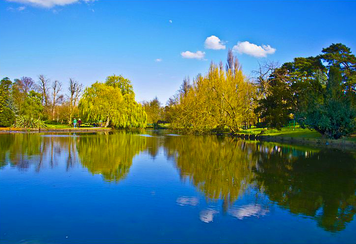
There are many parks and open spaces in Greater London, England. Green space in central London consists of five of the capital's eight Royal Parks, supplemented by a number of small garden squares scattered throughout the city centre. Open space in the rest of the region is dominated by the remaining three Royal Parks and many other parks and open spaces of a range of sizes, run mainly by the local London boroughs, although other owners include the National Trust and the City of London Corporation. London is made of 40% public green space, including 3,000 parks and totaling 35,000 acres. Royal parks The centrepieces of Greater London's park system are the eight Royal Parks of London. Covering 1976 hectares (4,882 acres), they are former royal hunting grounds which are now open to the public. * Richmond Park 955 ha (2,359.85 acres) * Bushy Park 450 ha (1,112 acres) * Regent's Park 197 ha (486.79 acres) * Hyde Park 140 ha (346 acres) * Kensington Gardens 111 ha (274 acres) * Gree ... [...More Info...] [...Related Items...] OR: [Wikipedia] [Google] [Baidu] |
Cycleways In London
Cycling infrastructure is all infrastructure cyclists are allowed to use. Bikeways include bike paths, bike lanes, cycle tracks, rail trails and, where permitted, sidewalks. Roads used by motorists are also cycling infrastructure, except where cyclists are barred such as many freeways/motorways. It includes amenities such as bike racks for parking, shelters, service centers and specialized traffic signs and signals. The more cycling infrastructure, the more people get about by bicycle. Good road design, road maintenance and traffic management can make cycling safer and more useful. Settlements with a dense network of interconnected streets tend to be places for getting around by bike. Their cycling networks can give people direct, fast, easy and convenient routes. History The history of cycling infrastructure starts from shortly after the bike boom of the 1880s when the first short stretches of dedicated bicycle infrastructure were built, through to the rise of the ... [...More Info...] [...Related Items...] OR: [Wikipedia] [Google] [Baidu] |


