|
London, Kiribati
London (Gilbertese: ''Ronton''; historically: ''Londres'') is a settlement in Kiribati, located on the island of Kiritimati, within the archipelago of Line Islands. In 2015, it was inhabited by 1,899 people, making it the second most populated of the four settlements of the island. London is the headquarters of the Ministry of Line and Phoenix Islands Development. The other main villages of Kiritimati are Banana and Tabwakea, which are located along the main road on the northern coast of the island, and Poland, which is across the main lagoon to the South. Climate London has a tropical savanna climate Tropical savanna climate or tropical wet and dry climate is a tropical climate sub-type that corresponds to the Köppen climate classification categories ''Aw'' (for a dry winter) and ''As'' (for a dry summer). The driest month has less than of p ... (Köppen climate classification: ''Aw''). References Populated places in Kiribati Kiritimati {{kiribati-geo-stub ... [...More Info...] [...Related Items...] OR: [Wikipedia] [Google] [Baidu] |
Kiribati
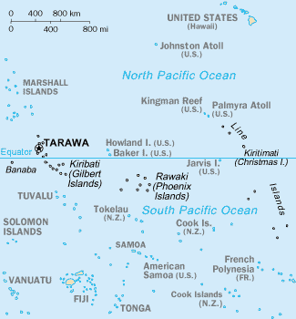
Kiribati (), officially the Republic of Kiribati ( gil, ibaberikiKiribati),Kiribati ''The World Factbook''. Europa (web portal). Retrieved 29 January 2016. is an in in the central . The permanent population is over 119,000 (2020), more than half of whom live on |
Subdivisions Of Kiribati
In Kiribati, there are no longer official administrative divisions but it is possible to divide Kiribati geographically into one isolated island and three archipelagos or island groups: * Banaba – isolated island * Gilbert Islands * Line Islands * Phoenix Islands Kiribati was divided into six districts before gaining independence: * Banaba * Tarawa * Northern Gilbert Islands * Central Gilbert Island * Southern Gilbert Islands * Line Islands Four of the former districts (including Tarawa) lie in the Gilbert Islands, where 90% of the country's population lives. Only three of the Line Islands are inhabited, while the Phoenix Islands are uninhabited apart from Canton Island (20 people) and had no official representation. Banaba itself is sparsely inhabited now (330 people in 2020). There is also a representative non-elected of the Banabans relocated since 1945 to Rabi Island in the country of Fiji. Local councils There are 21 inhabited islands in Kiribati. Each inhabited is ... [...More Info...] [...Related Items...] OR: [Wikipedia] [Google] [Baidu] |
Kiritimati
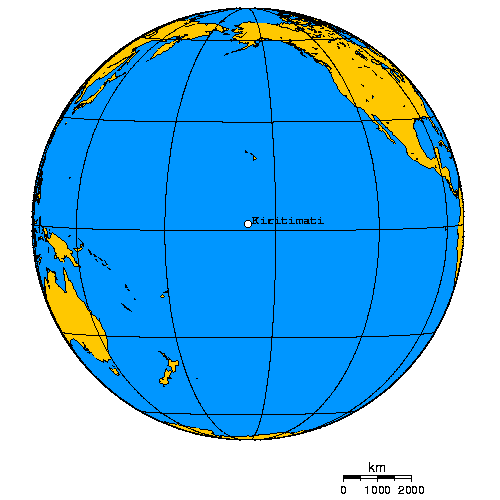
Kiritimati (also known as Christmas Island) is a Pacific Ocean atoll in the northern Line Islands. It is part of the Republic of Kiribati. The name is derived from the English word "Christmas" written in Gilbertese according to its phonology, in which the combination ''ti'' is pronounced ''s'', giving kiˈrɪsmæs. Kiritimati has the greatest land area of any atoll in the world, about ; its lagoon is roughly the same size. The atoll is about in perimeter, while the lagoon shoreline extends for over . Kiritimati comprises over 70% of the total land area of Kiribati, a country encompassing 33 Pacific atolls and islands. It lies north of the equator, south of Honolulu, and from San Francisco. Kiritimati is in the world's farthest forward time zone, UTC+14, and is therefore one of the first inhabited places on Earth to experience New Year's Day. (see also Caroline Atoll, Kiribati). Although it lies east of the 180th meridian, the Republic of Kiribati realigned the Internati ... [...More Info...] [...Related Items...] OR: [Wikipedia] [Google] [Baidu] |
Kiritimati Island 77
Kiritimati (also known as Christmas Island) is a Pacific Ocean atoll in the northern Line Islands. It is part of the Republic of Kiribati. The name is derived from the English word "Christmas" written in Gilbertese according to its phonology, in which the combination ''ti'' is pronounced ''s'', giving kiˈrɪsmæs. Kiritimati has the greatest land area of any atoll in the world, about ; its lagoon is roughly the same size. The atoll is about in perimeter, while the lagoon shoreline extends for over . Kiritimati comprises over 70% of the total land area of Kiribati, a country encompassing 33 Pacific atolls and islands. It lies north of the equator, south of Honolulu, and from San Francisco. Kiritimati is in the world's farthest forward time zone, UTC+14, and is therefore one of the first inhabited places on Earth to experience New Year's Day. (see also Caroline Atoll, Kiribati). Although it lies east of the 180th meridian, the Republic of Kiribati realigned the Interna ... [...More Info...] [...Related Items...] OR: [Wikipedia] [Google] [Baidu] |
Gilbertese Language
Gilbertese or taetae ni Kiribati, also Kiribati (sometimes ''Kiribatese''), is an Austronesian language spoken mainly in Kiribati. It belongs to the Micronesian branch of the Oceanic languages. The word ''Kiribati'', the current name of the islands, is the local adaptation of the previous European name "Gilberts" to Gilbertese phonology. Early European visitors, including Commodore John Byron, whose ships happened on Nikunau in 1765, had named some of the islands the Kingsmill or Kings Mill Islands or for the Northern group ''les îles Mulgrave'' in French but in 1820 they were renamed, in French, ''les îles Gilbert'' by Admiral Adam Johann von Krusenstern, after Captain Thomas Gilbert, who, along with Captain John Marshall, had passed through some of these islands in 1788. Frequenting of the islands by Europeans, Americans and Chinese dates from whaling and oil trading from the 1820s, when no doubt Europeans learnt to speak it, as Gilbertese learnt to speak English and oth ... [...More Info...] [...Related Items...] OR: [Wikipedia] [Google] [Baidu] |
Line Islands
The Line Islands, Teraina Islands or Equatorial Islands (in Gilbertese, ''Aono Raina'') are a chain of 11 atolls (with partly or fully enclosed lagoons) and coral islands (with a surrounding reef) in the central Pacific Ocean, south of the Hawaiian Islands. The island chain stretches northwest to southeast across , making it one of the longest island chains in the world. It lies at the geographic center of the Pacific Ocean (), near Starbuck Island. One of the atolls in the group, Kiritimati, has the largest land area of any atoll in the world. Of the 11 atolls, all of which were formed by volcanic activity, only the Kiritimati and Tabuaeran atolls and Teraina island have a permanent population (one of the reefs, Filippo Reef, is shown on some maps, but its existence is doubted). Eight of the atolls are parts of Kiribati. The remaining three—Jarvis Island, Kingman Reef (which is largely submerged), and Palmyra Atoll—are territories of the United States grouped with the United ... [...More Info...] [...Related Items...] OR: [Wikipedia] [Google] [Baidu] |
Ministry Of Line And Phoenix Islands Development
The Ministry for Line and Phoenix Islands Development (MLPID, also known by the portmanteau Linnix; gil, Botaki ibukin karikirakeaia aaba n te Aono Raina ao Rawaki) is a government ministry of Kiribati, headquartered in London, Kiritimati. It focuses on the development of the Line Islands and Phoenix Islands. The ministry was founded after the 1978 Gilbertese Chief Minister election Elections to the post of Chief Minister were held in the Gilbert Islands on 17 March 1978. The result was a victory for Ieremia Tabai, who won 55.6% of the vote. Voter turnout was 73.5%. This was the first election in which a head of government ... by Ieremia Tabai. Ministers * Teewe Arobati (1978–1982) * Ieremia Tata (1982–) * Tekinaiti Kateie (1990–1991) * Abureti Takaio * Teiraoi Tetabea (1998–2002) * Tawita Temoku (2003–2016) * Mikarite Temari (2016–) External linkMLPID References Government of Kiribati Regional ministries {{Kiribati-stub ... [...More Info...] [...Related Items...] OR: [Wikipedia] [Google] [Baidu] |
Banana, Kiribati
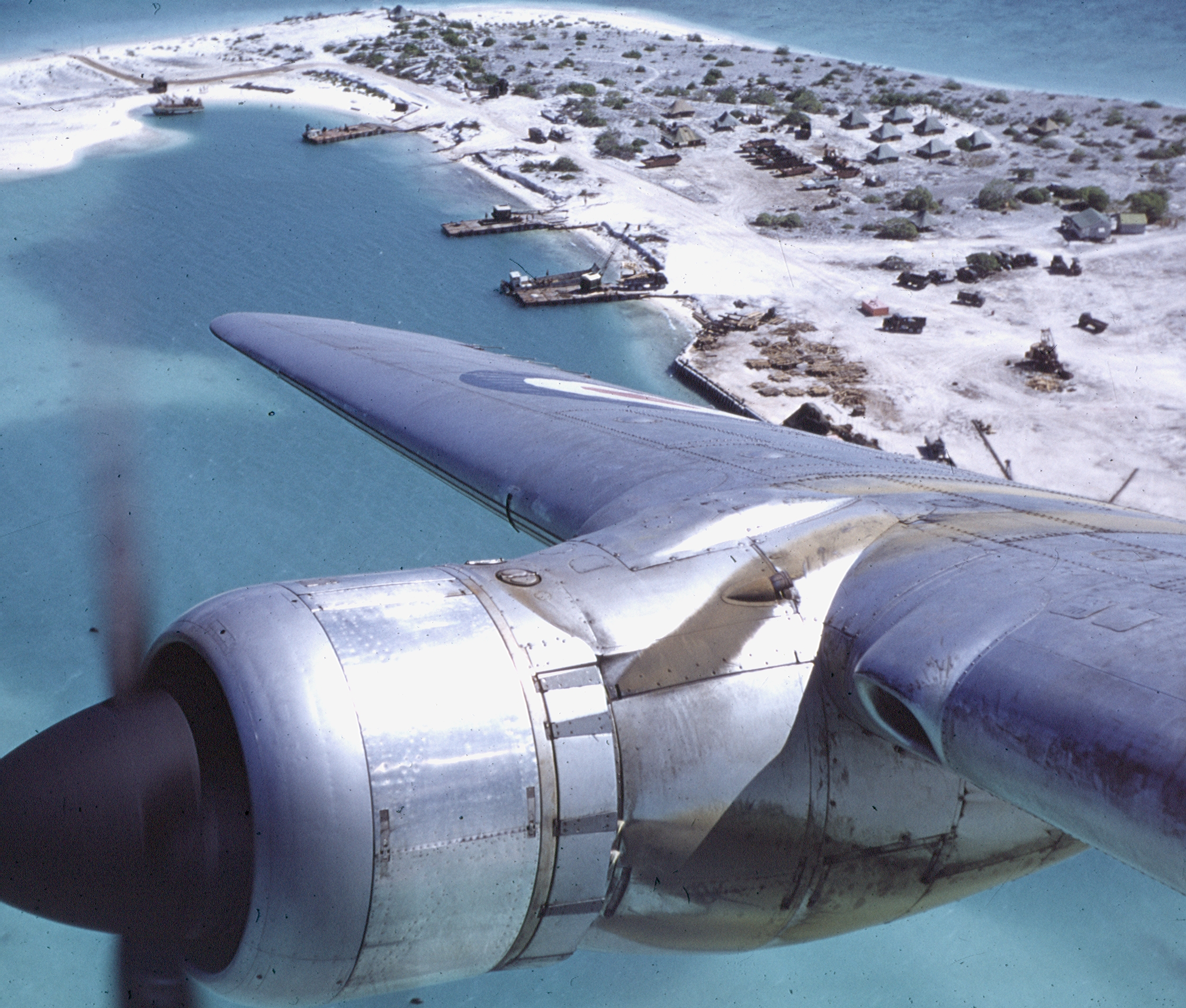
Banana (also called Banana Wells) is a small village located on the northern side of the Kiritimati Atoll (also known as Christmas Atoll), Kiribati. It is located close to Cassidy International Airport and the James Cook Hotel. It is the third-largest village on the island, with a population of 1,208 people in 2015. Banana is located near the settlements of Tabwakea, London, Poland and Paris, with Paris being abandoned. History Exploration and settlement Banana and the rest of Kiritimati is believed to have been inhabited first by the Polynesians, beginning around 1250–1450 AD. The islands were rediscovered during the Spanish expedition in 1537, and again by James Cook in the eighteenth century. 20th century During World War II World War II or the Second World War, often abbreviated as WWII or WW2, was a world war that lasted from 1939 to 1945. It involved the vast majority of the world's countries—including all of the great powers—forming two op ... [...More Info...] [...Related Items...] OR: [Wikipedia] [Google] [Baidu] |
Tabwakea
Tabwakea, also known as Tabakea, is a village in Kiribati, located on the island of Kiritimati, within the archipelago of Line Islands. In 2020, it was inhabited by 3,537 people, making it the most populated of the four settlements of the island. Name ''Tabwakea'' means turtle in Gilbertese language and may refer to the first name given by James Cook on 24 December 1777, Turtle Island, before giving to it the name of Christmas Island (Kiritimati). Demographics In 2005 it had a population of 1,881 people. In 2010 it had a population of 2,311, 3,001 in 2015, and 3,537 in 2020. It is the largest village on Kiritimati and in the whole Line Islands The Line Islands, Teraina Islands or Equatorial Islands (in Gilbertese, ''Aono Raina'') are a chain of 11 atolls (with partly or fully enclosed lagoons) and coral islands (with a surrounding reef) in the central Pacific Ocean, south of the Hawa .... References Populated places in Kiribati Kiritimati {{Kiribati-geo-stub ... [...More Info...] [...Related Items...] OR: [Wikipedia] [Google] [Baidu] |
Poland, Kiribati
Poland is a village in Kiribati, located on the island of Kiritimati, within the archipelago of Line Islands. In 2020, it was inhabited by 404 people, making it the smallest of the four settlements of the island. The village was named by after the birth country of his Polish plantation manager and engineer Stanisław Pełczyński, who aided the villagers. He solved the problem of effectively watering palm trees during the dry season by suggesting a modified irrigation system, then helping to build it, and teaching how to use it. The village was featured in one of the promotional videos for the 2013 United Nations Climate Change Conference in Warsaw, Poland. Location Poland is located on the westernmost part of the island, at geographic coordinates . Demographics At the time of the 2010 census, the population is 441 people. Name The village was named in honor of a Pole whose name was Stanisław (Stanislaus) Pełczyński. Having arrived with an American merchant vessel that ... [...More Info...] [...Related Items...] OR: [Wikipedia] [Google] [Baidu] |
Tropical Savanna Climate
Tropical savanna climate or tropical wet and dry climate is a tropical climate sub-type that corresponds to the Köppen climate classification categories ''Aw'' (for a dry winter) and ''As'' (for a dry summer). The driest month has less than of precipitation and also less than 100-\left (\frac \right)mm of precipitation. This latter fact is in a direct contrast to a tropical monsoon climate, whose driest month sees less than of precipitation but has ''more'' than 100-\left (\frac \right) of precipitation. In essence, a tropical savanna climate tends to either see less overall rainfall than a tropical monsoon climate or have more pronounced dry season(s). In tropical savanna climates, the dry season can become severe, and often drought conditions prevail during the course of the year. Tropical savanna climates often feature tree-studded grasslands due to its dryness, rather than thick jungle. It is this widespread occurrence of tall, coarse grass (called savanna) which has led to ... [...More Info...] [...Related Items...] OR: [Wikipedia] [Google] [Baidu] |
Populated Places In Kiribati
Population typically refers to the number of people in a single area, whether it be a city or town, region, country, continent, or the world. Governments typically quantify the size of the resident population within their jurisdiction using a census, a process of collecting, analysing, compiling, and publishing data regarding a population. Perspectives of various disciplines Social sciences In sociology and population geography, population refers to a group of human beings with some predefined criterion in common, such as location, race, ethnicity, nationality, or religion. Demography is a social science which entails the statistical study of populations. Ecology In ecology, a population is a group of organisms of the same species who inhabit the same particular geographical area and are capable of interbreeding. The area of a sexual population is the area where inter-breeding is possible between any pair within the area and more probable than cross-breeding with ind ... [...More Info...] [...Related Items...] OR: [Wikipedia] [Google] [Baidu] |


