|
Lochspouts Loch
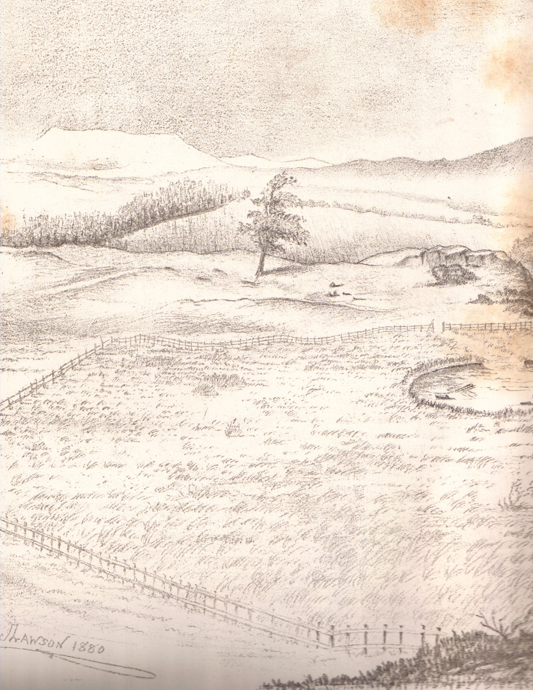
Lochspouts Loch (NS 2885 0586) or Lochspouts was situated in a hollow, surrounded by hilly ground on three sides and bounded by a narrow trap dyke to the north. The land was once held by the Ferguson family of Kilkerran and lies in the Parish of Kirkoswald, South Ayrshire South Ayrshire ( sco, Sooth Ayrshire; gd, Siorrachd Àir a Deas, ) is one of thirty-two council areas of Scotland, covering the southern part of Ayrshire. It borders onto Dumfries and Galloway, East Ayrshire and North Ayrshire. On 30 June 2 ..., Scotland. The loch became a reservoir in the 19th century. History This roughly oval-shaped loch was about southwest of Maybole. The natural trap dike dam that held back its waters was the only possible outflow, and several crevices in this barrier allowed excess water to escape so that during times of heavy rainfall several of these "spouts" carried water at the same time, hence "Lochspouts". The main exit was deepened to provide a water supply for a waulkmill, ... [...More Info...] [...Related Items...] OR: [Wikipedia] [Google] [Baidu] |
Loch
''Loch'' () is the Scottish Gaelic, Scots language, Scots and Irish language, Irish word for a lake or sea inlet. It is Cognate, cognate with the Manx language, Manx lough, Cornish language, Cornish logh, and one of the Welsh language, Welsh words for lake, llwch. In English English and Hiberno-English, the Anglicisation, anglicised spelling lough is commonly found in place names; in Lowland Scots and Scottish English, the spelling "loch" is always used. Many loughs are connected to stories of lake-bursts, signifying their mythical origin. Sea-inlet lochs are often called sea lochs or sea loughs. Some such bodies of water could also be called firths, fjords, estuary, estuaries, straits or bays. Background This name for a body of water is Insular Celtic languages, Insular CelticThe current form has currency in the following languages: Scottish Gaelic, Irish language, Irish, Manx language, Manx, and has been borrowed into Scots language, Lowland Scots, Scottish English, Iri ... [...More Info...] [...Related Items...] OR: [Wikipedia] [Google] [Baidu] |
Maybole
Maybole is a town and former burgh of barony and police burgh in South Ayrshire, Scotland. It had an estimated population of in . It is situated south of Ayr and southwest of Glasgow by the Glasgow and South Western Railway. The town is bypassed by the A77 road, A77. History Maybole has Middle Ages roots, receiving a charter from Donnchadh, Earl of Carrick in 1193. In 1516 it was made a burgh of regality, although for generations it remained under the suzerainty of the Kennedy clan, Kennedys, afterwards Earl of Cassillis, Earls of Cassillis and (later) Marquess of Ailsa, Marquesses of Ailsa, the most powerful family in Ayrshire. The Archibald Angus Charles Kennedy, 8th Marquess of Ailsa, Marquess of Ailsa lived at Cassillis House, just outside Maybole until its sale in 2007. In the late seventeenth century, a census recorded Maybole was home to 28 "lords and landowners with estates in Carrick and beyond." In former times, Maybole was the capital of the district of Carr ... [...More Info...] [...Related Items...] OR: [Wikipedia] [Google] [Baidu] |
South Ayrshire
South Ayrshire ( sco, Sooth Ayrshire; gd, Siorrachd Àir a Deas, ) is one of thirty-two council areas of Scotland, covering the southern part of Ayrshire. It borders onto Dumfries and Galloway, East Ayrshire and North Ayrshire. On 30 June 2020, the population of South Ayrshire was 112,140. Overview and history Creation and history The administrative boundaries were formed in 1996 as a direct successor to the Kyle and Carrick district council area, with the district of Dalmellington – located along the south-east of Kyle and Carrick – being transferred over to the newly formed East Ayrshire Council area. South Ayrshire's Headquarters, County Buildings, are located in Wellington Square, Ayr. The former council offices, Burns House on Burns Square and Parkhouse Street, were demolished in 2021, creating a new open space, landscaped with funding from the Scottish Government. Geography and climate Geographically, South Ayrshire is located on the western coast of Scotland, s ... [...More Info...] [...Related Items...] OR: [Wikipedia] [Google] [Baidu] |
Kirkoswald, South Ayrshire
Kirkoswald ( sco, Kirkossald) is a village and parish in the Carrick district of Ayrshire, Scotland, from the coast and southwest of Maybole. It takes its name from its ''kirk'' (church), dedicated to Oswald of Northumbria, who is said to have won a battle here in the 7th century. The old church, which was built in 1244 and houses the baptismal font of Robert the Bruce, is now a ruin in the grounds of the modern church, which was built in 1777 to a design by Robert Adam. Kirkoswald is also noted for its connection with Robert Burns, whose maternal ancestors, the Brouns, were from the village. Burns also attended school here, and would later base the characters Tam o' Shanter, Kirkton Jean and souter Johnnie on village locals Douglas Graham, Jean Aird and John Davidson, the shoemaker. Kirkoswald village had a population of 194 in 1991. Kirkoswald parish is in area, and also contains the coastal village of Maidens. Landmarks include Turnberry Castle, the ancient seat of the E ... [...More Info...] [...Related Items...] OR: [Wikipedia] [Google] [Baidu] |
Lochspouts Loch Site - West
Lochspouts Loch (NS 2885 0586) or Lochspouts was situated in a hollow, surrounded by hilly ground on three sides and bounded by a narrow trap dyke to the north. The land was once held by the Ferguson family of Kilkerran and lies in the Parish of Kirkoswald, South Ayrshire South Ayrshire ( sco, Sooth Ayrshire; gd, Siorrachd Àir a Deas, ) is one of thirty-two council areas of Scotland, covering the southern part of Ayrshire. It borders onto Dumfries and Galloway, East Ayrshire and North Ayrshire. On 30 June 2 ..., Scotland. The loch became a reservoir in the 19th century. History This roughly oval-shaped loch was about southwest of Maybole. The natural trap dike dam that held back its waters was the only possible outflow, and several crevices in this barrier allowed excess water to escape so that during times of heavy rainfall several of these "spouts" carried water at the same time, hence "Lochspouts". The main exit was deepened to provide a water supply for a waulkmill, ... [...More Info...] [...Related Items...] OR: [Wikipedia] [Google] [Baidu] |
Lochspouts Loch Looking East
Lochspouts Loch (NS 2885 0586) or Lochspouts was situated in a hollow, surrounded by hilly ground on three sides and bounded by a narrow trap dyke to the north. The land was once held by the Ferguson family of Kilkerran and lies in the Parish of Kirkoswald, South Ayrshire South Ayrshire ( sco, Sooth Ayrshire; gd, Siorrachd Àir a Deas, ) is one of thirty-two council areas of Scotland, covering the southern part of Ayrshire. It borders onto Dumfries and Galloway, East Ayrshire and North Ayrshire. On 30 June 2 ..., Scotland. The loch became a reservoir in the 19th century. History This roughly oval-shaped loch was about southwest of Maybole. The natural trap dike dam that held back its waters was the only possible outflow, and several crevices in this barrier allowed excess water to escape so that during times of heavy rainfall several of these "spouts" carried water at the same time, hence "Lochspouts". The main exit was deepened to provide a water supply for a waulkmill, ... [...More Info...] [...Related Items...] OR: [Wikipedia] [Google] [Baidu] |
Lochspouts Reservoir - Geograph
Lochspouts Loch (NS 2885 0586) or Lochspouts was situated in a hollow, surrounded by hilly ground on three sides and bounded by a narrow trap dyke to the north. The land was once held by the Ferguson family of Kilkerran and lies in the Parish of Kirkoswald, South Ayrshire South Ayrshire ( sco, Sooth Ayrshire; gd, Siorrachd Àir a Deas, ) is one of thirty-two council areas of Scotland, covering the southern part of Ayrshire. It borders onto Dumfries and Galloway, East Ayrshire and North Ayrshire. On 30 June 2 ..., Scotland. The loch became a reservoir in the 19th century. History This roughly oval-shaped loch was about southwest of Maybole. The natural trap dike dam that held back its waters was the only possible outflow, and several crevices in this barrier allowed excess water to escape so that during times of heavy rainfall several of these "spouts" carried water at the same time, hence "Lochspouts". The main exit was deepened to provide a water supply for a waulkmill, ... [...More Info...] [...Related Items...] OR: [Wikipedia] [Google] [Baidu] |
Ordnance Survey
, nativename_a = , nativename_r = , logo = Ordnance Survey 2015 Logo.svg , logo_width = 240px , logo_caption = , seal = , seal_width = , seal_caption = , picture = , picture_width = , picture_caption = , formed = , preceding1 = , dissolved = , superseding = , jurisdiction = Great BritainThe Ordnance Survey deals only with maps of Great Britain, and, to an extent, the Isle of Man, but not Northern Ireland, which has its own, separate government agency, the Ordnance Survey of Northern Ireland. , headquarters = Southampton, England, UK , region_code = GB , coordinates = , employees = 1,244 , budget = , minister1_name = , minister1_pfo = , chief1_name = Steve Blair , chief1_position = CEO , agency_type = , parent_agency = , child1_agency = , keydocument1 = , website = , footnotes = , map = , map_width = , map_caption = Ordnance Survey (OS) is the national mapping agency for Great Britain. The agency's name indicates its original military purpose (se ... [...More Info...] [...Related Items...] OR: [Wikipedia] [Google] [Baidu] |
Lochs Of South Ayrshire
''Loch'' () is the Scottish Gaelic, Scots and Irish word for a lake or sea inlet. It is cognate with the Manx lough, Cornish logh, and one of the Welsh words for lake, llwch. In English English and Hiberno-English, the anglicised spelling lough is commonly found in place names; in Lowland Scots and Scottish English, the spelling "loch" is always used. Many loughs are connected to stories of lake-bursts, signifying their mythical origin. Sea-inlet lochs are often called sea lochs or sea loughs. Some such bodies of water could also be called firths, fjords, estuaries, straits or bays. Background This name for a body of water is Insular CelticThe current form has currency in the following languages: Scottish Gaelic, Irish, Manx, and has been borrowed into Lowland Scots, Scottish English, Irish English and Standard English. in origin and is applied to most lakes in Scotland and to many sea inlets in the west and north of Scotland. The word comes from Proto-Indo-European ... [...More Info...] [...Related Items...] OR: [Wikipedia] [Google] [Baidu] |
History Of South Ayrshire
History (derived ) is the systematic study and the documentation of the human activity. The time period of event before the invention of writing systems is considered prehistory. "History" is an umbrella term comprising past events as well as the memory, discovery, collection, organization, presentation, and interpretation of these events. Historians seek knowledge of the past using historical sources such as written documents, oral accounts, art and material artifacts, and ecological markers. History is not complete and still has debatable mysteries. History is also an academic discipline which uses narrative to describe, examine, question, and analyze past events, and investigate their patterns of cause and effect. Historians often debate which narrative best explains an event, as well as the significance of different causes and effects. Historians also debate the nature of history as an end in itself, as well as its usefulness to give perspective on the problems o ... [...More Info...] [...Related Items...] OR: [Wikipedia] [Google] [Baidu] |


Nov2007.jpg)
.jpg)