|
Loch Achtriochtan
Loch Achtriochtan or Loch Trychardan is a small shallow freshwater loch located to the east of Glencoe village in Lochaber in the Scottish Highlands. It is now under the care of the National Trust for Scotland. During the 18th century, the loch flooded and nearby inhabitants had to abandon the area. Topography Loch Achtriochtan is a small fresh water lochan in Glencoe, fed by the River Coe, which eventually flows into Loch Leven at Invercoe. To the south of the Loch is Achnambeithach Cottage, accessible from the A82 road. To the north, there are the mountains Sgorr nam Fiannaidh and Stob Coire Leith and, to the south, the Three Sisters. Loch Actriochtan sits about three miles from Glencoe village. References See also * Glen Coe * Glencoe, Highland Glencoe or Glencoe Village (Gaelic: ''A’ Chàrnaich'') is the main settlement in Glen Coe in the Lochaber area of the Scottish Highlands. It lies at the north-west end of the glen, on the southern bank of the River Coe w ... [...More Info...] [...Related Items...] OR: [Wikipedia] [Google] [Baidu] |
Glencoe, Highland
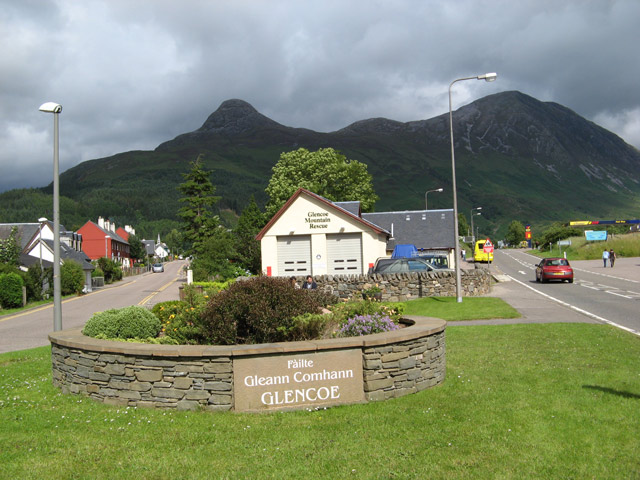
Glencoe or Glencoe Village (Gaelic: ''A’ Chàrnaich'') is the main settlement in Glen Coe in the Lochaber area of the Scottish Highlands. It lies at the north-west end of the glen, on the southern bank of the River Coe where it enters Loch Leven (a salt-water loch off Loch Linnhe). The village falls within the Ross, Skye and Lochaber part of the Highland council area for local government purposes. It is part of the registration county of Argyll and the lieutenancy area of Inverness for ceremonial functions. The use of the term 'Glencoe Village' is a modern one, to differentiate the settlement from the glen itself. History The village is on the site of the Massacre of Glencoe in 1692, in which 38 members of the Clan MacDonald of Glencoe were killed by forces acting on behalf of the government of King William III following the Glorious Revolution. Treachery was involved, since the Clan had fed the soldiers and given them shelter for nearly two weeks before they turned on t ... [...More Info...] [...Related Items...] OR: [Wikipedia] [Google] [Baidu] |
Lochaber
Lochaber ( ; gd, Loch Abar) is a name applied to a part of the Scottish Highlands. Historically, it was a provincial lordship consisting of the parishes of Kilmallie and Kilmonivaig, as they were before being reduced in extent by the creation of ''Quoad Sacra'' parishes in the 19th century. Lochaber once extended from the Northern shore of Loch Leven, a district called Nether Lochaber, to beyond Spean Bridge and Roybridge, which area is known as Brae Lochaber or ''Braigh Loch Abar'' in Gaelic. Lochaber is now also used to refer to a much wider area, one of the 16 ward management areas of the Highland Council of Scotland and one of eight former local government districts of the two-tier Highland region. The main town of Lochaber is Fort William. According to legend, a glaistig, a ghostly woman-goat hybrid, once lived in the area. Name William Watson outlined two schools of thought on this topic. He favoured the idea that ''Abar'' came from the Pictish and Welsh for "river m ... [...More Info...] [...Related Items...] OR: [Wikipedia] [Google] [Baidu] |
Scottish Highlands
The Highlands ( sco, the Hielands; gd, a’ Ghàidhealtachd , 'the place of the Gaels') is a historical region of Scotland. Culturally, the Highlands and the Lowlands diverged from the Late Middle Ages into the modern period, when Lowland Scots replaced Scottish Gaelic throughout most of the Lowlands. The term is also used for the area north and west of the Highland Boundary Fault, although the exact boundaries are not clearly defined, particularly to the east. The Great Glen divides the Grampian Mountains to the southeast from the Northwest Highlands. The Scottish Gaelic name of ' literally means "the place of the Gaels" and traditionally, from a Gaelic-speaking point of view, includes both the Western Isles and the Highlands. The area is very sparsely populated, with many mountain ranges dominating the region, and includes the highest mountain in the British Isles, Ben Nevis. During the 18th and early 19th centuries the population of the Highlands rose to around 300,000, but ... [...More Info...] [...Related Items...] OR: [Wikipedia] [Google] [Baidu] |
National Trust For Scotland
The National Trust for Scotland for Places of Historic Interest or Natural Beauty, commonly known as the National Trust for Scotland ( gd, Urras Nàiseanta na h-Alba), is a Scottish conservation organisation. It is the largest membership organisation in Scotland and describes itself as "the conservation charity that protects and promotes Scotland's natural and cultural heritage for present and future generations to enjoy". The Trust owns and manages around 130 properties and of land, including castles, ancient small dwellings, historic sites, gardens, coastline, mountains and countryside. It is similar in function to the National Trust, which covers England, Wales, and Northern Ireland, and to other national trusts worldwide. History The Trust was established in 1931 following discussions held in the smoking room of Pollok House (now a Trust property). The Trust was incorporated on 1 May 1931, with John Stewart-Murray, 8th Duke of Atholl being elected as its first president, ... [...More Info...] [...Related Items...] OR: [Wikipedia] [Google] [Baidu] |
A82 Road
The A82 is a major road in Scotland that runs from Glasgow to Inverness via Fort William, Highland, Fort William. It is one of the principal north-south routes in Scotland and is mostly a trunk road managed by Transport Scotland, who view it as an important link from the Central Belt to the Scottish Highlands and beyond. The road passes close to numerous landmarks, including; Loch Lomond, Rannoch Moor, Glen Coe, the Ballachulish Bridge, Ben Nevis, the Commando Memorial, Loch Ness, and Urquhart Castle. The route is derived in several places from the Old military roads of Scotland, military roads constructed through the Highlands by George Wade, General George Wade and William Caulfeild (British Army officer), Major William Caulfeild in the 18th century, along with later roads constructed by Thomas Telford in the 19th. The modern route is based on that designed by Telford, but with a number of improvements primarily dating from the 1920s and 30s. These include a diversion across ... [...More Info...] [...Related Items...] OR: [Wikipedia] [Google] [Baidu] |
Stob Coire Leith Scotland
{{Disambiguation, geo ...
Stob may refer to: People * Verity Stob (since 1988), pseudonymous author of IT satirical articles * Ralph Stob (1894–1965), U.S. academic, president (1933–1939) of Calvin College * Henry J. Stob (1908–1996), U.S. academic, namesake of the Calvinist Stob Lectures Places * Stob (village), part of Bulgaria's municipality of Kocherinovo * Stob Earth Pyramids, in Bulgaria's Kyustendil Province * Stob, Scottish prefix for "Mount", as in Stob Binnein, Stob Coire Sgreamhach, Stob Ghabhar, etc. * Stobs Military Camp just outside Hawick Hawick ( ; sco, Haaick; gd, Hamhaig) is a town in the Scottish Borders council area and historic county of Roxburghshire in the east Southern Uplands of Scotland. It is south-west of Jedburgh and south-south-east of Selkirk. It is one of ... [...More Info...] [...Related Items...] OR: [Wikipedia] [Google] [Baidu] |
Three Sisters (Glen Coe)
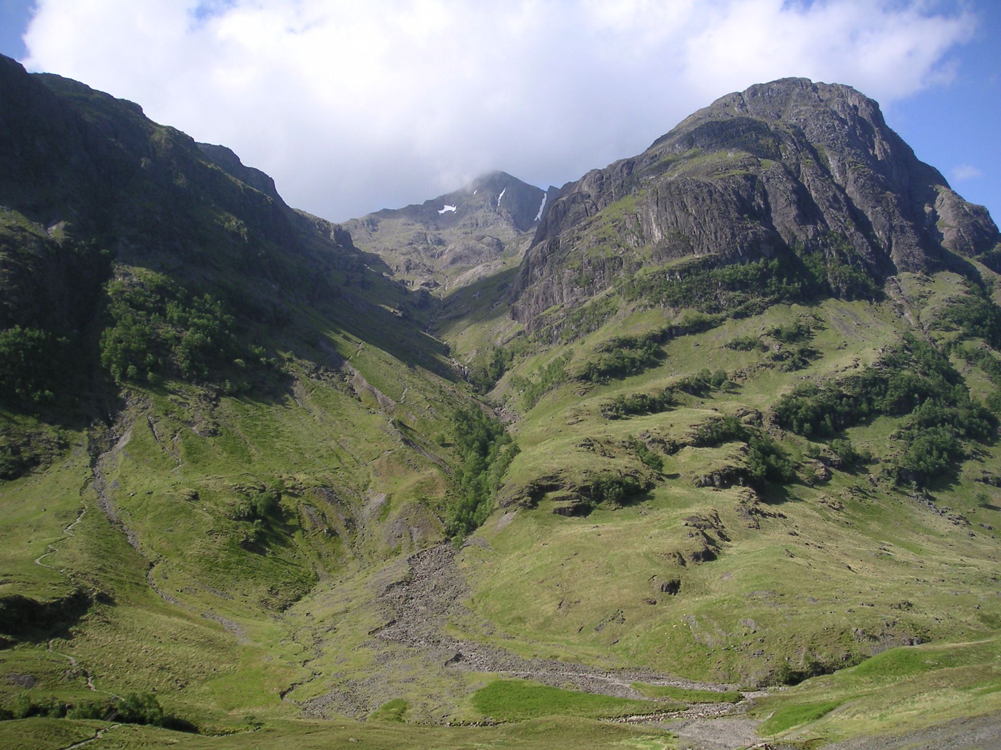
Bidean nam Bian ( gd, Bidean nam Beann, 'peak of the mountains') is the highest peak in a group of mountains south of Glen Coe and north of Glen Etive in the Scottish Highlands. With a height of , it is a Munro and the highest point in Argyll. It is a complex mountain, with many ridges and subsidiary peaks, one of which, Stob Coire Sgreamhach, is classified as a separate Munro. Landscape The most noticeable features of the Bidean nam Bian massif are the famous Three Sisters of Glen Coe, three steeply-sided ridges that extend north into the Glen. Two of the sisters, Gearr Aonach ('short ridge') and Aonach Dubh ('black ridge') converge at Stob Coire nan Lochan, a subsidiary peak of Bidean nam Bian that lies about 1 km to the northeast of the actual summit. The final, most easterly sister, Beinn Fhada ('long mountain'), joins the Bidean nam Bian massif at the summit of Stob Coire Sgreamhach. Beinn Fhada is separated from Gearr Aonach by a glen known as Coire Gabhail ('glen of ... [...More Info...] [...Related Items...] OR: [Wikipedia] [Google] [Baidu] |
Glen Coe
Glen Coe ( gd, Gleann Comhann ) is a glen of volcanic origins, in the Highlands of Scotland. It lies in the north of the county of Argyll, close to the border with the historic province of Lochaber, within the modern council area of Highland. Glen Coe is regarded as the home of Scottish mountaineering and is popular with hillwalkers and climbers. A 2010 review by Scottish Natural Heritage into the special qualities of Scotland's National scenic areas listed the "soaring, dramatic splendour of Glen Coe", and "the suddenness of the transition between high mountain pass and the lightly wooded strath" as being of note. The review also described the journey through the glen on the main A82 road as "one of the classic Highland journeys". The main settlement is the village of Glencoe located at the foot of the glen.Ordnance Survey Landranger 1:50000, Sheet 41 On the 13 February 1692, in the aftermath of the Jacobite uprising of 1689, an incident known as the Massacre of Glenco ... [...More Info...] [...Related Items...] OR: [Wikipedia] [Google] [Baidu] |
Lochs Of Highland (council Area)
''Loch'' () is the Scottish Gaelic, Scots and Irish word for a lake or sea inlet. It is cognate with the Manx lough, Cornish logh, and one of the Welsh words for lake, llwch. In English English and Hiberno-English, the anglicised spelling lough is commonly found in place names; in Lowland Scots and Scottish English, the spelling "loch" is always used. Many loughs are connected to stories of lake-bursts, signifying their mythical origin. Sea-inlet lochs are often called sea lochs or sea loughs. Some such bodies of water could also be called firths, fjords, estuaries, straits or bays. Background This name for a body of water is Insular CelticThe current form has currency in the following languages: Scottish Gaelic, Irish, Manx, and has been borrowed into Lowland Scots, Scottish English, Irish English and Standard English. in origin and is applied to most lakes in Scotland and to many sea inlets in the west and north of Scotland. The word comes from Proto-Indo-Europea ... [...More Info...] [...Related Items...] OR: [Wikipedia] [Google] [Baidu] |


