|
Loch Achonachie
Loch Achonachie is a freshwater loch in Ross-shire, Ross-Shire, Scotland, south-west of Contin. Situated on the River Conon, the loch is a manmade reservoir formed from the construction of the Torr Achilty hydroelectric dam in 1955. The dam acted as the control station for the entire Conon Valley Scheme, one of the major post-war infrastructure projects spearheaded by the North of Scotland Hydro-Electric Board, North of Scotland Hydro-Electric Board (NoSHEB). From the Ordnance Survey, Ordinance Survey's website, a possible etymology for "Achonachie" may be the Gàidhlig elements ''ach'' (abbreviated from ''achadh'') + ''aonach'', meaning "Loch of the Hill Field". Fairburn wind farm overlooks Loch Achonachie from the slopes of Beinn an Rubha Riabhaich, a hill on its south shore. The wind farm is privately owned by SSE plc, SSE. Loch Achonachie is a popular location for local anglers due to its large Sea trout, trout and Atlantic salmon, salmon populations. Fishing in the loch ... [...More Info...] [...Related Items...] OR: [Wikipedia] [Google] [Baidu] |
Easter Ross
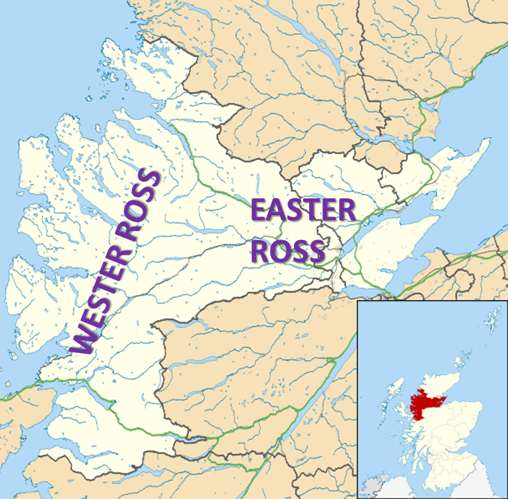
Easter Ross ( gd, Ros an Ear) is a loosely defined area in the east of Ross, Highland, Scotland. The name is used in the constituency name Caithness, Sutherland and Easter Ross, which is the name of both a British House of Commons constituency and a Scottish Parliament constituency. The two constituencies have however different boundaries. Settlements Places in Easter Ross include: * Alness * Dingwall (included in some contexts in the term ''Easter Ross'', though in some contexts it refers to the area to the north-east of Dingwall) * Evanton * Invergordon * Kildary * Milntown of Tarbat (Milton) * Portmahomack * The Seaboard villages: ** Balintore ** Hilton of Cadboll ** Shandwick * Tain Easter Ross is well known for Black Isle and its towns: Avoch, Rosemarkie, Fortrose, and Cromarty. See also * Black Isle * Ross and Cromarty * Ross-shire * Wester Ross Wester Ross () is an area of the Northwest Highlands of Scotland in the council area of Highland. The area is loosel ... [...More Info...] [...Related Items...] OR: [Wikipedia] [Google] [Baidu] |
Wind Farm
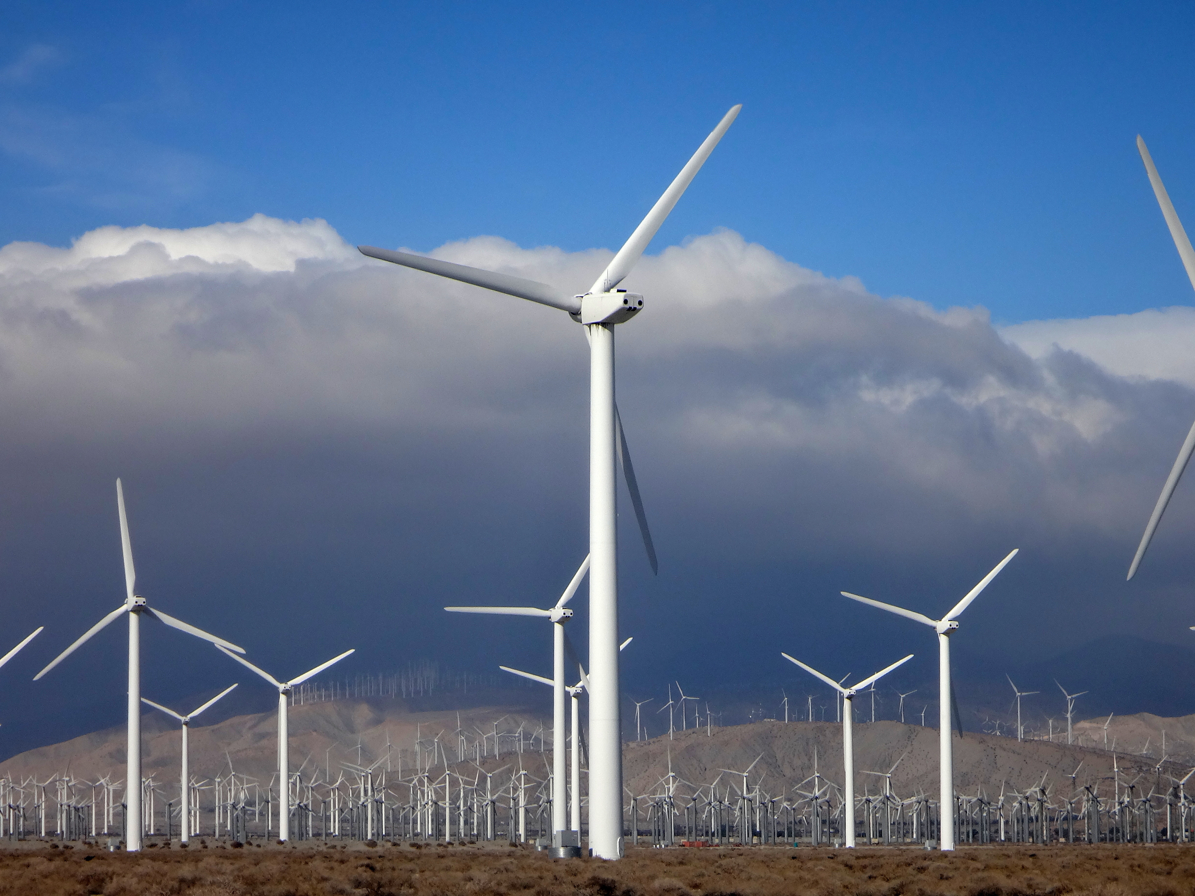
A wind farm or wind park, also called a wind power station or wind power plant, is a group of wind turbines in the same location used Wind power, to produce electricity. Wind farms vary in size from a small number of turbines to several hundred wind turbines covering an extensive area. Wind farms can be either onshore or offshore. Many of the largest operational onshore wind farms are located in China, India, and the United States. For example, the List of onshore wind farms, largest wind farm in the world, Gansu Wind Farm in China had a capacity of over 6,000 megawatt, MW by 2012,Watts, Jonathan & Huang, CecilyWinds Of Change Blow Through China As Spending On Renewable Energy Soars ''The Guardian'', 19 March 2012, revised on 20 March 2012. Retrieved 4 January 2012. with a goal of 20,000 MWFahey, JonathanIn Pictures: The World's Biggest Green Energy Projects ''Forbes'', 9 January 2010. Retrieved 19 June 2019. by 2020.Kanter, DougGansu Wind Farm ''Forbes''. Retrieved 1 ... [...More Info...] [...Related Items...] OR: [Wikipedia] [Google] [Baidu] |
University Of Glasgow
, image = UofG Coat of Arms.png , image_size = 150px , caption = Coat of arms Flag , latin_name = Universitas Glasguensis , motto = la, Via, Veritas, Vita , mottoeng = The Way, The Truth, The Life , established = , type = Public research universityAncient university , endowment = £225.2 million , budget = £809.4 million , rector = Rita Rae, Lady Rae , chancellor = Dame Katherine Grainger , principal = Sir Anton Muscatelli , academic_staff = 4,680 (2020) , administrative_staff = 4,003 , students = () , undergrad = () , postgrad = () , city = Glasgow , country = Scotland, UK , colours = , website = , logo ... [...More Info...] [...Related Items...] OR: [Wikipedia] [Google] [Baidu] |
Scottish Environment Protection Agency
The Scottish Environment Protection Agency (SEPA; gd, Buidheann Dìon Àrainneachd na h-Alba) is Scotland's Environmental regulation, environmental regulator and national flood forecasting, flood warning and strategic flood risk management authority.Environment Act (1995). (c.2), London, HMSO [Accessed 29 April 2010]. Its main role is to protect and improve Scotland's environment. SEPA does this by helping business and industry to understand their environmental responsibilities, enabling customers to comply with legislation and good practice and to realise the economic benefits of good environmental practice. One of the ways SEPA does this is through the NetRegs environmental guidance service. It protects communities by regulating activities that can cause harmful pollution and ... [...More Info...] [...Related Items...] OR: [Wikipedia] [Google] [Baidu] |
Loch Achonachie - Geograph
''Loch'' () is the Scottish Gaelic, Scots and Irish word for a lake or sea inlet. It is cognate with the Manx lough, Cornish logh, and one of the Welsh words for lake, llwch. In English English and Hiberno-English, the anglicised spelling lough is commonly found in place names; in Lowland Scots and Scottish English, the spelling "loch" is always used. Many loughs are connected to stories of lake-bursts, signifying their mythical origin. Sea-inlet lochs are often called sea lochs or sea loughs. Some such bodies of water could also be called firths, fjords, estuaries, straits or bays. Background This name for a body of water is Insular CelticThe current form has currency in the following languages: Scottish Gaelic, Irish, Manx, and has been borrowed into Lowland Scots, Scottish English, Irish English and Standard English. in origin and is applied to most lakes in Scotland and to many sea inlets in the west and north of Scotland. The word comes from Proto-Ind ... [...More Info...] [...Related Items...] OR: [Wikipedia] [Google] [Baidu] |
Atlantic Salmon
The Atlantic salmon (''Salmo salar'') is a species of ray-finned fish in the family Salmonidae. It is the third largest of the Salmonidae, behind Siberian taimen and Pacific Chinook salmon, growing up to a meter in length. Atlantic salmon are found in the northern Atlantic Ocean and in rivers that flow into it. Most populations are anadromous, hatching in streams and rivers but moving out to sea as they grow where they mature, after which the adults seasonally move upstream again to spawn. When the mature fish re-enter rivers to spawn, they change in colour and appearance. Some populations of this fish only migrate to large lakes, and are "landlocked", spending their entire lives in freshwater. Such populations are found throughout the range of the species. Unlike Pacific species of salmon, ''S. salar'' is iteroparous, which means it can survive spawning and return to sea to repeat the process again in another year. Such individuals can grow to extremely large sizes, althoug ... [...More Info...] [...Related Items...] OR: [Wikipedia] [Google] [Baidu] |
Sea Trout
Sea trout is the common name usually applied to anadromous (sea-run) forms of brown trout (''Salmo trutta''), and is often referred to as ''Salmo trutta'' morpha ''trutta''. Other names for anadromous brown trout are sewin (Wales), peel or peal ( Southwest England), mort (Northwest England), finnock (Scotland), white trout (Ireland) and salmon trout (culinary). The term "sea trout" is also used to describe other anadromous salmonids, such as coho salmon (''Oncorhynchus kisutch''), coastal cutthroat trout (''Oncorhynchus clarkii clarkii''), brook trout (''Salvelinus fontinalis''), Arctic char (''Salvelinus alpinus alpinus'') and Dolly Varden (''Salvenlinus malma''). Even some non-salmonid fish species are also commonly known as sea trout, such as Northern pikeminnow (''Ptychocheilus oregonensis'') and members of the weakfish family (''Cynoscion''). Range Anadromous brown trout are widely distributed in Europe along the Atlantic and Baltic coasts, the United Kingdom and the coa ... [...More Info...] [...Related Items...] OR: [Wikipedia] [Google] [Baidu] |
SSE Plc
SSE plc (formerly Scottish and Southern Energy plc) is a multinational energy company headquartered in Perth, Scotland. It is listed on the London Stock Exchange, and is a constituent of the FTSE 100 Index. SSE operates in the United Kingdom and Ireland. History Origins The company has its origins in two public sector electricity supply authorities. The former North of Scotland Hydro-Electric Board was founded in 1943 to design, construct and manage hydroelectricity projects in the Highlands of Scotland, and took over further generation and distribution responsibilities on the nationalisation of the electricity industry within the United Kingdom in 1948. The former Southern Electricity Board was created in 1948 to distribute electricity in Southern England. Whilst the Southern Electricity Board was a distribution only authority, with no power generation capacity of its own, the North of Scotland Hydro-Electric board was a broader spectrum organisation, with its own generating c ... [...More Info...] [...Related Items...] OR: [Wikipedia] [Google] [Baidu] |
Ordnance Survey
, nativename_a = , nativename_r = , logo = Ordnance Survey 2015 Logo.svg , logo_width = 240px , logo_caption = , seal = , seal_width = , seal_caption = , picture = , picture_width = , picture_caption = , formed = , preceding1 = , dissolved = , superseding = , jurisdiction = Great BritainThe Ordnance Survey deals only with maps of Great Britain, and, to an extent, the Isle of Man, but not Northern Ireland, which has its own, separate government agency, the Ordnance Survey of Northern Ireland. , headquarters = Southampton, England, UK , region_code = GB , coordinates = , employees = 1,244 , budget = , minister1_name = , minister1_pfo = , chief1_name = Steve Blair , chief1_position = CEO , agency_type = , parent_agency = , child1_agency = , keydocument1 = , website = , footnotes = , map = , map_width = , map_caption = Ordnance Survey (OS) is the national mapping agency for Great Britain. The agency's name indicates its original military purpose (se ... [...More Info...] [...Related Items...] OR: [Wikipedia] [Google] [Baidu] |
Scotland
Scotland (, ) is a country that is part of the United Kingdom. Covering the northern third of the island of Great Britain, mainland Scotland has a border with England to the southeast and is otherwise surrounded by the Atlantic Ocean to the north and west, the North Sea to the northeast and east, and the Irish Sea to the south. It also contains more than 790 islands, principally in the archipelagos of the Hebrides and the Northern Isles. Most of the population, including the capital Edinburgh, is concentrated in the Central Belt—the plain between the Scottish Highlands and the Southern Uplands—in the Scottish Lowlands. Scotland is divided into 32 administrative subdivisions or local authorities, known as council areas. Glasgow City is the largest council area in terms of population, with Highland being the largest in terms of area. Limited self-governing power, covering matters such as education, social services and roads and transportation, is devolved from the Scott ... [...More Info...] [...Related Items...] OR: [Wikipedia] [Google] [Baidu] |
North Of Scotland Hydro-Electric Board
The North of Scotland Hydro-Electric Board (1943–1990) was founded to design, construct and manage hydroelectricity projects in the Highlands of Scotland. It is regarded as one of the major achievements of Scottish politician Thomas Johnston, who chaired the board from 1945 to 1959. Background In the 1930s several schemes were proposed to develop hydro-electric power in the north of Scotland. These met with opposition by landowners, sporting interest and the coal mining industry on the grounds of competition. There was also opposition from official sources. Plans to build a power station at Kinlochleven for the benefit of the aluminium industry were shelved when Inverness County Council refused to allow water from the River Spey and River Laggan to cross the county border into Argyllshire. In 1938, the Caledonian Water Power bill was defeated in Parliament. This would have allowed a private company to build hydro-electric schemes in the Highlands, and its defeat was welcomed ... [...More Info...] [...Related Items...] OR: [Wikipedia] [Google] [Baidu] |
Contin
Contin (Gaelic: Cunndainn) is a Ross-shire village, and a civil parish and community council area between Strathpeffer and Garve in the Highland council area of Scotland. The parish has a population of 675. Retrieved 2009-12-18 The church in Contin is dedicated to St Maelrubha or |


