|
Little Red River (other)
Little Red River may refer to: In the United States *Little Red River (Arkansas) *Little Red River (Texas) In Canada *Little Red River Cree Nation, in Alberta *Little Red River 106C, an Indian reserve in Saskatchewan *Little Red River 106D, an Indian reserve in Saskatchewan *Little Red River (Saskatchewan), a river in central Saskatchewan {{Disambiguation, geo ... [...More Info...] [...Related Items...] OR: [Wikipedia] [Google] [Baidu] |
Little Red River (Arkansas)
The Little Red River is a river in White, Van Buren, Searcy, Stone and Cleburne counties of north-central Arkansas. History During the American Civil War, the Battle of Whitney's Lane took place near Searcy on the banks of the Little Red River. Location The upper tributaries of the Little Red River are known as the South Fork, the Middle Fork, and the Devils Fork. Prior to the impoundment of Greers Ferry Lake the three tributaries converged just east of Sugar Loaf Mountain. The South Fork begins in the Ozark National Forest near Scotland in Van Buren County and flows into Greers Ferry Lake near Clinton. The Middle Fork begins only a few miles from the South Fork near Tilly in Van Buren County but flows northward into Searcy County. In Searcy County the river turns east and flows into Stone County where it turns south and flows to meet Greers Ferry Lake in Cleburne County. The Devils Fork begins in northeastern Cleburne County, and flows southwest to meet Greers Ferry ... [...More Info...] [...Related Items...] OR: [Wikipedia] [Google] [Baidu] |
Little Red River (Texas)
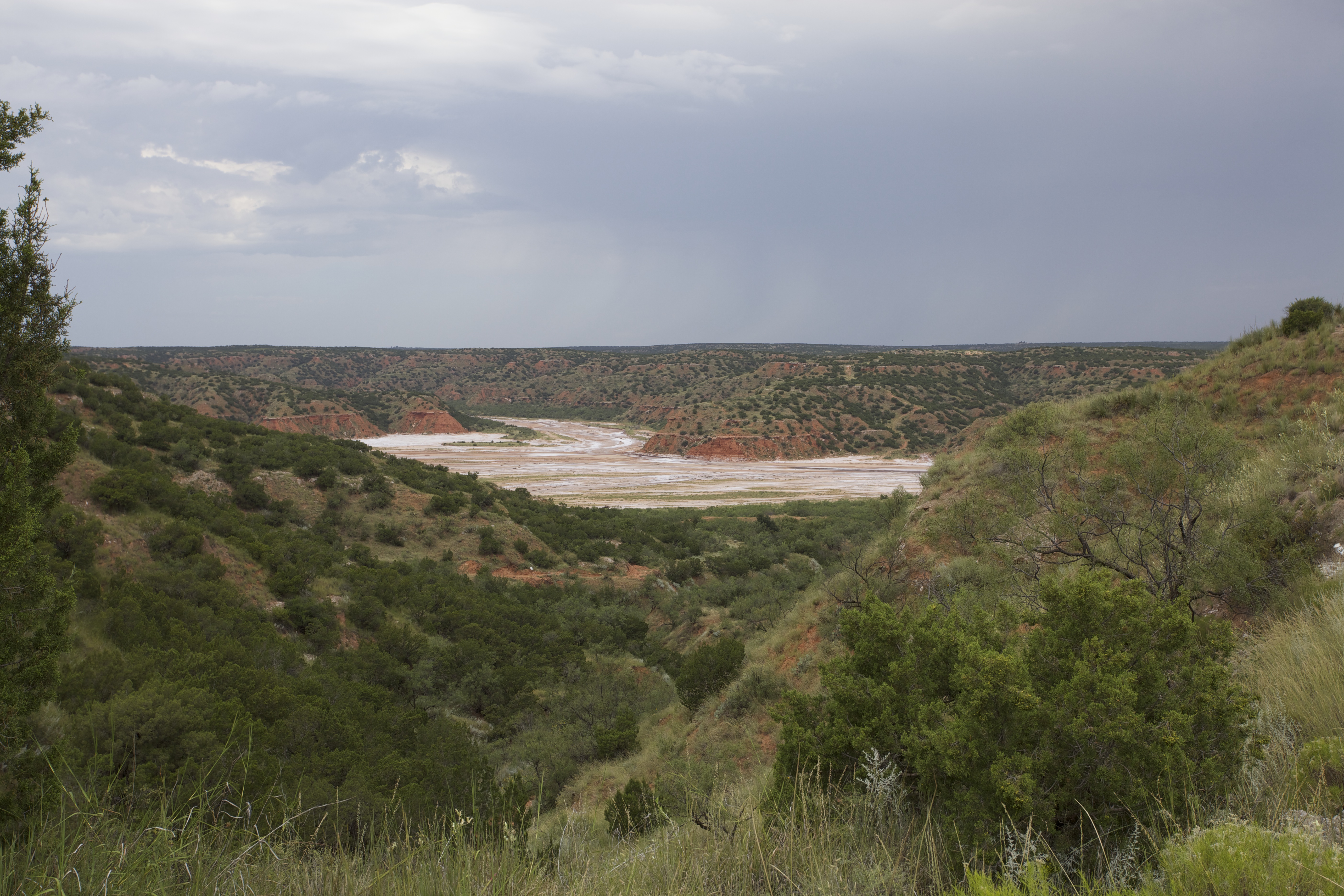
The Little Red River is an intermittent stream about long, formed at the confluence of the North Prong and South Prong Little Red River in Briscoe County, Texas, and flowing east-northeastward to join the Prairie Dog Town Fork Red River in Hall County, Texas. Geography The upper tributaries of the Little Red River are ephemeral streams known as the North Prong and South Prong Red River. Both streams originate along the eastern Caprock Escarpment of the Llano Estacado in Briscoe County, Texas, and flow through Caprock Canyons State Park. The North Prong flows to the north and the South Prong passes to the south of Haynes Ridge, a landmark feature of Caprock Canyons. The North Prong and South Prong merge at a point about north of Quitaque, Texas, to form the Little Red River proper. The Little Red River initially runs eastward across Briscoe County and then turns northeastward as it approaches the Hall County line. The stream then continues in an easterly direction across spa ... [...More Info...] [...Related Items...] OR: [Wikipedia] [Google] [Baidu] |
Little Red River Cree Nation
The Little Red River Cree Nation ( cr, ᒥᐦᒁᑲᒦᐏ ᓰᐲᓯᐢ, mihkwâkamîwi-sîpîsis) is a First Nations band government in northern Alberta, headquartered at John D'Or Prairie. Indian Reserves There are three Indian Reserves under the governance of the band: * Fox Lake Indian Reserve 162 10438.30 ha * Garden Creek Indian Settlement 3741 ha. * |
Little Red River 106C
Little Red River 106C is an Indian reserve of the Lac La Ronge Indian Band in Saskatchewan. It is 34 kilometres north of Prince Albert. In the 2016 Canadian Census The 2016 Canadian census was an enumeration of Canadian residents, which counted a population of 35,151,728, a change from its 2011 population of 33,476,688. The census, conducted by Statistics Canada, was Canada's seventh quinquennial census. ..., it recorded a population of 354 living in 88 of its 98 total private dwellings. In the same year, its Community Well-Being index was calculated at 48 of 100, compared to 58.4 for the average First Nations community and 77.5 for the average non-Indigenous community. References Indian reserves in Saskatchewan Division No. 15, Saskatchewan {{Saskatchewan-IndianReserve-stub ... [...More Info...] [...Related Items...] OR: [Wikipedia] [Google] [Baidu] |
Little Red River 106D
Little Red River 106D is an Indian reserve of the Lac La Ronge Indian Band in Saskatchewan. It is 25 miles north of Prince Albert, and in Township 53, Range 1, west of the Third Meridian. In the 2016 Canadian Census The 2016 Canadian census was an enumeration of Canadian residents, which counted a population of 35,151,728, a change from its 2011 population of 33,476,688. The census, conducted by Statistics Canada, was Canada's seventh quinquennial census. ..., it recorded a population of 5 living in 1 of its 3 total private dwellings. References Indian reserves in Saskatchewan Division No. 16, Saskatchewan {{Saskatchewan-IndianReserve-stub ... [...More Info...] [...Related Items...] OR: [Wikipedia] [Google] [Baidu] |
